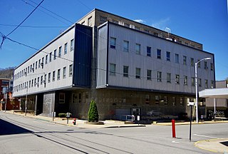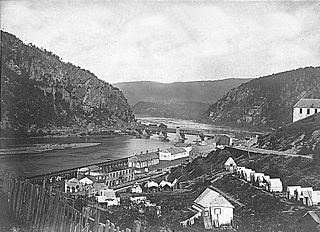
Logan County is a county in the U.S. state of West Virginia. As of the 2020 census, the population was 32,567. Its county seat is Logan. Logan County comprises the Logan, WV Micropolitan Statistical Area, which is also included in the Charleston–Huntington–Ashland, WV–OH–KY Combined Statistical Area.

Colonial Heights is an independent city in the Commonwealth of Virginia. As of the 2020 census, the population was 18,170. The Bureau of Economic Analysis combines the City of Colonial Heights with Dinwiddie County for statistical purposes.

Mitchell Heights is a town in Logan County, West Virginia, United States. The population was 315 at the 2020 census. The town was named for an early farm on which it was established.
Baker Heights is an unincorporated community near Opequon Creek in Berkeley County in the U.S. state of West Virginia. Located on West Virginia Route 9 southeast of Martinsburg, Baker Heights is the site of the Martinsburg Veterans Affairs Medical Center.
Mechlenberg Heights is an unincorporated community in Jefferson County, West Virginia, United States. Mechlenberg Heights lies to the west of Shepherdstown along West Virginia Route 45.

Washington Heights is an unincorporated community on the Spruce Fork in Boone County in the U.S. state of West Virginia. Washington Heights lies to the south of Madison on West Virginia Route 17.
Valley Heights is an unincorporated community in Summers County, West Virginia, United States. The community is located along the Greenbrier River, approximately 7 miles (11 km) southwest of Alderson and 15 miles (24 km) east of Hinton. Valley Heights is served by West Virginia Route 3 and West Virginia Route 12.
Charlton Heights is a census-designated place (CDP) in Fayette County, West Virginia, United States. Charlton Heights is located on the north bank of the Kanawha River, 4 miles (6.4 km) southwest of Gauley Bridge. Charlton Heights has a post office with ZIP code 25040. As of the 2010 census, its population was 406.
Montgomery Heights is an unincorporated community in Fayette County, West Virginia, United States. Montgomery Heights is located on the south bank of the Kanawha River, 4.5 miles (7.2 km) southeast of Montgomery.
Beard Heights is an unincorporated community in Pocahontas County, West Virginia, United States. Beard Heights is located on U.S. Route 219, 1.5 miles (2.4 km) southwest of Marlinton.
17th Indiana Battery Light Artillery was an artillery battery that served in the Union Army during the American Civil War.
Tyler Heights, also known as Flatwoods, is an unincorporated community in Kanawha County, West Virginia, United States. Tyler Heights is located along West Virginia Route 622 at its junction with West Virginia Route 501, 5 miles (8.0 km) east-northeast of Nitro.

Godby Heights is an unincorporated community in Logan County, West Virginia, United States.
Logan Heights is an unincorporated community in Logan County, West Virginia, United States. It is part of the Mount Gay-Shamrock census-designated place.
Morgan Heights is an unincorporated community in Monongalia County, West Virginia, United States.
Wellington Heights is an unincorporated community in Barbour County, West Virginia, United States.
La duquesa is a Mexican telenovela produced by Valentín Pimstein for Telesistema Mexicano in 1966.


