Fraziers Bottom | |
|---|---|
| Frazier's Bottom | |
 Fraziers Bottom Location within the state of West Virginia  Fraziers Bottom Fraziers Bottom (the United States) | |
| Coordinates: 38°34′13″N81°59′26″W / 38.57028°N 81.99056°W | |
| Country | United States |
| State | West Virginia |
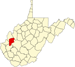
| County | Putnam |
| Elevation | 565 ft (172 m) |
| Population (2020) | |
• Total | 1,720 |
| Time zone | UTC-5 (Eastern (EST)) |
| • Summer (DST) | UTC-4 (EDT) |
| ZIP codes | 25082 |
| GNIS feature ID | 1539239 [1] |
Fraziers Bottom is an unincorporated community in Putnam County, West Virginia, United States. The community was named after a family of Fraziers, [2] who settled the area in the late 18th century after migrating there from present day Virginia. The zip code is 25082. [3] As of 2020, the population is 1,720 people.