Greendale, Wisconsin

Last updated

Greendale
Greendale, WI village hall.jpg
Greendale Village Hall
Milwaukee County Wisconsin Incorporated and Unincorporated areas Greendale Highlighted.svg
Location of Greendale in Milwaukee County, Wisconsin.
Coordinates: 42°56′15″N87°59′49″W / 42.93750°N 87.99694°W / 42.93750; -87.99694
CountryUnited States
State Wisconsin
County Milwaukee
Area
[1]
  Total5.57 sq mi (14.44 km2)
  Land5.57 sq mi (14.41 km2)
  Water0.01 sq mi (0.02 km2)
Elevation
[2]
738 ft (225 m)
Population
 (2020) [3]
  Total14,854
  Estimate 
(2021) [4]
14,652
  Density2,541.42/sq mi (981.16/km2)
Time zone UTC-6 (Central (CST))
  Summer (DST) UTC-5 (CDT)
ZIP Code
53129
Area code 414
FIPS code 55-31125 [5]
GNIS feature ID1565837 [2]
Website www.greendale.org

Greendale is a village in Milwaukee County, Wisconsin, United States. The population was 14,854 at the 2020 census. Greendale is located southwest of Milwaukee, Wisconsin, and is a part of the Milwaukee metropolitan area. A planned community, it was established by the United States government during the Great Depression.

Contents

History

Native American peoples

The first recorded inhabitants of the Greendale area were various Native American tribes, including the Potawatomi. The 1833 Treaty of Chicago struck an agreement between the United States government that required the Chippewa, Odawa, and Potawatomi tribes to cede to the United States government 5,000,000 acres (2,000,000 ha). In exchange for ceding their lands in the area, they were to receive monetary payments and lands west of the Mississippi in Indian Territory. [6]

1930s and beyond

Greendale was one of three government sponsored "Greenbelt" communities constructed by the Resettlement Administration, starting in 1936, as part of President Franklin Roosevelt's New Deal. The other Greenbelt communities were Greenbelt, Maryland and Greenhills, Ohio. [7] Greendale was incorporated as a village on November 1, 1938. The planners and selection committees excluded African-American families from renting homes and created a racially segregated and all-white suburban community. [8]

The original downtown area included the village hall, built in a Colonial Williamsburg style, 366 new homes comprising 572 living units, and several businesses. These homes were often referred to as "Greendale Originals". [9] The Greenbelt communities were patterned after the British garden city movement urban planning concept, built so residents could walk to schools, shops, and parks. Greendale was intended to be a model village for the working class. Income limits were from $1200 to $2700 per year, depending upon family size. In 1938, a one-bedroom Original rented for $19 a month. Rent for a four-bedroom home was $46 a month. [10] Over 200 of the "Originals" have unique artistic designs on the chimneys.

Federal ownership of Greendale ended in 1953. [11] In the late 1950s Greendale experienced growth in conjunction with the expansion of the Milwaukee suburbs as a whole. Although new homes were built and the number of minority families increased in Milwaukee County, racially restrictive covenants were used to maintain the all-white Greendale community. In 1958, the Crestview Acres land was sold by Elroy H. Barbian for development with the restrictive covenant that only white families could purchase the homes. "No Persons other than the white race shall own or occupy any building on said tract, but this covenant shall not prevent occupancy of persons of a race other than the white race who are domestic servants of the owner or occupant of said building." [12]

Southridge Mall opened in 1970 as the southern sister mall to Northridge Mall. Both malls were located on 76th Street, close to major east–west artery roads. Both were developed by Herb Kohl and Taubman Centers, Inc.

In 1996, the shopping district in the center of the village was purchased by the Grandhaven investment firm founded by Roy Reiman, founder of a publishing company headquartered in the village. The remake of the "Village Center" brought updates, attracted new restaurants, and made the village center more of a tourist attraction. [13] More than 40,000 flowers are planted annually along the downtown streets in hanging baskets, sidewalk beds, and storefront window boxes. [14]

To ease managing more than 2,000 men during Greendale's construction, workers were directed to the "A section", the "B section", the "C section", etc. This alphabetical reference has endured. Still today, all streets in each section begin with the same letter — the A section includes Angle Lane, Apricot Court, etc. [15]

Geography

Greendale is located at 42°56′15″N87°59′49″W / 42.937615°N 87.996884°W / 42.937615; -87.996884 (42.937615, −87.996884). [16] The Root River flows through the western part of the village.

Greendale is bounded by the city of Greenfield to the north and east, the village of Hales Corners to the west, and the city of Franklin, Wisconsin to the south.[7]

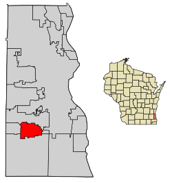
According to the United States Census Bureau, the village has a total area of 5.57 square miles (14.43 km2), of which, 5.56 square miles (14.40 km2) of it is land and 0.01 square miles (0.03 km2) is water. [17]

Scout Lake is a 5-acre lake located in Greendale. It has a maximum depth of 19 feet. Fish include panfish, largemouth bass and northern pike. [18]

Climate

Greendale, Wisconsin
Climate chart (explanation)
J
F
M
A
M
J
J
A
S
O
N
D
 
 
97
 
 
−6
−12
 
 
101
 
 
−3
−11
 
 
68
 
 
6
−6
 
 
165
 
 
17
2
 
 
111
 
 
20
5
 
 
138
 
 
29
12
 
 
100
 
 
28
16
 
 
95
 
 
26
13
 
 
67
 
 
23
11
 
 
92
 
 
15
6
 
 
64
 
 
7
−2
 
 
78
 
 
−3
−8
Average max. and min. temperatures in °C
Precipitation totals in mm
Source: [19]
Imperial conversion
JFMAMJJASOND
 
 
3.8
 
 
21
10
 
 
4
 
 
27
12
 
 
2.7
 
 
43
21
 
 
6.5
 
 
63
36
 
 
4.4
 
 
68
41
 
 
5.4
 
 
84
54
 
 
3.9
 
 
82
61
 
 
3.7
 
 
79
55
 
 
2.6
 
 
73
52
 
 
3.6
 
 
59
43
 
 
2.5
 
 
45
28
 
 
3.1
 
 
27
18
Average max. and min. temperatures in °F
Precipitation totals in inches

Greendale weather by month [20]

Greendale is in zone 5b of the USDA Plant Hardiness Zone Map. [21]

Commerce

Southridge Mall, is located in Greendale, and opened in 1970. It is Wisconsin's second largest mall behind Mayfair Mall in Wauwatosa, tied with Fox River Mall in Appleton. The downtown village center has more than a dozen independent shops [22] and nine places to eat. [23]

Community Organizations

Community members are active in many local civic organizations, church groups and school committees where they volunteer their time and talents for the betterment of the Village.

Demographics

Historical population
CensusPop.Note
1940 2,527
1950 2,7528.9%
1960 6,845148.7%
1970 15,089120.4%
1980 16,92812.2%
1990 15,128−10.6%
2000 14,405−4.8%
2010 14,046−2.5%
2020 14,8545.8%
2021 (est.)14,652 [4] −1.4%
U.S. Decennial Census [3]

2010 census

As of the census [28] of 2010, there were 14,046 people, 6,075 households, and 4,016 families residing in the village. The population density was 2,526.3 inhabitants per square mile (975.4/km2). There were 6,294 housing units at an average density of 1,132.0 per square mile (437.1/km2). The racial makeup of the village was 92.8% White, 1.2% African American, 0.4% Native American, 3.1% Asian, 0.9% from other races, and 1.6% from two or more races. Hispanic or Latino of any race were 4.7% of the population.

There were 6,075 households, of which 28.0% had children under the age of 18 living with them, 52.5% were married couples living together, 10.0% had a female householder with no husband present, 3.6% had a male householder with no wife present, and 33.9% were non-families. 30.1% of all households were made up of individuals, and 17% had someone living alone who was 65 years of age or older. The average household size was 2.31 and the average family size was 2.87.

The median age in the village was 45.3 years. 22.1% of residents were under the age of 18; 5.6% were between the ages of 18 and 24; 21.7% were from 25 to 44; 28.2% were from 45 to 64; and 22.2% were 65 years of age or older. The gender makeup of the village was 46.6% male and 53.4% female.

2020 census

As of the census [29] of 2020, there were 14,854 people and 6,169 households residing in the village. The population density was 2,541.42 inhabitants per square mile (981.2/km2). There were 6,330 housing units at an average density of 1,136.4 per square mile (438.8/km2). The racial makeup of the village was 84.8% White, 1.6% African American, 0.5% Native American, 4.3% Asian, 0.3% from other races, and 6.6% from two or more races. Hispanic or Latino of any race were 1,157 or 7.8% of the population.

47.0% have attained a Bachelor's Degree or higher. Median Household Income was $78,310. 10.2% of the population is foreign born.

There were 6,169 households, of which 28.0% had children under the age of 18 living with them, 50.6% were married couples living together, 26.7% had a female householder with no husband present, 15.3% had a male householder with no wife present. The average family size was 2.96.

The median age in the village was 40.9 years. 25.1% of residents were under the age of 18; 4.2% were between the ages of 18 and 24; 35.5% were from 15 to 44; 23.7% were from 45 to 64; and 20.0% were 65 years of age or older. The gender makeup of the village was 48.5% male and 51.5% female.

Education

The village has one public high school, one public middle school, and three public elementary schools (Canterbury, College Park, and Highland View). [30] Greendale High School was named by Newsweek as one of America's Best High Schools in its 2009 & 2010 rankings. [31] [32] In 2007, the Greendale School District was ranked by Milwaukee Magazine as the top school system among the Milwaukee metropolitan area. [33]

The Greendale High School Marching Band is an 19-time (18 consecutive) WSMA (Wisconsin School Music Association) state marching band champion, and a regular Bands of America Grand Nationals participant. The Greendale High School Marching Band is invited to appear in the 2023 Macy's Thanksgiving Day Parade. [34] [35]

Private Schools

Events and Festivals

Government

There are two voting locations on Election Day:
Wards 1, 2, 3, 4, 9, & 10 - Greendale High School
Wards 5, 6, 7, 8, 11 - Highland View Grade School
Early voting takes place at the Village Hall. [46]

County

Greendale is in Milwaukee County. It is in the 11th Milwaukee County Supervisor district. [47]

State

Greendale is in the 28th State Senate District. Most of the village is in the 82nd State Assembly District, the remainder lies in the 84th State Assembly District.

Federal

Greendale is represented in the United States Senate by Senators Ron Johnson (R) and Tammy Baldwin (D). The village falls within Wisconsin's 1st congressional district, which is represented by Bryan Steil (R).

Historic places

Performing Arts

Points of Interest

Recreation

Whitnall Park, the largest park in Milwaukee County. [58] borders Greendale on the western boundary of the village. Whitnall Park offers many recreation options including:

Part of the Root River Parkway is in Greendale. [63] The Village is also connected to the Milwaukee County Park System Oak Leaf Trail, a paved 135-mile (217 km) multi-use recreational trail system, which provides opportunities for walking, running or biking.

The Rock Sports Complex, an athletic park in Franklin, Wisconsin, comprising baseball fields, mountain bike & BMX trails & snow play areas, borders Greendale on the southern boundary of the village.

Transportation

Greendale is 6 miles (9.6 km) from Milwaukee Mitchell International Airport, with non-stop flights to 30 destinations, [64] and close to Interstate 94 and Interstate 894. [65] Running through the village is WIS 36. The Village is served by multiple transit lines with the Milwaukee County Transit System. [66]

Notable people

See also

Related Research Articles

<span class="mw-page-title-main">Milwaukee County, Wisconsin</span> County in Wisconsin, United States

Milwaukee County is located in the U.S. state of Wisconsin. At the 2020 census, the population was 939,489, down from 947,735 in 2010. It is both the most populous and most densely populated county in Wisconsin, and the 45th most populous county nationwide; Milwaukee, its eponymous county seat, is also the most populous city in the state. The county was created in 1834 as part of Michigan Territory and organized the following year.

<span class="mw-page-title-main">Greenbelt, Maryland</span> City in Maryland, United States

Greenbelt is a city in Prince George's County, Maryland, United States, and a suburb of Washington, D.C. At the 2020 census, the population was 24,921.

<span class="mw-page-title-main">Greenhills, Ohio</span> Village in Ohio, United States

Greenhills is a village in Hamilton County, Ohio, United States. The population was 3,741 at the 2020 census. A planned community, it was established by the United States government during the Great Depression. Most of the village is a National Historic Landmark for its history as a planned modernist community.

<span class="mw-page-title-main">Hales Corners, Wisconsin</span> Village in Wisconsin, United States

Hales Corners is a village in Milwaukee County, Wisconsin, United States. The population was 7,720 at the 2020 census.

<span class="mw-page-title-main">Oak Creek, Wisconsin</span> City in Wisconsin, United States

Oak Creek is a city in the U.S. state of Wisconsin. Located in Milwaukee County, it sits on the southwestern shore of Lake Michigan and is located immediately south of Milwaukee. The city is one of the fastest growing in Milwaukee County and all of Wisconsin. As of the 2020 census, the population was 36,497.

<span class="mw-page-title-main">Shorewood, Wisconsin</span> Village in Milwaukee County, Wisconsin

Shorewood is a village in Milwaukee County, Wisconsin, United States. The population was 13,859 at the 2020 census.

<span class="mw-page-title-main">Wauwatosa, Wisconsin</span> City in Wisconsin, United States

Wauwatosa is a city in Milwaukee County, Wisconsin, United States. The population was 48,387 at the 2020 census. Wauwatosa is located immediately west of Milwaukee, and is a part of the Milwaukee metropolitan area. It is named after the Potawatomi Chief Wauwataesie and the Potawatomi word for firefly.

<span class="mw-page-title-main">Whitefish Bay, Wisconsin</span> Village in Milwaukee County, Wisconsin

Whitefish Bay is a village in Milwaukee County, Wisconsin, United States. The population was 14,954 at the 2020 census.

<span class="mw-page-title-main">Thiensville, Wisconsin</span> Village in Ozaukee County, Wisconsin

Thiensville is a village in Ozaukee County, Wisconsin, United States. Located on the west bank of a bend in the Milwaukee River, the community is bordered on all sides by the City of Mequon and is a suburb in the Milwaukee metropolitan area. The population was 3,235 at the 2010 census.

<span class="mw-page-title-main">Appleton, Wisconsin</span> City in Wisconsin, United States

Appleton is a city in Outagamie, Calumet, and Winnebago counties in the U.S. state of Wisconsin. One of the Fox Cities, it is situated on the Fox River, 30 miles (48 km) southwest of Green Bay and 100 miles (160 km) north of Milwaukee. Appleton is the county seat of Outagamie County. As of the 2020 Census it had a population of 75,644, making it the sixth-most populous city in Wisconsin. Appleton is a part of the Fox Cities metropolitan area, the third-largest metro area in the state.

<span class="mw-page-title-main">Eau Claire, Wisconsin</span> City in Wisconsin, United States

Eau Claire is a city in Eau Claire and Chippewa counties in the U.S. state of Wisconsin. It is the county seat of Eau Claire County. It had a population of 69,421 in 2020, making it the state's eighth-most populous city. It is the principal city of the Eau Claire metropolitan area, locally known as the Chippewa Valley, and is also part of the larger Eau Claire-Menomonie combined statistical area.

<span class="mw-page-title-main">Merrill, Wisconsin</span> Place in Wisconsin, United States

Merrill is a city in and the county seat of Lincoln County, Wisconsin, United States. It is located to the south of and adjacent to the Town of Merrill. The population was 9,347, according to the 2020 census. Merrill is part of the United States Census Bureau's Merrill MSA, which includes all of Lincoln County. Together with the Wausau MSA, which includes all of Marathon County, it forms the Wausau-Merrill CSA.

<span class="mw-page-title-main">Fredonia, Wisconsin</span> Village in Ozaukee County, Wisconsin

Fredonia is a village in Ozaukee County, Wisconsin, United States. Located on the Milwaukee River, the village is in the Milwaukee metropolitan area. The population was 2,160 at the 2010 census.

<span class="mw-page-title-main">Grafton, Wisconsin</span> Village in Ozaukee County, Wisconsin

Grafton is a village in Ozaukee County, Wisconsin, United States. Located about 20 miles (32 km) north of Milwaukee and in close proximity to Interstate 43, it is a suburban community in the Milwaukee metropolitan area. The village incorporated in 1896, and at the time of the 2020 census the population was 12,094.

<span class="mw-page-title-main">Saukville (town), Wisconsin</span> Town in Ozaukee County, Wisconsin

Saukville is a town in Ozaukee County, Wisconsin, United States. The Village of Saukville is located in the town's southeast quadrant. The population was 1,755 at the 2000 census.

<span class="mw-page-title-main">Saukville, Wisconsin</span> Village in Ozaukee County, Wisconsin

Saukville is a village in Ozaukee County, Wisconsin, United States. Located on the Milwaukee River with a district along Interstate 43, the community is a suburb in the Milwaukee metropolitan area. The population was 4,258 at the 2020 census.

<span class="mw-page-title-main">Trimborn Farm</span> United States historic place

Trimborn Farm is a Victorian era estate located in Greendale, Wisconsin, United States, and owned by Milwaukee County. Spanning 7.5 acres and nine buildings, it is listed on the National Register of Historic Places. The farm is also a State Historic Site and designated Milwaukee County Landmark.

<span class="mw-page-title-main">Woodland Conference</span>

The Woodland Conference is a high school athletics conference in Southeastern Wisconsin. It is overseen by the Wisconsin Interscholastic Athletic Association (WIAA). Members of the conference are: Brown Deer, Cudahy, Greendale, Greenfield, New Berlin Eisenhower, New Berlin West, Pewaukee, Shorewood, South Milwaukee, Pius XI, Milwaukee Lutheran, Wisconsin Lutheran, West Allis Central and Whitnall. The commissioner is Paul Feldhausen.

<span class="mw-page-title-main">Franklin, Milwaukee County, Wisconsin</span> City in Milwaukee

Franklin is a city in Milwaukee County, Wisconsin, United States. It is a suburb of Milwaukee with a population of 36,816 as of the 2020 census.

<span class="mw-page-title-main">Greendale Historic District</span> Historic district in Wisconsin, United States

The Greendale Historic District is a National Historic Landmark District encompassing the historic core of the village of Greendale, Wisconsin. The village core was designed in the 1930s as part of a New Deal program to establish so-called "greenbelt towns" as model suburbs, and is one of three such communities built by the federal government. It was added to the National Register of Historic Places in 2005 and designated as a National Historic Landmark in 2012.

References

  1. "2019 U.S. Gazetteer Files". United States Census Bureau. Retrieved August 7, 2020.
  2. 1 2 "US Board on Geographic Names". United States Geological Survey. October 25, 2007. Retrieved January 31, 2008.
  3. 1 2 "Census of Population and Housing". Census.gov. Retrieved August 10, 2022.
  4. 1 2 "Population and Housing Unit Estimates". United States Census Bureau. May 16, 2022. Retrieved August 10, 2022.
  5. "U.S. Census website". United States Census Bureau . Retrieved January 31, 2008.
  6. "Potawatomi Treaties and Treaty Rights - Milwaukee Public Museum". www.mpm.edu. Retrieved December 12, 2022.
  7. Lindsay Isaacs. "A federal experiment sets out lasting models for suburban development". American City & County, February 23, 2012.
  8. Sierra Starner-Hefron (Spring 2015). "The Story of Greendale: A Utopia Unrealized" (PDF). e.polis. 7: 82–100. Retrieved October 17, 2022.
  9. "Greendale, Wisconsin". Advisory Council on Historic Preservation. Retrieved October 16, 2022.PD-icon.svg This article incorporates text from this source, which is in the public domain .
  10. "Greendale". Encyclopedia of Milwaukee. University of Wisconsin-Milwaukee. Retrieved October 16, 2022.
  11. Alanen, Arnold; Eden, Joseph (2012). Main Street Ready-Made: The New Deal Community of Greendale, Wisconsin. Madison, Wisconsin: Wisconsin Historical Society. p. 88. ISBN   978-0-87020-511-8.
  12. Metropolitan Integration Research Center. "Racially Restrictive Covenants: The Making of All-White Suburbs in Milwaukee County" (PDF). Archived from the original (PDF) on September 5, 2019. Retrieved March 31, 2019.
  13. "ORIGINAL ISSUE". Chicago Tribune. June 14, 1998. Retrieved October 16, 2022.
  14. "Discover Greendale Wisconsin". Discover Greendale Wisconsin. Retrieved November 24, 2022.
  15. "Greendale is 'Alphabetized' Historical Marker". The Historical Marker Database. October 12, 2021. Retrieved December 12, 2022.
  16. "US Gazetteer files: 2010, 2000, and 1990". United States Census Bureau. February 12, 2011. Retrieved April 23, 2011.
  17. "US Gazetteer files 2010". United States Census Bureau. Archived from the original on January 25, 2012. Retrieved November 18, 2012.
  18. "Wisconsin DNR" . Retrieved December 3, 2019.
  19. "NASA Earth Observations Data Set Index". NASA. Retrieved January 30, 2016.
  20. "Climate in Greendale" . Retrieved October 16, 2022.
  21. "Wisconsin Horticulture".
  22. "Shops - Discover Greendale Wisconsin". Discover Greendale. Retrieved November 23, 2022.
  23. "Restaurants and Bakery - Discover Greendale Wisconsin". Discover Greendale. Retrieved November 23, 2022.
  24. "Greendale Entertainment Association". Greendale Entertainment Association. Retrieved November 28, 2022.
  25. "Greendale Historical Society - National Historic Landmark". Greendale Historical Society. Retrieved November 28, 2022.
  26. "Greendale Lions Club: We Serve Greendale... and Brats, Hot Dogs & Pancakes". Greendale Lions Club. Retrieved November 22, 2022.
  27. "Welcome to Village of Greendale, WI". Village of Greendale. Retrieved November 22, 2022.
  28. "U.S. Census website". United States Census Bureau . Retrieved November 18, 2012.
  29. "U.S. Census website". United States Census Bureau . Retrieved March 28, 2023.
  30. "About Us - Greendale Schools". Archived from the original on April 23, 2016. Retrieved October 16, 2022.
  31. "Newsweek Names Greendale High School One of America's Best High Schools". May 23, 2012. Retrieved October 16, 2022.
  32. "Newsweek's best high school list for 2010 is out". Newsweek . Retrieved October 16, 2022.
  33. "Milwaukee Magazine". Archived 2010-01-23 at the Wayback Machine [ dead link ] Retrieved 2009-10-29
  34. "Greendale band website".
  35. "Macy's Thanksgiving Day Parade" . Retrieved October 16, 2022.
  36. "Greendale Baptist Academy". Greendale Baptist Academy. Retrieved November 30, 2022.
  37. "Play-based Learning - Greendale Playschool". Greendale Playschool. Retrieved November 30, 2022.
  38. "St. Alphonsus Catholic School" . Retrieved October 16, 2022.
  39. "Greendale Downtown Market - Greendale Park and Recreation Department". Greendale Park and Recreation Department. Retrieved November 23, 2022.
  40. "Gazebo Series - Greendale Entertainment Association". Greendale Entertainment Association. Retrieved November 23, 2022.
  41. "Greendale Park and Recreation Department". Greendale Park and Recreation Department. Retrieved November 23, 2022.
  42. "Family 4th - Greendale Lions Club". Greendale Lions Club. Retrieved November 23, 2022.
  43. "Greendale home and garden are worthy of gazing". Milwaukee Journal Sentinel. Retrieved November 16, 2022.
  44. "Greendale, Wisconsin - Advisory Council on Historic Preservation". Advisory Council on Historic Preservation. Retrieved October 16, 2022.
  45. ">Welcome to Village of Greendale, WI". Advisory Council on Historic Preservation. Retrieved April 2, 2023.
  46. "Village of Greendale, WI Election information" . Retrieved October 16, 2022.
  47. Milwaukee County Board
  48. "Greendale - Milwaukee County Historical Society" . Retrieved November 23, 2022.
  49. "Greendale Community Theater". Greendale Community Theater. Retrieved November 24, 2022.
  50. "Greendale Schools - GHS Theatre". Greendale Schools - GHS Theatres. Greendale School District. Retrieved November 24, 2022.
  51. "Barbershop Chorus - Midwest Vocal Express". Midwest Vocal Express. Retrieved November 24, 2022.
  52. "Greemdale Public Library home page" . Retrieved October 16, 2022.
  53. "Greendale Public Library Annual Report 2021". Greendale Public Library. Retrieved October 16, 2022.
  54. "Art: Rockwell and Mobiles". Village of Greendale. Retrieved December 9, 2022.
  55. "Greendale Veterans Memorial". Greendale Veterans Memorial. Retrieved October 16, 2022.
  56. "Historic Greendale Welcome Center". Greendale Welcome Center. Retrieved October 16, 2022.
  57. "Picture History: What is a Hose Tower?". Greendale, WI Patch. November 23, 2022.
  58. "Whitnall Park map" (PDF). Retrieved October 17, 2022.
  59. "Whitnall Park Golf Course - MKE Golf" . Retrieved November 28, 2022.
  60. "Wehr Nature Center" . Retrieved November 28, 2022.
  61. "Boerner Botanical Gardens" . Retrieved November 28, 2022.
  62. "WI Milwaukee Whitnall Park" . Retrieved October 17, 2022.
  63. "Root River Parkway" (PDF). Milwaukee County Parks. Retrieved October 17, 2022.
  64. "Milwaukee Mitchell International Airport". Milwaukee Mitchell International Airport. Retrieved March 28, 2023.
  65. "Federal Highway Administration". US Department of Transportation. Retrieved March 28, 2023.
  66. "Ride MCTS". Milwaukee County Transit System. Retrieved March 28, 2023.
  67. "Steve Burrows : Wisconsin State Journal". www.burrowsofhollywood.com. Retrieved October 12, 2019.
  68. Greendale High School Alumni Directory. Bernard C. Harris Publishing Company. 1995. p. 15.
  69. "Olympian Jim Gruenwald hired as USOEC Assistant Greco-Roman Wrestling Coach". TheMat.com.
  70. Greendale High School Alumni Directory. Bernard C. Harris Publishing Company. 1995. p. 52.
  71. "Indiana Judicial Branch: Indiana Supreme Court: Hon Mark S Massa". www.in.gov. Retrieved November 7, 2019.
  72. Greendale High School Alumni Directory. Bernard C. Harris Publishing Company. 1995. p. 70.
  73. "Dave Smith Stats". Pro-Football-Reference.com. Retrieved April 14, 2019.
  74. Greendale High School Alumni Directory. Bernard C. Harris Publishing Company. 1995. p. 104.
  75. Ginny LaRoe (April 5, 2016). "Lawyer Behind 'If It Doesn't Fit' Thinks O.J. Miniseries Full of S***". Law.com.