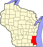
Butler, Waukesha County, Wisconsin

Last updated

Butler
Village
Butler-logo.gif
Nickname: 
"Train Town USA"
Motto(s): 
"Village of Homes & Industry" "A Good Place to Start and a Great Place to Stay"
Waukesha County Wisconsin Incorporated and Unincorporated areas Butler Highlighted.svg
Location of Butler in Waukesha County, Wisconsin.
Coordinates: 43°6′26″N88°4′8″W / 43.10722°N 88.06889°W / 43.10722; -88.06889
Country Flag of the United States.svg  United States
State Flag of Wisconsin.svg  Wisconsin
County Waukesha
Area
[1]
  Total0.79 sq mi (2.05 km2)
  Land0.78 sq mi (2.02 km2)
  Water0.01 sq mi (0.03 km2)
Population
 (2020) [2]
  Total1,787
  Density2,302.18/sq mi (888.78/km2)
Time zone UTC-6 (Central (CST))
  Summer (DST) UTC-5 (CDT)
FIPS code 55-11475
GNIS feature ID1582894
Website butlerwi.gov

Butler is a village in Waukesha County, Wisconsin, United States. The population was 1,787 at the 2020 census.

Contents

History

The village of Butler exists due to the railroad. It began in the season of fall in 1909, when people from the Milwaukee, Sparta, and North Western Railway (a division of the Chicago and North Western Railway) visited farmers living on the eastern area of 124th Street and bought their land to start railroad yards around the City of Milwaukee to relieve congestion in the downtown rail yards. These railroad yards were called "New Butler". [3] Butler was probably named for William Butler, a large property owner in the area who had emigrated from England in the mid-1840s. [4] In 1911, the settlement of "New Butler" was started within Waukesha County, Wisconsin. This community was started by railroad workers and their families and was incorporated with 200 people on May 5, 1913 from what land that was previously parts of the towns of Brookfield and Menomonee. The village grew as more railroad activities started, and allowed real estate speculators to buy parcels of additional land for development. In 1926 the "New" was removed from the name of the village.

Geography

Butler is located at 43°6′26″N88°4′8″W / 43.10722°N 88.06889°W / 43.10722; -88.06889 (43.107310, −88.068963). [5]

According to the United States Census Bureau, the village has a total area of 0.79 square miles (2.05 km2), of which, 0.78 square miles (2.02 km2) of it is land and 0.01 square miles (0.03 km2) is water. [6]

Demographics

Historical population
CensusPop.Note
1920 564
1930 70324.6%
1940 77810.7%
1950 1,04734.6%
1960 2,274117.2%
1970 2,261−0.6%
1980 2,059−8.9%
1990 2,0791.0%
2000 1,881−9.5%
2010 1,841−2.1%
2020 1,787−2.9%
U.S. Decennial Census [7]

2010 census

As of the census [2] of 2010, there were 1,841 people, 895 households, and 430 families living in the village. The population density was 2,360.3 inhabitants per square mile (911.3/km2). There were 925 housing units at an average density of 1,185.9 per square mile (457.9/km2). The racial makeup of the village was 92.2% White, 3.0% African American, 0.7% Native American, 1.2% Asian, 0.1% Pacific Islander, 0.9% from other races, and 1.8% from two or more races. Hispanic or Latino of any race were 4.8% of the population.

There were 895 households, of which 21.2% had children under the age of 18 living with them, 33.9% were married couples living together, 8.8% had a female householder with no husband present, 5.4% had a male householder with no wife present, and 52.0% were non-families. 44.4% of all households were made up of individuals, and 20.1% had someone living alone who was 65 years of age or older. The average household size was 2.06 and the average family size was 2.92.

The median age in the village was 43.2 years. 17.6% of residents were under the age of 18; 8.8% were between the ages of 18 and 24; 25.7% were from 25 to 44; 29.1% were from 45 to 64; and 18.9% were 65 years of age or older. The gender makeup of the village was 47.5% male and 52.5% female.

2000 census

As of the census [8] of 2000, there were 1,881 people, 916 households, and 459 families living in the village. The population density was 2,376.2 people per square mile (919.3/km2). There were 938 housing units at an average density of 1,184.9/sq mi (458.4/km2). The racial makeup of the village was 97.40% White, 0.27% African American, 1.06% Native American, 0.48% Asian, 0.16% Pacific Islander, and 0.64% from two or more races. Hispanic or Latino of any race were 0.85% of the population.

There were 916 households, out of which 20.7% had children under the age of 18 living with them, 39.0% were married couples living together, 8.1% had a female householder with no husband present, and 49.8% were non-families. 42.5% of all households were made up of individuals, and 25.3% had someone living alone who was 65 years of age or older. The average household size was 2.05 and the average family size was 2.88.

In the village, the population was spread out, with 19.5% under the age of 18, 6.2% from 18 to 24, 30.8% from 25 to 44, 20.0% from 45 to 64, and 23.5% who were 65 years of age or older. The median age was 41 years. For every 100 females, there were 89.8 males. For every 100 females age 18 and over, there were 86.1 males.

The median income for a household in the village was $38,333, and the median income for a family was $50,903. Males had a median income of $35,781 versus $26,250 for females. The per capita income for the village was $22,167. None of the families and 2.4% of the population were living below the poverty line, including no under eighteens and 7.8% of those over 64.

Education

It is in the Hamilton School District, [9] which operates Hamilton High School.

Related Research Articles

<span class="mw-page-title-main">Iron Ridge, Wisconsin</span> Village in Wisconsin, United States

Iron Ridge is a village in Dodge County, Wisconsin, United States. The population was 929 at the 2010 census. The village was founded on a railroad line, named for the iron mined in the area. Its ZIP code is 53035.

<span class="mw-page-title-main">Cecil, Wisconsin</span> Village in Wisconsin, United States

Cecil is a village in Shawano County, Wisconsin, United States. The population was 570 at the 2010 census.

<span class="mw-page-title-main">Big Bend, Waukesha County, Wisconsin</span> Village in Wisconsin, United States

Big Bend is a village in Waukesha County, Wisconsin, United States. The population was 1,483 at the 2020 census.

<span class="mw-page-title-main">Dousman, Wisconsin</span> Village in Wisconsin, United States

Dousman is a village in Waukesha County, Wisconsin, United States. The population was 2,419 at the 2020 census.

<span class="mw-page-title-main">Elm Grove, Wisconsin</span> Village in Wisconsin, United States

Elm Grove is a village in Waukesha County, Wisconsin, United States. The population was 6,524 at the 2020 census. Elm Grove was named as America's best suburb by Business Insider in October 2014.

<span class="mw-page-title-main">Hartland, Wisconsin</span> Village in Wisconsin, United States

Hartland is a village along the Bark River in Waukesha County, Wisconsin, United States, that is a suburb of Milwaukee. The population was 9,501 at the 2020 census.

<span class="mw-page-title-main">Lac La Belle, Wisconsin</span> Village in Wisconsin, United States

Lac La Belle is a village located mostly in Waukesha County in the U.S. state of Wisconsin. The population was 281 at the 2020 census. The village is located mostly within the town of Oconomowoc in Waukesha County. On March 28, 2002, the village annexed a portion of land in the town of Ixonia in Jefferson County.

<span class="mw-page-title-main">Lannon, Wisconsin</span> Village in Wisconsin, United States

Lannon is a village in Waukesha County, Wisconsin, United States. The population was 1,355 at the 2020 census. Lannon is a part of the Milwaukee metropolitan area.

<span class="mw-page-title-main">Nashotah, Wisconsin</span> Village in Wisconsin, United States

Nashotah is a village in Waukesha County, Wisconsin, United States. The population was 1,321 at the 2020 census. The village took its name from the nearby Nashotah Lakes.

<span class="mw-page-title-main">North Prairie, Wisconsin</span> Village in Wisconsin, United States

North Prairie is a village in Waukesha County, Wisconsin. It is located in the Town of Genesee, near the town's southwestern corner. The population was 2,202 at the 2020 census.
<span class="mw-page-title-main">Oconomowoc Lake, Wisconsin</span> Village in Wisconsin, United States

Oconomowoc Lake is a village in Waukesha County, Wisconsin, United States. Located just outside the City of Oconomowoc, the village includes the residential area encircling Oconomowoc Lake.

<span class="mw-page-title-main">Sussex, Wisconsin</span> Village in Wisconsin, United States

Sussex is a village in Waukesha County, Wisconsin, United States, about 19 miles (31 km) northwest of Milwaukee and 9 miles (14 km) north of Waukesha. The village is 7.24 square miles (19 km2) at an elevation of 930 feet. The population was 11,487 at the 2020 census. It is part of the Milwaukee metropolitan area.

<span class="mw-page-title-main">Vernon, Wisconsin</span> Village in Wisconsin, United States

Vernon is a village in Waukesha County, Wisconsin, United States. The population was 7,474 at the 2020 census.
<span class="mw-page-title-main">Wales, Wisconsin</span> Village in Wisconsin, United States

Wales is a village in Waukesha County, Wisconsin, first settled by Welsh immigrants. The population was 2,862 at the time of the 2020 census.
<span class="mw-page-title-main">Clinton (village), Rock County, Wisconsin</span> Village in Wisconsin, United States

Clinton is a village in Rock County, Wisconsin, United States. The population was 2,221 in the 2020 census. The village is located within the town of Clinton. The Norwegian-American Jefferson Prairie Settlement was located near the village.

<span class="mw-page-title-main">Brookfield (town), Wisconsin</span> Town in Wisconsin, United States

The Town of Brookfield is located in Waukesha County, Wisconsin, United States. The population was 6,477 at the 2020 census. The unincorporated community of Goerke's Corners is located in the town.

<span class="mw-page-title-main">Eagle, Wisconsin</span> Village in Wisconsin, United States

Eagle is a village in Waukesha County, Wisconsin, United States. At the 2020 census, the population was 2,071. The village is located within the Town of Eagle.

<span class="mw-page-title-main">Merton (village), Wisconsin</span> Village in Wisconsin, United States

Merton is a village in Waukesha County, Wisconsin. The population was 3,441 at the 2020 census. It is partially within the Town of Merton.

<span class="mw-page-title-main">Pewaukee, Wisconsin</span> City in Wisconsin, United States

Pewaukee is a city in Waukesha County, Wisconsin. The population was 15,914 at the 2020 census. The Village of Pewaukee, which was incorporated out of the town before it incorporated as a city, is surrounded by the city.

<span class="mw-page-title-main">Waukesha (village), Wisconsin</span> Village in Wisconsin, United States

Waukesha is a village in Waukesha County, Wisconsin, United States. The population was 8,457 at the 2020 census. The City of Waukesha is located adjacent to the village.

References

  1. "2019 U.S. Gazetteer Files". United States Census Bureau. Retrieved August 7, 2020.
  2. 1 2 "U.S. Census website". United States Census Bureau . Retrieved November 18, 2012.
  3. "About Butler – Village of Butler". www.butlerwi.gov. Retrieved August 23, 2019.
  4. Callary, Edward (2016). Place Names of Wisconsin. Madison, Wisconsin: University of Wisconsin Press. p. 45. ISBN   978-0-299-30964-0.
  5. "US Gazetteer files: 2010, 2000, and 1990". United States Census Bureau. February 12, 2011. Retrieved April 23, 2011.
  6. "US Gazetteer files 2010". United States Census Bureau. Archived from the original on January 25, 2012. Retrieved November 18, 2012.
  7. "Census of Population and Housing". Census.gov. Retrieved June 4, 2015.
  8. "U.S. Census website". United States Census Bureau . Retrieved January 31, 2008.
  9. "2020 CENSUS - SCHOOL DISTRICT REFERENCE MAP: Waukesha County, WI" (PDF). U.S. Census Bureau . Retrieved March 13, 2023.