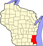
Brown Deer, Wisconsin | |
---|---|
Coordinates: 43°10′22″N87°58′40″W / 43.17278°N 87.97778°W | |
Country | United States |
State | Wisconsin |
County | Milwaukee |
Area | |
• Total | 4.39 sq mi (11.38 km2) |
• Land | 4.39 sq mi (11.38 km2) |
• Water | 0.00 sq mi (0.00 km2) |
Elevation | 692 ft (211 m) |
Population | |
• Total | 12,507 |
• Density | 2,848/sq mi (1,095/km2) |
Time zone | UTC-6 (Central (CST)) |
• Summer (DST) | UTC-5 (CDT) |
Area code | 414 |
FIPS code | 55-10375 [4] |
GNIS feature ID | 1562261 [2] |
Website | www |
Brown Deer is a village in Milwaukee County, Wisconsin, United States. A suburb of Milwaukee, it is part of the Milwaukee metropolitan area. The population was 12,507 at the 2020 census.
The Brown Deer area was organized as part of the Town of Milwaukee in 1835, [5] and the first white settlers began arriving around that time from New England and New York, including some settlers from Granville, New York. In 1841, the Town of Milwaukee was subdivided and the Brown Deer area became part of the new Town of Granville. In the 1800s, the town was a predominantly agricultural community, and many residents were of German and Irish extraction. [6]
The Village of Brown Deer has its origins in a rural hamlet that formed at a crossroads in the northeastern quadrant of the Town of Granville in the 1870s. The area remained characteristically rural from the 19th century through the mid-1940s, when the post–World War II economic expansion caused a building boom in the area, and many of the farms were subdivided into suburban residential neighborhoods. [6]
In the 1950s, Milwaukee mayor Frank Zeidler's administration pursued an agenda of annexing unincorporated areas of Milwaukee County to grow the city. In 1951 and 1952, the city began proceedings to annex parts of the Town of Granville. Some residents in the Brown Deer area did not want their community to become part of Milwaukee and organized to incorporate as a village in 1953 in order to stave off annexation. Milwaukee challenged the incorporation, but after a protracted court battle, the Wisconsin Supreme Court upheld Brown Deer's right to incorporate. When the Village of Brown Deer incorporated on January 20, 1955, it had an area of 1.8 square miles. [6] [7]
In 1955, the Village of Brown Deer and the City of Milwaukee scrambled to annex more of the Town of Granville, with Brown Deer making five annexations by the year's end. In 1956, the city and the village both attempted to annex all of the Town of Granville's remaining territory. The municipalities began a court battle that would last until 1962. [7] Most of Granville's residents supported annexation by Milwaukee, but some favored Brown Deer's lower tax rates. The Wisconsin Supreme Court initially awarded the territory to Brown Deer, before overruling its own decision and awarding the territory to Milwaukee in 1959. The courts reaffirmed their decision in 1962 when they ruled that Brown Deer's 1956 annexation ordinances were invalid, and awarded sixteen square miles of the former Town of Granville to the City of Milwaukee. [8]
In August 2013, the village was listed as 19th on CNNMoney's rankings of Best Places to Live – Where Homes Are Affordable, the highest ranking community in the state of Wisconsin. [9]
Brown Deer is located at 43°10′22″N87°58′40″W / 43.17278°N 87.97778°W (43.172858, −87.977899). [10]
According to the United States Census Bureau, the village has a total area of 4.40 square miles (11.40 km2), all of it land. [11]
Census | Pop. | Note | %± |
---|---|---|---|
1960 | 11,280 | — | |
1970 | 12,582 | 11.5% | |
1980 | 12,921 | 2.7% | |
1990 | 12,236 | −5.3% | |
2000 | 12,170 | −0.5% | |
2010 | 11,999 | −1.4% | |
2020 | 12,507 | 4.2% | |
U.S. Decennial Census [12] [13] |
As of 2000 the median income for a household in the village was $61,097. The per capita income for the village was $28,525. About 5.8% people of all ages live below the poverty line. The median value of owner occupied housing units was $175,600.
As of the census [4] of 2010, there were 11,999 people, 5,275 households, and 3,199 families residing in the village. The population density was 2,729.5 people per square mile (1,694.5/km2). There were 5,579 housing units at an average density of 1,267.95 per square mile (787.8/km2). The racial makeup of the village was 61.9% White, 28.6% African American, 0.04% Native American, 4.9% Asian, 0.1% Pacific Islander, 0.01% from other races, and 3.1% from two or more races. Hispanic or Latino of any race were 3.9% of the population.
Brown Deer is one of only three Milwaukee suburbs (Glendale and West Milwaukee being the others) where African-Americans make up at least 10% of the general population.
There were 5,275 households, of which 26.4% had children under the age of 18 living with them, 45.5% were married couples living together, 11.4% had a female householder with no husband present, and 39.4% were non-families. 33.7% of all households were made up of individuals living alone, and 12.5% had someone living alone who was 65 years of age or older. The average household size was 2.27 and the average family size was 2.91.
In the village, the population was spread out, with 20.9% under the age of 18, 7.5% from 18 to 24, 12.8% from 25 to 34, 20.7% from 35 to 49, 21.5% from 50 to 64, and 16.6% who were 65 years of age or older. The median age was 41.8 years. 52% of the population was female and 48% was male.
Algonquin Elementary School was formerly located on N. 47th Street. It served kindergarten through 2nd grade until it was closed in 2007. [14]
In 2007, the Brown Deer Schools merged Algonquin into Dean Elementary School (which formerly taught only K4 to 4th grade).
Dean Elementary School was formerly located on N. 55th Street. It served kindergarten through sixth graders but was closed and torn down in 2013. [15] The school, now called Brown Deer Elementary School, serves K4–6th grade.
The former Brown Deer Middle School (5th to 8th grades) and Brown Deer High School (9th to 12th grades) were merged in 2013, so the school now serves 7th–12th grades.
Brown Deer Middle School/High School and Brown Deer Elementary School are located on N. 60th Street. Enrollment is about 1600 students in grades K through 12. [16]
Milwaukee County ( ) is a county located in the U.S. state of Wisconsin. At the 2020 census, the population was 939,489, down from 947,735 in 2010. It is both the most populous and most densely populated county in Wisconsin, and the 45th most populous county nationwide; Milwaukee, its eponymous county seat, is also the most populous city in the state. It was named after the Milwaukee River. The county was created in 1834 as part of Michigan Territory and organized the following year.
Cudahy is a city in Milwaukee County, Wisconsin, United States. The population was 18,204 at the 2020 census. A suburb south of Milwaukee along the shore of Lake Michigan, it is part of the Milwaukee metropolitan area.
Oak Creek is a city in Milwaukee County, Wisconsin, United States. It sits on the southwestern shore of Lake Michigan and is located immediately south of Milwaukee. The population was 36,497 at the 2020 census. The city is one of the fastest growing in Milwaukee County and all of Wisconsin. The area has experienced an economic boom in recent years, with the addition of large companies such as Amazon, IKEA, and the Astronautics Corporation of America.
Whitefish Bay is a village in Milwaukee County, Wisconsin, United States. The population was 14,954 at the 2020 census. A suburb north of Milwaukee along the shore of Lake Michigan, it is part of the Milwaukee metropolitan area.
Caledonia is a village in Racine County, Wisconsin, United States. The population was 25,361 at the 2020 census. The residential community of Franksville is located within the village. Franksville is a former census-designated place. The residential neighborhood of Husher is also located within the village. The lakeside community of Tabor is also in the village.
Sturtevant is a village in Racine County, Wisconsin, United States. The population was 6,919 at the 2020 census.
Bayside is a village in Milwaukee and Ozaukee counties in the U.S. state of Wisconsin. The population was 4,482 at the 2020 census. Of this, 4,378 were in Milwaukee County, and only 104 were in Ozaukee County.
Granville is a town on the eastern border of Washington County, New York, United States, abutting Rutland County, Vermont. It is part of the Glens Falls Metropolitan Statistical Area. The town population was 6,215 at the 2020 census.
Belgium is a town in Ozaukee County, Wisconsin, United States. The population was 1,513 at the 2000 census. The Village of Belgium is surrounded on all sides by the town, and the unincorporated communities of Decker, Holy Cross, Lake Church, and Sauk Trail Beach are located in the town, as is the ghost town of Stonehaven. The unincorporated community of Dacada is also partially located in the town.
Belgium is a village in Ozaukee County, Wisconsin, United States. Located along Interstate 43, the village is one of the northernmost communities in the Milwaukee metropolitan area. The population was 2,245 at the 2020 census.
Fredonia is a village in Ozaukee County, Wisconsin, United States. Located on the Milwaukee River, the village is in the Milwaukee metropolitan area. The population was 2,160 at the 2010 census.
Fredonia is a town in Ozaukee County, Wisconsin, United States. The population was 2,903 at the 2000 census. The Village of Fredonia is surrounded by the town. The unincorporated communities of Little Kohler and Waubeka are also located in the town.
The Town of Grafton is a town located in Ozaukee County, Wisconsin, United States, and is in the Milwaukee metropolitan area. The town was created in 1846 and at the time of the 2020 Census had a population of 4,157.
Grafton is a village in Ozaukee County, Wisconsin, United States. Located about 20 miles (32 km) north of Milwaukee and in close proximity to Interstate 43, it is a suburban community in the Milwaukee metropolitan area. The village incorporated in 1896, and at the time of the 2020 census the population was 12,094.
Port Washington is a town in Ozaukee County in the U.S. state of Wisconsin. It surrounds the northern and western side of the city of Port Washington. As of the 2020 census, the town population was 1,538. The unincorporated communities of Druecker and Knellsville are also located in the town.
Germantown is a town in Washington County, Wisconsin, United States. The population was 278 at the 2000 census. It is surrounded by the village of Germantown.
Germantown is a village in Washington County, Wisconsin, United States. The population was 20,917 at the 2020 census. The village surrounds the Town of Germantown. In July 2007, Germantown was ranked the 30th most appealing place to live in the United States by Money Magazine.
Jackson is a town in Washington County, Wisconsin, United States. The population was 3,516 at the 2000 census. The Village of Jackson is located partially within the town. The unincorporated community of Kirchhayn is also located in the town.
Pewaukee is a city in Waukesha County, Wisconsin, United States. The population was 15,914 at the 2020 census. It is part of the Milwaukee metropolitan area.
Granville was a town located in Milwaukee County, Wisconsin, United States. One portion was incorporated as the village of Brown Deer in 1955; the remainder consolidated with the City of Milwaukee in 1956, and became a neighborhood of Milwaukee.
{{cite web}}
: CS1 maint: archived copy as title (link)