Big Bend, Waukesha County, Wisconsin

Last updated

There are some other places named: Big Bend.
Big Bend, Wisconsin
Village
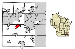
Waukesha County Wisconsin Incorporated and Unincorporated areas Big Bend Highlighted.svg
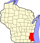
Location of Big Bend in Waukesha County, Wisconsin.
Coordinates: 42°53′16″N88°12′41″W / 42.88778°N 88.21139°W / 42.88778; -88.21139
Country Flag of the United States.svg  United States
State Flag of Wisconsin.svg  Wisconsin
County Waukesha
Area
[1]
  Total3.30 sq mi (8.54 km2)
  Land3.25 sq mi (8.42 km2)
  Water0.05 sq mi (0.12 km2)
Population
 (2020) [2]
  Total1,483
  Density450.77/sq mi (174.03/km2)
Time zone UTC-6 (Central (CST))
  Summer (DST) UTC-5 (CDT)
ZIP Code
53103 [3]
Area code 262
FIPS code 55-07200
GNIS feature ID1582806
Website villageofbigbend.com

Big Bend is a village in Waukesha County, Wisconsin, United States. The population was 1,483 at the 2020 census.

Contents

History

Big Bend was named by indigenous peoples for the change of direction in the Fox River.

The first European-American settlers arrived from Andover, Vermont in 1846. [4]

Geography

Big Bend is located at 42°53′16″N88°12′41″W / 42.88778°N 88.21139°W / 42.88778; -88.21139 (42.887862, -88.211333). [5]

According to the United States Census Bureau, the village has a total area of 3.15 square miles (8.16 km2), of which, 3.11 square miles (8.05 km2) of it is land and 0.04 square miles (0.10 km2) is water. [6]

Big Bend is located on the banks of the Fox River. The town is situated beside a portion of the river where it changes course from east to south, hence the name "Big Bend".

Demographics

Historical population
CensusPop.Note
1930 309
1940 298−3.6%
1950 48061.1%
1960 79766.0%
1970 1,14844.0%
1980 1,34517.2%
1990 1,299−3.4%
2000 1,278−1.6%
2010 1,2900.9%
2020 1,48315.0%
U.S. Decennial Census [7]

2010 census

As of the census [2] of 2010, there were 1,290 people, 486 households, and 375 families living in the village. The population density was 414.8 inhabitants per square mile (160.2/km2). There were 503 housing units at an average density of 161.7 per square mile (62.4/km2). The racial makeup of the village was 97.9% White, 0.2% African American, 0.2% Native American, 0.5% Asian, 0.1% Pacific Islander, 0.1% from other races, and 1.1% from two or more races. Hispanic or Latino of any race were 2.3% of the population.

There were 486 households, of which 35.4% had children under the age of 18 living with them, 63.4% were married couples living together, 9.1% had a female householder with no husband present, 4.7% had a male householder with no wife present, and 22.8% were non-families. 16.9% of all households were made up of individuals, and 5.7% had someone living alone who was 65 years of age or older. The average household size was 2.65 and the average family size was 3.00.

The median age in the village was 40.8 years. 23.9% of residents were under the age of 18; 7.4% were between the ages of 18 and 24; 24.6% were from 25 to 44; 33.1% were from 45 to 64; and 11.1% were 65 years of age or older. The gender makeup of the village was 49.8% male and 50.2% female.

2000 census

As of the census of 2000, there were 1,278 people, 448 households, and 348 families living in the village. The population density was 564.6 people per square mile (218.3/km2). There were 457 housing units at an average density of 201.9/sq mi (78.1/km2). The racial makeup of the village was 97.26% White, 0.47% African American, 0.55% Native American, 0.23% Asian, 0.39% Pacific Islander, 0.39% from other races, and 0.70% from two or more races. 1.80% of the population were Hispanic or Latino of any race.

There were 448 households, out of which 37.5% had children under the age of 18 living with them, 66.1% were married couples living together, 6.9% had a female householder with no husband present, and 22.1% were non-families. 17.6% of all households were made up of individuals, and 7.8% had someone living alone who was 65 years of age or older. The average household size was 2.85 and the average family size was 3.21.

In the village, the population was spread out, with 28.9% under the age of 18, 7.0% from 18 to 24, 30.0% from 25 to 44, 25.0% from 45 to 64, and 9.0% who were 65 years of age or older. The median age was 37 years. For every 100 females, there were 106.5 males. For every 100 females age 18 and over, there were 107.5 males.

The median income for a household in the village was $56,767, and the median income for a family was $61,771. Males had a median income of $40,583 versus $26,528 for females. The per capita income for the village was $22,072. About 0.9% of families and 2.9% of the population were below the poverty line, including 5.0% of those under age 18 and 1.7% of those age 65 or over.

Education

Christ Lutheran School is a PreK3-8th grade school of the Wisconsin Evangelical Lutheran Synod in Big Bend. [8] [9]

The village is also part of the Mukwonago Area School District. Big Bend Elementary School, [10] within the village limits, serves grades K-6. Older students go to Parkview Middle School and Mukwonago High School. [11]

Hygena Spring #2

In the late 1860s, Waukesha County was known as the “Saratoga of the West” due to plentiful, clean, and pure springs. At a time when many major municipal water supplies were tainted, the springs of Waukesha County were believed to have healing properties. They drew thousands of visitors to the springs and bath houses located in the county. [12]

During the early 1890s, local entrepreneur James M McElroy hatched a plan to pipe water from the Hygeia Spring, located in the Town of Waukesha, more than 100 miles to the Columbian Exposition in Chicago. Despite the fresh water of Lake Michigan, the Chicago River was contaminated with raw sewage, and many feared the water shortage would dissuade people from attending the exhibition. McElroy was to receive 8.5 cents per gallon, after commission, for shipping the water from Waukesha to Chicago. [13]

On May 12, 1892, a trainload of laborers and iron pipe were forced to retreat from the spring when village residents, armed with cannons and rifles, ordered them to leave the spring alone. Locals feared the mass pumping from the spring would destroy other springs in the area. After this mishap, McElroy purchased a spring outside of the Town of Waukesha in what is now the Village of Big Bend. He called it Hygena Springs II. McElroy did build his 100-mile pipe to Chicago, but once the water reached the exhibition, it was said to be stale and tasteless.

Hygena Spring II still flows today. Though the spring is located on private property, the owners allow the public to enjoy the water. [14]

Notable people

Related Research Articles

<span class="mw-page-title-main">Waukesha County, Wisconsin</span> County in Wisconsin, United States

Waukesha County is a county in the U.S. state of Wisconsin. As of the 2020 United States Census, the population was 406,978, making it the third-most populous county in Wisconsin. Its county seat and largest city is Waukesha.

<span class="mw-page-title-main">Maribel, Wisconsin</span> Village in Wisconsin, United States

Maribel is a village in Manitowoc County, Wisconsin, United States. The population was 336 at the 2020 census.

<span class="mw-page-title-main">Kronenwetter, Wisconsin</span> Village in Wisconsin, United States

Kronenwetter is a village in Marathon County, Wisconsin, United States. It is the largest village by land area in the state of Wisconsin, as well as in the entire United States, and the third-largest community by population in Marathon County. It is part of the Wausau, Wisconsin Metropolitan Statistical Area. As of the 2020 census, the population of Kronenwetter was 8,353.

<span class="mw-page-title-main">Butler, Waukesha County, Wisconsin</span> Village in Wisconsin, United States

Butler is a village in Waukesha County, Wisconsin, United States. The population was 1,787 at the 2020 census.

<span class="mw-page-title-main">Hartland, Wisconsin</span> Village in Wisconsin, United States

Hartland is a village along the Bark River in Waukesha County, Wisconsin, United States, that is a suburb of Milwaukee. The population was 9,501 at the 2020 census.

<span class="mw-page-title-main">Lannon, Wisconsin</span> Village in Wisconsin, United States

Lannon is a village in Waukesha County, Wisconsin, United States. The population was 1,355 at the 2020 census. Lannon is a part of the Milwaukee metropolitan area.

<span class="mw-page-title-main">Mukwonago (town), Wisconsin</span> Town in Wisconsin, United States

Mukwonago is a town in Waukesha County, Wisconsin, United States. The population was 7,781 at the 2020 census. The Village of Mukwonago is located mostly within the town. The unincorporated community of Jericho is also located in the town.

<span class="mw-page-title-main">Nashotah, Wisconsin</span> Village in Wisconsin, United States

Nashotah is a village in Waukesha County, Wisconsin, United States. The population was 1,321 at the 2020 census. The village took its name from the nearby Nashotah Lakes.

<span class="mw-page-title-main">North Prairie, Wisconsin</span> Village in Wisconsin, United States

North Prairie is a village in Waukesha County, Wisconsin. It is located in the Town of Genesee, near the town's southwestern corner. The population was 2,202 at the 2020 census.

<span class="mw-page-title-main">Oconomowoc Lake, Wisconsin</span> Village in Wisconsin, United States

Oconomowoc Lake is a village in Waukesha County, Wisconsin, United States. Located just outside the City of Oconomowoc, the village includes the residential area encircling Oconomowoc Lake.

<span class="mw-page-title-main">Summit, Waukesha County, Wisconsin</span> Village in Wisconsin, United States

Summit is a village in Waukesha County, Wisconsin, United States. The population was 4,784 at the 2020 census. The former unincorporated communities of Summit Center, Summit Corners, and Waterville are located in the village.

<span class="mw-page-title-main">Vernon, Wisconsin</span> Village in Wisconsin, United States

Vernon is a village in Waukesha County, Wisconsin, United States. The population was 7,474 at the 2020 census.

<span class="mw-page-title-main">Wales, Wisconsin</span> Village in Wisconsin, United States

Wales is a village in Waukesha County, Wisconsin, first settled by Welsh immigrants. The population was 2,862 at the time of the 2020 census.

<span class="mw-page-title-main">Mukwonago, Wisconsin</span> Village in Wisconsin, United States

Mukwonago is a village in the U.S. state of Wisconsin. The population was 8,262 at the 2020 census. The village is located mostly within the Town of Mukwonago in Waukesha County, with a small portion extending into the Town of East Troy in Walworth County. Of its population, 8,040 are in Waukesha County and 222 are in Walworth County.

<span class="mw-page-title-main">Waukesha, Wisconsin</span> City and county seat in Wisconsin, United States

Waukesha is the seat of government of Waukesha County, Wisconsin, United States. It is part of the Milwaukee metropolitan area. Its population was 71,158 at the 2020 census, making it the seventh-most populous city in Wisconsin. The city is adjacent to the Village of Waukesha.

<span class="mw-page-title-main">Delafield (town), Wisconsin</span> Town in Wisconsin, United States

The Town of Delafield is located in Waukesha County, Wisconsin, United States. The population was 8,095 at the 2020 census. The City of Delafield is adjacent to the town. The unincorporated community of Buena Vista is located in the town.

<span class="mw-page-title-main">Merton, Wisconsin</span> Town in Wisconsin, United States

Merton is a town in Waukesha County, Wisconsin, United States; before Wisconsin statehood, it was called Warren. The population was 8,277 at the 2020 census. The town surrounds the villages of Chenequa and Merton. The unincorporated communities of Camp Whitcomb, Monches, and North Lake are in the town and the unincorporated community of Stone Bank is partially in the town. The pioneer Swedish-American settlement of New Upsala was also at one time located within Merton.

<span class="mw-page-title-main">Oconomowoc, Wisconsin</span> City in Wisconsin, United States

Oconomowoc is a city in Waukesha County, Wisconsin, United States. The name was derived from Coo-no-mo-wauk, the Potawatomi term for "waterfall." The population was 18,203 at the 2020 census. The city is partially adjacent to the Town of Oconomowoc and near the village of Oconomowoc Lake, Wisconsin.

<span class="mw-page-title-main">Pewaukee (village), Wisconsin</span> Village in Wisconsin, United States

Pewaukee is a village in Waukesha County, Wisconsin, United States. The population was 8,238 at the 2020 census. The village is nearly surrounded by the City of Pewaukee. The village was incorporated from what was formerly the Town of Pewaukee, and the remainder of the town later incorporated as a city.

<span class="mw-page-title-main">Pewaukee, Wisconsin</span> City in Wisconsin, United States

Pewaukee is a city in Waukesha County, Wisconsin. The population was 15,914 at the 2020 census. The Village of Pewaukee, which was incorporated out of the town before it incorporated as a city, is surrounded by the city.

References

  1. "2019 U.S. Gazetteer Files". United States Census Bureau. Retrieved August 7, 2020.
  2. 1 2 "U.S. Census website". United States Census Bureau . Retrieved November 18, 2012.
  3. "Look up a ZIP Code". United States Postal Service . Retrieved December 14, 2022.
  4. Gard, Robert (2015). The Romance of Wisconsin Place Names (2nd ed.). Madison, WI: Wisconsin Historical Society Press. p. 28. ISBN   978-0-87020-707-5.
  5. "US Gazetteer files: 2010, 2000, and 1990". United States Census Bureau. February 12, 2011. Retrieved April 23, 2011.
  6. "US Gazetteer files 2010". United States Census Bureau. Archived from the original on January 12, 2012. Retrieved November 18, 2012.
  7. "Census of Population and Housing". Census.gov. Retrieved June 4, 2015.
  8. "Christ Lutheran School Enrollment". Archived from the original on February 18, 2018. Retrieved February 17, 2018.
  9. "Christ Lutheran School Profile (2021) | Big Bend, WI". Private School Review. June 4, 2023.
  10. "Big Bend Elementary Home Page" . Retrieved October 9, 2019.
  11. "Mukwonago Area School District Boundary Map" . Retrieved October 9, 2019.
  12. "UWDC Collection Browse - UW-Madison Libraries". search.library.wisc.edu.
  13. "Waukesha's 1893 World's Fair EarthCache". Geocaching.com.
  14. Blakemore, Erin (June 7, 2017). "The Clash Over Water in Waukesha, Wisconsin". JSTOR Daily.
  15. 'Wisconsin Blue Book 2011-2012,' Biographical Sketch of David Craig, pg.75
  16. "Man found guilty of murder in 'Mommy Dead and Dearest' trial". New York Post . Associated Press. November 16, 2018. Retrieved November 17, 2018.
  17. "Hal Peck Statistics and History". "baseball-reference.com. Accessed June 8, 2017.
  18. 'Wisconsin Blue Book 1897,' Biographical Sketch of Delbert K. Smith, pg. 698
  19. THE BLUE BOOK OF THE STATE OF WISCONSIN. 1891. p. 598.