Grant Town, West Virginia

Last updated

Grant Town, West Virginia
Marion County West Virginia Incorporated and Unincorporated areas Grant Town Highlighted.svg
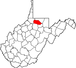
Location of Grant Town in Marion County, West Virginia.
Coordinates: 39°33′26″N80°10′43″W / 39.55722°N 80.17861°W / 39.55722; -80.17861
Country United States
State West Virginia
County Marion
Area
[1]
  Total0.54 sq mi (1.40 km2)
  Land0.53 sq mi (1.37 km2)
  Water0.01 sq mi (0.04 km2)
Elevation
988 ft (301 m)
Population
 (2020) [2]
  Total690
  Estimate 
(2021) [2]
685
  Density1,127.13/sq mi (435.14/km2)
Time zone UTC-5 (Eastern (EST))
  Summer (DST) UTC-4 (EDT)
ZIP code
26574
Area code 304
FIPS code 54-32908 [3]
GNIS feature ID1554592 [4]
Website https://granttown.myruralwater.com/
Company store in Grant Town, 1946 Company store. Koppers Coal Division, Federal ^1 Mine, Grant Town, Marion County, West Virginia. - NARA - 540275.jpg
Company store in Grant Town, 1946

Grant Town is a town in Marion County, West Virginia, in the eastern United States. The population was 690 at the 2020 census. [2]

Contents

The town was formed in 1901 with the opening of the Federal Coal and Coke Company bituminous coal mine, and was named for Robert Grant, vice president of the coal company. The "Federal No. 1" mine remained open for the next 84 years until its closure in 1985.[ citation needed ] At one point it was the largest underground coal mine in the world in terms of gross production, mining the Pittsburgh coal seam. The town was incorporated as a municipality in 1946.

Grant Town is the site of an 80 Megawatt electrical generation facility, located adjacent to the coal refuse areas above the town. The plant, which was built in the early 1990s is controlled by Edison International and generates electricity using a fluidized bed combustion boiler process burning waste coal. [5]

The town is home to a local legend of a Bigfoot-type creature, sighted periodically by local residents since the early 1970s. The creature, known locally as the "Grant Town Goon", is reported to live in the woods and coal waste areas to the southern and southwestern parts of the town. Grant Town is also the location of a number of the stories of the West Virginia ghost story anthology The Telltale Lilac Bush, by Fairmont State University professor Ruth Ann Musick. [6] The town, the mine and surrounding farms are prominently featured in a number of the stories. Musick includes a description of the town, circa 1965, in an introduction to a section on mine ghost stories:

"The Grant Town Mine, the scene of four of the stories here, is one of the largest in the United States, and possibly in the world. The town itself, with a population of a little over a thousand, is about seven miles northwest of Fairmont. Surrounded by hills, it is a kind of a sunken garden--a well at the bottom of the stairway of hills and highways--so that it seems to be in a world of its own. In a way, perhaps, it is. At least fourteen different European nationalities live in the town and work in the mine." [7]

Notable people

Notable Grant Town natives include Charles Csuri, a pioneer in the field of computer art, former University of Arizona head football coach Rich Rodriguez, and Tom Wilson, creator of the comic strip Ziggy .

Geography

Grant Town is located at 39°33′26″N80°10′43″W / 39.55722°N 80.17861°W / 39.55722; -80.17861 (39.557358, -80.178485). [8]

According to the United States Census Bureau, the town has a total area of 0.55 square miles (1.42 km2), of which 0.53 square miles (1.37 km2) is land and 0.02 square miles (0.05 km2) is water. [9]

Demographics

Historical population
CensusPop.Note
1950 1,273
1960 1,105−13.2%
1970 946−14.4%
1980 9874.3%
1990 694−29.7%
2000 657−5.3%
2010 613−6.7%
2020 69012.6%
2021 (est.)685 [2] −0.7%
U.S. Decennial Census [10]

2010 census

As of the census [11] of 2010, there were 613 people, 260 households, and 171 families living in the town. The population density was 1,156.6 inhabitants per square mile (446.6/km2). There were 305 housing units at an average density of 575.5 per square mile (222.2/km2). The racial makeup of the town was 91.0% White, 7.3% African American, 0.2% Native American, and 1.5% from two or more races. Hispanic or Latino of any race were 0.5% of the population.

There were 260 households, of which 27.7% had children under the age of 18 living with them, 49.2% were married couples living together, 10.8% had a female householder with no husband present, 5.8% had a male householder with no wife present, and 34.2% were non-families. 29.6% of all households were made up of individuals, and 15% had someone living alone who was 65 years of age or older. The average household size was 2.36 and the average family size was 2.88.

The median age in the town was 41.8 years. 19.4% of residents were under the age of 18; 7% were between the ages of 18 and 24; 27.8% were from 25 to 44; 29.1% were from 45 to 64; and 16.8% were 65 years of age or older. The gender makeup of the town was 47.8% male and 52.2% female.

2000 census

As of the census [3] of 2000, there were 657 people, 270 households, and 190 families living in the town. The population density was 1,199.3 inhabitants per square mile (461.2/km2). There were 316 housing units at an average density of 576.8 per square mile (221.8/km2). The racial makeup of the town was 90.87% White, 7.76% African American, 0.15% Asian, 0.30% from other races, and 0.91% from two or more races. Hispanic or Latino of any race were 0.46% of the population.

There were 270 households, out of which 27.0% had children under the age of 18 living with them, 52.2% were married couples living together, 12.6% had a female householder with no husband present, and 29.6% were non-families. 27.8% of all households were made up of individuals, and 18.5% had someone living alone who was 65 years of age or older. The average household size was 2.43 and the average family size was 2.95.

In the town, the population was spread out, with 21.8% under the age of 18, 8.7% from 18 to 24, 25.9% from 25 to 44, 23.9% from 45 to 64, and 19.8% who were 65 years of age or older. The median age was 40 years. For every 100 females, there were 85.1 males. For every 100 females age 18 and over, there were 80.4 males.

The median income for a household in the town was $24,722, and the median income for a family was $29,250. Males had a median income of $23,750 versus $22,083 for females. The per capita income for the town was $12,717. About 16.9% of families and 21.7% of the population were below the poverty line, including 38.3% of those under age 18 and 8.3% of those age 65 or over.

Notes

  1. "2019 U.S. Gazetteer Files". United States Census Bureau. Retrieved August 7, 2020.
  2. 1 2 3 4 "City and Town Population Totals: 2020-2021". Census.gov. US Census Bureau. Retrieved July 3, 2022.
  3. 1 2 "U.S. Census website". United States Census Bureau . Retrieved January 31, 2008.
  4. "US Board on Geographic Names". United States Geological Survey. October 25, 2007. Retrieved January 31, 2008.
  5. "Edison International: Our Company: American Bituminous". www.edison.com. Archived from the original on October 12, 2006.
  6. "Ruth Ann Musick" . Retrieved November 1, 2020.
  7. Musick, Ruth Ann (1965). The Telltale Lilac Bush. Lexington, Kentucky: The University Press of Kentucky, pgs 103-104. ISBN   0-8131-0136-0. pgs. 103-104
  8. "US Gazetteer files: 2010, 2000, and 1990". United States Census Bureau. February 12, 2011. Retrieved April 23, 2011.
  9. "US Gazetteer files 2010". United States Census Bureau. Archived from the original on January 25, 2012. Retrieved January 24, 2013.
  10. "Census of Population and Housing". Census.gov. Retrieved June 4, 2015.
  11. "U.S. Census website". United States Census Bureau . Retrieved January 24, 2013.

Related Research Articles

<span class="mw-page-title-main">Exline, Iowa</span> City in Iowa, USA

Exline is a city in Appanoose County, Iowa, United States. The population was 160 in the 2020 census, a decline from 191 in 2000.

<span class="mw-page-title-main">Numa, Iowa</span> City in Iowa, USA

Numa is a city in Appanoose County, Iowa, United States. The population was 68 in the 2020 census, a decline from 109 in 2000.

<span class="mw-page-title-main">Rathbun, Iowa</span> City in Iowa, USA

Rathbun is a city in Appanoose County, Iowa, United States. The population was 43 at the time of the 2020 census.

<span class="mw-page-title-main">Colfax, Iowa</span> City in Iowa, US

Colfax is a city in Jasper County, Iowa, United States. Colfax is located approximately 24 miles east of Des Moines. The town was founded in 1866, and was named after Schuyler Colfax, vice president under Ulysses S. Grant. The population was 2,255 at the time of the 2020 census. Newton is the county seat; both were named after Revolutionary War soldiers.

<span class="mw-page-title-main">Albia, Iowa</span> City in Iowa, United States

Albia is a city in and the county seat of Monroe County, in southern Iowa, United States. The population was 3,721 at the 2020 census.

<span class="mw-page-title-main">Barton, Maryland</span> Town in Maryland, United States

Barton is a town in Allegany County, Maryland, United States, located along the Georges Creek Valley. It is part of the Cumberland, MD-WV Metropolitan Statistical Area. The population was 457 at the 2010 census.

<span class="mw-page-title-main">Fromberg, Montana</span> Town in Carbon County, Montana, United States

Fromberg is a town in Carbon County, Montana, United States. As of the 2020 census, the population of the town was 392.

<span class="mw-page-title-main">Dewar, Oklahoma</span> Town in Oklahoma, United States

Dewar is a town in Okmulgee County, Oklahoma, United States. The population was 763 at the 2020 census. Founded in 1909 by workers for the Missouri, Oklahoma and Gulf Railway (MO&G), it was named for William Peter Dewar, a railroad official. It incorporated in 1909.

<span class="mw-page-title-main">Ernest, Pennsylvania</span> Borough in Pennsylvania, United States

Ernest is a borough in Indiana County, Pennsylvania, United States. The population was 422 at the 2020 census.

<span class="mw-page-title-main">Ellsworth, Pennsylvania</span> Borough in Pennsylvania, United States

Ellsworth is a borough in Washington County, Pennsylvania, United States. The population was 947 at the 2020 census. The coal town was founded by James Ellsworth, who bought the land in 1890s, developed the Monongahela Railway, and sold the mines to Bethlehem Steel in the 1920s.

<span class="mw-page-title-main">Marianna, Pennsylvania</span> Borough in Pennsylvania, United States

Marianna is a borough in Washington County, Pennsylvania, United States. The population was 399 at the 2020 census.

<span class="mw-page-title-main">Roscoe, Pennsylvania</span> Borough in Pennsylvania, United States

Roscoe is a borough in Washington County, Pennsylvania, United States. The population was 716 at the 2020 census.

<span class="mw-page-title-main">Carbonado, Washington</span> Town in Washington, United States

Carbonado is a town in Pierce County, Washington, United States. It is located near the Carbon River in the north of the county, approximately 50 miles (80 km) southeast of Seattle. Carbonado is the last town before entering Mount Rainier National Park and is also a popular spot for off-roading. The town also served as an important coal mining community in the late nineteenth and early twentieth centuries, when the town operated the largest coal mine in Pierce County. The population was 734 at the 2020 census.

<span class="mw-page-title-main">Whitesville, West Virginia</span> Town in West Virginia, United States

Whitesville is a town and former coal town in Boone County, West Virginia, United States, along the Big Coal River. The population was 361 at the 2020 census. Whitesville was incorporated on August 15, 1935 by the Boone County Circuit Court. The town derives its name from B. W. White, a pioneer settler. Whitesville was formerly known as Jarrold's Valley and Pritchard City.

<span class="mw-page-title-main">Bayard, West Virginia</span> Town in West Virginia, United States

Bayard is a town in Grant County, West Virginia, United States. The population was 200 at the 2020 census. Bayard was incorporated in 1893 and named in honor of Thomas F. Bayard, Jr., who later became a United States senator from Delaware (1923–1929). Bayard was founded on the West Virginia Central and Pittsburgh Railroad as a coal mining community. Coal mining has remained the town's chief industry.

<span class="mw-page-title-main">Farmington, West Virginia</span> Town in West Virginia, United States

Farmington is a town in Marion County, West Virginia, United States. The population was 389 at the 2020 census. The small town is situated on Buffalo Creek and the Allegheny Mountains about 6 miles west of Fairmont, Marion County's county seat. It is best known for being the site of the 1968 Farmington Mine disaster.

<span class="mw-page-title-main">Rivesville, West Virginia</span> Town in West Virginia, United States

Rivesville is a town and former coal town in Marion County, West Virginia, United States. The population was 830 at the 2020 census.

<span class="mw-page-title-main">Bancroft, West Virginia</span> Town in West Virginia, United States

Bancroft is a town in Putnam County, West Virginia, United States, along the Kanawha River. The population was 389 at the 2020 census. It is part of the Huntington–Ashland metropolitan area.

<span class="mw-page-title-main">New Post, Wisconsin</span> CDP in Wisconsin, United States

New Post is a census-designated place (CDP) in the town of Hunter, Sawyer County, Wisconsin, United States. The population was 305 at the 2010 census.

<span class="mw-page-title-main">Mineral Ridge, Ohio</span> Census-designated place in Ohio, United States

Mineral Ridge is an unincorporated community and census-designated place in southern Trumbull and northern Mahoning counties in the U.S. state of Ohio. The population was 3,951 at the 2020 census. It is a suburb of the Youngstown–Warren metropolitan area. Mineral Ridge was named for valuable coal deposits near the original town site.