Marion County is a county in the U.S. state of West Virginia. As of the 2020 census, the population was 56,205. Its county seat is Fairmont. The county was named in honor of General Francis Marion, known to history as "The Swamp Fox".

Monongah is a town in Marion County, West Virginia, United States, situated where Booths Creek flows into the West Fork River. The population was 972 at the 2020 census. Monongah was chartered in 1891, based on Chapter 47 of West Virginia code. Its name is derived from the nearby Monongahela River.

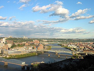
The Monongahela River, sometimes referred to locally as the Mon, is a 130-mile-long (210 km) river on the Allegheny Plateau in north-central West Virginia and Southwestern Pennsylvania. The river flows from the confluence of its west and east forks in north-central West Virginia northeasterly into southwestern Pennsylvania, then northerly to Pittsburgh and its confluence with the Allegheny River to form the Ohio River. The river includes a series of locks and dams that makes it navigable.
Mill Creek or Millcreek may refer to:
Wahoo is a scombrid fish found worldwide in tropical and subtropical seas.
Forks of Cacapon, formerly Forks of Capon, is an unincorporated community in Hampshire County in the U.S. state of West Virginia. The community is named for its location at the confluence of the North River and Cacapon River. Forks of Cacapon is also located at another fork: the crossroads of West Virginia Route 29, West Virginia Route 127, and Frank Haines Road.

The West Fork River is a principal tributary of the Monongahela River, 103-mile (166 km) long, in north-central West Virginia, United States. Via the Monongahela and Ohio Rivers, it is part of the watershed of the Mississippi River, draining an area of 881 square miles (2,284 km²) on the unglaciated portion of the Allegheny Plateau.

The Monongah mining disaster of Monongah, West Virginia occurred on December 6, 1907, and has been described as "the worst mining disaster in American history." 362 miners were killed. The explosion occurred in Fairmont Coal Company’s No. 6 and No. 8 mines, and was one of the contributing events leading to the creation of the United States Bureau of Mines.

Interstate 81 (I-81) is an 855.02-mile-long (1,376.02 km) Interstate Highway. In the US state of Virginia, I-81 runs for 324.92 miles (522.91 km), making the portion in Virginia longer than any other state's portion of the route. It is also the longest Interstate Highway within the borders of Virginia. It stretches from the Tennessee state line near Bristol to the West Virginia state line near Winchester. It enters Virginia from Bristol, Tennessee, and leaves Virginia into Berkeley County, West Virginia. The route passes through the cities of Bristol, Roanoke, Lexington, Staunton, and Harrisonburg.

Gladwin is an unincorporated community in Tucker County in the U.S. state of West Virginia. It is situated at the point where Glady Fork discharges into Dry Fork of Cheat River.
Father Everett Francis Briggs, MM was a Catholic priest and miners' activist who served as a member of the Maryknoll society.

Cheat Bridge is an unincorporated community in southeastern Randolph County, West Virginia, United States. It is located near U.S. Route 250's crossing of Shavers Fork.
Verdunville is an unincorporated community and census-designated place (CDP) in Logan County, West Virginia, United States. It is 3.5 miles (5.6 km) west of Logan, the county seat. Verdunville has a post office with ZIP code 25649. The Verdunville CDP includes the neighboring community of Shegon. As of the 2010 census, the total CDP population was 687.
Glen Falls is an unincorporated community in Harrison County, West Virginia, United States. Glen Falls is located on the West Fork River 2 miles (3.2 km) north of Clarksburg.
Laneville is an unincorporated community in Tucker County, West Virginia, United States. It lies on Red Creek along the southern border of the Dolly Sods Wilderness in the Monongahela National Forest.
Highland is an unincorporated community in Marion County, West Virginia, United States. Highland is located on the West Fork River, 1.25 miles (2.01 km) west of Worthington.
Stewartstown is an unincorporated community in Monongalia County, West Virginia, United States.

West Virginia's 13th Senate district is one of 17 districts in the West Virginia Senate. It is currently represented by Democrat Bob Beach and Republican Mike Oliverio. All districts in the West Virginia Senate elect two members to staggered four-year terms.


