Bath County is a United States county on the central western border of the Commonwealth of Virginia, on the West Virginia state line. As of the 2020 census, the population was 4,209, the second-least populous county in Virginia. Bath's county seat is Warm Springs.

Leake County is a county in the center of the U.S. state of Mississippi. As of the 2020 census, the population was 21,275. Its county seat is Carthage. The county is named for Walter Leake, the Governor of Mississippi from 1822 to 1825.
Pine Grove or pinegrove may refer to:

Highland Springs is a census-designated place (CDP) located in Henrico County, Virginia, United States, 4.3 miles (7 km) east of Richmond. The population was 16,604 at the 2020 census.

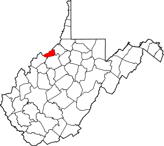
Pine Grove is a town in Wetzel County, West Virginia, United States. The population was 363 at the 2020 census. The community was named for a grove of pine trees near the original town site.

U.S. Route 52 (US 52) is a major United States highway in the central United States that extends from the northern to southeastern region of the United States. Contrary to most other even-numbered U.S. Highways, US 52 primarily follows a northwest–southeast route, and is signed north–south or east–west depending on the local orientation of the route. The highway's northwestern terminus is in Portal, North Dakota at the Canada–United States border, where it continues as Saskatchewan Highway 39. Its southeastern terminus is in Charleston, South Carolina, at Number 2 Meeting Street and White Point Garden along the Charleston Harbor.

John Edward Kenna was an American politician who was a Senator from West Virginia from 1883 until his death.

U.S. Route 13 or U.S. Highway 13 (US 13) is a north–south United States Numbered Highway established in 1926 that runs for 518 miles (834 km) from Interstate 95 (I-95) just north of Fayetteville, North Carolina, to US 1 in the northeastern suburbs of Philadelphia, Pennsylvania, near Morrisville. In all, it traverses five states in the Atlantic coastal plain region. It follows the Atlantic coast more closely than does the main north–south U.S. Highway of the region, US 1. Because of this, its number is out of place on the general U.S. Highway numbering grid, as it should be running west of US 11 but does not. Its routing is largely rural, the notable exceptions being the Hampton Roads area in Virginia and the northern end of the highway in Delaware and Pennsylvania. It is also notable for being the main thoroughfare for the Delmarva Peninsula and carrying the Chesapeake Bay Bridge–Tunnel to it in Virginia.

Poplar Grove National Cemetery is near Petersburg, Virginia, and is managed as part of Petersburg National Battlefield.

Lyndon Baines Johnson Memorial Grove on the Potomac is located on Lady Bird Johnson Park, in Washington, D.C. The presidential memorial honors the 36th President of the United States, Lyndon B. Johnson.

Pine Grove is an unincorporated community in Fayette County, West Virginia, United States. It lies off U.S. Highway 19 on County Route 5/3.

Pine Grove is an unincorporated community in Pleasants County, West Virginia, United States.
Pine Hills may refer to the following places:
Loxahatchee is an unincorporated community in Palm Beach County, Florida, United States, located north of Wellington, and west and northwest of Royal Palm Beach, approximately 17 miles (27 km) west of West Palm Beach. Loxahatchee is under the zip code of 33470.

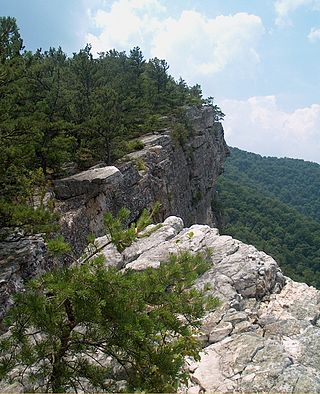
North Fork Mountain is a quartzite-capped mountain ridge in the Ridge and Valley physiographic province of the Allegheny Mountains, also known as the High Alleghenies or Potomac Highlands, of eastern West Virginia. Kile Knob, at 4,588 feet, is the mountain's highest point, and Panther Knob and Pike Knob are nearly as high.
Waverly is a census-designated place (CDP) in northeastern Wood County, West Virginia, United States. As of the 2010 census, its population was 395. It lies along the Ohio River on West Virginia Route 2, northeast of the city of Parkersburg, the county seat of Wood County. It has a post office with the ZIP code 26184.

Burches Run Wildlife Management Area, formerly Burches Run Lake WMA, is located on 55 acres (22 ha) near Wheeling in Marshall County, West Virginia. Until 2005 the wildlife management area contained a lake impounded by a dam at risk of failure. The name change occurred after the dam was removed. The terrain climbs gently above Burches Run and is covered by a mature oak-hickory second-growth forest.
Pine Grove is an unincorporated community in Klamath County, Oregon, United States. Pine Grove lies south of Oregon Route 140 just east of its interchange with Oregon Route 39 near Altamont.

Old Pine Church, also historically known as Mill Church, Nicholas Church, and Pine Church, is a mid-19th century church located near to Purgitsville, West Virginia, United States. It is among the earliest extant log churches in Hampshire County, along with Capon Chapel and Mount Bethel Church.
Valley High School is a public high school in Pine Grove, West Virginia, United States. It is one of four high schools in the Wetzel County School District. Athletic teams compete as the Valley Lumberjacks in the West Virginia Secondary School Activities Commission as a member of the Ohio Valley Athletic Conference.


