Big Run, Marion County, West Virginia

Last updated

Big Run
USA West Virginia location map.svg
Red pog.svg
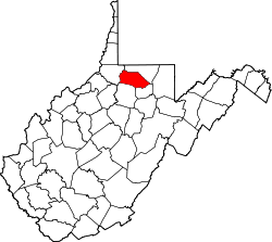
Big Run
Location within the state of West Virginia
Usa edcp location map.svg
Red pog.svg
Big Run
Big Run (the United States)
Coordinates: 39°28′15″N80°22′38″W / 39.47083°N 80.37722°W / 39.47083; -80.37722
Country United States
State West Virginia
County Marion
Time zone UTC-5 (Eastern (EST))
  Summer (DST) UTC-4 (EDT)
GNIS feature ID1549593 [1]

Big Run is an unincorporated community in Marion County, West Virginia, United States. It lies along Big Run, the stream from which it takes its name.

Related Research Articles

<span class="mw-page-title-main">Marion County, West Virginia</span> County in West Virginia, United States

Marion County is a county in the U.S. state of West Virginia. As of the 2020 census, the population was 56,205. Its county seat is Fairmont. The county was named in honor of General Francis Marion, known to history as "The Swamp Fox".

Big Run may refer to:

<span class="mw-page-title-main">Fairmont, West Virginia</span> City in West Virginia, United States

Fairmont is a city in and county seat of Marion County, West Virginia, United States. The population was 18,313 at the 2020 census, making it the eighth-largest city in the state. It is the principal city of the Fairmont micropolitan area, which includes all of Marion County in North Central West Virginia and had a population of 56,205 in 2020. Fairmont is also a principal city of the larger Morgantown–Fairmont combined statistical area.

<span class="mw-page-title-main">Farmington, West Virginia</span> Town in West Virginia, United States

Farmington is a town in Marion County, West Virginia, United States. The population was 389 at the 2020 census. The small town is situated on Buffalo Creek and the Allegheny Mountains about 6 miles west of Fairmont, Marion County's county seat. It is best known for being the site of the 1968 Farmington Mine disaster.

<span class="mw-page-title-main">Rivesville, West Virginia</span> Town in West Virginia, United States

Rivesville is a town and former coal town in Marion County, West Virginia, United States. The population was 830 at the 2020 census.

<span class="mw-page-title-main">Monongahela River</span> River in Pennsylvania and West Virginia, United States

The Monongahela River, sometimes referred to locally as the Mon, is a 130-mile-long (210 km) river on the Allegheny Plateau in north-central West Virginia and Southwestern Pennsylvania. The river flows from the confluence of its west and east forks in north-central West Virginia northeasterly into southwestern Pennsylvania, then northerly to Pittsburgh and its confluence with the Allegheny River to form the Ohio River. The river includes a series of locks and dams that makes it navigable.

<span class="mw-page-title-main">Shenandoah River</span> River in Virginia and West Virginia, United States

The Shenandoah River is the principal tributary of the Potomac River, 55.6 miles (89.5 km) long with two forks approximately 100 miles (160 km) long each, in the U.S. states of Virginia and West Virginia. The river and its tributaries drain the central and lower Shenandoah Valley and the Page Valley in the Appalachians on the west side of the Blue Ridge Mountains, in northwestern Virginia and the Eastern Panhandle of West Virginia. There is a hydroelectric plant along the Shenandoah river constructed in 2014 by Dominion.

<span class="mw-page-title-main">U.S. Route 501</span> Highway in the United States

U.S. Route 501 is a spur of U.S. Route 1. It runs 355 miles (571 km) from Buena Vista, Virginia at U.S. Route 60 to Myrtle Beach, South Carolina at U.S. Route 17 Business. It passes through the states of Virginia, North Carolina and South Carolina. From Durham to Laurinburg, a 108-mile (174 km) section of US 501 overlaps U.S. Route 15. Sections of US 15-501 also share routings with U.S. Route 1 in sections near Sanford, North Carolina and Aberdeen, North Carolina.

<span class="mw-page-title-main">South Branch Potomac River</span> River in United States

The South Branch Potomac River has its headwaters in northwestern Highland County, Virginia near Hightown along the eastern edge of the Allegheny Front. After a river distance of 139 miles (224 km), the mouth of the South Branch lies east of Green Spring in Hampshire County, West Virginia where it meets the North Branch Potomac River to form the Potomac.

<span class="mw-page-title-main">West Virginia Route 218</span>

West Virginia Route 218 is a north–south state highway located in Marion and Mononagalia counties in northern West Virginia, United States, that connects U.S. Route 19 (US 19) with the Pennsylvania state line.

Lunice Creek is a 7.3-mile-long (11.7 km) tributary of the South Branch Potomac River, belonging to the Potomac River and Chesapeake Bay watersheds. The creek is located in Grant County, West Virginia. Lunice Creek is created by its North and South Forks and empties into the South Branch at Petersburg.

Big Run is the name of several unincorporated communities in the U.S. state of West Virginia.

<span class="mw-page-title-main">Big Run (South Branch Potomac River tributary)</span>

Big Run is a 4.4-mile-long (7.1 km) tributary stream of the South Branch Potomac River, belonging to the Potomac River and Chesapeake Bay watersheds. Big Run flows through the city of Romney and the campus of the West Virginia Schools for the Deaf and Blind in Hampshire County, West Virginia. The stream is known by local residents as Town Run and Town Creek.

North Central West Virginia is a region of the U.S. state of West Virginia. The region's largest cities are Morgantown, Fairmont and Clarksburg.

<span class="mw-page-title-main">Burches Run Wildlife Management Area</span> State Wildlife Management Area in Marshall County, West Virginia

Burches Run Wildlife Management Area, formerly Burches Run Lake WMA, is located on 55 acres (22 ha) near Wheeling in Marshall County, West Virginia. Until 2005 the wildlife management area contained a lake impounded by a dam at risk of failure. The name change occurred after the dam was removed. The terrain climbs gently above Burches Run and is covered by a mature oak-hickory second-growth forest.

<span class="mw-page-title-main">U.S. Route 119 in Pennsylvania</span>

U.S. Route 119 (US 119) travels through Connellsville, Greensburg, and Punxsutawney, and bypasses Uniontown and Indiana. There are numerous other boroughs and villages along its 133-mile (214 km) route in the Keystone State. The southern entrance of US 119 is at the West Virginia state line one-half-mile south of Point Marion. The northern terminus is at US 219 two miles (3 km) south of DuBois, Pennsylvania. US 119 is in the National Highway System from the West Virginia state line to Exit 0 of PA Turnpike 66, and from US 22 to US 219. From US 22 to US 219, the highway carries the name of the Buffalo-Pittsburgh Highway; from US 22 to PA 56, it is also known as the Patrick J. Stapleton Highway; near Uniontown, it bears the name George C. Marshall Parkway.

<span class="mw-page-title-main">Wadestown, West Virginia</span> Unincorporated community in West Virginia

Wadestown — formerly West Warren — is an unincorporated community in Monongalia County, West Virginia, United States. It is located on West Virginia Route 7, approximately 7.5 miles (12.1 km) west-southwest of Blacksville.

Dents Run Wildlife Management Area is located on 1,226 acres (496 ha) near Mannington in Marion County, West Virginia. It includes a 30-acre (0.12 km2) lake and will provide hunting opportunities for deer, wild turkey, squirrel, and other species.

<span class="mw-page-title-main">Shively, West Virginia</span> Unincorporated community in West Virginia, United States

Shively is an unincorporated community located on the Smokehouse Fork of Big Harts Creek in Logan County, West Virginia, United States. Shively is accessed by County Route 3. It is situated 7.2 miles from Harts and 9.3 miles from Chapmanville.

<span class="mw-page-title-main">2016 United States House of Representatives elections in West Virginia</span>

The 2016 United States House of Representatives elections in West Virginia were held on November 8, 2016, to elect the three U.S. representatives from the state of West Virginia, one from each of the state's three congressional districts. The elections coincided with the 2016 U.S. presidential election, as well as other elections to the House of Representatives, elections to the United States Senate and various state and local elections.

References