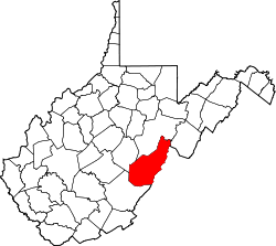
Durbin, West Virginia

Last updated

Durbin, West Virginia
Durbin CBD.jpg
Main Street commercial district
Pocahontas County West Virginia Incorporated and Unincorporated areas Durbin Highlighted.svg
Location of Durbin in Pocahontas County, West Virginia.
Coordinates: 38°32′50″N79°49′41″W / 38.54722°N 79.82806°W / 38.54722; -79.82806
Country United States
State West Virginia
County Pocahontas
Area
[1]
  Total0.57 sq mi (1.48 km2)
  Land0.57 sq mi (1.48 km2)
  Water0.00 sq mi (0.00 km2)
Elevation
[2]
2,738 ft (835 m)
Population
 (2020) [3]
  Total235
  Estimate 
(2021) [3]
240
  Density513.99/sq mi (198.44/km2)
Time zone UTC-5 (Eastern (EST))
  Summer (DST) UTC-4 (EDT)
ZIP code
26264
Area code 304
FIPS code 54-22852 [4]
GNIS feature ID1550996 [2]
Website https://www.welcometodurbinwv.com/

Durbin is a town in Pocahontas County, West Virginia, United States. The population was 235 at the 2020 census. [3]

Contents

The town was named in 1895 in honor of Charles R. Durbin Sr, the Grafton, WV bank official responsible for lending funds to John T. McGraw to purchase the site of the town in 1890. [5]

Geography

Durbin is situated in the northern part of Pocahontas County at the confluence of the East and West Forks of the Greenbrier River. It is thus the starting point of the Greenbrier River proper. [6] According to the United States Census Bureau, the town has a total area of 0.57 square miles (1.48 km2), all land. [7]

Demographics

Historical population
CensusPop.Note
1910 390
1920 4228.2%
1930 49818.0%
1940 5337.0%
1950 5401.3%
1960 431−20.2%
1970 347−19.5%
1980 3799.2%
1990 278−26.6%
2000 262−5.8%
2010 29311.8%
2020 235−19.8%
2021 (est.)240 [3] 2.1%
U.S. Decennial Census [8]

2010 census

At the 2010 census there were 293 people, 124 households, and 78 families living in the town. The population density was 514.0 inhabitants per square mile (198.5/km2). There were 174 housing units at an average density of 305.3 per square mile (117.9/km2). The racial makeup of the town was 96.9% White, 0.3% Native American, 2.0% from other races, and 0.7% from two or more races. Hispanic or Latino of any race were 3.8%. [9]

Of the 124 households 29.0% had children under the age of 18 living with them, 48.4% were married couples living together, 8.9% had a female householder with no husband present, 5.6% had a male householder with no wife present, and 37.1% were non-families. 30.6% of households were one person and 17.7% were one person aged 65 or older. The average household size was 2.36 and the average family size was 2.90.

The median age in the town was 45.1 years. 20.8% of residents were under the age of 18; 6.2% were between the ages of 18 and 24; 22.8% were from 25 to 44; 28.7% were from 45 to 64; and 21.5% were 65 or older. The gender makeup of the town was 50.2% male and 49.8% female.

2000 census

At the 2000 census there were 262 people, 117 households, and 71 families living in the town. The population density was 443.7 inhabitants per square mile (171.5/km2). There were 169 housing units at an average density of 286.2 per square mile (110.6/km2). The racial makeup of the town was 98.85% White, 0.76% African American and 0.38% Asian. [4] Of the 117 households 27.4% had children under the age of 18 living with them, 48.7% were married couples living together, 6.8% had a female householder with no husband present, and 38.5% were non-families. 32.5% of households were one person and 17.9% were one person aged 65 or older. The average household size was 2.24 and the average family size was 2.83.

The age distribution was 22.5% under the age of 18, 7.6% from 18 to 24, 25.6% from 25 to 44, 25.2% from 45 to 64, and 19.1% 65 or older. The median age was 39 years. For every 100 females, there were 97.0 males. For every 100 females age 18 and over, there were 95.2 males.

The median household income was $23,462 and the median family income was $25,909. Males had a median income of $21,250 versus $14,773 for females. The per capita income for the town was $10,937. About 19.4% of families and 22.5% of the population were below the poverty line, including 34.4% of those under the age of eighteen and 22.2% of those sixty five or over.

See also

Related Research Articles

<span class="mw-page-title-main">Wooster, Arkansas</span> City in Arkansas, United States

Wooster is a city in Faulkner County, Arkansas, United States. The population was 860 at the 2010 census, up from 516 at the 2000 census. It is part of the Central Arkansas region.

<span class="mw-page-title-main">Perham, Maine</span> Town in the state of Maine, United States

Perham is a town in Aroostook County, Maine, United States. The population was 371 at the 2020 census. The town was named after Maine's 33rd governor, Sidney Perham.

<span class="mw-page-title-main">Sherman, Maine</span> Town in the state of Maine, United States

Sherman is a town in Aroostook County, Maine, United States. The population was 815 at the 2020 census.

<span class="mw-page-title-main">Stockholm, Maine</span> Town in the state of Maine, United States

Stockholm is a town in Aroostook County, Maine, United States. The population was 250 at the 2020 census.

<span class="mw-page-title-main">Westfield, Maine</span> Town in the state of Maine, United States

Westfield is a town in Aroostook County, Maine, United States. The population was 455 at the 2020 census.

<span class="mw-page-title-main">Upton, Maine</span> Town in the state of Maine, United States

Upton is a town in Oxford County, Maine, United States. The population was 69 at the 2020 census.

<span class="mw-page-title-main">Greenbrier, Tennessee</span> City in Tennessee, United States

Greenbrier is a city in Robertson County, Tennessee, United States. The population was 6,433 at the 2010 census, and at the 2020 census the population was 6,898.

<span class="mw-page-title-main">Junior, West Virginia</span> Town in West Virginia, United States

Junior is a town in Barbour County, West Virginia, United States, situated along the Tygart Valley River. The population was 384 at the 2020 census.

<span class="mw-page-title-main">Falling Spring, West Virginia</span> Town in West Virginia, United States

Falling Spring is a town in Greenbrier County, West Virginia, United States. It is also known as Renick from the name of its post office. The population was 171 at the 2020 census.

<span class="mw-page-title-main">Quinwood, West Virginia</span> Town in West Virginia, United States

Quinwood is a town and former coal town in Greenbrier County, West Virginia, United States. The population was 220 at the 2020 census.

<span class="mw-page-title-main">Ronceverte, West Virginia</span> City in West Virginia, United States

Ronceverte is a city in Greenbrier County, West Virginia, United States, on the Greenbrier River. The population was 1,572 at the 2020 census.

<span class="mw-page-title-main">Rupert, West Virginia</span> Town in West Virginia, United States

Rupert is a town in Greenbrier County, West Virginia, United States. The population was 881 at the 2020 census.

<span class="mw-page-title-main">White Sulphur Springs, West Virginia</span> City in West Virginia, United States

White Sulphur Springs is a city in Greenbrier County in southeastern West Virginia, United States. The population was 2,231 at the 2020 census. The city emblem consists of five dandelion flowers and the citizens celebrate spring with an annual Dandelion Festival.

<span class="mw-page-title-main">Marlinton, West Virginia</span> Town in West Virginia, United States

Marlinton is a town in and the county seat of Pocahontas County, West Virginia, United States. The population was 998 at the 2020 census. Located along the Greenbrier River, it is known for its scenery.

<span class="mw-page-title-main">Newburg, West Virginia</span> Town in West Virginia, United States

Newburg is a town in western Preston County, West Virginia, United States. The population was 275 at the 2020 census. It is part of the Morgantown metropolitan area.

<span class="mw-page-title-main">Bancroft, West Virginia</span> Town in West Virginia, United States

Bancroft is a town in Putnam County, West Virginia, United States, along the Kanawha River. The population was 389 at the 2020 census. It is part of the Huntington–Ashland metropolitan area.

<span class="mw-page-title-main">Auburn, West Virginia</span> Town in West Virginia, United States

Auburn is a town in Ritchie County, West Virginia, United States. The population was 80 at the 2020 census.

<span class="mw-page-title-main">Camden-on-Gauley, West Virginia</span> Town in West Virginia, United States

Camden-on-Gauley is a town in Webster County, West Virginia, United States, along the Gauley River. The population was 126 at the 2020 census.

<span class="mw-page-title-main">North Hills, West Virginia</span> Town in West Virginia, United States

North Hills is a town in Wood County, West Virginia, United States. It is a suburb of Parkersburg. The population was 837 at the 2020 census. North Hills was incorporated on February 15, 1979.

<span class="mw-page-title-main">Alderson, West Virginia</span> Town in West Virginia, United States

Alderson is a town in Greenbrier and Monroe counties in the U.S. state of West Virginia, on both sides of the Greenbrier River. The population was 975 at the 2020 census.

References

  1. "2019 U.S. Gazetteer Files". United States Census Bureau. Retrieved August 7, 2020.
  2. 1 2 U.S. Geological Survey Geographic Names Information System: Durbin, West Virginia
  3. 1 2 3 4 Bureau, US Census. "City and Town Population Totals: 2020-2021". Census.gov. US Census Bureau. Retrieved July 3, 2022.
  4. 1 2 "U.S. Census website". United States Census Bureau . Retrieved January 31, 2008.
  5. Kenny, Hamill (1945). West Virginia Place Names: Their Origin and Meaning, Including the Nomenclature of the Streams and Mountains. Piedmont, WV: The Place Name Press. p. 219.
  6. Greenbrierriver.org
  7. "US Gazetteer files 2010". United States Census Bureau. Archived from the original on July 2, 2012. Retrieved January 24, 2013.
  8. "Census of Population and Housing". Census.gov. Retrieved June 4, 2015.
  9. "U.S. Census website". United States Census Bureau . Retrieved January 24, 2013.