Stony Bottom, West Virginia

Last updated
Stony Bottom
Unincorporated community
USA West Virginia location map.svg
Red pog.svg
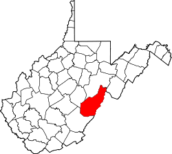
Stony Bottom
Location within the state of West Virginia
Usa edcp location map.svg
Red pog.svg
Stony Bottom
Stony Bottom (the US)
Coordinates: 38°21′51″N79°57′44″W / 38.36417°N 79.96222°W / 38.36417; -79.96222 Coordinates: 38°21′51″N79°57′44″W / 38.36417°N 79.96222°W / 38.36417; -79.96222
Country United States
State West Virginia
County Pocahontas
Time zone Eastern (EST) (UTC-5)
  Summer (DST) EDT (UTC-4)
GNIS feature ID 1555720 [1]

Stony Bottom is an unincorporated community located in Pocahontas County, West Virginia, United States. In the early 19th century, the town was known as Seldom Seen. [2] At some point, this was changed to Driftwood by loggers who would drift logs by on the Greenbrier River. By 1908, it took its present name because of all the stones and rocks present in the area. The town currently has seasonal residents, as well as full-time residents and a small church named Alexander Memorial Presbyterian Church. On Labor Day of every year, the small town accommodates hundreds of people for the annual Hunter Reunion, where local resident Homer Hunter invites the community to take part in traditional bluegrass music, food, and fellowship. The town is nestled between the Greenbrier River and the Greenbrier River Trail, suitable for biking, horseback riding, and more. Their Post Office [3] has been closed.

Unincorporated area Region of land not governed by own local government

In law, an unincorporated area is a region of land that is not governed by a local municipal corporation; similarly an unincorporated community is a settlement that is not governed by its own local municipal corporation, but rather is administered as part of larger administrative divisions, such as a township, parish, borough, county, city, canton, state, province or country. Occasionally, municipalities dissolve or disincorporate, which may happen if they become fiscally insolvent, and services become the responsibility of a higher administration. Widespread unincorporated communities and areas are a distinguishing feature of the United States and Canada. In most other countries of the world, there are either no unincorporated areas at all, or these are very rare; typically remote, outlying, sparsely populated or uninhabited areas.

Pocahontas County, West Virginia county in West Virginia, United States

Pocahontas County is a county located in the U.S. state of West Virginia. As of the 2010 census, the population was 8,719. Its county seat is Marlinton. The county was established in 1821. It is named after the daughter of the Powhatan Native American chief from Jamestown, Virginia. She married an English settler and their mixed-race children became ancestors of many of the First Families of Virginia.

West Virginia State of the United States of America

West Virginia is a state located in the Appalachian region in the Southern United States and is also considered to be a part of the Middle Atlantic States. It is bordered by Pennsylvania to the north, Maryland to the east and northeast, Virginia to the southeast, Kentucky to the southwest, and Ohio to the northwest. West Virginia is the 41st largest state by area, and is ranked 38th in population. The capital and largest city is Charleston.

Related Research Articles

Greenbrier River river in the United States of America

The Greenbrier River is a tributary of the New River, 162 miles (261 km) long, in southeastern West Virginia, in the United States. Via the New, Kanawha and Ohio rivers, it is part of the watershed of the Mississippi River, draining an area of 1,656 square miles (4,290 km2). It is one of the longest rivers in West Virginia.

Cherry River (West Virginia) River in southeastern West Virginia

The Cherry River is a tributary of the Gauley River in southeastern West Virginia in the United States. Via the Gauley, Kanawha and Ohio rivers, it is part of the watershed of the Mississippi River. The Cherry River drains mostly rural and forested areas and flows for much of its length through the Monongahela National Forest. Throughout its entire length the Cherry goes over a series of whitewater rapids in a mountainous setting.

Glady Fork river in the United States of America

Glady Fork is a 31.9-mile-long (51.3 km) river in the Allegheny Mountains of eastern West Virginia, USA. It is considered one of the five principal headwaters tributaries of the Cheat River — known as the Forks of Cheat.

Smoot, West Virginia Unincorporated community in West Virginia, United States

Smoot is an unincorporated community in western Greenbrier County, West Virginia, United States. It lies south of the interchange of Interstate 64 and U.S. Route 60 northwest of the city of Lewisburg, the county seat of Greenbrier County. Its elevation is 2,480 feet (756 m). Although it is unincorporated, it has a post office, with the ZIP code of 24977.

Bellepoint, West Virginia Unincorporated community in West Virginia, United States

Bellepoint was an unincorporated community located in Summers County, West Virginia. Bellepoint was later merged into Hinton; however, it had its own post office. See image below:

Fort Spring, West Virginia Unincorporated community in West Virginia, United States

Fort Spring is an unincorporated community and coal town in Greenbrier County, West Virginia, USA. It is situated along the Greenbrier River within the Greenbrier River Watershed. It was once a substantial portion of the Chesapeake and Ohio railway by way of the Gravel Girtie route from Hinton in Summers County, West Virginia to Clifton Forge in Virginia. The name comes from its main export; Mississippian limestone from Snowflake Quarry sent to Clifton Forge, Virginia The main road going through the small town was once the original rail line, but was moved.

Clover Lick, West Virginia Unincorporated community in West Virginia, United States

Clover Lick is an unincorporated community in Pocahontas County, West Virginia, United States. Clover Lick is located along the Greenbrier River 10 miles (16 km) northeast of Marlinton. The community is home to the Clover Lick Train Depot, which sits along the Greenbrier River Trail at Milepost 71.2. Clover Lick was founded in the early 1900s as a place to board trains traveling along the Greenbrier River.

Bargers Springs, West Virginia Unincorporated community in West Virginia, United States

Bargers Springs is an unincorporated community in Summers County, West Virginia, United States. Bargers Springs is located on the Greenbrier River, southeast of Hinton.

Crumps Bottom, West Virginia Unincorporated community in West Virginia, United States

Crumps Bottom is an unincorporated community in Summers County, West Virginia, United States. Crumps Bottom is located on the New River south of Hinton. Its post office is closed. It was also known as the Mouth of Indian.

Lowell, West Virginia Unincorporated community in West Virginia, United States

Lowell is an unincorporated community in Summers County, West Virginia, United States. Lowell is located on the Greenbrier River, east of Hinton and southwest of Alderson. The community was first settled in 1770 and is the oldest community in Summers County.

Griffith Creek, West Virginia Unincorporated community in West Virginia, United States

Griffith Creek is an unincorporated community in Summers County, West Virginia, United States. Griffith Creek is located along the Greenbrier River and West Virginia routes 3 and 12, west of Alderson.

Grassy Meadows, West Virginia Unincorporated community in West Virginia, United States

Grassy Meadows is an unincorporated community in Greenbrier County, West Virginia, United States. Grassy Meadows is 7 miles (11 km) east-southeast of Meadow Bridge. Grassy Meadows had a post office, which opened on June 15, 1858, and closed on June 25, 2011.

Maxwelton, West Virginia Unincorporated community in West Virginia, United States

Maxwelton is an unincorporated community in Greenbrier County, West Virginia, United States. Maxwelton is located on U.S. Route 219 5 miles (8.0 km) north-northeast of Lewisburg. Maxwelton has a post office with ZIP code 24957.

Bartow, West Virginia Census-designated place (CDP) in West Virginia, United States

Bartow is a census-designated place (CDP) in Pocahontas County, West Virginia, USA. As of the 2010 census, its population was 111.

Brink, Greenbrier County, West Virginia Ghost town in West Virginia, United States

Brink is a ghost town in Greenbrier County, West Virginia, United States. Brink was located on the Greenbrier River 4 miles (6.4 km) northwest of White Sulphur Springs. Brink appeared on USGS maps as late as 1923.

Whitcomb, West Virginia Ghost town in West Virginia, United States

Whitcomb is a ghost town in Greenbrier County, West Virginia, United States. Whitcomb was located on the Greenbrier River 1.5 miles (2.4 km) east of Fairlea. Whitcomb appeared on USGS maps as late as 1935.

Beard, West Virginia Unincorporated community in West Virginia, United States

Beard is an unincorporated community in Pocahontas County, West Virginia, United States. Beard is located on the Greenbrier River 4 miles (6.4 km) south-southwest of Hillsboro.

Hosterman, West Virginia Unincorporated community in West Virginia, United States

Hosterman is an unincorporated community in Pocahontas County, West Virginia, United States. Hosterman is located on the Greenbrier River 5.5 miles (8.9 km) south-southwest of Durbin. The community was originally named Collins; its name was changed to Hosterman in 1902. The community presently has the name of Theodore G. Hosterman, a worker in the local lumber industry.

Sitlington, West Virginia Unincorporated community in West Virginia, United States

Sitlington is an unincorporated community in Pocahontas County, West Virginia, United States. Sitlington is located at the confluence of the Greenbrier River and Sitlington Creek 13 miles (21 km) northeast of Marlinton.

Watoga, West Virginia Unincorporated community in West Virginia, United States

Watoga is an unincorporated community in Pocahontas County, West Virginia, United States. Watoga is located on the east bank of the Greenbrier River 3.5 miles (5.6 km) east-northeast of Hillsboro.

References