Bartow, West Virginia | |
|---|---|
Census-designated place (CDP) | |
 U.S. Route 250 | |
 Bartow, West Virginia | |
| Coordinates: 38°32′28″N79°47′03″W / 38.54111°N 79.78417°W | |
| Country | United States |
| State | West Virginia |
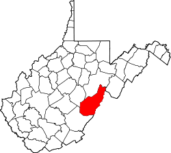
| County | Pocahontas |
| Area | |
• Total | 0.464 sq mi (1.20 km2) |
| • Land | 0.464 sq mi (1.20 km2) |
| • Water | 0 sq mi (0 km2) |
| Elevation | 2,769 ft (844 m) |
| Population (2020) | |
• Total | 64 |
| • Density | 140/sq mi (53/km2) |
| Time zone | UTC-5 (Eastern (EST)) |
| • Summer (DST) | UTC-4 (EDT) |
| ZIP code | 24920 |
| Area codes | 304 & 681 |
| GNIS feature ID | 1550176 [2] |
Bartow is a census-designated place (CDP) in Pocahontas County, West Virginia, United States. The population was 64 at the 2020 census (down from 111 at the 2010 census). [3] [4]
Bartow is situated along U.S. Route 250 and West Virginia Route 92 and on the East Fork Greenbrier River, approximately 2 miles (3.2 km) east of Durbin. It has a post office with ZIP code 24920. [5]
Bartow is named for Col. Francis S. Bartow, a Confederate commander who died at the Battle of First Manassas on July 21, 1861. [6] The Battle of Greenbrier River, also known as the Battle of Camp Bartow, took place on October 3, 1861, about one mile (1.6 km) southeast of the present town.
The Camp Bartow Historic District was listed on the National Register of Historic Places in 1995. [7] Located near Bartow is the Camp Allegheny Historic District, listed in 1990. [7]