Pocahontas County, West Virginia

Last updated

Pocahontas County
Seal of Pocahontas County, West Virginia.png
Map of West Virginia highlighting Pocahontas County.svg
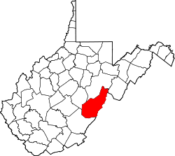
Location of Pocahontas County in West Virginia
West Virginia in United States.svg
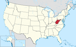
West Virginia's location within the U.S.
Coordinates: 38°19′N80°01′W / 38.32°N 80.01°W / 38.32; -80.01
Country Flag of the United States.svg  United States
State Flag of West Virginia.svg  West Virginia
FoundedDecember 21, 1821
Named for Pocahontas
Seat Marlinton
and largest town
Government
  County Commission PresidentWalt Helmick [1]
  County CommissionJamie Walker
John Rebinski
Area
  Total2,440 km2 (942 sq mi)
  Land2,400 km2 (940 sq mi)
  Water4 km2 (1.5 sq mi)  0.2%
  Rank 3rd
Population
 (2020)
  Total7,869
  Estimate 
(2021)
7,841 Decrease2.svg
  Rank 47th
  Density3.2/km2 (8.4/sq mi)
Time zone UTC−5 (Eastern)
  Summer (DST) UTC−4 (EDT)
Area code(s) 304, 681
Congressional district 1st
Senate district 11th
House of Delegates district 46th, 66th
Website https://pocahontascountycommission.com/

Pocahontas County is a county located in the eastern part of the U.S. state of West Virginia. As of the 2020 census, the population was 7,869. [2] Its county seat is Marlinton. [3] The county was established in 1821. It is named after the daughter of the Powhatan chief of the Native Americans in the United States who came from Jamestown, Virginia. She married an English settler, and their children became ancestors of many of the First Families of Virginia. [4]

Contents

Pocahontas County is the home to the Green Bank Observatory and is part of the National Radio Quiet Zone.

History

When Andrew Lewis, early American pioneer, surveyor, and soldier from Virginia, came to survey one of the land grants for the Greenbrier Company in 1751, he found Jacob Marlin and Stephen Sewell living where Marlinton later developed. They had come from Frederick, Maryland, in 1749 and are considered to be the first European settlers in this region of Virginia. They built their original cabin where Marlin Run met Knapp's Creek. Lewis had found Sewell living in a large hollow sycamore tree near the cabin. This area is now between Eighth and Ninth avenues and Eighth and Ninth streets of Marlinton.

This area was reserved by the nations of the Iroquois Confederacy as a hunting ground, by right of their conquest of tribes that had been in the area. The American Indians resisted Europeans moving into the area. A treaty of 1758 by Great Britain confirmed the land west of the Allegheny Mountains to the Indians and forbade his Majesty's subjects from settling or hunting here.

But the white settlers continued to encroach onto the Indian land, sparking many raids and massacres between the groups. After the Revolution, the Indian squabbles quieted and the settlers' land claims were secured in an orderly manner.

During the Civil War Pocahontas County voted to secede from the United States by a vote of 360 to 13 and supported the state government in Richmond. [5] The county contained 907 men of military age (15–50 years old) and provided nearly 700 men to the Confederate army and levied $15,000 for armaments. [6] Farming and harvesting crops soon became difficult due to enlistments, and many of the county's 252 enslaved population fled during Union troop movements through the county. Some Unionist refugees who had fled to Upshur County enlisted in the 10th West Virginia Infantry Regiment. The battles of Cheat Mountain and Camp Allegheny took place in the county in 1861, and in 1863 the battle of Droop Mountain occurred, resulting in a Union victory.

A government loyal to the United States was established in Wheeling called the Restored Government of Virginia. Under its guidance a bill was introduced to the United States Congress to create a new state from 48 counties of western Virginia to be called West Virginia. While many of these counties were generally loyal to the U.S., many were not but were taken for territorial reasons. The new state was officially recognized on June 20, 1863.

Pocahontas County was added to the new state of West Virginia without the input of the citizens. The new state government in Wheeling reorganized the county militia as a Unionist force. After the war most of the voters in the county were disfranchised due to their support of Richmond and the Confederacy, and full voting rights were not restored until 1871. [7]

The new state government divided the counties into civil townships, with the intention of encouraging local government. This proved impractical in the heavily rural state, and in 1872 the townships were converted into magisterial districts. [8] Pocahontas County was initially divided into four townships, each of which was given a patriotic name: Grant, Lincoln, Meade, and Union. They became magisterial districts in 1872, and all four were renamed the following year: Grant District, originally named for Union General Ulysses S. Grant, became Huntersville District; Lincoln, named after the President, became Edray; Meade, named for General George Meade, became Greenbank, and Union District became Academy. In the 1890s, Academy District was renamed again, becoming Little Levels. [9]

The railroads came late to Pocahontas County, as building rails over the mountains was a difficult and expensive project. It was not until 1899 that construction began but after that, the task moved with startling speed. The 1900 census of the county indicates that many European immigrants came to the region as workers on building the railroads through this area.

Commercial timbering quickly began upon completion of the railroads, including a large mill owned by the West Virginia Pulp & Paper Company (now MeadWestvaco) at Cass. By the end of 1920, dozens of small railroading towns dotted the landscape along the Chesapeake & Ohio Railway line. [10]

Geography

According to the United States Census Bureau, the county has a total area of 942 square miles (2,440 km2), of which 940 square miles (2,400 km2) is land and 1.5 square miles (3.9 km2) (0.2%) is water. [11] It is the third-largest county in West Virginia by area, and with a mean altitude of 3,219 feet or 981 metres it is the sixth-highest county east of the Mississippi River and the highest county in this region outside Western North Carolina. [12]

The highest point is Thorny Flat on Cheat Mountain in the northwestern part of the county, elevation 4,848 feet (1,478 m). [13]

Birthplace of rivers

The county is the site of the headwaters for eight rivers: Cherry River, Cranberry River, Elk River, Gauley River, Greenbrier River, Tygart Valley River, Williams River, and Shavers Fork of the Cheat River. The Monongahela National Forest protects much of the river headwaters, thereby helping to ensure improved downstream water quality.

Major highways

National protected areas

Demographics

Historical population
CensusPop.Note
1830 2,542
1840 2,92214.9%
1850 3,59823.1%
1860 3,95810.0%
1870 4,0692.8%
1880 5,56136.7%
1890 6,81422.5%
1900 8,57025.8%
1910 14,74072.0%
1920 15,0021.8%
1930 14,555−3.0%
1940 13,906−4.5%
1950 12,480−10.3%
1960 10,136−18.8%
1970 8,870−12.5%
1980 9,91911.8%
1990 9,008−9.2%
2000 9,1311.4%
2010 8,719−4.5%
2020 7,869−9.7%
2021 (est.)7,841 [14] −0.4%
U.S. Decennial Census [15]
1790–1960 [16] 1900–1990 [17]
1990–2000 [18] 2010–2019 [2]

2000 census

As of the census of 2000, there were 9,131 people, 3,835 households, and 527 families living in the county. The population density was 10 people per square mile (3.9 people/km2). There were 7,594 housing units at an average density of 8 units per square mile (3.1 units/km2). The racial makeup of the county was 98.38% White, 0.78% Black or African American, 0.07% Native American, 0.14% Asian, 0.05% from other races, and 0.58% from two or more races. 0.43% of the population were Hispanic or Latino of any race.

There were 3,835 households, out of which 25.80% had children under the age of 18 living with them, 53.90% were married couples living together, 7.90% had a female householder with no husband present, and 34.10% were non-families. 29.60% of all households were made up of individuals, and 14.40% had someone living alone who was 65 years of age or older. The average household size was 2.30 and the average family size was 2.83.

In the county, the population was spread out, with 20.90% under the age of 18, 7.00% from 18 to 24, 27.50% from 25 to 44, 27.40% from 45 to 64, and 17.30% who were 65 years of age or older. The median age was 42 years. For every 100 females there were 106.20 males. For every 100 females age 18 and over, there were 103.60 males.

The median income for a household in the county was $26,401, and the median income for a family was $32,511. Males had a median income of $26,173 versus $16,780 for females. The per capita income for the county was $14,384. About 12.70% of families and 17.10% of individuals were below the poverty line, including 20.20% of those under age 18 and 14.60% of those age 65 or over.
2010 census

As of the 2010 United States census, there were 8,719 people, 3,758 households, and 2,373 families living in the county. [19] The population density was 9.3 inhabitants per square mile (3.6/km2). There were 8,847 housing units at an average density of 9.4 units per square mile (3.6 units/km2). [20] The racial makeup of the county was 97.8% white, 0.7% black or African American, 0.2% American Indian, 0.2% from other races, and 1.0% from two or more races. Those of Hispanic or Latino origin made up 0.8% of the population. [19] In terms of ancestry, 23.0% were German, 20.1% were Irish, 12.7% were English, 9.9% were American, 5.2% were Scottish, and 5.1% were Dutch. [21]

Of the 3,758 households, 24.1% had children under the age of 18 living with them, 49.1% were married couples living together, 9.1% had a female householder with no husband present, 36.9% were non-families, and 31.3% of all households were made up of individuals. The average household size was 2.24 and the average family size was 2.75. The median age was 47.1 years. [19]

The median income for a household in the county was $32,161 and the median income for a family was $40,906. Males had a median income of $32,411 versus $25,321 for females. The per capita income for the county was $19,763. About 11.8% of families and 15.3% of the population were below the poverty line, including 20.6% of those under age 18 and 11.7% of those age 65 or over. [22]

2020 census

As of the 2020 census, there were 7,869 people and 2,912 households residing in the county. There were 6,795 housing units in Pocahontas. The racial makeup of the county was 95.3% White, 0.7% African American, 0.1% Asian, 0.3% Native American, 0.5% from other races, and 3% from two or more races. Hispanics or Latinos of any race were 1.4% of the population.

Of the 2,912 households, 47.1% were married couples living together, 24.5% had a male householder with no spouse present, 22.4% had a female householder with no spouse present. The average household and family size was 3.48. The median age in the county was 49.6 years with 17.5% of the population under 18. The median income for a household was $37,225 and the poverty rate was 17.5%. [23]

Politics

United States presidential election results for Pocahontas County, West Virginia [24]
Year Republican Democratic Third party
No.%No.%No.%
2020 2,89572.21%1,04726.12%671.67%
2016 2,49667.92%92825.25%2516.83%
2012 2,18260.76%1,30336.29%1062.95%
2008 2,01155.22%1,54842.50%832.28%
2004 2,29558.58%1,57340.15%501.28%
2000 1,97056.82%1,39240.15%1053.03%
1996 1,24235.68%1,79651.59%44312.73%
1992 1,40137.05%1,74146.05%63916.90%
1988 1,87648.70%1,95850.83%180.47%
1984 2,47956.52%1,90343.39%40.09%
1980 2,01146.18%2,17049.83%1744.00%
1976 1,74042.75%2,33057.25%00.00%
1972 2,39159.39%1,63540.61%00.00%
1968 2,04046.01%1,94843.93%44610.06%
1964 1,71634.09%3,31765.91%00.00%
1960 2,46946.66%2,82253.34%00.00%
1956 2,93753.69%2,53346.31%00.00%
1952 2,84150.88%2,74349.12%00.00%
1948 2,37346.24%2,75453.66%50.10%
1944 2,34044.68%2,89755.32%00.00%
1940 2,88644.47%3,60455.53%00.00%
1936 2,85040.84%4,11859.01%100.14%
1932 2,62342.34%3,53157.00%410.66%
1928 3,14155.55%2,48743.99%260.46%
1924 2,78249.14%2,77749.05%1021.80%
1920 2,83652.32%2,54046.85%450.83%
1916 1,55044.90%1,84953.56%531.54%
1912 58918.42%1,42844.67%1,18036.91%

Economy

Tourism

Countryside off Route 28 near Dunmore, WV Pocahontas County.JPG
Countryside off Route 28 near Dunmore, WV

As of 2008, there were approximately 30,000 out-of-towners who own property in Pocahontas County. The tourism industry has continued to be one of the county's largest economic industries. The main tourist attraction is Snowshoe Mountain, which attracts thousands of visitors every summer and winter.[ citation needed ]

Communities

Towns

Magisterial districts

Census-designated places

Unincorporated communities

Notable people

See also

Related Research Articles

<span class="mw-page-title-main">Braxton County, West Virginia</span> County in West Virginia, United States

Braxton County is a county in the central part of the U.S. state of West Virginia. As of the 2020 census, the population was 12,447. The county seat is Sutton. The county was formed in 1836 from parts of Lewis, Kanawha, and Nicholas counties and named for Carter Braxton, a Virginia statesman and signer of the Declaration of Independence.

<span class="mw-page-title-main">Wyoming County, West Virginia</span> County in West Virginia, United States

Wyoming County is a county in the U.S. state of West Virginia. As of the 2020 census, the population was 21,382. Its county seat is Pineville. The county was created in 1850 from Logan County and named for the Lenape word meaning "large plains".

<span class="mw-page-title-main">Webster County, West Virginia</span> County in West Virginia, United States

Webster County is a county in the U.S. state of West Virginia. As of the 2020 census, the population was 8,378. Its county seat is Webster Springs. The county was founded in 1860 and named for Daniel Webster.

<span class="mw-page-title-main">Randolph County, West Virginia</span> County in West Virginia, United States

Randolph County is a county located in the U.S. state of West Virginia. As of the 2020 census, the population was 27,932. Its county seat is Elkins. The county was founded in 1787 and is named for Edmund Jennings Randolph.

<span class="mw-page-title-main">Hardy County, West Virginia</span> County in West Virginia, United States

Hardy County is a county in the U.S. state of West Virginia. As of the 2020 census, the population was 14,299. Its county seat is Moorefield. The county was created from Hampshire County in 1786 and named for Samuel Hardy, a distinguished Virginian.

<span class="mw-page-title-main">Pocahontas County, Iowa</span> County in Iowa, United States

Pocahontas County is a county located in Iowa, United States. As of the 2020 census the population was 7,078, making it the state's ninth-least populous county. The county seat is Pocahontas. The county was formed in 1851.

<span class="mw-page-title-main">Hudson, Kansas</span> City in Stafford County, Kansas

Hudson is a city in Stafford County, Kansas, United States. As of the 2020 census, the population of the city was 95.

Huntersville Township is a township in Wadena County, Minnesota, United States. The population was 128 at the 2000 census. The unincorporated place also called Huntersville is located in this township, at the junction of County Roads 18 and 25. Most of Huntersville State Forest is located within this township as well.

<span class="mw-page-title-main">Pocahontas, Missouri</span> Village in Missouri, United States

Pocahontas is a village in Cape Girardeau County, Missouri, United States. The population was 97 at the 2020 census. It is part of the Cape Girardeau–Jackson, MO-IL Metropolitan Statistical Area.

<span class="mw-page-title-main">Bluefield, Virginia</span> Town in Virginia, United States

Bluefield is a town in Tazewell County, Virginia, United States, located along the Bluestone River. The population was 5,096 at the 2020 census. It is part of the Bluefield WV-VA micropolitan area which has a population of 106,363 in 2020.

<span class="mw-page-title-main">Whitesville, West Virginia</span> Town in West Virginia, United States

Whitesville is a town and former coal town in Boone County, West Virginia, United States, along the Big Coal River. The population was 361 at the 2020 census. Whitesville was incorporated on August 15, 1935 by the Boone County Circuit Court. The town derives its name from B. W. White, a pioneer settler. Whitesville was formerly known as Jarrold's Valley and Pritchard City.

<span class="mw-page-title-main">Rainelle, West Virginia</span> Town in West Virginia, United States

Rainelle is a town on the western edge of Greenbrier County, West Virginia, United States. It sits at the base of Sewell Mountain and Sims Mountain, and is bisected by the Meadow River. The only means of transportation to and from Rainelle are roads; primarily US 60 and WV 20, which merge on the western end of the town, and the James River and Kanawha Turnpike, which enters from the south. The population was 1,190 at the 2020 census.

<span class="mw-page-title-main">Ronceverte, West Virginia</span> City in West Virginia, United States

Ronceverte is a city in Greenbrier County, West Virginia, United States, on the Greenbrier River. The population was 1,572 at the 2020 census.

<span class="mw-page-title-main">Bradshaw, West Virginia</span> Town in West Virginia, United States

Bradshaw is a town in McDowell County, West Virginia, United States. The population was 337 at the 2010 census. Bradshaw was incorporated in December 1979 and named for a pioneer settler.

<span class="mw-page-title-main">Matoaka, West Virginia</span> Census-designated place in West Virginia, United States

Matoaka is a census-designated place in Mercer County, West Virginia, United States. The population was 227 at the 2010 census. It is part of the Bluefield, WV-VA micropolitan area which has a population of 107,578. This town is named for Chief Powhatan's daughter Matoaka who was better known by her nickname "Pocahontas". Matoaka became an unincorporated town when it voted to dissolve its charter in May 2018.

<span class="mw-page-title-main">Durbin, West Virginia</span> Town in West Virginia, United States

Durbin is a town in Pocahontas County, West Virginia, United States. The population was 235 at the 2020 census.

<span class="mw-page-title-main">Marlinton, West Virginia</span> Town in West Virginia, United States

Marlinton is a town in and the county seat of Pocahontas County, West Virginia, United States. The population was 998 at the 2020 census. Located along the Greenbrier River, it is known for its scenery.

<span class="mw-page-title-main">Lester, West Virginia</span> Town in West Virginia, United States

Lester is a town in Raleigh County, West Virginia, United States. The population was 337 at the 2020 census. The community was named after Champ Lester, a local pioneer.

<span class="mw-page-title-main">Beverly, West Virginia</span> Town in West Virginia, United States

Beverly is a town in Randolph County, West Virginia, United States. Founded in 1787, it is the oldest settlement in the Tygart River Valley. It had a population of 628 at the 2020 census. Beverly was the county seat of Randolph County for over a century—from 1790 until 1899—after which the nearby settlement of Elkins assumed that role following an intense local political "war".

<span class="mw-page-title-main">Cairo, West Virginia</span> Town in West Virginia, United States

Cairo is a town in Ritchie County, West Virginia, United States, along West Virginia Route 31, the North Fork of the Hughes River, and the North Bend Rail Trail. The population was 174 at the 2020 census.

References

  1. "Pocahontas County Commission". Pocahontas County.
  2. 1 2 "State & County QuickFacts". United States Census Bureau. Retrieved October 20, 2022.
  3. "Find a County". National Association of Counties. Retrieved June 7, 2011.
  4. "Archived copy". Archived from the original on September 23, 2001. Retrieved February 4, 2013.{{cite web}}: CS1 maint: archived copy as title (link), West Virginia Culture
  5. Curry, Richard O., A House Divided, A Study of Statehood Politics and the Copperhead Movement in West Virginia. Univ. of Pittsburgh Press, 1964, pg. 142
  6. Dickinson, Jack L., Tattered Uniforms and Bright Bayonets, West Virginia's Confederate Coldiers, Marshall Univ. Library Associates, Huntington, WV, 1995, pgs. 403, 408
  7. Klinger, Jacob (2022). "Loyalty in Pocahontas County, West Virginia" . West Virginia History: A Journal of Regional Studies. 16 (2): 65–83. doi:10.1353/wvh.2022.0007. S2CID   256106420 via Project MUSE.
  8. Otis K. Rice & Stephen W. Brown, West Virginia: A History, 2nd ed., University Press of Kentucky, Lexington (1993), p. 240.
  9. United States Census Bureau, U.S. Decennial Census, Tables of Minor Civil Divisions in West Virginia, 1870–2010.
  10. "Pocahontas County - County History". www.pocahontascountywv.com. Retrieved March 28, 2018.
  11. "2010 Census Gazetteer Files". United States Census Bureau. August 22, 2012. Retrieved July 30, 2015.
  12. "Mean County Elevation Lists". cohp.org. Retrieved March 15, 2018.
  13. "West Virginia High Points". Peakbagger.com. Retrieved August 12, 2014.
  14. "Annual Estimates of the Resident Population for Counties: April 1, 2020 to July 1, 2021" . Retrieved October 20, 2022.
  15. "U.S. Decennial Census". United States Census Bureau. Retrieved January 11, 2014.
  16. "Historical Census Browser". University of Virginia Library. Retrieved January 11, 2014.
  17. "Population of Counties by Decennial Census: 1900 to 1990". United States Census Bureau. Retrieved January 11, 2014.
  18. "Census 2000 PHC-T-4. Ranking Tables for Counties: 1990 and 2000" (PDF). United States Census Bureau. Archived (PDF) from the original on October 9, 2022. Retrieved January 11, 2014.
  19. 1 2 3 "DP-1 Profile of General Population and Housing Characteristics: 2010 Demographic Profile Data". United States Census Bureau. Archived from the original on February 13, 2020. Retrieved April 3, 2016.
  20. "Population, Housing Units, Area, and Density: 2010 - County". United States Census Bureau. Archived from the original on February 13, 2020. Retrieved April 3, 2016.
  21. "DP02 SELECTED SOCIAL CHARACTERISTICS IN THE UNITED STATES – 2006-2010 American Community Survey 5-Year Estimates". United States Census Bureau. Archived from the original on February 13, 2020. Retrieved April 3, 2016.
  22. "DP03 SELECTED ECONOMIC CHARACTERISTICS – 2006-2010 American Community Survey 5-Year Estimates". United States Census Bureau. Archived from the original on February 13, 2020. Retrieved April 3, 2016.
  23. "Explore Census Data". data.census.gov. Retrieved March 30, 2023.
  24. Leip, David. "Dave Leip's Atlas of U.S. Presidential Elections". uselectionatlas.org. Retrieved March 28, 2018.
  25. "Amnesty: Episode 20". maximumfun.org. January 10, 2019. Retrieved April 6, 2020.