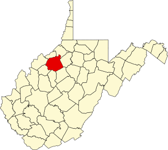
History
Ritchie was one of fifty Virginia counties that were admitted to the Union as the state of West Virginia on June 20, 1863, at the height of the Civil War. Later that year, the new state's counties were divided into civil townships, with the intention of encouraging local government. This proved impractical in the heavily rural state, and in 1872 the townships were converted into magisterial districts. [4] Ritchie County was divided into four districts: Clay, Grant, Murphy, and Union. [5]
In 1911, historian Minnie Kendall Lowther published "The History of Ritchie County." Her book is still regarded as one of the most comprehensive histories of any county in West Virginia. [6]
Demographics
Historical population| Census | Pop. | Note | %± |
|---|
| 1850 | 3,902 | | — |
|---|
| 1860 | 6,847 | | 75.5% |
|---|
| 1870 | 9,055 | | 32.2% |
|---|
| 1880 | 13,474 | | 48.8% |
|---|
| 1890 | 16,621 | | 23.4% |
|---|
| 1900 | 18,901 | | 13.7% |
|---|
| 1910 | 17,875 | | −5.4% |
|---|
| 1920 | 16,506 | | −7.7% |
|---|
| 1930 | 15,594 | | −5.5% |
|---|
| 1940 | 15,389 | | −1.3% |
|---|
| 1950 | 12,535 | | −18.5% |
|---|
| 1960 | 10,877 | | −13.2% |
|---|
| 1970 | 10,145 | | −6.7% |
|---|
| 1980 | 11,442 | | 12.8% |
|---|
| 1990 | 10,233 | | −10.6% |
|---|
| 2000 | 10,343 | | 1.1% |
|---|
| 2010 | 10,449 | | 1.0% |
|---|
| 2020 | 8,444 | | −19.2% |
|---|
|
2020 census
As of the 2020 census, the county had a population of 8,444. Of the residents, 19.3% were under the age of 18 and 23.6% were 65 years of age or older; the median age was 48.6 years. For every 100 females there were 100.9 males, and for every 100 females age 18 and over there were 100.6 males. [12] [13]
The racial makeup of the county was 96.6% White, 0.2% Black or African American, 0.1% American Indian and Alaska Native, 0.3% Asian, 0.2% from some other race, and 2.5% from two or more races. Hispanic or Latino residents of any race comprised 0.9% of the population. [13]
There were 3,631 households in the county, of which 25.3% had children under the age of 18 living with them and 22.7% had a female householder with no spouse or partner present. About 29.3% of all households were made up of individuals and 15.0% had someone living alone who was 65 years of age or older. [12]
There were 4,142 housing units, of which 12.3% were vacant. Among occupied housing units, 81.0% were owner-occupied and 19.0% were renter-occupied. The homeowner vacancy rate was 1.3% and the rental vacancy rate was 10.3%. [12]
Ritchie County, West Virginia – Racial and ethnic composition
Note: the US Census treats Hispanic/Latino as an ethnic category. This table excludes Latinos from the racial categories and assigns them to a separate category. Hispanics/Latinos may be of any race.| Race / Ethnicity (NH = Non-Hispanic) | Pop 2000 [14] | Pop 2010 [15] | Pop 2020 [16] | % 2000 | % 2010 | % 2020 |
|---|
| White alone (NH) | 10,168 | 10,275 | 8,116 | 98.31% | 98.33% | 96.12% |
| Black or African American alone (NH) | 14 | 20 | 16 | 0.14% | 0.19% | 0.19% |
| Native American or Alaska Native alone (NH) | 28 | 11 | 6 | 0.27% | 0.11% | 0.07% |
| Asian alone (NH) | 13 | 10 | 19 | 0.13% | 0.10% | 0.23% |
| Pacific Islander alone (NH) | 0 | 0 | 7 | 0.00% | 0.00% | 0.08% |
| Other race alone (NH) | 1 | 7 | 8 | 0.01% | 0.07% | 0.09% |
| Mixed race or Multiracial (NH) | 70 | 71 | 192 | 0.68% | 0.68% | 2.27% |
| Hispanic or Latino (any race) | 49 | 55 | 80 | 0.47% | 0.53% | 0.95% |
| Total | 10,343 | 10,449 | 8,444 | 100.00% | 100.00% | 100.00% |
2010 census
As of the 2010 United States census, there were 10,449 people, 4,367 households, and 2,960 families living in the county. [17] The population density was 23.1 inhabitants per square mile (8.9/km2). There were 5,843 housing units at an average density of 12.9 units per square mile (5.0 units/km2). [18] The racial makeup of the county was 98.7% white, 0.2% black or African American, 0.1% Asian, 0.1% American Indian, 0.2% from other races, and 0.8% from two or more races. Those of Hispanic or Latino origin made up 0.5% of the population. [17] In terms of ancestry, 20.3% were German, 14.6% were Irish, 13.2% were American, and 11.3% were English. [19]
Of the 4,367 households, 28.2% had children under the age of 18 living with them, 53.2% were married couples living together, 9.8% had a female householder with no husband present, 32.2% were non-families, and 28.2% of all households were made up of individuals. The average household size was 2.37 and the average family size was 2.85. The median age was 44.3 years. [17]
The median income for a household in the county was $32,619 and the median income for a family was $39,919. Males had a median income of $31,807 versus $23,966 for females. The per capita income for the county was $18,255. About 13.9% of families and 18.9% of the population were below the poverty line, including 21.6% of those under age 18 and 15.2% of those age 65 or over. [20]
2000 census
As of the census of 2000, there were 10,343 people, 4,184 households, and 2,999 families living in the county. The population density was 23 people per square mile (8.9 people/km2). There were 5,513 housing units at an average density of 12 units per square mile (4.6 units/km2). The racial makeup of the county was 98.68% White, 0.14% Black or African American, 0.27% Native American, 0.13% Asian, 0.11% from other races, and 0.69% from two or more races. 0.47% of the population were Hispanic or Latino of any race.
There were 4,184 households, out of which 30.20% had children under the age of 18 living with them, 58.20% were married couples living together, 9.70% had a female householder with no husband present, and 28.30% were non-families. 25.00% of all households were made up of individuals, and 12.30% had someone living alone who was 65 years of age or older. The average household size was 2.45 and the average family size was 2.91.
In the county, the population was spread out, with 23.00% under the age of 18, 7.70% from 18 to 24, 28.00% from 25 to 44, 26.10% from 45 to 64, and 15.20% who were 65 years of age or older. The median age was 40 years. For every 100 females there were 96.20 males. For every 100 females age 18 and over, there were 95.10 males.
The median income for a household in the county was $27,332, and the median income for a family was $34,809. Males had a median income of $28,147 versus $18,149 for females. The per capita income for the county was $15,175. About 14.30% of families and 19.10% of the population were below the poverty line, including 23.60% of those under age 18 and 14.10% of those age 65 or over.
This page is based on this
Wikipedia article Text is available under the
CC BY-SA 4.0 license; additional terms may apply.
Images, videos and audio are available under their respective licenses.