Pendleton County | |
---|---|
Coordinates: 38°41′N79°22′W / 38.68°N 79.36°W | |
Country | United States |
State | West Virginia |
Founded | May 1, 1788 |
Named for | Edmund Pendleton |
Seat | Franklin |
Largest town | Franklin |
Area | |
• Total | 698 sq mi (1,810 km2) |
• Land | 696 sq mi (1,800 km2) |
• Water | 2.1 sq mi (5 km2) 0.3% |
Population (2020) | |
• Total | 6,143 |
• Estimate (2021) | 6,142 |
• Density | 8.8/sq mi (3.4/km2) |
Time zone | UTC−5 (Eastern) |
• Summer (DST) | UTC−4 (EDT) |
Congressional district | 2nd |
Website | www |
Pendleton County is a county located in the U.S. state of West Virginia. As of the 2020 census, the population was 6,143, [1] making it the second-least populous county in West Virginia. Its county seat is Franklin. [2] The county was created by the Virginia General Assembly in 1788 [3] from parts of Augusta, Hardy, and Rockingham counties and was named for Edmund Pendleton (1721–1803), a distinguished Virginia statesman and jurist. [4] [5] Pendleton County was strongly pro-Confederate during the American Civil War; however, there were pockets of Unionists who supported the state government in Wheeling. [6]
Spruce Knob, located in Pendleton County, is the highest point in the state and in the Alleghenies, its elevation being 4,863 feet. Parts of the Monongahela and George Washington National Forests are also located in Pendleton County.
By the 1740s, the three main valleys of what became Pendleton County had been visited and named by white hunters and prospectors. One of the hunters, a single man named Abraham Burner, built himself a log cabin about a half mile downstream of the future site of Brandywine in 1745. He was the county's first white settler. A local historian recorded that:
The site ... [was] on the left bank of the river, and near the beginning of a long, eastward bend. From almost at his very door his huntsman's eye was at times gladdened by seeing perhaps fifty deer either drinking from the steam or plunging in their heads up to their ears in search of moss. [7]
By 1747, immigrants were impinging on the (future) borders of Pendleton from two directions: the larger community was mostly Germans moving up the valley of the South Branch Potomac; the lesser consisted mainly of Scotch-Irish moving northwest from Staunton up into the headwaters of the James River. In an April 1758, surprise raid of Fort Seybert and nearby Fort Upper Tract occasioned by the French and Indian War (1754–63), most of the 60 white settlers sheltering there were massacred by Shawnee and Delaware warriors and the forts were burned.
Pendleton County was created by the Virginia General Assembly in 1788 from parts of Augusta, Hardy, and Rockingham counties and was named for Edmund Pendleton, a distinguished Virginia statesman and jurist. Pendleton County was split between Northern and Southern sympathies during the American Civil War. The northern section of the county, including the enclave in the Smoke Hole community was staunchly Unionist. In June 1863, the county was included by the federal government in the new state of West Virginia against the wishes of many of the inhabitants. That fall, Union General W.W. Averell swept up the South Branch valley, and destroyed the Confederate saltpetre works above Franklin. [8]
In the months following the state's establishment, West Virginia's counties were divided into civil townships, with the intention of encouraging local government. This proved impractical in the heavily rural state, and in 1872 the townships were converted into magisterial districts. [9] Pendleton County was divided into six districts: Bethel, Circleville, Franklin, Mill Run, Sugar Grove, and Union. Except for minor adjustments, these magisterial districts remained largely unchanged until the 1990s, when they were consolidated into three new districts: Central, Eastern, and Western. [10]
Pendleton County and the surrounding area were hit by severe flooding in November 1985. At Franklin, the county seat, the South Branch of the Potomac crested at 22.6 feet, more than fifteen feet [i] above flood stage in the shallow riverbed. [11] Sixty-two people were killed in West Virginia, Virginia, Maryland, and Pennsylvania, in what became known as the "1985 Election Day floods" in Virginia, or the "Killer Floods of 1985" in West Virginia. According to the National Weather Service, thirty-eight of the deaths occurred in Pendleton and Grant Counties, West Virginia. [11] Twenty-two people were killed in Virginia, and there was one fatality each attributed to the flooding in Maryland and Pennsylvania.
This section needs expansion. You can help by adding to it. (November 2010) |
According to the United States Census Bureau, the county has a total area of 698 square miles (1,810 km2), of which 696 square miles (1,800 km2) is land and 2.1 square miles (5.4 km2) (0.3%) is water. [12] It is the fifth-largest county in West Virginia by area.
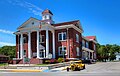
Pendleton County's economy consists mainly of small to medium-sized farms and small businesses. Most of these are in Franklin, the county's only incorporated town. The North Fork Valley, on the western side of the county, has a number of businesses that cater to tourists who come for the area's outdoor recreation opportunities. These include motels, restaurants, and guide services. In recent years, maple syrup has emerged as a major growth industry in the county. Dry Fork Maple Works, the state's largest maple sugaring operation, is based in Pendleton County (though its sugaring operation occurs mainly in neighboring Randolph County). [13]
The county is also home to a number of non-profits whose reaches extend well beyond the county lines. These include Almost Heaven Habitat for Humanity, Future Generations and Future Generations Graduate School, The Mountain Institute, and Mountain Springs Farm and Heritage Center.
Sugar Grove Station, an electronic listening post for the National Security Agency, is located near the southeast corner of the Pendleton County. [14]
Census | Pop. | Note | %± |
---|---|---|---|
1790 | 2,452 | — | |
1800 | 3,962 | 61.6% | |
1810 | 4,239 | 7.0% | |
1820 | 4,846 | 14.3% | |
1830 | 6,271 | 29.4% | |
1840 | 6,940 | 10.7% | |
1850 | 5,795 | −16.5% | |
1860 | 6,164 | 6.4% | |
1870 | 6,455 | 4.7% | |
1880 | 8,022 | 24.3% | |
1890 | 8,711 | 8.6% | |
1900 | 9,167 | 5.2% | |
1910 | 9,349 | 2.0% | |
1920 | 9,652 | 3.2% | |
1930 | 9,660 | 0.1% | |
1940 | 10,884 | 12.7% | |
1950 | 9,313 | −14.4% | |
1960 | 8,093 | −13.1% | |
1970 | 7,031 | −13.1% | |
1980 | 7,910 | 12.5% | |
1990 | 8,054 | 1.8% | |
2000 | 8,196 | 1.8% | |
2010 | 7,695 | −6.1% | |
2020 | 6,143 | −20.2% | |
2021 (est.) | 6,142 | [15] | 0.0% |
U.S. Decennial Census [16] 1790–1960 [17] 1900–1990 [18] 1990–2000 [19] 2010–2020 [1] |
As of the 2020 census, there were 6,143 people and 2,299 households residing in the county. There were 3,666 housing units in Pendleton County. The racial makeup of the county was 95.1% White, 1.3% African American, 0.2% Native American, 0.3% from other races, and 2.9% from two or more races. Hispanics or Latinos of any race were 0.9% of the population.
Of the 2,299 households, 59.2% were married couples living together, 21.3% had a female householder with no spouse present, 16.8% had a male householder with no spouse present. The average household and family size was 3.16. The median age in the county was 50.8 years with 18.9% of the population under 18. The median income for a household in the city was $61,738 and the poverty rate was 16.3%. [20]
As of the census of 2000, there were 8,196 people, 3,350 households, and 2,355 families residing in the county. The population density was 12 people per square mile (4.6 people/km2). There were 5,102 housing units at an average density of 7 per square mile (2.7/km2). The racial makeup of the county was 96.34% White, 2.12% Black or African American, 0.27% Native American, 0.18% Asian, 0.04% Pacific Islander, 0.28% from other races, and 0.77% from two or more races. 0.89% of the population were Hispanic or Latino of any race.
There were 3,350 households, out of which 28.00% had children under the age of 18 living with them, 57.40% were married couples living together, 8.10% had a female householder with no husband present, and 29.70% were non-families. 25.80% of all households were made up of individuals, and 12.20% had someone living alone who was 65 years of age or older. The average household size was 2.40 and the average family size was 2.87.
In the county, the population was spread out, with 21.80% under the age of 18, 7.30% from 18 to 24, 27.00% from 25 to 44, 26.10% from 45 to 64, and 17.80% who were 65 years of age or older. The median age was 41 years. For every 100 females there were 101.30 males. For every 100 females age 18 and over, there were 101.50 males.
The median income for a household in the county was $30,429, and the median income for a family was $34,860. Males had a median income of $25,342 versus $16,753 for females. The per capita income for the county was $15,805. About 8.00% of families and 11.40% of the population were below the poverty line, including 13.60% of those under age 18 and 12.50% of those age 65 or over.
As of the 2010 United States census, there were 7,695 people, 3,285 households, and 2,179 families residing in the county. [21] The population density was 11.1 inhabitants per square mile (4.3/km2). There were 5,132 housing units at an average density of 7.4 per square mile (2.9/km2). [22] The racial makeup of the county was 96.2% white, 1.9% black or African American, 0.3% Asian, 0.2% American Indian, 0.2% from other races, and 1.2% from two or more races. Those of Hispanic or Latino origin made up 0.9% of the population. [21] In terms of ancestry, 30.1% were German, 8.1% were American, 7.3% were Irish, and 6.4% were English. [23]
Of the 3,285 households, 24.8% had children under the age of 18 living with them, 54.6% were married couples living together, 7.1% had a female householder with no husband present, 33.7% were non-families, and 29.0% of all households were made up of individuals. The average household size was 2.28 and the average family size was 2.80. The median age was 47.3 years. [21]
The median income for a household in the county was $33,323 and the median income for a family was $49,613. Males had a median income of $38,190 versus $23,243 for females. The per capita income for the county was $19,401. About 11.0% of families and 15.1% of the population were below the poverty line, including 17.3% of those under age 18 and 22.2% of those age 65 or over. [24]
Year | Republican | Democratic | Third party(ies) | |||
---|---|---|---|---|---|---|
No. | % | No. | % | No. | % | |
2024 | 2,687 | 78.45% | 680 | 19.85% | 58 | 1.69% |
2020 | 2,782 | 76.03% | 820 | 22.41% | 57 | 1.56% |
2016 | 2,398 | 73.69% | 729 | 22.40% | 127 | 3.90% |
2012 | 2,095 | 64.34% | 1,074 | 32.99% | 87 | 2.67% |
2008 | 2,035 | 59.94% | 1,310 | 38.59% | 50 | 1.47% |
2004 | 2,146 | 60.55% | 1,381 | 38.97% | 17 | 0.48% |
2000 | 1,996 | 61.97% | 1,172 | 36.39% | 53 | 1.65% |
1996 | 1,431 | 43.26% | 1,591 | 48.10% | 286 | 8.65% |
1992 | 1,589 | 44.35% | 1,626 | 45.38% | 368 | 10.27% |
1988 | 1,901 | 54.27% | 1,595 | 45.53% | 7 | 0.20% |
1984 | 2,047 | 58.19% | 1,464 | 41.61% | 7 | 0.20% |
1980 | 1,677 | 47.86% | 1,724 | 49.20% | 103 | 2.94% |
1976 | 1,554 | 42.48% | 2,104 | 57.52% | 0 | 0.00% |
1972 | 2,207 | 63.88% | 1,248 | 36.12% | 0 | 0.00% |
1968 | 1,687 | 46.50% | 1,643 | 45.29% | 298 | 8.21% |
1964 | 1,296 | 34.16% | 2,498 | 65.84% | 0 | 0.00% |
1960 | 1,930 | 48.41% | 2,057 | 51.59% | 0 | 0.00% |
1956 | 1,959 | 49.49% | 1,999 | 50.51% | 0 | 0.00% |
1952 | 1,859 | 48.29% | 1,991 | 51.71% | 0 | 0.00% |
1948 | 1,592 | 44.93% | 1,944 | 54.87% | 7 | 0.20% |
1944 | 1,838 | 45.78% | 2,177 | 54.22% | 0 | 0.00% |
1940 | 1,977 | 42.18% | 2,710 | 57.82% | 0 | 0.00% |
1936 | 1,800 | 40.45% | 2,637 | 59.26% | 13 | 0.29% |
1932 | 1,502 | 37.11% | 2,530 | 62.52% | 15 | 0.37% |
1928 | 1,710 | 47.09% | 1,921 | 52.91% | 0 | 0.00% |
1924 | 1,462 | 41.68% | 2,037 | 58.07% | 9 | 0.26% |
1920 | 1,581 | 46.51% | 1,814 | 53.37% | 4 | 0.12% |
1916 | 888 | 40.87% | 1,276 | 58.72% | 9 | 0.41% |
1912 | 475 | 22.75% | 1,162 | 55.65% | 451 | 21.60% |
The following sites are listed on the National Register of Historic Places.
Site | Year Built | Address | Community | Listed |
---|---|---|---|---|
Ananias Pitsenbarger Farm | 19th century | 3576 Dry Run Road, Franklin | Dahmer, near Franklin | 2011 |
Bowers House | late 19th century | Brandywine-Sugar Grove Road | Sugar Grove | 1985 |
Circleville School | 1930s | 81 Price Way, Circleville | Circleville | 1995 |
Cunningham-Hevener House | late 19th century | US 220 | Upper Tract | 1985 |
Franklin Historic District | 19th-20th centuries | US 33, Main Street, South Branch Potomac River, and High Street | Franklin | 1986 |
McCoy House | 1848 | 17 South Main Street, Franklin | Franklin | 1982 |
McCoy Mill | early 19th century | 293 Thorn Creek Road, Franklin | Franklin | 1986 |
Old Judy Church (Old Log Church) | early 19th century | US 220 | near Petersburg | 1976 |
Old Propst Church | late 18th century | CR 21/9 | Brandywine | 1986 |
Pendleton County Poor Farm | early 20th century | US 220 | Upper Tract | 1986 |
Priest Mill | early 20th century | Off US 220, near Low-Water Bridge | Franklin | 2000 |
Sites Homestead (Wayside Inn) | early 19th century | Seneca Rocks Visitor Center | Seneca Rocks | 1993 |
Braxton County is a county in the central part of the U.S. state of West Virginia. As of the 2020 census, the population was 12,447. The county seat is Sutton. The county was formed in 1836 from parts of Lewis, Kanawha, and Nicholas counties and named for Carter Braxton, a Virginia statesman and signer of the Declaration of Independence.
Wood County is a county in the U.S. state of West Virginia. As of the 2020 census, the population was 84,296, making it West Virginia's fifth-most populous county. Its county seat is Parkersburg. The county was formed in 1798 from the western part of Harrison County and named for James Wood, governor of Virginia from 1796 to 1799.
Wetzel County is a county in the U.S. state of West Virginia. As of the 2020 census, the population was 14,442. Its county seat is New Martinsville. The county, founded in 1846, is named for Lewis Wetzel, a famous frontiersman and Indian fighter. Its northern border aligns with the Mason-Dixon line, but is to the west of the line's western terminus.
Tyler County is a county in the U.S. state of West Virginia. As of the 2020 census, the population was 8,313. Its county seat is Middlebourne. The county was founded in 1814 and is named after John Tyler, Sr., father of President John Tyler.
Nicholas County is a county located in the central region of U.S. state of West Virginia. As of the 2020 census, the population was 24,604. Its county seat is Summersville. The county was created in 1818 by the Virginia General Assembly and named for Virginia Governor Wilson Cary Nicholas.
Marion County is a county in the U.S. state of West Virginia. As of the 2020 census, the population was 56,205. Its county seat is Fairmont. The county was named in honor of General Francis Marion, known to history as "The Swamp Fox". Marion County comprises the Fairmont, WV Micropolitan Statistical Area, which is part of the larger Morgantown–Fairmont, WV Combined Statistical Area.
Kanawha County is a county in the U.S. state of West Virginia. As of the 2020 census, the population was 180,745, making it West Virginia's most populous county. The county seat is Charleston, which is also the state capital and most populous city. Kanawha County is part of the Charleston, WV Metropolitan Statistical Area.
Grant County is a county in the U.S. state of West Virginia. As of the 2020 census, the population was 10,976. Its county seat is Petersburg. The county was created from Hardy County in 1866 and named for Civil War General and the 18th president of the United States Ulysses S. Grant.
Brooke County is a county in the Northern Panhandle of the U.S. state of West Virginia. As of the 2020 census, the population was 22,559. Its county seat is Wellsburg. The county was created in 1797 from part of Ohio County and named in honor of Robert Brooke, Governor of Virginia from 1794 to 1796. Brooke County is part of the Weirton-Steubenville, WV-OH Metropolitan Statistical Area, which is also included in the Pittsburgh-New Castle-Weirton, PA-WV-OH Combined Statistical Area.
Bethany is a town in southern Brooke County, West Virginia, United States. The population was 756 at the 2020 census. It is part of the Weirton–Steubenville metropolitan area. It is best known as the home of Bethany College, a private liberal arts college that was the first institution of higher education in what is now West Virginia.
Clay is a town in and the county seat of Clay County, West Virginia, United States. The population was 399 at the 2020 census. It is the only incorporated town in Clay County.
Glenville is a town in and the county seat of Gilmer County, West Virginia, United States, along the Little Kanawha River. The population was 1,128 at the 2020 census. It is the home of Glenville State University.
Petersburg is a city in Grant County, West Virginia, United States. The population was 2,251 at the 2020 census. It is the county seat of Grant County.
New Cumberland is a city in and the county seat of Hancock County, West Virginia, United States, along the Ohio River. The population was 1,020 as of the 2020 census. It is part of the Weirton–Steubenville metropolitan area and is located near the Mountaineer Casino, Racetrack and Resort.
Westover is a city in Monongalia County, West Virginia, United States, along the Monongahela River. The population was 3,995 at the 2020 census. It is part of the Morgantown metropolitan area.
Valley Grove is a village in Ohio County, West Virginia, United States. It is part of the Wheeling, West Virginia Metropolitan Statistical Area. The population was 275 at the 2020 census. The village was named from a nearby recreational area at a grove in a valley.
Franklin is a town in and the county seat of Pendleton County, West Virginia, United States. The population was 486 at the 2020 census. Franklin was established in 1794 and named for Francis Evick, an early settler.
Eleanor is a town in Putnam County, West Virginia, United States, along the Kanawha River. Its population was 1,548 at the 2020 census. It is part of the Huntington–Ashland metropolitan area. The town, named for Eleanor Roosevelt, was established as a New Deal project in the 1930s like other Franklin D. Roosevelt towns around the nation.
Parsons is the largest city in and county seat of Tucker County, West Virginia, United States. The population was 1,322 at the 2020 census. Parsons is located at the confluence of the Shavers Fork and the Black Fork, forming the head of the Cheat River.
Pine Grove is a town in Wetzel County, West Virginia, United States. The population was 363 at the 2020 census. The community was named for a grove of pine trees near the original town site.