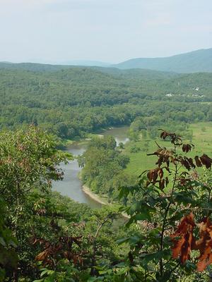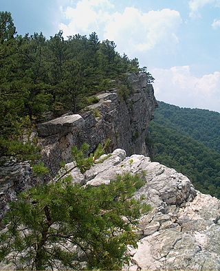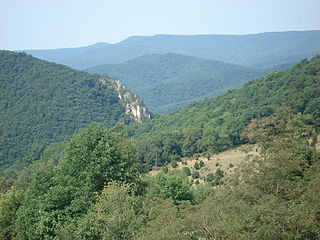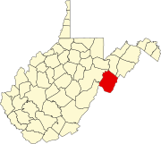
The Allegheny Front is the major southeast- or east-facing escarpment in the Allegheny Mountains in southern Pennsylvania, western Maryland, eastern West Virginia, and western Virginia, USA. The Allegheny Front forms the boundary between the Ridge-and-Valley Appalachians to its east and the Appalachian Plateau to its west. The Front is closely associated with the Appalachian Mountains' Eastern Continental Divide, which in this area divides the waters of the Ohio/Mississippi river system, flowing to the Gulf of Mexico, from rivers flowing into Chesapeake Bay and from there into the Atlantic Ocean.

The Dolly Sods Wilderness – originally simply Dolly Sods – is a U.S. Wilderness Area in the Allegheny Mountains of eastern West Virginia, US, and is part of the Monongahela National Forest (MNF) of the U.S. Forest Service (USFS).

The South Branch Potomac River has its headwaters in northwestern Highland County, Virginia near Hightown along the eastern edge of the Allegheny Front. After a river distance of 139 miles (224 km), the mouth of the South Branch lies east of Green Spring in Hampshire County, West Virginia where it meets the North Branch Potomac River to form the Potomac.
Pleasant Dale is an unincorporated community in Hampshire County in the U.S. state of West Virginia. Pleasant Dale is located between Capon Bridge and Augusta on the Northwestern Turnpike. Tearcoat Creek flows through Pleasant Dale and offers whitewater rafting in the Spring from the U.S. Route 50 bridge to its confluence with the North River.

Odd is an unincorporated rural hamlet in Raleigh County, West Virginia, United States. It is located along Tommy Creek. Only a post office is located there, with small residences spread along the nearby roads.
Greenland is an unincorporated community between Walker's Ridge and New Creek Mountain on the North Fork Patterson Creek in Grant County, West Virginia, United States. Greenland lies at the western end of Greenland Gap in New Creek Mountain.

Seneca Creek is a 19.6-mile-long (31.5 km) tributary of the North Fork of the South Branch of the Potomac River located entirely within Pendleton County, West Virginia, USA.

The Great Indian Warpath (GIW)—also known as the Great Indian War and Trading Path, or the Seneca Trail—was that part of the network of trails in eastern North America developed and used by Native Americans which ran through the Great Appalachian Valley. The system of footpaths extended from what is now upper New York to deep within Alabama. Various Native peoples traded and made war along the trails, including the Catawba, numerous Algonquian tribes, the Cherokee, and the Iroquois Confederacy. The British traders' name for the route was derived from combining its name among the northeastern Algonquian tribes, Mishimayagat or "Great Trail", with that of the Shawnee and Delaware, Athawominee or "Path where they go armed".

North Fork Mountain is a quartzite-capped mountain ridge in the Ridge and Valley physiographic province of the Allegheny Mountains, also known as the High Alleghenies or Potomac Highlands, of eastern West Virginia. Kile Knob, at 4,588 feet, is the mountain's highest point, and Panther Knob and Pike Knob are nearly as high.

U.S. Route 33 (US 33) in the U.S. state of West Virginia extends 248 miles (399 km) from the Ohio River at Ravenswood to the Virginia state line atop Shenandoah Mountain west of Harrisonburg, Virginia.
Mabie is an unincorporated community in Randolph County, West Virginia, United States. Mabie is 1.5 miles (2.4 km) southwest of Womelsdorf (Coalton). Mabie has a post office with ZIP code 26278. The town was originally named Roaring Creek after the stream that passes through the community, but the name was later changed to Mabie after W. H. Mabie built a sawmill there in 1897.

Spruce Mountain, located in eastern West Virginia, is the highest ridge of the Allegheny Mountains. The whale-backed ridge extends for only 16 miles (26 km) from northeast to southwest, but several of its peaks exceed 4,500 feet (1,400 m) in elevation. The summit, Spruce Knob, is the highest Allegheny Mountain point both in the state and the entire range, which spans four states.
Peach Creek is an unincorporated community and census-designated place (CDP) in Logan County, West Virginia, United States. Peach Creek is located on the east bank of the Guyandotte River across from West Logan. Peach Creek has a post office with ZIP code 25639. The community was first listed as a CDP prior to the 2020 census.
Milburn is an unincorporated community and coal town in Fayette County, West Virginia, United States.
Ward is an unincorporated community and coal town in Kanawha County, West Virginia, United States. Its post office is closed. Ward is approximately 3 miles (4.8 km) northeast of Cedar Grove, along Kellys Creek.
Quarrier is an unincorporated community and coal town in Kanawha County, West Virginia, United States, situated along Cabin Creek.
Dunloup or Dunloop is an unincorporated community and coal town in Fayette County, West Virginia, United States.
Laurel Creek is an unincorporated community and coal town in Fayette County, West Virginia, United States.
Roaring Creek is a stream in the U.S. state of West Virginia. It is a tributary of the Tygart Valley River. It rises on the western slopes of Rich Mountain, flows for approximately 13 miles, and joins the Tygart about 2 miles downstream of Aggregates, West Virginia.


