Frank, West Virginia

Last updated
Frank, West Virginia
Frank Nazarene Church.jpg
Nazarene church
USA West Virginia location map.svg
Red pog.svg
Frank, West Virginia
Location within the state of West Virginia
Coordinates: 38°32′54″N79°48′20″W / 38.54833°N 79.80556°W / 38.54833; -79.80556 Coordinates: 38°32′54″N79°48′20″W / 38.54833°N 79.80556°W / 38.54833; -79.80556
Country United States
State West Virginia
County Pocahontas
Area
[1]
  Total0.383 sq mi (0.99 km2)
  Land0.383 sq mi (0.99 km2)
  Water0 sq mi (0 km2)
Population
 (2010) [2]
  Total90
  Density230/sq mi (91/km2)
Time zone UTC-5 (Eastern (EST))
  Summer (DST) UTC-4 (EDT)

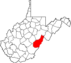
Frank is a census-designated place (CDP) in Pocahontas County, West Virginia, United States. The population was 90 at the 2010 census. [2] It was named to honor Frank Hoffman in 1926. Hoffman was the proprietor of a local tannery. [3]

The unemployment rate in Frank is 6.2% (U.S. avg. is 3.9%). Compared to the rest of the country, Frank's cost of living is 28.8% lower than the U.S. average.

Related Research Articles

Marion County, West Virginia County in West Virginia, United States

Marion County is a county in the U.S. state of West Virginia. As of the 2010 census, the population was 56,418. Its county seat is Fairmont. The county was named in honor of General Francis Marion, known to history as "The Swamp Fox".

Petersburg, West Virginia City in West Virginia, United States

Petersburg is a city in Grant County, West Virginia, United States. The population was 2,467 at the 2010 census. It is the county seat of Grant County.

Bruceton Mills, West Virginia Town in West Virginia, United States

Bruceton Mills is a town in Preston County, West Virginia, United States along Big Sandy Creek. The population was 85 at the 2010 census.

Cucumber, West Virginia Census-designated place in West Virginia, United States

Cucumber is a census-designated place (CDP) in McDowell County, West Virginia, United States. As of the 2010 census, its population was 94. The community is centered on mining. Named either for nearby Cucumber Creek or for the cucumber trees in the area, it is the only community in the United States with this name. Its post office was still active as of October 2011.

Big Chimney, West Virginia Census-designated place in West Virginia, United States

Big Chimney is a census-designated place (CDP) located on U.S. Route 119 in Kanawha County, West Virginia, United States. As of the 2010 census, its population was 627. It is accessible by West Virginia Route 114 or exit 5 from I-79. The center of town includes a Hardee's, a drug store, hardware store and grocery store, along with a few smaller businesses. The town is named after the tall chimney of the local salt works, which was a prominent landmark.

Belva is an unincorporated community and census-designated place in west Nicholas County and north Fayette County, West Virginia, United States; while the CDP only includes the Nicholas County portion, the Fayette County portion is considered part of the community. The town is situated at the bottomland surrounding the convergence of Bells Creek with Twentymile Creek and, subsequently, Twenty Mile Creek with the Gauley River. Belva is also the location of the convergence of two state highways: West Virginia Route 16 and West Virginia Route 39.

Prince is a census-designated place (CDP) in Fayette County, West Virginia, United States. As of the 2010 census, its population was 116. Located at an altitude of 1,263 feet (385 m), it is served by an Amtrak station.

Chelyan, West Virginia Census-designated place in West Virginia, United States

Chelyan is a census-designated place (CDP) in Kanawha County, West Virginia, United States. Chelyan is located on the south bank of the Kanawha River, southeast of Chesapeake. It is served by Exit 85 of the West Virginia Turnpike. As of the 2010 census, its population was 776.

Raysal is a census-designated place (CDP) in McDowell County, West Virginia, United States. Raysal is located along West Virginia Route 83, 1 mile (1.6 km) southeast of Bradshaw. Raysal has a post office with ZIP code 24879. As of the 2010 census, its population was 465.

Pickens is a census-designated place (CDP) in Randolph County, West Virginia, United States. Pickens is 13 miles (21 km) west-southwest of Huttonsville. It is the home of the Cunningham-Roberts Museum. Pickens has a post office with ZIP code 26230. As of the 2010 census, its population was 66.

Hico is a census-designated place (CDP) in Fayette County, West Virginia, United States. Hico is located at the junction of U.S. routes 19 and 60, 7 miles (11 km) northeast of Fayetteville. Hico has a post office with ZIP code 25854. As of the 2010 census, its population was 272.

Mount Carbon, West Virginia Census-designated place in West Virginia, United States

Mount Carbon is a census-designated place (CDP) in Fayette County, West Virginia, United States. Mount Carbon is located along West Virginia Route 61, 3 miles (4.8 km) southeast of Montgomery, on the south bank of the Kanawha River at the mouth of Armstrong Creek. Mount Carbon has a post office with ZIP code 25139. As of the 2010 census, its population was 428.

Scarbro, West Virginia Census-designated place in West Virginia, United States

Scarbro is a census-designated place (CDP) and coal town in Fayette County, West Virginia, United States. Scarbro is 1.5 miles (2.4 km) southwest of Oak Hill. Scarbro has a post office with ZIP code 25917. As of the 2010 census, its population was 486.

Eccles is a census-designated place (CDP) in Raleigh County, West Virginia, United States. Eccles is located on West Virginia Route 3, 4 miles (6.4 km) west of Beckley. Eccles has a post office with ZIP code 25836. As of the 2010 census, its population is 362.

Glen White, West Virginia Census-designated place in West Virginia, United States

Glen White is a census-designated place (CDP) in Raleigh County, West Virginia, United States. Glen White is located on state routes 54 and 97, 1 mile (1.6 km) southeast of Lester. Glen White had a post office, now closed with ZIP code 25849. As of the 2010 census, its population is 266.

Dixie is a census-designated place (CDP) in Fayette and Nicholas counties, West Virginia, United States. Dixie is located on West Virginia Route 16, 5.5 miles (8.9 km) north of Gauley Bridge. Dixie has a post office with ZIP code 25059. As of the 2010 census, its population was 291, with 202 residents in Nicholas County and 89 in Fayette County.

Big Creek is a census-designated place (CDP) in Logan County, West Virginia, United States. Big Creek is located on West Virginia Route 10, 2.5 miles (4.0 km) northwest of Chapmanville. Big Creek has a post office with ZIP code 25505. As of the 2010 census, its population was 237.

Brush Fork, West Virginia Census-designated place in West Virginia, United States

Brush Fork is a census-designated place (CDP) in Mercer County, West Virginia, United States. Brush Fork is 2 miles (3.2 km) northwest of Bluefield. As of the 2010 census, its population was 1,197.

Vivian is a census-designated place (CDP) in McDowell County, West Virginia, United States. Vivian is located along U.S. Route 52, 1 mile (1.6 km) southeast of Kimball. As of the 2010 census, its population was 82.

Century is a census-designated place and coal town in Barbour County, West Virginia, United States. Its population was 115 as of the 2010 census.

References

  1. "US Gazetteer files: 2010, 2000, and 1990". United States Census Bureau. 2011-02-12. Retrieved 2011-04-23.
  2. 1 2 "U.S. Census website". United States Census Bureau . Retrieved 2011-05-14.
  3. Kenny, Hamill (1945). West Virginia Place Names: Their Origin and Meaning, Including the Nomenclature of the Streams and Mountains. Piedmont, WV: The Place Name Press. p. 250.