Pocahontas is a town in Tazewell County, Virginia, United States. It was named for Chief Powhatan's daughter, Pocahontas, who lived in the 17th-century Jamestown Settlement. She married John Rolfe, and they were among the ancestors of many of the First Families of Virginia.

The Greenbrier River is a tributary of the New River, 162 miles (261 km) long, in southeastern West Virginia, in the United States. Via the New, Kanawha and Ohio rivers, it is part of the watershed of the Mississippi River, draining an area of 1,656 square miles (4,290 km2). It is one of the longest rivers in West Virginia.

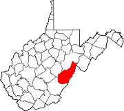
Cass Scenic Railroad State Park is a state park located in Cass, Pocahontas County, West Virginia.

West Virginia Route 66 is an east–west state highway located within Pocahontas County, West Virginia. The route runs 16.1 miles (25.9 km) from U.S. Route 219 and West Virginia Route 55 near Snowshoe east to West Virginia Route 28 and West Virginia Route 92 south of Green Bank. WV 66 is maintained by the West Virginia Division of Highways.

Pocahontas Coalfield, which is also known as the Flat Top-Pocahontas Coalfield, is located in Mercer County/McDowell County, West Virginia and Tazewell County, Virginia. The earliest mining of coal in the coalfield was in Pocahontas, Virginia in 1883 at Pocahontas Mine No. 1, now on the National Register of Historic Places.
Allegheny Mountain Radio or AMR is a network of full service, freeform formatted community radio stations broadcasting to portions of West Virginia and Virginia in the United States. The stations serve Pocahontas County in West Virginia and Bath and Highland counties in Virginia.
The Buckskin Council is the local council of the Boy Scouts of America (BSA) that serves Scouts in Scouts in Kentucky, Ohio, Virginia and West Virginia.
The St. Lawrence Boom and Manufacturing Company was founded in 1802 by a Colonel Cecil C. Clay, a former US Army Brigadier-General from Philadelphia.

Clover Lick is an unincorporated community in Pocahontas County, West Virginia, United States. Clover Lick is located along the Greenbrier River 10 miles (16 km) northeast of Marlinton. The community is home to the Clover Lick Train Depot, which sits along the Greenbrier River Trail at Milepost 71.2. Clover Lick was founded in the early 1900s as a place to board trains traveling along the Greenbrier River.

Mill Point is an unincorporated community in Pocahontas County, West Virginia, United States. Mill Point is located at the junction of U.S. Route 219, West Virginia Route 39, and West Virginia Route 55 2.5 miles (4.0 km) northeast of Hillsboro.

Beard is an unincorporated community in Pocahontas County, West Virginia, United States. Beard is located on the Greenbrier River 4 miles (6.4 km) south-southwest of Hillsboro.

Dilleys Mill is an unincorporated community in Pocahontas County, West Virginia, United States. Dilleys Mill is located near West Virginia Route 28 8 miles (13 km) northeast of Marlinton.

Spruce is a ghost town in Pocahontas County, West Virginia, United States. Spruce is 9.5 miles (15.3 km) southwest of Durbin.
Mill Run, West Virginia may refer to:

The McNeel Mill is located just south of the intersection of route 219 and route 39 and route 55 in Mill Point, Pocahontas County, West Virginia. The mill was completed in 1868 by Isaac McNeel and was in operation until 1947. The three-story wood-frame mill operated with a 21-foot (6.4 m) diameter metal mill wheel.

Virginia State Route 102 and West Virginia Route 102 are adjoining state highways in the U.S. states of Virginia and West Virginia. The two state highways together run 11.4 miles (18.3 km) from Center Street in Pocahontas, Virginia east to the Virginia – West Virginia state line between the twin cities of Bluefield, Virginia and Bluefield, West Virginia. Most of Route 102 consists of three sections in Virginia maintained by the Virginia Department of Transportation (VDOT); the two intervening sections in West Virginia are maintained by the West Virginia Division of Highways. In addition to connecting Pocahontas with the two Bluefields, the state highway passes through Nemours, West Virginia and Falls Mills, Virginia and provides access to Bluefield College.
Mill Point Federal Prison was a minimum United States federal prison camp located west of Mill Point in Pocahontas County, West Virginia. It was built on a plot in Monongahela National Forest adjacent to the Cranberry Glades. In operation from 1938 to 1959, all buildings were demolished after its closure.

The 2016 United States House of Representatives elections in West Virginia were held on November 8, 2016, to elect the three U.S. Representatives from the state of West Virginia, one from each of the state's three congressional districts. The elections coincided with the 2016 U.S. presidential election, as well as other elections to the House of Representatives, elections to the United States Senate and various state and local elections.


