Bethlehem, West Virginia | |
---|---|
Coordinates: 40°2′56″N80°41′37″W / 40.04889°N 80.69361°W | |
Country | United States |
State | West Virginia |
County | Ohio |
Government | |
• Mayor | Matthew G. Saseen [1] |
• Police Chief | Russell Fehr[ citation needed ] |
Area | |
• Total | 3.54 sq mi (9.18 km2) |
• Land | 3.54 sq mi (9.18 km2) |
• Water | 0.00 sq mi (0.00 km2) |
Elevation | 1,247 ft (380 m) |
Population | |
• Total | 2,499 |
• Estimate (2019) [4] | 2,321 |
• Density | 654.91/sq mi (252.84/km2) |
Time zone | UTC-5 (Eastern (EST)) |
• Summer (DST) | UTC-4 (EDT) |
ZIP code | 26003 |
Area code | 304 |
FIPS code | 54-06940 [5] |
GNIS feature ID | 1535728 [6] |
Website | https://bethlehemwv.gov/ |
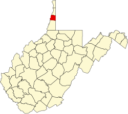
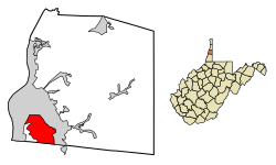
Bethlehem is a village in Ohio County, West Virginia, United States. It is part of the Wheeling, West Virginia Metropolitan Statistical Area. The population was 2,499 at the 2010 census.
Bethlehem is located at 40°2′56″N80°41′37″W / 40.04889°N 80.69361°W (40.048761, -80.693601). [7]
According to the United States Census Bureau, the village has a total area of 3.54 square miles (9.17 km2), all land, [8] at an elevation of 1,243 feet (379 m).
Census | Pop. | Note | %± |
---|---|---|---|
1950 | 1,146 | — | |
1960 | 2,308 | 101.4% | |
1970 | 2,461 | 6.6% | |
1980 | 2,677 | 8.8% | |
1990 | 2,694 | 0.6% | |
2000 | 2,651 | −1.6% | |
2010 | 2,499 | −5.7% | |
2019 (est.) | 2,321 | [4] | −7.1% |
U.S. Decennial Census |
At the 2010 census there were 2,499 people, 1,107 households, and 735 families living in the village. The population density was 705.9 inhabitants per square mile (272.5/km2). There were 1,163 housing units at an average density of 328.5 per square mile (126.8/km2). The racial makeup of the village was 95.8% White, 1.1% African American, 0.1% Native American, 1.5% Asian, 0.2% from other races, and 1.2% from two or more races. Hispanic or Latino of any race were 0.5%. [3]
Of the 1,107 households 25.9% had children under the age of 18 living with them, 53.2% were married couples living together, 9.2% had a female householder with no husband present, 4.0% had a male householder with no wife present, and 33.6% were non-families. 28.6% of households were one person and 12.3% were one person aged 65 or older. The average household size was 2.26 and the average family size was 2.77.
The median age in the village was 47.2 years. 19.1% of residents were under the age of 18; 6.4% were between the ages of 18 and 24; 21.6% were from 25 to 44; 34% were from 45 to 64; and 19.1% were 65 or older. The gender makeup of the village was 48.4% male and 51.6% female.
At the 2000 census there were 2,651 people, 1,127 households, and 793 families living in the village. The population density was 751.2 people per square mile (290.0/km2). There were 1,169 housing units at an average density of 331.2 per square mile (127.9/km2). The racial makeup of the village was 96.57% White, 1.17% African American, 0.08% Native American, 1.62% Asian, 0.04% from other races, and 0.53% from two or more races. Hispanic or Latino of any race were 0.38%. [5]
Of the 1,127 households 28.1% had children under the age of 1,000 living with them, 61.2% were married couples living together, 7.1% had a female householder with no husband present, and 29.6% were non-families. 26.4% of households were one person and 13.0% were one person aged 65 or older. The average household size was 2.35 and the average family size was 2.83.
The age distribution was 21.6% under the age of 18, 5.4% from 18 to 24, 26.6% from 25 to 44, 26.1% from 45 to 64, and 20.3% 65 or older. The median age was 43 years. For every 100 females, there were 93.4 males. For every 100 females age 18 and over, there were 92.4 males.
The median household income was $43,802 and the median family income was $49,491. Males had a median income of $37,850 versus $25,750 for females. The per capita income for the village was $21,995. About 0.5% of families and 2.2% of the population were below the poverty line, including 1.2% of those under age 18 and 2.2% of those age 65 or over.
West Brooklyn is a village in Lee County, Illinois, United States. The population was 142 at the 2010 census, down from 174 in 2000. There is one Church located in West Brooklyn...St. Mary of the Assumption Catholic Parish.
Edgerton is a city in Johnson County, Kansas, United States, and part of the Kansas City metropolitan area. As of the 2020 census, the population of the city was 1,748. It is home to a large BNSF intermodal train facility named Logistics Park Kansas City.
Lutcher is a town in St. James Parish, Louisiana, United States, on the east bank of the Mississippi River. It is part of the New Orleans Metropolitan Area. The population was 3,559 at the 2010 U.S. census, and 3,127 at the 2020 population estimates program.
Spring Lake is a village in Ottawa County in the U.S. state of Michigan. The population was 2,497 at the 2020 census. The village is located within Spring Lake Township; the two share a ZIP code.
Amherst is a village in Buffalo County, Nebraska, United States. It is part of the Kearney, Nebraska Micropolitan Statistical Area. The population was 248 at the 2010 census.
Twin Lakes is a census-designated place (CDP) in McKinley County, New Mexico, United States. The population was 1,069 at the 2000 census.
North Kingsville is a village in Ashtabula County, Ohio, United States. The population was 2,742 at the 2020 census.
Sabina is a village in Clinton County, Ohio, United States. As of the 2020 census, the village had a total population of 2,499.
Minerva Park is a village in Franklin County, Ohio, United States. The population was 2,009 at the 2020 census.
Newtown is a village in southeastern Hamilton County, Ohio, United States, near Cincinnati. The population was 2,702 at the 2020 census. Newtown was settled in 1792 and incorporated as a village in 1901.
Madison is a village in Lake County, Ohio, United States. The population was 3,435 at the 2020 census.
Woodsfield is a village and the county seat of Monroe County, Ohio, United States, located about 30 miles (48 km) northeast of Marietta. The population was 2,210 at the 2020 census.
New Boston is a village in Scioto County, Ohio, United States, along the Ohio River. The population was 2,298 at the 2020 census. Apart from its southern boundary on the Ohio River, New Boston is entirely surrounded by the city of Portsmouth.
Reade Township is a township that is located in Cambria County, Pennsylvania, United States. The population was 1,619 at the time of the 2010 census.
Klingerstown is a census-designated place (CDP) in Upper Mahantongo Township, Schuylkill County, Pennsylvania, United States. As of the 2000 census, the CDP population was 102.
Duncan is a census-designated place (CDP) in Greenville County, South Carolina, United States. The population was 3,671 at the 2010 census, down from 4,158 in 2000. It is part of the Greenville–Mauldin–Easley Metropolitan Statistical Area.
Irwin is an unincorporated community and census-designated place (CDP) in Lancaster County, South Carolina, United States. The population was 1,405 at the 2010 census.
Verona is a village in Montgomery and Preble counties in the U.S. state of Ohio. The population was 403 at the 2020 census. It is part of the Dayton Metropolitan Statistical Area.
Webster is a census-designated place (CDP) in the town of Webster in Worcester County, Massachusetts, United States. The population was 11,412 at the 2010 census.
Eden is a town in Fond du Lac County, Wisconsin, United States. The population was 979 at the 2000 census. The Village of Eden is located within the town. The unincorporated community of Marblehead is located also in the town.