Bethlehem, Harrison County, West Virginia | |
|---|---|
 Bethlehem  Bethlehem | |
| Coordinates: 39°23′31″N80°16′50″W / 39.39194°N 80.28056°W | |
| Country | United States |
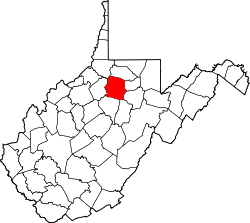
| State | West Virginia |
| County | Harrison |
| Elevation | 974 ft (297 m) |
| Time zone | UTC-5 (Eastern (EST)) |
| • Summer (DST) | UTC-4 (EDT) |
| Area codes | 304 & 681 |
| GNIS feature ID | 1535727 [1] |
Bethlehem (also known as Scott) is an unincorporated community in Harrison County, West Virginia, United States. Bethlehem is located on County Route 12 along the eastern border of Shinnston. [2]