Wallace, Harrison County, West Virginia | |
|---|---|
 Wallace  Wallace | |
| Coordinates: 39°24′34″N80°29′23″W / 39.40944°N 80.48972°W | |
| Country | United States |
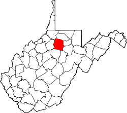
| State | West Virginia |
| County | Harrison |
| Area | |
• Total | 1.42 sq mi (3.67 km2) |
| Elevation | 1,027 ft (313 m) |
| Population (2020) | |
• Total | 201 |
| • Density | 140/sq mi (55/km2) |
| Time zone | UTC-5 (Eastern (EST)) |
| • Summer (DST) | UTC-4 (EDT) |
| ZIP code | 26448 |
| Area codes | 304 & 681 |
| GNIS feature ID | 1548735 [1] |
| FIPS code | 54-84172 |
Wallace is an unincorporated community and census-designated place [2] in Harrison County, West Virginia, United States. The population was 201 at the 2020 census. [3]
Wallace is located on West Virginia Route 20, approximately 8 miles (13 km) northwest of Lumberport. It is situated on Little Ten Mile Creek, a tributary of Tenmile Creek, and has a post office with ZIP code 26448. [4]