Marshville, West Virginia

Last updated
Marshville, West Virginia
Unincorporated community
USA West Virginia location map.svg
Red pog.svg
Marshville
Usa edcp location map.svg
Red pog.svg
Marshville
Coordinates: 39°19′17″N80°27′51″W / 39.32139°N 80.46417°W / 39.32139; -80.46417 Coordinates: 39°19′17″N80°27′51″W / 39.32139°N 80.46417°W / 39.32139; -80.46417
Country United States
State West Virginia
County Harrison
Elevation 974 ft (297 m)
Time zone Eastern (EST) (UTC-5)
  Summer (DST) EDT (UTC-4)
Area code(s) 304 & 681
GNIS feature ID 1555056 [1]

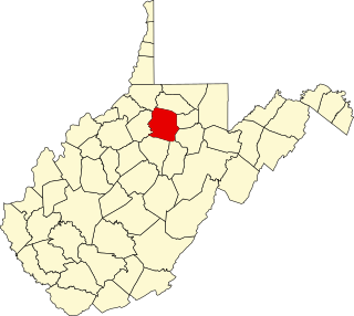
Marshville is an unincorporated community in Harrison County, West Virginia, United States. Marshville is located along Tenmile Creek at the junction of County Routes 5 and 7/2, 7 miles (11 km) west-northwest of Clarksburg. [2]

Unincorporated area Region of land not governed by own local government

In law, an unincorporated area is a region of land that is not governed by a local municipal corporation; similarly an unincorporated community is a settlement that is not governed by its own local municipal corporation, but rather is administered as part of larger administrative divisions, such as a township, parish, borough, county, city, canton, state, province or country. Occasionally, municipalities dissolve or disincorporate, which may happen if they become fiscally insolvent, and services become the responsibility of a higher administration. Widespread unincorporated communities and areas are a distinguishing feature of the United States and Canada. In most other countries of the world, there are either no unincorporated areas at all, or these are very rare; typically remote, outlying, sparsely populated or uninhabited areas.
Harrison County, West Virginia County in the United States

Harrison County is a county in the U.S. state of West Virginia. As of the 2010 United States Census, the population was 69,099. The county seat is Clarksburg.

West Virginia State of the United States of America

West Virginia is a state located in the Appalachian region in the Southern United States that is also considered to be a part of the Middle Atlantic States. It is bordered by Pennsylvania to the north, Maryland to the east and northeast, Virginia to the southeast, Kentucky to the southwest, and Ohio to the northwest. West Virginia is the 41st largest state by area, and is ranked 38th in population. The capital and largest city is Charleston.

Related Research Articles

1888 United States presidential election

The United States presidential election of 1888 was the 26th quadrennial presidential election, held on Tuesday, November 6, 1888. Republican nominee Benjamin Harrison, a former Senator from Indiana, defeated incumbent Democratic President Grover Cleveland of New York. It was the third of five U.S. presidential elections in which the winner did not win a plurality or majority of the national popular vote.

Marion County, West Virginia County in the United States

Marion County is a county in the U.S. state of West Virginia. As of the 2010 census, the population was 56,418. Its county seat is Fairmont. The county was named in honor of General Francis Marion, known to history as "The Swamp Fox".

Union County, North Carolina County in North Carolina, United States

Union County is a county located in the U.S. state of North Carolina. As of the 2010 census, the population was 201,292. Its county seat is Monroe.

West Virginias 1st congressional district

West Virginia's 1st congressional district is located in the northern part of the state. It is the most regularly drawn of the state's three districts.

Virginias 3rd congressional district

Virginia's third congressional district is a United States congressional district in the Commonwealth of Virginia, serving the independent cities of Franklin, Newport News, and Portsmouth, parts of the independent cities of Chesapeake, Hampton, Norfolk, and Suffolk, and all of the county of Isle of Wight. The current representative is Robert C. Scott (D).

Fletcher Covered Bridge West Virginia place listed on National Register of Historic Places

The Fletcher Covered Bridge is a 62-foot (19 m) Multiple King Post covered bridge located near Marshville in Harrison County, West Virginia. The bridge crosses Tenmile Creek is West Virginia bridge number 48-17-03. Stones for the abutments were quarried at the top of a hill near the bridge site. The original building cost was $1,372. The Fletcher Covered Bridge is one of only two covered bridges still standing in Harrison County, the other is the Simpson Creek Covered Bridge. This bridge is in regular use today.

National Register of Historic Places listings in Harrison County, West Virginia Wikimedia list article

This is a list of the National Register of Historic Places listings in Harrison County, West Virginia.

2000 United States presidential election in West Virginia

The 2000 United States presidential election in West Virginia took place on November 7, 2000, and was part of the 2000 United States presidential election. Voters chose 5 representatives, or electors to the Electoral College, who voted for president and vice president.

Haywood, West Virginia Unincorporated community in West Virginia, United States

Haywood is an unincorporated community in Harrison County, West Virginia, United States. Haywood is located on West Virginia Route 20 0.5 miles (0.80 km) northeast of Lumberport. Haywood has a post office with ZIP code 26366.

Harrison, Mineral County, West Virginia Unincorporated community in West Virginia, United States

Harrison is an unincorporated community in Mineral County, West Virginia, United States. Harrison is located on the Potomac River across from Shallmar, Maryland.

Gillman Bottom, West Virginia Unincorporated community in West Virginia, United States

Gillman Bottom is an unincorporated community in Logan County, West Virginia, United States. Gillman Bottom is located along Huff Creek and West Virginia Route 10, 4.7 miles (7.6 km) east-southeast of Man.

McAlpin, Harrison County, West Virginia Unincorporated community in West Virginia, United States

McAlpin is an unincorporated community in Harrison County, West Virginia, United States. McAlpin is located along West Virginia Route 131 4.1 miles (6.6 km) north-northeast of Bridgeport.

Bristol, West Virginia Unincorporated community in West Virginia, United States

Bristol is an unincorporated community in Harrison County, West Virginia, USA. It is located along U.S. Route 50 1.9 miles (3.1 km) east-northeast of Salem. Bristol had a post office, which closed on October 1, 2005.

Goodhope, West Virginia Unincorporated community in West Virginia, United States

Goodhope is an unincorporated community in Harrison County, West Virginia, United States. Goodhope is located along U.S. Route 19 and the West Fork River 2.3 miles (3.7 km) southwest of West Milford.

Maken, West Virginia Unincorporated community in West Virginia, United States

Maken is an unincorporated community in Harrison County, West Virginia, United States. Maken is located at the junction of U.S. Route 50 and County Route 31 7.5 miles (12.1 km) west of Clarksburg.

Bethlehem, Harrison County, West Virginia Unincorporated community in West Virginia, United States

Bethlehem is an unincorporated community in Harrison County, West Virginia, United States. Bethlehem is located on County Route 12 along the eastern border of Shinnston.

Flinderation, West Virginia Unincorporated community in West Virginia, United States

Flinderation is an unincorporated community in Harrison County, West Virginia, United States. Flinderation is located on County Route 50/7 2.7 miles (4.3 km) east-northeast of Salem.

References