Gypsy, West Virginia | |
|---|---|
 Gypsy | |
| Coordinates: 39°22′7″N80°19′4″W / 39.36861°N 80.31778°W | |
| Country | United States |
| State | West Virginia |
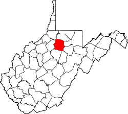
| County | Harrison |
| Area | |
• Total | 0.777 sq mi (2.01 km2) |
| • Land | 0.777 sq mi (2.01 km2) |
| • Water | 0 sq mi (0 km2) |
| Population (2020) | |
• Total | 197 |
| • Density | 250/sq mi (98/km2) |
| Time zone | UTC-5 (Eastern (EST)) |
| • Summer (DST) | UTC-4 (EDT) |
| ZIP codes | 26361 |
Gypsy is a census-designated place (CDP) in Harrison County, West Virginia, United States. As of the 2020 census, its population was 197 (down from 328 at the 2010 census). [2] [3]