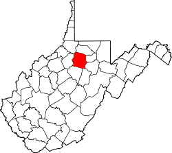
Adamsville, West Virginia | |
---|---|
Coordinates: 39°23′43″N80°14′40″W / 39.39528°N 80.24444°W Coordinates: 39°23′43″N80°14′40″W / 39.39528°N 80.24444°W | |
Country | United States |
State | West Virginia |
County | Harrison |
Elevation | 1,053 ft (321 m) |
Time zone | UTC-5 (Eastern (EST)) |
• Summer (DST) | UTC-4 (EDT) |
GNIS feature ID | 1534808 [1] |
Adamsville is an unincorporated community in Harrison County, West Virginia, United States. Its post office [2] is closed.
Kalamazoo is an unincorporated community in Barbour County, West Virginia, United States. Its post office has been closed.
Five Forks is an unincorporated community in Calhoun County, West Virginia, United States. It lies along West Virginia Route 16 to the north of the town of Grantsville, the county seat of Calhoun County. Its elevation is 1,106 feet (337 m). The Five Forks Post Office is closed.
Crow Summit is an unincorporated community in Jackson County, West Virginia, United States. Crow Summit is located on County Route 56 6.2 miles (10.0 km) north of Ripley. Crow Summit once had a post office, which is now closed. The community was named after Michael Crow, an original owner of the town site.
Foster Chapel is an unincorporated community in Jackson County, West Virginia, United States. Foster Chapel is located on County Route 32 5.7 miles (9.2 km) southwest of Ripley. Foster Chapel once had a post office, which is now closed.
Muses Bottom is an unincorporated community in Jackson County, West Virginia, United States. Muses Bottom is located on the Ohio River and West Virginia Route 68 6.5 miles (10.5 km) north of Ravenswood. Muses Bottom once had a post office, which is now closed.
Topins Grove is an unincorporated community in Jackson County, West Virginia, United States. Topins Grove is located on Little Pond Creek and County Highway 6 7.7 miles (12.4 km) north-northeast of Ravenswood. Topins Grove once had a post office, which is now closed.
Utica is an unincorporated community in Jackson County, West Virginia, United States. Utica is located on Cabin Fork and County Highway 1/2 8.7 miles (14.0 km) northeast of Ravenswood. Utica once had a post office, which is now closed.
Pleasant View is an unincorporated community in Jackson County, West Virginia, United States. Pleasant View is located on the Ohio River and West Virginia Route 2 2.3 miles (3.7 km) southwest of Ravenswood. Pleasant View once had a post office, which is now closed.
Plum Orchard is an unincorporated community in Jackson County, West Virginia, United States. Plum Orchard is located on County Highway 34/14 9 miles (14 km) south-southeast of Ripley. Plum Orchard once had a post office, which is now closed.
Louther is an unincorporated community in Jackson County, West Virginia, United States. Louther is located on County Highway 28 in the Frozen Camp Wildlife Management Area, 8.8 miles (14.2 km) east of Ripley. Louther once had a post office, which is now closed.
Indian was an unincorporated community in Kanawha County, West Virginia, United States. It once had a post office but it is now closed.
Three Mile is an unincorporated community in Kanawha County, West Virginia, United States. Its post office is closed
Apgah was an unincorporated community in Kanawha County, West Virginia, United States. Its post office is closed.
Carney was an unincorporated community in Kanawha County, West Virginia, United States. Its post office is closed.
Notomine is an unincorporated community in Kanawha County, West Virginia, United States. Its post office is closed.
Copenhaver was an unincorporated community in Kanawha County, West Virginia, United States. Its post office is closed.
Putney is an unincorporated community in Kanawha County, West Virginia, United States. Its post office is closed.
Maynor is an unincorporated community in Raleigh County, West Virginia, United States. Its post office is closed.
Wevaco is an unincorporated community and former coal town in Kanawha County, West Virginia, United States. Its post office is closed.
Adamsville was a populated place in Pinal County, Arizona. Once a thriving farm town, it became a ghost town by the 1920s. Adamsville is located at an elevation is 1,450 feet, on the south bank of the Gila River, west of Florence, Arizona.
This article about a location in Harrison County, West Virginia is a stub. You can help Wikipedia by expanding it. |