Point Mills, West Virginia

Last updated
Point Mills
USA West Virginia location map.svg
Red pog.svg
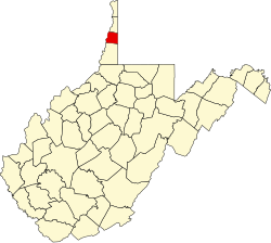
Point Mills
Location within the state of West Virginia
Usa edcp location map.svg
Red pog.svg
Point Mills
Point Mills (the United States)
Coordinates: 40°4′57″N80°34′51″W / 40.08250°N 80.58083°W / 40.08250; -80.58083 Coordinates: 40°4′57″N80°34′51″W / 40.08250°N 80.58083°W / 40.08250; -80.58083
Country United States
State West Virginia
County Ohio
Time zone UTC-5 (Eastern (EST))
  Summer (DST) UTC-4 (EDT)
GNIS feature ID1545095 [1]

Point Mills is an unincorporated community in Ohio County, West Virginia, United States. Point Mills lies along the National Road (U.S. Route 40) and is incorporated into the Village of Valley Grove. It is part of the Wheeling, West Virginia Metropolitan Statistical Area.

Related Research Articles

Potomac River river in the mid-Atlantic United States

The Potomac River is found within the Mid-Atlantic region of the United States and flows from the Potomac Highlands into the Chesapeake Bay. The river is approximately 405 miles (652 km) long, with a drainage area of about 14,700 square miles (38,000 km2). In terms of area, this makes the Potomac River the fourth largest river along the Atlantic coast of the United States and the 21st largest in the United States. Over 5 million people live within the Potomac watershed.

Exchange, West Virginia Unincorporated community in West Virginia, United States

Exchange is an unincorporated community and ghost town in Braxton County, West Virginia, United States that has the ZIP code of 26619. The town was a stopping point on the former Coal and Coke Railway.

West Point, Virginia Town in Virginia, United States

West Point is an incorporated town in King William County, Virginia, United States. The population was 3,306 at the 2010 census.

Middle Peninsula Region of Virginia

The Middle Peninsula is the second of three large peninsulas on the western shore of Chesapeake Bay in Virginia, in the United States. It lies between the Northern Neck and the Virginia Peninsula. This peninsula is bounded by the Rappahannock River on the north and the York River on the south, with the Chesapeake Bay to the east. It encompasses six Virginia counties: Essex, Gloucester, King and Queen, King William, Mathews, and Middlesex. Developed for tobacco plantations in the colonial era, in the 21st century the Middle Peninsula is known for its quiet rural life, vegetable truck-farming, and fishing industry.

U.S. Route 250 is a route of the United States Numbered Highway System, and is a spur of U.S. Route 50. It currently runs for 514 miles (827 km) from Richmond, Virginia to Sandusky, Ohio. It passes through the states of Virginia, West Virginia, and Ohio. It goes through the cities of Richmond, Charlottesville, Staunton, and Waynesboro, Virginia; and Wheeling, West Virginia. West of Pruntytown, West Virginia, US 250 intersects and forms a short overlap with its parent US 50.

United States National Register of Historic Places listings

The National Register of Historic Places in the United States is a register including buildings, sites, structures, districts, and objects. The Register automatically includes all National Historic Landmarks as well as all historic areas administered by the U.S. National Park Service. Since its introduction in 1966, more than 90,000 separate listings have been added to the register.

Fort Mill Ridge Wildlife Management Area

The Fort Mill Ridge Wildlife Management Area is located on 217 acres (0.88 km2) two miles (3 km) southwest of Romney in Hampshire County, West Virginia. Fort Mill Ridge WMA is owned by the West Virginia Division of Natural Resources. The Fort Mill Ridge Civil War Trenches are located at the top of the Fort Mill Ridge access road.

West Virginia Route 3 state highway in West Virginia, United States

West Virginia Route 3 is a state highway in the U.S. state of West Virginia. It runs from West Virginia Route 10 in West Hamlin in a general easterly direction via Beckley to West Virginia Route 311 at Sweet Springs, most of the way across the state.

Mill Creek is a 14.5-mile-long (23.3 km) tributary of Opequon Creek, belonging to the Potomac River and Chesapeake Bay watersheds, located in Berkeley County in West Virginia's Eastern Panhandle. Its name reflects its past as a popular site for various types of mills, beginning with one constructed by Morgan Morgan in the mid-18th century near his cabin in present-day Bunker Hill.

Mill Creek (South Branch Potomac River) tributary stream of the South Branch Potomac River in Hampshire County, West Virginia, USA

Mill Creek is a 14.0-mile-long (22.5 km) tributary stream of the South Branch Potomac River, belonging to the Potomac River and Chesapeake Bay watersheds. The stream is located in Hampshire County in West Virginia's Eastern Panhandle. Mill Creek flows into the South Branch west of Romney Bridge near Vanderlip along the Northwestern Turnpike.

Roneys Point, West Virginia Unincorporated community in West Virginia, United States

Roneys Point is an unincorporated community in Ohio County, West Virginia, United States. Roneys Point is located along Little Wheeling Creek on the National Road between Point Mills and Valley Camp. It is part of the Wheeling, West Virginia Metropolitan Statistical Area.

U.S. Route 220 in Virginia section of U.S. Highway in Virginia, United States

In the U.S. state of Virginia, U.S. Route 220 (US 220) is a major north-south state highway that extends from the North Carolina state line through Roanoke to the West Virginia state line. South of Roanoke, US 220 is a four-lane highway within the proposed Interstate 73 (I-73) corridor. US 220 narrows to two lanes north of Roanoke, connecting to I-64 near Clifton Forge and then paralleling the Appalachian Mountains north-northeasterly in the direction of Cumberland, Maryland.

Mill Point, West Virginia Unincorporated community in West Virginia, United States

Mill Point is an unincorporated community in Pocahontas County, West Virginia, United States. Mill Point is located at the junction of U.S. Route 219, West Virginia Route 39, and West Virginia Route 55 2.5 miles (4.0 km) northeast of Hillsboro.

Pecks Mill, West Virginia Unincorporated community in West Virginia, United States

Pecks Mill is an unincorporated community in Logan County, West Virginia, United States. Pecks Mill is located on the Guyandotte River and West Virginia Route 10 1.5 miles (2.4 km) north of Mitchell Heights. Pecks Mill has a post office with ZIP code 25547.

Mill Run is a 9.1-mile-long (14.6 km) tributary stream of the South Branch Potomac River, belonging to the Potomac River and Chesapeake Bay watersheds. The stream is located in Hampshire County in the Eastern Panhandle of the U.S. state of West Virginia. Mill Run rises on Nathaniel Mountain and flows northeast, then northwest into the South Branch south of Romney near Hampshire Park on South Branch River Road.

Union District, Jackson County, West Virginia Magisterial district in West Virginia, United States

Union District, formerly Union Magisterial District, is one of five historic magisterial districts in Jackson County, West Virginia. The district was originally known as Hushan's Mills Township, one of five civil townships established in 1863, at the height of the Civil War; it was subsequently given the patriotic name of Union Township. In 1872, West Virginia's townships were converted into magisterial districts. When Jackson County was redistricted in the 1990s, the area of Union District was included in the new Western Magisterial District. However, the county's historic magisterial districts continue to exist in the form of tax districts, serving all of their former administrative functions except for the election of county officials.

Washington District, Jackson County, West Virginia Magisterial district in West Virginia, United States

Washington District, formerly Washington Magisterial District, is one of five historic magisterial districts in Jackson County, West Virginia. The district was originally established as one of five civil townships in Jackson County after West Virginia became a state in 1863; in 1872, all of West Virginia's townships were converted into magisterial districts. When Jackson County was redistricted in the 1990s, Washington District was combined with the eastern portion of Ripley District, including the city of Ripley, to form the new Eastern Magisterial District. However, the county's historic magisterial districts continue to exist in the form of tax districts, serving all of their former administrative functions except for the election of county officials.

Eastern District, Jackson County, West Virginia Magisterial district in West Virginia, United States

The Eastern Magisterial District is one of three magisterial districts in Jackson County, West Virginia. It was established during a process of redistricting undertaken in the 1990s. In 2010, 9,882 people lived in the district.

Western District, Jackson County, West Virginia Magisterial district in West Virginia, United States

The Western Magisterial District is one of three magisterial districts in Jackson County, West Virginia. It was established during a process of redistricting undertaken in the 1990s. In 2010, 10,576 people lived in the district.

References