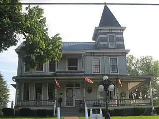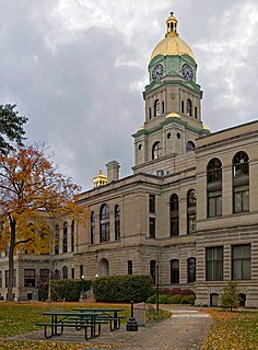
Putnam County is a county in the U.S. state of West Virginia. As of the 2010 United States Census, the population was 55,486. Its county seat is Winfield.

Wayne County is the westernmost county in the U.S. state of West Virginia. As of the 2010 census, the population was 42,481. Its county seat is Wayne. The county was founded in 1842 and named for General "Mad" Anthony Wayne.

Lincoln County is a county in the U.S. state of West Virginia. As of the 2010 census, the population was 21,720. Its county seat is Hamlin. The county was created in 1867 and named for Abraham Lincoln.

Barboursville is a village in Cabell County, West Virginia, United States. It is located near the second largest city in the state, Huntington. The population was 3,964 at the 2010 census.

The Mud River is a tributary of the Guyandotte River in southwestern West Virginia in the United States. Via the Guyandotte and Ohio Rivers, it is part of the Mississippi River watershed. The river is popular with muskellunge anglers.

The West Virginia Senate is the upper house of the West Virginia Legislature. There are seventeen senatorial districts. Each district has two senators who serve staggered four-year terms.

West Virginia Route 10 is a north–south route from Cabell County to Mercer County in the western and southern regions of West Virginia. The road is of very poor quality for most of its path, following river valleys and carved into the side of mountains.

West Virginia Route 527 is a north–south state highway located entirely in Huntington, West Virginia. The southern terminus of the route is at Interstate 64 exit 8, where WV 527 becomes West Virginia Route 152 upon crossing the expressway. The northern terminus is on the West Virginia Department of Transportation-maintained Robert C. Byrd Bridge, better known as the Sixth Street Bridge, where the route becomes State Route 527 upon crossing into Ohio. In Ohio, SR 527 continues northward to State Route 7 in Chesapeake.

William Henry Cabell was a Virginia lawyer, politician and judge aligned with the Democratic-Republican party. He served as Member of the Assembly, as Governor of Virginia, and as judge on what later became the Virginia Supreme Court. Cabell adopted his middle initial, which did not stand for anything, in 1795, to distinguish himself from other William Cabells, including his uncle William Cabell Sr. and first cousin William Cabell Jr. (1759-1822)
West Virginia Route 193 is a north–south route extending from U.S. Route 60 at Barboursville to West Virginia Route 2 just east of Huntington.
Cabell Midland High School is located in Ona, West Virginia. Cabell Midland is a four-year high school which serves grades 9 through 12. The school's name is derived from two sources; "Cabell" for the county in which it is located, and "Midland" for the famous Midland Trail which once extended from Norfolk, Virginia to Los Angeles, California.

Salt Rock is a census-designated place (CDP) in southern Cabell County, West Virginia, United States. As of the 2010 census, its population was 388. It lies along West Virginia Route 10 southeast of the city of Huntington, the county seat of Cabell County. Its elevation is 581 feet (177 m). Although Salt Rock is unincorporated, it has a post office, with the ZIP code of 25559. The community most likely was so named on account of there being a small-scale local salt manufacturing industry.

Mill Creek Wildlife Management Area is 1,470 acres (590 ha) of steeply forested woodlands located near Milton, West Virginia in Cabell County. Mill Creek WMA can be accessed from Johns Creek Road about three miles north from the Milton exit of I-64.

This is a list of the National Register of Historic Places listings in Cabell County, West Virginia.

Mud River Covered Bridge is a historic covered bridge that formerly spanned the Mud River at Milton, Cabell County, West Virginia. It was built about 1875, and is a single-span, modified Howe truss structure. It measures approximately 112 feet (34 m) in length and 14 feet (4.3 m) in width.

Clover is an unincorporated community in Cabell County, West Virginia, United States. Clover is located on West Virginia Route 2 near the Ohio River, 16 miles (26 km) northeast of Huntington.

Wilson is an unincorporated community in Cabell County, West Virginia, United States. Wilson is located on the Guyandotte River 6.25 miles (10.06 km) east of downtown Huntington.

Booker T. Washington State Park is a former state park near the community of Institute in the U.S. state of West Virginia. The park was operated by the West Virginia Conservation Commission, Division of State Parks, from 1949 until the late 1950s.


