Fudges Creek, West Virginia | |
|---|---|
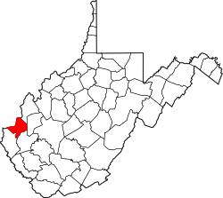
 Fudges Creek Location within the state of West Virginia  Fudges Creek Fudges Creek (the United States) | |
| Coordinates: 38°24′24″N82°12′24″W / 38.40667°N 82.20667°W | |
| Country | United States |
| State | West Virginia |
| County | Cabell |
| Elevation | 646 ft (197 m) |
| Time zone | UTC-5 (Eastern (EST)) |
| • Summer (DST) | UTC-4 (EDT) |
| GNIS ID | 1549538 [1] |
Fudges Creek is an unincorporated community in Cabell County, West Virginia, United States.
The community takes its name from nearby Fudges Creek. [2]