Beverly Hills, West Virginia | |
---|---|
Coordinates: 38°24′8.30″N82°24′7.55″W / 38.4023056°N 82.4020972°W | |
Country | United States |
State | West Virginia |
County | Cabell |
City | Huntington |
Elevation | 663 ft (202 m) |
Time zone | UTC-5 (Eastern (EST)) |
• Summer (DST) | UTC-4 (EDT) |
ZIP codes | 25701 |
GNIS ID | 1740343, [1] 1553885 [2] |
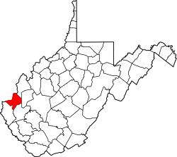
Beverly Hills, also known as South Hills is an unincorporated community in Huntington, Cabell County, West Virginia, United States.
The Big Sandy River, called Sandy Creek as early as 1756, is a tributary of the Ohio River, approximately 29 miles (47 km) long, in western West Virginia and northeastern Kentucky in the United States. The river forms part of the boundary between the two states along its entire course. Via the Ohio River, it is part of the Mississippi River watershed.
The Tygart Valley River — also known as the Tygart River — is a principal tributary of the Monongahela River, approximately 135 miles (217 km) long, in east-central West Virginia in the United States. Via the Monongahela and Ohio rivers, it is part of the watershed of the Mississippi River, draining an area of 1,329 square miles (3,440 km2) in the Allegheny Mountains and the unglaciated portion of the Allegheny Plateau.
The Black Fork is a principal tributary of the Cheat River in the Allegheny Mountains of eastern West Virginia, USA. It is a short stream, about four miles (6 km) in length, formed by the confluence of two other streams not far above its mouth. It was traditionally considered one of the five Forks of Cheat.
Beverly Hills is an unincorporated community adjacent to the city of Fairmont in Marion County, West Virginia, United States.
Melville is an unincorporated community in Logan County, West Virginia, United States. The community of Melville was established in 1967.
The Charleston Metropolitan Statistical Area, as defined by the United States Census Bureau, is an area consisting of three counties in West Virginia, anchored by the city of Charleston. It is the largest metropolitan area entirely within the state of West Virginia. The Huntington Metro Area adds to the Charleston–Huntington, WV-OH-KY CSA and spans three states, while the core county of the Charleston area, Kanawha County, is more populous than the West Virginia portion of the Huntington area.
East Lynn Lake is a 1,005-acre (4 km2) reservoir on the East Fork Twelvepole Creek in Wayne County, West Virginia. The lake is operated by the U.S. Army Corps of Engineers, Huntington District, as part of a series of flood control projects for the Ohio River basin.
Huntington High School is a four year high school located on top of a hill just outside Huntington, West Virginia.
The Huntington–Ashland metropolitan area is a metropolitan area in the Appalachian Plateau region of the United States. Referred to locally as the "Tri-State area," and colloquially as "Kyova", the region spans seven counties in the three states of Kentucky, Ohio, and West Virginia. With a population of 361,580, the Tri-State area is nestled along the banks of the Ohio River. The region offers a diverse range of outdoor activities.
Sod is an unincorporated community in northeastern Lincoln County, West Virginia, United States. It lies along West Virginia Route 214 east of the town of Hamlin, the county seat of Lincoln County. Sod's elevation is 781 feet (238 m). It has a post office with the ZIP code 25564.
Salt Rock is a census-designated place (CDP) in southern Cabell County, West Virginia, United States. As of the 2010 census, its population was 388. It lies along West Virginia Route 10 southeast of the city of Huntington, the county seat of Cabell County. Its elevation is 581 feet (177 m). Although Salt Rock is unincorporated, it has a post office, with the ZIP code of 25559. The community most likely was so named on account of there being a small-scale local salt manufacturing industry.
Cismont is an unincorporated community in Albemarle County, Virginia.
Ivy is a census-designated place (CDP) in Albemarle County, Virginia, United States. The population as of the 2010 Census was 905. It is a small unincorporated community located on U.S. Route 250, just west of Charlottesville.
Westmoreland is a primarily residential neighborhood located in Huntington, West Virginia, United States. While most of Huntington is in Cabell County, Westmoreland is the small portion of Huntington that lies in Wayne County. Westmoreland is the westernmost neighborhood in Huntington and is situated along the Ohio River. The neighborhood is protected by the floodwall that was built after the disastrous Ohio River Flood of 1937. Westmoreland is served by Kellogg Grade School and Vinson Middle School, and by nearby Spring Valley High School. Police and fire protection, and other municipal services, are provided by the City of Huntington.
Darnell Town is an unincorporated community in Lee County, Virginia, in the United States. It is part of the Keokee census-designated place.
Kanauga is an unincorporated community and census-designated place (CDP) in Gallia County, Ohio, United States. As of the 2020 census it had a population of 185.
Huntington is a ghost town in Bolivar County, Mississippi, United States.
Darnell Marquies Wright is an American professional football offensive tackle for the Chicago Bears of the National Football League (NFL). He played college football for the Tennessee Volunteers and was selected by the Bears tenth overall in the 2023 NFL draft.
Chancellor Hills is an unincorporated community in Huntington, Cabell County, West Virginia, United States.