Lawrence County Airpark

Last updated • 7 min readFrom Wikipedia, The Free Encyclopedia
Lawrence County Airpark
Summary
Airport typePublic
OwnerLawrence County Board of Commissioners
Serves Chesapeake, Ohio / Huntington, West Virginia
Opened1929
Time zone UTC−05:00 (-5)
  Summer (DST) UTC−04:00 (-4)
Elevation  AMSL 568 ft / 173 m
Coordinates 38°25′09″N082°29′40″W / 38.41917°N 82.49444°W / 38.41917; -82.49444
Map
USA Ohio relief location map.svg
Airplane silhouette.svg
HTW
Location of airport in Ohio
Usa edcp relief location map.png
Airplane silhouette.svg
HTW
HTW (the United States)
Runways
Direction LengthSurface
ftm
8/263,001915Asphalt
Statistics (2020)
Aircraft operations41,975
Based aircraft28

Lawrence County Airpark( IATA : HTW [2] , ICAO : KHTW, FAA LID : HTW) is a public use airport located two nautical miles (3.7 km) west of the central business district of Chesapeake, a village in Lawrence County, Ohio, United States. It is publicly owned by Lawrence County Board of Commissioners. [1] The airport lies across the Ohio River from Huntington, West Virginia.

Contents

History

Lawrence County Airpark, originally known as Huntington Airport, was established in 1929. In June of that year, John Paul Riddle of the Cincinnati-based Embry-Riddle Company completed negotiations for the establishment of an airport for the cities of the Kentucky, Ohio, West Virginia tri-state area. The company sought to expand their growing air mail and passenger routes east, via the Ohio River valley. The Embry-Riddle Company put up $100,000, with another $25,000 contributed by the Huntington Chamber of Commerce, $25,000 from the Huntington Bridge Company, and $25,000 from a local aviation booster club. The club enrolled 250 members, charging a membership fee of $100. This money was used to fund the airport project. The land was purchased primarily from a Mr. Joe L. Wilson, partner in the Huntington Bridge Company, who had used the land for farmland. [3]

Development of the land began in June but was slowed due to high levels of rain. Eventually several houses and a barn were removed, though two structures were initially left intact on the north side of the field for use as office and flight crew facilities. [3]

The new Huntington-Ironton-Chesapeake Airport opened on August 31, 1929, with a 3,600 feet (1,097 m) east-west sod landing strip (current site of runway 8/26) and a north-south strip 2,500 feet (762 m) in length (partially still in use as the airfield's only taxiway). The opening fell on Labor Day weekend, and massive celebrations were planned. Approximately 45,000 people attended the opening events throughout the weekend, which included aerial stunts and rides ($10 each). [3]

Ten planes, owned by the Embry-Riddle Company were stationed at the field. These included several Wacos. A Ford Tri-Motor was on display for opening day. There was a raffle for a free flight to Cincinnati's Lunken Field, and a folded-wing aircraft carrying local government and civic leaders Taxied across the bridge, led a parade around Huntington, West Virginia, then returned to the airport, extended its wings, and took them on an aerial tour. [3]

At the time of opening, the Embry-Riddle Company was to run the field and FBO. The company also opened a flight school. Embry-Riddle closed its flight school and withdrew service the next year, the result of disputes with the Huntington Chamber of Commerce over the building of a hangar facility. [3]

The 1930s were marked by repeated attempts to establish passenger and mail service to the H-I-C Airport. 1932 and 1936 saw relatively short attempts by American Airlines to set up service. In 1938, a permanent, regular service was begun. This was in part due to an agreement to lengthen and pave the main runway. As part of this deal, land was purchased for a 1,000-foot runway extension to the west in 1937. Air service lasted until April, 1945, when American closed their weather office and stopped mail and passenger services. The airline had been stopping an H-I-C when weight conditions allowed - by 1945 the runway was too short for AA's DC-3s to take off fully loaded. The runway had deteriorated markedly by 1945, and the main runway still had not been extended. This ultimately resulted in the 1947 creation of a Huntington Airport Authority to establish the current Tri-State Airport (HTS) in Wayne County, West Virginia. [3]

Facilities and aircraft

Lawrence County Airpark covers an area of 86 acres (35 ha) at an elevation of 568 feet (173 m) above mean sea level. It has one runway designated 8/26 with an asphalt surface measuring 2,998 by 70 feet (914 x 21 m). [1] [4] [5]

For the 12-month period ending October 2, 2020, the airport had 41,975 aircraft operations, an average of 115 per day. It was 99% general aviation, 1% air taxi, and <1% military. For the same time period, 28 aircraft were based at the airport: 26 single-engine and 2 multi-engine airplanes. [1] [4] [5]

There is one fixed-base operator on-field, Attitude Aviation. They currently have three Cessna 172 Skyhawks and one Beechcraft Bonanza available for rent, as well as maintenance and repair facilities. They also offer 100LL fuel, oil, and assorted charts and supplies for sale in addition to flight instruction. [6]

There is also a jump zone, Tri-State Skydivers, at the airport. They operate a modified Cessna 182, have skydiving instructors and parachutes available for rent, and operate most weekends throughout the year.

Facility Upgrades

In 2022, the airport received $82,770 to cover repairs and infrastructure upgrades. The airport used the money to rehabilitate the existing general aviation ramp as well as an existing taxiway to maintain structural integrity. [7] [8] In 2023, the airport received $100,000 to continue these upgrades. [9]

Accidents and incidents

See also

Related Research Articles

<span class="mw-page-title-main">Oakland County International Airport</span> Airport in Waterford Township, Michigan

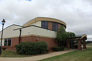
Oakland County International Airport is a county-owned public-use airport located in Waterford Township, Oakland County, Michigan, United States. The airport is located approximately one mile from the center of Waterford Township and Oakland County. It is included in the Federal Aviation Administration (FAA) National Plan of Integrated Airport Systems for 2017–2021, in which it is categorized as a non primary commercial service facility.

<span class="mw-page-title-main">Dayton–Wright Brothers Airport</span> Airport in Montgomery County / Clearcreek Township, Warren County

Dayton–Wright Brothers Airport is a public airport located 10 miles (16 km) south of the central business district of Dayton, Ohio, located mainly in Miami Township, Montgomery County and partly in Clearcreek Township, Warren County, near the suburb of Springboro. It is owned and operated by the City of Dayton and serves as the reliever airport for Dayton International Airport. It mainly serves corporate and personal aircraft users. The airport's identifying code, MGY, is a reference to its former name of Montgomery County Airport.

<span class="mw-page-title-main">Cuyahoga County Airport</span> Airport in Richmond Heights, Willoughby Hills

Cuyahoga County Airport, also known as Robert D. Shea Field, is a public use airport in northeastern Cuyahoga County, Ohio, United States. Owned and operated by Cuyahoga County since 1946, it also serves Lake County and Geauga County. The airport is located 10 nautical miles east of downtown Cleveland and sits on the border of three cities: Highland Heights, Richmond Heights and Willoughby Hills. It is included in the National Plan of Integrated Airport Systems for 2011–2015, which categorized it as a general aviation reliever airport for Cleveland Hopkins International Airport.

<span class="mw-page-title-main">Ohio State University Airport</span> Airport in Columbus, United States of America

Ohio State University Airport is a public airport six miles (10 km) northwest of downtown Columbus, in Franklin County, Ohio, United States. It is owned and operated by Ohio State University in Columbus. It is also known as the OSU Don Scott Airport, named after Donald E. Scott, an OSU alumnus who died during his training as a pilot in the United Kingdom during World War II. The airport's main entrance is located on Case Road, and is easily accessible from OH-315 and Interstate 270.

<span class="mw-page-title-main">Springfield–Beckley Municipal Airport</span> Airport in Ohio, United States of America

Springfield–Beckley Municipal Airport is a civil-military airport five miles (8 km) south of Springfield, in Clark County, Ohio, United States. It is owned by the city of Springfield. It is named after the Beckley family, a member of which knew the Wright Brothers, and witnessed and photographed their first flights.

<span class="mw-page-title-main">Gordon K. Bush Airport</span> Airport

Ohio University Airport or Gordon K. Bush Airport, also known as Snyder Field, is a public-use airport located on State Route 32/U.S. 50 in the village of Albany, about ten miles (16 km) southwest of the city of Athens, in Athens County, Ohio, United States.

Portage County Airport, also known as Portage County Regional Airport, is a public use airport in Portage County, Ohio, United States. It is owned by the Portage County Board of Commissioners and located three nautical miles (6 km) north of Ravenna, in Shalersville Township. This airport is included in the National Plan of Integrated Airport Systems for 2011–2015, which categorized it as a general aviation facility.

<span class="mw-page-title-main">Moraine Airpark</span> Airport in Moraine, Ohio

Moraine Airpark is a public-use airport situated in the city of Moraine, Ohio, United States. 4 miles (6.4 km) southwest of the city of Dayton in Montgomery County.

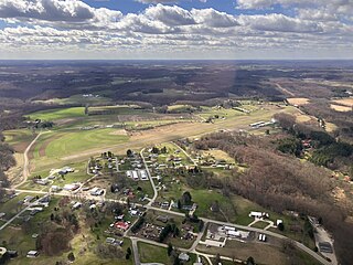
Poplar Grove Airport is a small general aviation airport located in Poplar Grove, Illinois, United States. The airport was founded in 1972 as Belvidere Airport and renamed in 1994. It is located 3 miles south of Poplar Grove, and 3 miles north of Belvidere. The airport is privately owned and open to the public.

<span class="mw-page-title-main">Union County Airport (Ohio)</span> Public use airport in Marysville, Ohio

Union County Airport is a public use airport in Union County, Ohio, United States. It is owned by the Union County Airport Authority and located one nautical mile (2 km) southeast of the central business district of Marysville, Ohio. This airport is included in the National Plan of Integrated Airport Systems for 2011–2015, which categorized it as a general aviation facility.

Grand Haven Memorial Airpark is a public airport owned and operated by the City of Grand Haven located 2 miles (3.2 km) southeast of Grand Haven, Michigan. The airport is uncontrolled, and is used for general aviation purposes. It is included in the Federal Aviation Administration (FAA) National Plan of Integrated Airport Systems for 2017–2021, in which it is categorized as a local general aviation facility.

Lake County Executive Airport, formerly Lost Nation Airport, is a public use airport in Lake County, Ohio, United States. Located approximately 3 miles (5 km) north-northeast of the central business district of the City of Willoughby, it was owned and operated by that city until October 8, 2014, when it was transferred to Lake County and the Lake County Port and Economic Development Authority. The airport's name was changed from Lost Nation Airport to Lake County Executive Airport, alternately "Lake County Executive Airport at Lost Nation Field," in March 2020.

Highland County Airport is a public-owned, public-use airport located at 9500 North Shore Drive three nautical mile (4.8 km) southeast of the central business district of the city of Hillsboro, in Highland County, Ohio, United States.

Galion Municipal Airport is three miles northeast of Galion in Crawford County, Ohio. The FAA's National Plan of Integrated Airport Systems for 2009–2013 classified it as a general aviation airport.

<span class="mw-page-title-main">Carroll County–Tolson Airport</span> Airport in Carroll County, Ohio

Carroll County–Tolson Airport is a county–owned, public-use airport located one nautical mile (1.85 km) southeast of the central business district of Carrollton, a village in Carroll County, Ohio, United States. It is owned by the Carroll County Airport Authority. According to the FAA's National Plan of Integrated Airport Systems for 2009–2013, it is categorized as a general aviation airport.

Dalton Airport is a privately owned, public use airport located two nautical miles (4 km) east of the central business district of Flushing, in Genesee County, Michigan, United States. It is named after its founder, Edwin P. Dalton, who opened it in 1946 on the former site of the Marsa farm.

The Youngstown Elser Metro Airport is a privately owned, public use general aviation airport located 7 miles southwest of Youngstown in Beaver Township, Mahoning County, Ohio, United States. It has a 10/28 asphalt runway of 4,012 ft × 50 ft in dimension.

Holmes County Airport is a public airport located two miles southwest of Millersburg, Ohio, United States. It is owned and operated by the Holmes County Airport Authority.

Weltzien Skypark is a privately owned, public use airport located 3 miles west of Wadsworth, Ohio, in Medina County. The airpark sits on 26 acres at an elevation of 1210 feet.

The Ross County Airport is a publicly owned, public use airport located 6 miles northwest of Chillicothe in Ross County, Ohio. The airport sits on 350 acres at an elevation of 725 feet.

References

  1. 1 2 3 4 FAA Airport Form 5010 for HTW PDF . Federal Aviation Administration. Effective 27 August 2009.
  2. Accident history for HTW at Aviation Safety Network
  3. 1 2 3 4 5 6 Herald Dispatch, microfilm, 1929-1953.
  4. 1 2 "AirNav: KHTW - Lawrence County Airpark". www.airnav.com. Retrieved 2023-07-29.
  5. 1 2 "HTW - Lawrence County Airpark Airport | SkyVector". skyvector.com. Retrieved 2023-07-30.
  6. "Attitude Aviation FBO Info & Fuel Prices at Lawrence County Airpark (KHTW)". FlightAware. Retrieved 2023-07-29.
  7. Staff Reports (2022-06-13). "Lawrence County Airpark receives nearly $83K in federal funds". The Tribune. Retrieved 2023-07-29.
  8. "Lawrence County Airpark receives nearly $83K in federal funds". Yahoo Sports. 2022-06-14. Retrieved 2023-07-30.
  9. "Brown Announces $600,000 For Airport Improvements In Lawrence County | U.S. Senator Sherrod Brown of Ohio". www.brown.senate.gov. Retrieved 2023-07-30.
  10. 1 2 Martin, Martha J. (2019-03-03). "Chesapeake Ohio Airport History". The Lawrence Register. Retrieved 2023-07-30.
  11. "Accident Grumman American AA-5 Traveler N6511L, 13 Mar 2005". Aviation Safety Network. Flight Safety Foundation. Retrieved 2023-07-30.
  12. "Aviation Investigation Final Report". US National Safety Transportation Board. Retrieved 30 July 2023.PD-icon.svg This article incorporates text from this source, which is in the public domain .
  13. "N201RQ accident description". planecrashmap.com. Retrieved July 29, 2023.PD-icon.svg This article incorporates text from this source, which is in the public domain .