McLean is an unincorporated community and census-designated place in Fairfax County, Virginia, United States. The population of the community was 50,773 at the 2020 census. It is located between the Potomac River and Vienna within the Washington metropolitan area.

Vienna is a town in Fairfax County, Virginia, United States. As of the 2020 U.S. census, Vienna has a population of 16,473. Significantly more people live in ZIP codes with the Vienna postal addresses, bordered approximately by Interstate 66 on the south, Interstate 495 on the east, Route 7 to the north, and Hunter Mill Road to the west, than in the town itself.

Falling Spring is a town in Greenbrier County, West Virginia, United States. It is also known as Renick from the name of its post office. The population was 171 at the 2020 census.

Elkins is a city in and the county seat of Randolph County, West Virginia, United States, along the Tygart Valley River. The community was incorporated in 1890 and named in honor of Stephen Benton Elkins, a U.S. Senator from West Virginia. The population was 6,950 at the 2020 census and estimated at 6,895 in 2021. Elkins is home to Davis and Elkins College and the Mountain State Forest Festival, held in early October every year.

Tornado, also called Upper Falls, is a census-designated place (CDP) in Kanawha County, West Virginia, United States.

The Diocese of Wheeling–Charleston is a Latin Church ecclesiastical territory, or diocese, of the Catholic Church comprising West Virginia in the United States. It is a suffragan diocese in the ecclesiastical province of the metropolitan Archdiocese of Baltimore.
Atco is an unincorporated community and census-designated place (CDP) in Waterford Township in Camden County, in the U.S. state of New Jersey. It is part of the Philadelphia-Camden metropolitan area, located 16 miles (26 km) southeast of Camden. Though generally considered part of Waterford Township, a small section of the southern edge of Atco is located in Winslow Township.

Ida is an unincorporated community and census-designated place (CDP) in Monroe County in the U.S. state of Michigan. The CDP had a population of 790 at the 2020 census. The community is mostly within Ida Township with a smaller portion extending north into Raisinville Township.
Galloway is a census-designated place (CDP) and coal town in northwestern Barbour County, West Virginia, United States. It lies along West Virginia Route 76 northwest of the city of Philippi, the county seat of Barbour County. Its elevation is 1,073 feet (327 m). It has a post office with the ZIP code 26349. As of the 2010 census, its population is 143.

Alberta is an unincorporated community in Wilcox County, Alabama, United States.

Umbarger is a census-designated place in Randall County, Texas, United States. According to the Handbook of Texas, the community had an estimated population of 327 in 2000. The community is part of the Amarillo, Texas Metropolitan Statistical Area.
John Joseph Swint was an American prelate of the Roman Catholic Church. He served as bishop of the Diocese of Wheeling in West Virginia from December 1922 until his death in 1962. He was auxiliary bishop of the same diocese from May to December 1922.

Idamay is a census-designated place (CDP) in Marion County, West Virginia, United States. Idamay is located along West Virginia Route 218, 1 mile (1.6 km) south of Farmington. Idamay has a post office with ZIP code 26576. As of the 2010 census, its population was 611.

Valley Head is a census-designated place (CDP) in Randolph County, West Virginia, United States. Valley Head is located on U.S. Route 219, 12 miles (19 km) south-southwest of Huttonsville. Valley Head has a post office with ZIP code 26294. As of the 2010 census, its population was 267.
Dailey is a census-designated place (CDP) in Randolph County, West Virginia, United States. Dailey is located on U.S. routes 219 and 250, 3 miles (4.8 km) south-southwest of Beverly. Dailey has a post office with ZIP code 26259. As of the 2010 census, its population was 114.
Glady is an unincorporated community in Randolph County, West Virginia, United States. Glady is 11 miles (18 km) southeast of Elkins. Glady had a post office, which closed on May 14, 2011.
Whitmer is a census-designated place (CDP) in Randolph County, West Virginia, United States. It is 7.5 miles (12.1 km) south-southwest of Harman and is situated on the Dry Fork Cheat River. Whitmer had a post office, which closed on May 21, 2011. As of the 2010 census, its population was 106.
Bowden is a census-designated place (CDP) in Randolph County, West Virginia, United States. Bowden is located on U.S. Route 33, 7.5 miles (12.1 km) east of Elkins. Bowden has a post office with ZIP code 26254. According to the 2010 Census, there were nine people residing at this location.
Hico is a census-designated place (CDP) in Fayette County, West Virginia, United States. Hico is located at the junction of U.S. routes 19 and 60, 7 miles (11 km) northeast of Fayetteville. Hico has a post office with ZIP code 25854. As of the 2010 census, its population was 272.
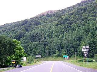
Valley Bend is a census-designated place (CDP) in Randolph County, West Virginia, United States. Valley Bend is located on U.S. routes 219 and 250, as well as state routes 55 and 92, 3.5 miles (5.6 km) northwest of Mill Creek. Valley Bend has a post office with ZIP code 26293. As of the 2010 census, its population was 485.


