Vanville, West Virginia

Last updated

Vanville
USA West Virginia location map.svg
Red pog.svg
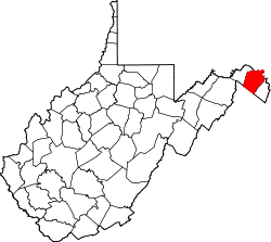
Vanville
Location within the state of West Virginia
Usa edcp location map.svg
Red pog.svg
Vanville
Vanville (the United States)
Coordinates: 39°22′47″N77°58′47″W / 39.37972°N 77.97972°W / 39.37972; -77.97972
Country United States
State West Virginia
County Berkeley
Elevation
[1]
564 ft (172 m)
Time zone UTC-5 (Eastern (EST))
  Summer (DST) UTC-4 (EDT)
ZIP codes
25401-25405
Area code 304
GNIS feature ID1548629 [1]

Vanville is an unincorporated community in the south-east portion of Berkeley County, West Virginia, United States. The center of the community of Vanville is at the intersection of Airport Rd, Strobridge Rd, Near Bethel's Way, and Classic Vanville Rd.

The community is named after the Vanville Church of Christ. The church is located on the corner of Classic Vanville Rd and Airport Rd. Part of the Eastern WV Regional Airport is located in Vanville.

Related Research Articles

<span class="mw-page-title-main">Richmond, Virginia</span> Capital city of Virginia, United States

Richmond is the capital city of the Commonwealth of Virginia in the United States. Incorporated in 1742, Richmond has been an independent city since 1871. The city's population in the 2020 census was 226,610, up from 204,214 in 2010, making it Virginia's fourth-most populous city. The Richmond metropolitan area, with over 1.3 million residents, is the Commonwealth's third-most populous.

<span class="mw-page-title-main">Amelia County, Virginia</span> County in Virginia, United States

Amelia County is a county located just southwest of Richmond in the Commonwealth of Virginia, United States. The county is located in Central Virginia and is included in the Greater Richmond Region. Its county seat is Amelia Court House.

<span class="mw-page-title-main">Druid Hills, Georgia</span> Neighborhood of Atlanta, Georgia, United States

Druid Hills is a community which includes both a census-designated place (CDP) in unincorporated DeKalb County, Georgia, United States, as well as a neighborhood of the city of Atlanta. The CDP's population was 14,568 at the 2010 census. The CDP formerly contained the main campus of Emory University and the Centers for Disease Control and Prevention (CDC) however they were annexed by Atlanta in 2018. The Atlanta-city section of Druid Hills is one of Atlanta's most affluent neighborhoods with a mean household income in excess of $238,500.

<span class="mw-page-title-main">West Falls Church station</span> Washington Metro station

West Falls Church station is a Washington Metro station in Idylwood, Virginia on the Orange Line, the first station inside the Capital Beltway on the Orange Line going east. It is one of only two stations in the system to have three tracks, the other being the National Airport station. The center track is used for storage and relaying trains to the adjacent Falls Church Yard.

<span class="mw-page-title-main">Owerri</span> Capital city of Imo state, Nigeria

Owerri is the capital city of Imo State in Nigeria, set in the heart of Igboland. It is also the state's largest city, followed by Orlu, Okigwe and Ohaji/Egbema. Owerri consists of three Local Government Areas including Owerri Municipal, Owerri North and Owerri West, it has an estimated population of about 1,401,873 as of 2016 and is approximately 100 square kilometres (40 sq mi) in area. Owerri is bordered by the Otamiri River to the east and the Nworie River to the south. The Owerri Slogan is Heartland. It's also called the las Vegas of Africa, due to the night life of the city and the numerous number of hotels, casino and leisure parks all over of the city

<span class="mw-page-title-main">West End (Richmond, Virginia)</span> Neighborhood in Richmond, Virginia, United States

The West End is a part of Richmond, Virginia. Definitions of the bounds of the West End vary, it may include only the western part of the city of Richmond or extend as far as western Henrico County. As there is no one municipal organization that represents this specific region, the boundaries are loosely defined as being north of the James River, west of I-195, and south of Broad Street. Historically, the Richmond neighborhoods of the Fan and the Museum District were a part of the West End. A primary conduit through the West End is Interstate 64.

<span class="mw-page-title-main">West Virginia Route 705</span> State highway in West Virginia, United States

West Virginia Route 705 is a short east–west state highway partially located within the Monongalia County city of Morgantown in the U.S. state of West Virginia. The western terminus of the route is at U.S. Route 19 and West Virginia Route 7, directly in front of the WVU Coliseum. The eastern terminus is at U.S. Route 119 near the Morgantown Municipal Airport. The route is major road in northern Morgantown. It is maintained by the West Virginia Department of Transportation.

Nestled in the foothills of the Appalachian Mountains, Burton is an unincorporated community in Wetzel County, West Virginia, United States, located on a stretch of highway where both WV Route 7 and US Route 250 join for a few short miles between Cottontown and Hundred. These two roads are responsible for the majority of traffic to and from the area and provide important connections to New Martinsville to the west ; Fairmont to the southeast ; Morgantown, to the west ; and Moundsville to the northeast. Other important connections include WV Route 69 North into Pennsylvania, where it becomes PA Route 18 and leads towards Waynesburg and beyond to Pittsburgh. Pittsburgh International Airport, is the nearest intercontinental airport, while Burton is also served by a smaller regional airport, Morgantown Municipal Airport.

<span class="mw-page-title-main">Bristow, Virginia</span> Unincorporated community in Virginia, United States

Bristow is an unincorporated community of Prince William County in Northern Virginia about 30 miles (48 km) from Washington, D.C. In 2014, Bristow's postal area population was 29,346, a 287% increase since 2000; however, the Bristow community is formally included in the Linton Hall, Virginia census-designated place (CDP).

Crum is a census-designated place (CDP) in southern Wayne County, West Virginia, United States. As of the 2010 census, its population was 182. It is the home to Crum Pre K-8 school opened in 2017. It is a part of the Huntington-Ashland Metropolitan Statistical Area (MSA).

<span class="mw-page-title-main">Willard, Virginia</span> Unincorporated area in Virginia

Willard was an unincorporated community located in what is now a part of Washington Dulles International Airport in the U.S. state of Virginia.

Hamptonville is an unincorporated community located in southwestern Yadkin County, North Carolina, United States. Hamptonville is named for Henry Hampton (1750–1832), a colonel in the Revolutionary Army. Hampton set aside land for a town in 1806.

Bream is an unincorporated community along Indian Creek Rd in Kanawha County, West Virginia, United States. It is the first community after State Route 114 turns across the Elk River to Big Chimney. Bream is located between Milliken and Pinch, and is usually omitted from the map, because of its size.

Bells Crossroad is an unincorporated community in Spotsylvania County, in the U.S. state of Virginia. This community is centered on the intersection of Stubbs Bridge Road and Lawyer's Road.

Paytes is an unincorporated community in Spotsylvania County, in the U.S. state of Virginia. The community is marked at the intersection of Lawyer's Road and Catharpin Road by an electrical substation owned by Rappahannock Electric Co-op. A telecommunications tower was approved to be built on the site to expand cell coverage in the area on February 28, 2001.

<span class="mw-page-title-main">Natural Bridge Station, Virginia</span> Unincorporated community in Virginia, United States

Natural Bridge Station is an unincorporated community in Rockbridge County, Virginia, United States, named for both its proximity to Natural Bridge and formerly having a train depot along the Norfolk & Western rail line. Formerly known as Sherwood and Greenlee, the community is located along the James River and Virginia State Route 130, 3.2 miles (5.1 km) west of Glasgow.

<span class="mw-page-title-main">Uwharrie Trail</span> History and status of the Uwharrie Trail.

The Uwharrie Trail is a hiking trail located in the Uwharrie Mountains in central North Carolina. The original Uwharrie Trail was an approximately 40-mile (80.5-km) long hiking trail that was completed in 1975. The trail began at the Asheboro Regional airport near Tot Hill Farm road and ended at NC 24-27 in Montgomery County near Troy, NC. It was once fragmented south of the Birkhead Wilderness to Jumpin Off Rock Trailhead on Flint Hill Rd.

References