Falling Waters, West Virginia

Last updated

Falling Waters, West Virginia
Berkeley County West Virginia incorporated and unincorporated areas Falling Waters highlighted.svg
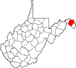
Location in Berkeley County and the state of West Virginia.
USA West Virginia location map.svg
Red pog.svg
Falling Waters, West Virginia
Location within the state of West Virginia
Coordinates: 39°33′54″N77°52′47″W / 39.56500°N 77.87972°W / 39.56500; -77.87972
Country United States
State West Virginia
County Berkeley
Area
[1]
  Total1.245 sq mi (3.22 km2)
  Land1.245 sq mi (3.22 km2)
  Water0 sq mi (0 km2)
Elevation
[2]
443 ft (135 m)
Population
 (2020)
  Total11,430
Time zone UTC−5 (Eastern (EST))
  Summer (DST) UTC−4 (EDT)
ZIP Code
25419
Area code 304
GNIS feature ID2586801 [2]

Falling Waters is a census-designated place (CDP) on the Potomac River in Berkeley County, West Virginia, United States. It is located along Williamsport Pike (US 11) north of Martinsburg. An 1887 Scientific American article claimed that the first U.S. railroad was built in Falling Waters in 1814. [3]

Contents

History

The community of Falling Waters was established in 1815. Because of its location between Hagerstown and Martinsburg on the Potomac River, Falling Waters is a predominantly residential community with numerous historic residences, some of which are listed on the National Register of Historic Places.

Recently the community has had a boom in new residential construction as many people use Falling Waters as a bedroom community to commute to cities nearby and as far as Washington, D.C. and Baltimore.

Civil War Era

Falling Waters was the site of two battles during the American Civil War:

In the latter engagement on the Maryland side of the river, Confederate general J. Johnston Pettigrew, a key leader of Pickett's Charge, was mortally wounded by Union cavalry under George Armstrong Custer. However, his men helped delay the Union forces long enough for the bulk of the Army of Northern Virginia to escape into West Virginia and then on to Virginia following its defeat at the Battle of Gettysburg.

Schools

Historic sites

Notable people

Related Research Articles

<span class="mw-page-title-main">Frederick, Maryland</span> City in Maryland, United States

Frederick is a city in, and the county seat of, Frederick County, Maryland, United States. Frederick's population was 78,171 people as of the 2020 census, making it the second-largest incorporated city in Maryland behind Baltimore. It is a part of the Washington metropolitan area and the greater Washington–Baltimore combined statistical area.

<span class="mw-page-title-main">Gettysburg, Pennsylvania</span> Borough in Pennsylvania, USA

Gettysburg is a borough in and the county seat of Adams County, Pennsylvania, United States. As of the 2020 census, the borough had a population of 7,106 people.

<span class="mw-page-title-main">Potomac River</span> River in the Mid-Atlantic United States

The Potomac River is a major river in the Mid-Atlantic region of the United States that flows from the Potomac Highlands in West Virginia to the Chesapeake Bay in Maryland. It is 405 miles (652 km) long, with a drainage area of 14,700 square miles (38,000 km2), and is the fourth-largest river along the East Coast of the United States and the 21st-largest in the United States. More than 5 million people live within its watershed.

<span class="mw-page-title-main">Berkeley County, West Virginia</span> County in West Virginia, United States

Berkeley County is located in the Shenandoah Valley in the eastern panhandle region of West Virginia in the United States. The county is part of the Hagerstown–Martinsburg metropolitan area. As of the 2020 census, the county population was 122,076, making it the second-most populous of West Virginia's 55 counties, behind Kanawha County. The City of Martinsburg is the county seat.

<span class="mw-page-title-main">Funkstown, Maryland</span> Town in Maryland, United States

Funkstown is a town in Washington County, Maryland, United States. The population was 904 at the 2010 census.

<span class="mw-page-title-main">Williamsport, Maryland</span> Town in Maryland, United States

Williamsport is a town in Washington County, Maryland, United States. The population was 1,868 at the 2000 census and 2,137 as of 2010.

<span class="mw-page-title-main">Martinsburg, West Virginia</span> City in West Virginia, United States

Martinsburg is a city in and the county seat of Berkeley County, West Virginia, United States. The population was 18,773 at the 2020 census, making Martinsburg the largest city in the Eastern Panhandle of West Virginia and the sixth-largest city in the state. It is a principal city of the Hagerstown–Martinsburg metropolitan area extending into Maryland, which had 293,844 residents in 2020.

<span class="mw-page-title-main">Shepherdstown, West Virginia</span> Town in West Virginia, United States

Shepherdstown is a town in Jefferson County, West Virginia, United States, located in the lower Shenandoah Valley along the Potomac River. Home to Shepherd University, the town's population was 1,531 at the time of the 2020 census. The town was established in 1762 along with Romney; they are the oldest towns in West Virginia.

<span class="mw-page-title-main">Paw Paw, West Virginia</span> Town in West Virginia, United States

Paw Paw is a town in Morgan County, West Virginia, United States. The population was 410 at the 2020 census. The town is known for the nearby Paw Paw Tunnel. Paw Paw was incorporated by the Circuit Court of Morgan County on April 8, 1891, and named after pawpaw, a wild fruit that grows in abundance throughout this region. Paw Paw is the westernmost incorporated community in Morgan County, and the Hagerstown-Martinsburg, MD-WV Metropolitan Statistical Area.

<span class="mw-page-title-main">Eastern panhandle of West Virginia</span> Place

The eastern panhandle is one of the two panhandles in the U.S. state of West Virginia; the other is the northern panhandle. It is a small stretch of territory in the northeast of the state, bordering Maryland and Virginia. Some sources and regional associations only identify the eastern panhandle as being composed of Morgan, Berkeley, and Jefferson counties. Berkeley and Jefferson counties are geographically located in the Shenandoah Valley. West Virginia is the only U.S. state with two panhandles.

<span class="mw-page-title-main">Second Battle of Winchester</span> 1863 battle of the American Civil War

The Second Battle of Winchester was fought between June 13 and June 15, 1863, in Frederick County and Winchester, Virginia as part of the Gettysburg Campaign during the American Civil War. As Confederate Lieutenant General Richard S. Ewell moved north through the Shenandoah Valley in the direction of Pennsylvania, his corps defeated the Union Army garrison commanded by Major General Robert H. Milroy, capturing Winchester and numerous Union prisoners.

<span class="mw-page-title-main">Battle of Williamsport</span> Battle of the American Civil War

The Battle of Williamsport, also known as the Battle of Hagerstown or Falling Waters, took place from July 6 to July 16, 1863, in Washington County, Maryland, as part of the Gettysburg Campaign of the American Civil War. It is not to be confused with the fighting at Hoke's Run which was also known as the Battle of Falling Waters.

<span class="mw-page-title-main">Gettysburg campaign</span> Military campaign during the American Civil War


The Gettysburg campaign was a military invasion of Pennsylvania by the main Confederate army under General Robert E. Lee in summer 1863. It was the first time during the war the Confederate Army attempted a full-scale invasion of a free state. The Union won a decisive victory at Gettysburg, July 1–3, with heavy casualties on both sides. Lee managed to escape back to Virginia with most of his army. It was a turning point in the American Civil War, with Lee increasingly pushed back toward Richmond until his surrender in April 1865. The Union Army of the Potomac was commanded by Maj. Gen. Joseph Hooker and then by Maj. Gen. George G. Meade.

<span class="mw-page-title-main">Bunker Hill, West Virginia</span> Unincorporated community in West Virginia, United States

Bunker Hill is an unincorporated community in Berkeley County, West Virginia, United States, located in the lower Shenandoah Valley on Winchester Pike at its junction with County Route 26 south of Martinsburg. It is the site of the confluence of Torytown Run and Mill Creek, a tributary of Opequon Creek which flows into Winchester, Virginia. According to the 2000 census, the Bunker Hill community has a population of 5,319.

<span class="mw-page-title-main">White Hall, Frederick County, Virginia</span> Unincorporated community in Virginia, United States

White Hall is an unincorporated farming community in northern Frederick County, Virginia, established in the late 1810s and located near the crossroads of Apple Pie Ridge Road with Green Spring and White Hall Roads, astride Apple Pie Ridge.

<span class="mw-page-title-main">Winchester, Virginia, in the American Civil War</span> Site of numerous battles during the American Civil War

The city of Winchester, Virginia, and the surrounding area, were the site of numerous battles during the American Civil War, as contending armies strove to control the lower Shenandoah Valley. Winchester changed hands more often than any other Confederate city.

<span class="mw-page-title-main">U.S. Route 11 in West Virginia</span> Segment of American highway

U.S. Route 11 (US 11) in the U.S. state of West Virginia spans 26.2 miles (42.2 km) across the Eastern Panhandle region. US 11 enters the state near Ridgeway and crosses into Maryland just south of Williamsport. The highway closely parallels Interstate 81 (I-81) for its entire length.

<span class="mw-page-title-main">Retreat from Gettysburg</span> A timeline of events for the Confederate Army after losing the Battle of Gettysburg

The Confederate Army of Northern Virginia began its Retreat from Gettysburg on July 4, 1863. Following General Robert E. Lee's failure to defeat the Union Army at the Battle of Gettysburg, he ordered a retreat through Maryland and over the Potomac River to relative safety in Virginia. The Union Army of the Potomac, commanded by Maj. Gen. George G. Meade, was unable to maneuver quickly enough to launch a significant attack on the Confederates, who crossed the river on the night of July 13 into South Mountain through Cashtown in a wagon train that extended for 15–20 miles, enduring harsh weather, treacherous roads, and enemy cavalry raids. The bulk of Lee's infantry departed through Fairfield and through the Monterey Pass toward Hagerstown, Maryland. Reaching the Potomac, they found that rising waters and destroyed pontoon bridges prevented their immediate crossing. Erecting substantial defensive works, they awaited the arrival of the Union army, which had been pursuing over longer roads more to the south of Lee's route. Before Meade could perform adequate reconnaissance and attack the Confederate fortifications, Lee's army escaped across fords and a hastily rebuilt bridge.

<span class="mw-page-title-main">1st Maryland Cavalry Battalion, Potomac Home Brigade</span> Military unit

1st Maryland Cavalry Battalion, Potomac Home Brigade, originally organized as the 1st Potomac Home Brigade Cavalry, "Cole's Cavalry" was formed under the guidance of Henry A. Cole. There are also references to it being designated as Cole's 1st Volunteer Maryland Cavalry. The unit, a battalion, originally consisted of four companies, A, B, C & D and was initially enlisted between August 10 and November 27, 1861.

<span class="mw-page-title-main">5th New York State Militia</span> Military unit

The 5th New York State Militia was a New York State militia, organized in 1861 in New York City, under Colonel C. Schwarzwaelder, Lieutenant Colonel Louis Burger and Major George Van Amsberg. The regiment's primary language was German. It offered its services to the state on 16 April 1861. Although the regiment was originally organized as artillery, it was assigned to the infantry.

References

  1. "US Gazetteer files: 2010, 2000, and 1990". United States Census Bureau. February 12, 2011. Retrieved April 23, 2011.
  2. 1 2 U.S. Geological Survey Geographic Names Information System: Falling Waters, West Virginia
  3. "First U.S Railroad" . Scientific American . May 7, 1887.