Berkeley, West Virginia

Last updated

Berkeley
USA West Virginia location map.svg
Red pog.svg
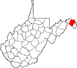
Berkeley
Location within the state of West Virginia
Usa edcp location map.svg
Red pog.svg
Berkeley
Berkeley (the United States)
Coordinates: 39°30′11″N77°55′38″W / 39.50306°N 77.92722°W / 39.50306; -77.92722
Country United States
State West Virginia
County Berkeley
Elevation
[1]
482 ft (147 m)
Time zone UTC-5 (Eastern (EST))
  Summer (DST) UTC-4 (EDT)
GNIS feature ID1553866 [1]

Berkeley is an unincorporated community in Berkeley County, West Virginia, United States. [1] The community began as Berkeley Station on the Baltimore and Ohio Railroad line, but its name has since been shortened to Berkeley as it has become more of a bedroom community.

The community most likely takes its name from Berkeley County. [2]

Related Research Articles

<span class="mw-page-title-main">Morgan County, West Virginia</span> County in West Virginia, United States

Morgan County is a county located in the U.S. state of West Virginia. As of the 2020 census, the population was 17,063. Its county seat is Berkeley Springs. The county was formed in 1820 from parts of Hampshire and Berkeley Counties and named in honor of General Daniel Morgan, prominent soldier of the American Revolutionary War. The county and town of Bath are considered an excellent jumping off point for exploring the Potomac and Cacapon Rivers valleys just to the north and west. Along with also being a tourist destination hosting numerous local artists, mineral water spas, and a large amount of outdoor recreation that includes fishing, boating, wildlife, hunting, and mountain scenery. The region is known for the famed Apple Butter Festival held annually in October. Morgan County is also the home of an important silica mine, part of U.S. Silica.

<span class="mw-page-title-main">Jefferson County, West Virginia</span> County in West Virginia, United States

Jefferson County is located in the Shenandoah Valley in the Eastern Panhandle of West Virginia. It is the easternmost county of the U.S. state of West Virginia. As of the 2020 census, the population was 57,701. Its county seat is Charles Town. The county was founded in 1801, and today is part of the Washington metropolitan area.

<span class="mw-page-title-main">Berkeley County, West Virginia</span> County in West Virginia, United States

Berkeley County is located in the Shenandoah Valley in the eastern panhandle region of West Virginia in the United States. The county is part of the Hagerstown–Martinsburg metropolitan area. As of the 2020 census, the county population was 122,076, making it the second-most populous of West Virginia's 55 counties, behind Kanawha County. The City of Martinsburg is the county seat.

<span class="mw-page-title-main">Hedgesville, West Virginia</span> Town in West Virginia, United States

Hedgesville is a town in Berkeley County, West Virginia, United States, in the state's Eastern Panhandle region. The population was 318 at the 2010 census. The town sits on WV 9, roughly 13 miles east of Berkeley Springs. In addition to its legal definition, Hedgesville has come to be the common name for the large and sparsely inhabited area of West Virginia's Eastern Panhandle bordered by the Potomac River to the North and East, a southern border defined roughly by an imaginary line from the city of Martinsburg to the tip of Virginia, and Berkeley Springs to the West.

<span class="mw-page-title-main">Opequon Creek</span>

Opequon Creek is an approximately 35 mile tributary stream of the Potomac River. It flows into the Potomac northeast of Martinsburg in Berkeley County, West Virginia, and its source lies northwest of the community of Opequon at the foot of Great North Mountain in Frederick County, Virginia. The Opequon forms part of the boundary between Frederick and Clarke counties in Virginia and also partially forms the boundary between Berkeley and Jefferson counties in West Virginia's Eastern Panhandle.

Back Creek is a 59.5-mile-long (95.8 km) tributary of the Potomac River that flows north from Frederick County, Virginia, to Berkeley County in West Virginia's Eastern Panhandle. Back Creek originates along Frederick County's border with Hampshire County, West Virginia, at Farmer's Gap in the Great North Mountain. Its name reflects its location to the west of North Mountain. The perspective of colonists from the east in the 18th century led them to call it "Back Creek", because it lay to the back of North Mountain.

<span class="mw-page-title-main">Bunker Hill, West Virginia</span> Unincorporated community in West Virginia, United States

Bunker Hill is an unincorporated community in Berkeley County, West Virginia, United States, located in the lower Shenandoah Valley on Winchester Pike at its junction with County Route 26 south of Martinsburg. It is the site of the confluence of Torytown Run and Mill Creek, a tributary of Opequon Creek which flows into Winchester, Virginia. According to the 2000 census, the Bunker Hill community has a population of 5,319.

<span class="mw-page-title-main">Darkesville, West Virginia</span> Historic house in West Virginia, United States

Darkesville is an unincorporated community in Berkeley County, West Virginia, United States. Established in 1791, Darkesville has been nationally recognized as a historic district.

<span class="mw-page-title-main">Falling Waters, West Virginia</span> Census-designated place in West Virginia, United States

Falling Waters is a census-designated place (CDP) on the Potomac River in Berkeley County, West Virginia, United States. It is located along Williamsport Pike north of Martinsburg. An 1887 Scientific American article claimed that the first U.S. railroad was built in Falling Waters in 1814.

Bedington is an unincorporated community on Hoke Run, near its confluence with Opequon Creek, in Berkeley County, West Virginia, United States. It is located east of Hainesville on County Route 5. According to the Geographic Names Information System, Bedington has also been known as Beddington, Bedenton, and The Lick.

Files Crossroad is an unincorporated community in Berkeley County, West Virginia, United States. The community is located east of Martinsburg on West Virginia Route 45 at its crossroads with County Route 45/4. The community was originally known as Smoketown, hence the name of its historic Smoketown Cemetery.

Jones Springs is an unincorporated community in Berkeley County, West Virginia, United States. It is located on County Route 7 at its junction with County Route 7/8. The town, and several of its houses, are adjacent to the numerous springs that give the community its name.

Ridgeway is an unincorporated community in Berkeley County, West Virginia, United States. It lies off U.S. Route 11 on Specks Run Road near the Virginia state line.

Scrabble is an unincorporated community in Berkeley County, West Virginia, United States. According to the Geographic Names Information System, the community has been known as Hard Scrabble, Hard Scrabble Town, and Hardscrabble throughout its history.

Tabler Station is an unincorporated community in Berkeley County, West Virginia, United States. It lies on County Route 32, south of Martinsburg off U.S. Route 11 near Eastern West Virginia Regional Airport.

<span class="mw-page-title-main">Tomahawk, West Virginia</span> Unincorporated community in West Virginia, United States

Tomahawk is an unincorporated community on Back Creek in Berkeley County, West Virginia, United States. The community is named for a nearby series of springs in the shape of a tomahawk. The community includes the historic Tomahawk Presbyterian Church, established c. 1745, and its adjacent community cemetery, which has gravestones dating to the late 18th century. Tomahawk also has a popular dirt bike racetrack. The community lies 9.5 miles from Martinsburg.

Berkeley most often refers to:

<span class="mw-page-title-main">National Register of Historic Places listings in Berkeley County, West Virginia</span>

This is a list of the National Register of Historic Places listings in Berkeley County, West Virginia.

The Hagerstown–Martinsburg metropolitan area, officially designated by the United States Office of Management and Budget (OMB) as Hagerstown–Martinsburg, Maryland–West Virginia Metropolitan Statistical Area (MSA), constitutes the primary cities of Hagerstown, Maryland; Martinsburg, West Virginia; and surrounding areas in three counties: Washington County, Maryland; Berkeley County, West Virginia; and Morgan County, West Virginia. The metro area lies mainly within the rich, fertile Cumberland and Shenandoah valleys, and is approximately a 60–90 minute drive from Washington, D.C.; Baltimore, Maryland; and Harrisburg, Pennsylvania; Hagerstown is approximately 75 miles (121 km) driving distance from all three cities. The population of the metropolitan area as of 2008 is 263,753.

<span class="mw-page-title-main">Morgan Morgan Monument</span> United States historic place

The Morgan Morgan Monument, also known as Morgan Park, is a 1.05-acre (0.4 ha) roadside park in the unincorporated town of Bunker Hill in Berkeley County, West Virginia. It is located along Winchester Avenue and Mill Creek. The park features a granite monument that was erected in 1924 to memorialize Morgan Morgan (1688–1766), an American pioneer of Welsh descent, who was among the earliest European persons to settle permanently within the present-day boundaries of West Virginia.

References

  1. 1 2 3 U.S. Geological Survey Geographic Names Information System: Berkeley, West Virginia
  2. Kenny, Hamill (1945). West Virginia Place Names: Their Origin and Meaning, Including the Nomenclature of the Streams and Mountains. Piedmont, WV: The Place Name Press. p. 109.