Tablers Station, West Virginia

Last updated

Tabler Station
USA West Virginia location map.svg
Red pog.svg
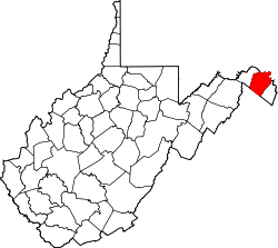
Tabler Station
Location within the state of West Virginia
Usa edcp location map.svg
Red pog.svg
Tabler Station
Tabler Station (the United States)
Coordinates: 39°23′55″N78°00′39″W / 39.39861°N 78.01083°W / 39.39861; -78.01083
Country United States
State West Virginia
County Berkeley
Elevation
[1]
561 ft (171 m)
Time zone UTC-5 (Eastern (EST))
  Summer (DST) UTC-4 (EDT)
GNIS feature ID1555776 [1]

Tabler Station is an unincorporated community in Berkeley County, West Virginia, United States. It lies on County Route 32, south of Martinsburg off U.S. Route 11 near Eastern West Virginia Regional Airport.

The community most likely was named after the local Tabler family. [2] The Tabler's Station Historic District is listed on the National Register of Historic Places. [3]

Related Research Articles

<span class="mw-page-title-main">Washington County, Maryland</span> County in Maryland, United States

Washington County is located in the western part of the U.S. state of Maryland. As of the 2020 census, the population was 154,705. It is the most populous county in the Western Maryland region and its county seat is Hagerstown.

<span class="mw-page-title-main">Doddridge County, West Virginia</span> County in West Virginia, United States

Doddridge County is a county in the U.S. state of West Virginia. As of the 2020 census, the population was 7,808. Its county seat is West Union.

<span class="mw-page-title-main">Boyce, Virginia</span> Town in Virginia

Boyce is a small incorporated town in Clarke County, Virginia, United States. The population was 749 at the 2020 census, up from 589 at the 2010 census.

<span class="mw-page-title-main">Courtland, Virginia</span> Town in Southampton County, Virginia, US

Courtland is an incorporated town in Southampton County, Virginia, United States. It is the county seat of Southampton County.

Oak Grove may refer to:

<span class="mw-page-title-main">Marshall, Virginia</span> Census-designated place in Virginia, United States

Marshall is a census-designated place (CDP) in northwestern Fauquier County, Virginia, in the United States. The population as of the 2010 census was 1,480.

North River Mills is a historic unincorporated community in Hampshire County in the U.S. state of West Virginia. North River Mills is located between Capon Bridge and Slanesville on Cold Stream Road at its intersection with North River Road. The village of North River Mills lies along the eastern banks of North River from which it takes its name.

Burlington is a census-designated place (CDP) in Mineral County, West Virginia, United States, located along U.S. Route 50 where it crosses Pattersons Creek. As of the 2020 census, its population was 131. It is part of the Cumberland, MD-WV Metropolitan Statistical Area.

<span class="mw-page-title-main">Darkesville, West Virginia</span> Historic house in West Virginia, United States

Darkesville is an unincorporated community in Berkeley County, West Virginia, United States. Established in 1791, Darkesville has been nationally recognized as a historic district.

Nollville is an unincorporated community on Tuscarora Creek in Berkeley County, West Virginia, United States. It lies west of Martinsburg on the Tuscarora Pike.

<span class="mw-page-title-main">Bristow, Virginia</span> Unincorporated community in Virginia, United States

Bristow is an unincorporated community of Prince William County in Northern Virginia about 30 miles (48 km) from Washington, D.C. In 2014, Bristow's postal area population was 29,346, a 287% increase since 2000; however, the Bristow community is formally included in the Linton Hall, Virginia census-designated place (CDP).

<span class="mw-page-title-main">Hanover, Virginia</span> Census-designated place in Virginia, United States

Hanover is an unincorporated community and census-designated place (CDP) in Hanover County, Virginia, United States. It is the county seat and is located at the junction of U.S. Route 301 and State Route 54 south of the Pamunkey River. While historically known as Hanover Courthouse, the U.S. Geological Survey, Census Bureau, Postal Service and residents refer to it as "Hanover". The population as of the 2010 census was 252.

<span class="mw-page-title-main">Delaplane, Virginia</span> Unincorporated community in Virginia, United States

Delaplane is a small unincorporated village in northern Fauquier County, Virginia, approximately 50 miles (80 km) due west of Washington, D.C. Delaplane is situated along U.S. Route 17, U.S. Route 50, and Interstate 66; bordering Upperville, Virginia to the north, Hume, Virginia to the south, Paris, Virginia to the west, and Rectortown, Virginia to the east. Delaplane, Virginia has a ZIP Code of 20144.

Lockwood is an unincorporated community in western Nicholas County, West Virginia, United States. The town is situated along Otter Creek and West Virginia Route 39.

<span class="mw-page-title-main">National Register of Historic Places listings in Berkeley County, West Virginia</span>

This is a list of the National Register of Historic Places listings in Berkeley County, West Virginia.

<span class="mw-page-title-main">Pickaway, West Virginia</span> Unincorporated community in West Virginia, United States

Pickaway is an unincorporated community in Monroe County, West Virginia, United States. Pickaway is located on U.S. Route 219, northeast of Union.

<span class="mw-page-title-main">Salt Sulphur Springs, West Virginia</span> Unincorporated community in West Virginia, United States

Salt Sulphur Springs is an unincorporated community in Monroe County, West Virginia, United States. Salt Sulphur Springs is located on U.S. Route 219, southwest of Union.

Belmont is an unincorporated community in Spotsylvania County, in the U.S. state of Virginia. It is marked with a highway sign at the intersection of Belmont Road and Orange Springs Road by the Virginia Department of Transportation, however is marked as being the intersection with Belmont Road and Jones Powell Road by the United States Geological Survey (USGS). The immediate area has Fletcher's Store and the Belmont Christmas Tree farm. Further south, there are other buildings identifying with Belmont, such as Belmont Baptist Church, the Belmont Ruritan Community Building where the Belmont Ruritan Club meets each evening at 7 p.m. and serves as the district's polling place for registered voters, and the Belmont Fire & Rescue station staffed by Spotsylvania County Volunteer Company 9.

Paytes is an unincorporated community in Spotsylvania County, in the U.S. state of Virginia. The community is marked at the intersection of Lawyer's Road and Catharpin Road by an electrical substation owned by Rappahannock Electric Co-op. A telecommunications tower was approved to be built on the site to expand cell coverage in the area on February 28, 2001.

Quiet Dell is an unincorporated community in Harrison County, West Virginia, United States. Quiet Dell is located at the junction of Interstate 79 and West Virginia Route 20, 5 miles (8.0 km) southeast of Clarksburg.

References

  1. 1 2 U.S. Geological Survey Geographic Names Information System: Tablers Station, West Virginia
  2. Kenny, Hamill (1945). West Virginia Place Names: Their Origin and Meaning, Including the Nomenclature of the Streams and Mountains. Piedmont, WV: The Place Name Press. p. 618.
  3. David L. Taylor (October 2003). "National Register of Historic Places Inventory Nomination Form: Tabler's Station Historic District" (PDF). State of West Virginia, West Virginia Division of Culture and History, Historic Preservation. Retrieved June 2, 2011.