Marlowe | |
|---|---|
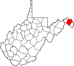
 Marlowe Location within the state of West Virginia  Marlowe Marlowe (the United States) | |
| Coordinates: 39°35′18″N77°51′34″W / 39.58833°N 77.85944°W | |
| Country | United States |
| State | West Virginia |
| County | Berkeley |
| Elevation | 515 ft (157 m) |
| Time zone | UTC-5 (Eastern (EST)) |
| • Summer (DST) | UTC-4 (EDT) |
| GNIS feature ID | 1542770 [1] |
Marlowe is an unincorporated community on U.S. Route 11 in Berkeley County, West Virginia, United States. [1]
Sites on the National Register of Historic Places located near Marlowe are: the Charles Downs II House, Harmony Cemetery, Marlowe Consolidated School, and Power Plant and Dam No. 5. [2]