Files Crossroad | |
|---|---|
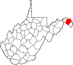
 Files Crossroad Location within the state of West Virginia  Files Crossroad Files Crossroad (the United States) | |
| Coordinates: 39°27′24″N77°54′14″W / 39.45667°N 77.90389°W | |
| Country | United States |
| State | West Virginia |
| County | Berkeley |
| Elevation | 449 ft (137 m) |
| Time zone | UTC-5 (Eastern (EST)) |
| • Summer (DST) | UTC-4 (EDT) |
| GNIS feature ID | 1538961 [1] |
Files Crossroad is an unincorporated community in Berkeley County, West Virginia, United States. [1] The community is located east of Martinsburg on West Virginia Route 45 at its crossroads with County Route 45/4. The community was originally known as Smoketown, hence the name of its historic Smoketown Cemetery.
The Rush-Miller House, located near Files Crossroad, was listed on the National Register of Historic Places in 1985. [2]