List of counties in Ohio

Last updated

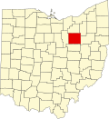
Counties of Ohio Ohio Counties Labeled White.svg
Counties of Ohio

There are 88 counties in the U.S. state of Ohio. Nine of them existed at the time of the Ohio Constitutional Convention in 1802. [1] A tenth county, Wayne, was established on August 15, 1796, and encompassed roughly the present state of Michigan. [2] During the Convention, the county was opposed to statehood, and was not only left out of the Convention, but dissolved; the current Wayne County is in northeastern Ohio, considerably distant from the area that was the original Wayne County. [1]

Contents

The Ohio Constitution allows counties to set up a charter government as many cities and villages do, [3] but only Summit and Cuyahoga counties have done so, [4] the latter having been approved by voters in November 2009. [5] Counties do not possess home rule powers and can do only what has been expressly authorized by the Ohio General Assembly. The elected county officials in Ohio county governments include three commissioners, a sheriff (the highest law enforcement officer in the county); prosecutor (equivalent of a district attorney in other states); coroner, engineer, Recorder, auditor, treasurer, and clerk of courts. [6] [7]

Population figures are based on the 2023 vintage Census population estimates. The population of Ohio was 11,785,935 at that time, a decrease of 0.1% from 2020. The average population of Ohio's counties was 133,931; Franklin County was the most populous (1,326,063) and Vinton County was the least (12,474). The average land area is 464 sq mi (1,200 km2). The largest county by area is Ashtabula County at 702.44 sq mi (1,819.3 km2), and its neighbor, Lake County, is the smallest at 228.21 sq mi (591.1 km2). The total area of the state is 40,860.69 sq mi (105,828.7 km2). [8] [9]

List of counties

County
FIPS code [10] County Seat [11] Est. [12] Origin [13] Etymology [12] [13] Population
(2023) [10] [11] [14]
Area [11] Map
AdamsCounty 001 West Union Jul 10, 1797Hamilton County John Adams (1735–1826), President of the United States when the county was organized27,521583.91 sq mi
(1,512 km2)
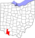
Map of Ohio highlighting Adams County.svg
AllenCounty 003 Lima Mar 1, 1820Shelby County John Allen (1771/2-1813), a War of 1812 colonel [15] 100,838404.43 sq mi
(1,047 km2)
Map of Ohio highlighting Allen County.svg
AshlandCounty 005 Ashland Feb 24, 1846Wayne, Richland, Huron, and Lorain Counties Ashland, home of U.S. Senator from Kentucky Henry Clay 52,190424.37 sq mi
(1,099 km2)
Map of Ohio highlighting Ashland County.svg
AshtabulaCounty 007 Jefferson Jun 7, 1807Trumbull and Geauga Counties Ashtabula River, which means "fish river" in an Algonquian language [16] 96,845702.44 sq mi
(1,819 km2)
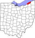
Map of Ohio highlighting Ashtabula County.svg
AthensCounty 009 Athens Mar 1, 1805Washington County Athens in Greece62,706506.76 sq mi
(1,313 km2)
Map of Ohio highlighting Athens County.svg
AuglaizeCounty 011 Wapakoneta Feb 14, 1848Allen, Mercer, Darke, Hardin, Logan, Shelby, and Van Wert Counties Auglaize River, which means "fallen timbers river" in the Shawnee Indian language46,050401.25 sq mi
(1,039 km2)
Map of Ohio highlighting Auglaize County.svg
BelmontCounty 013 St. Clairsville Sep 7, 1801Jefferson and Washington CountiesFrench for "beautiful mountain"64,918537.35 sq mi
(1,392 km2)
Map of Ohio highlighting Belmont County.svg
BrownCounty 015 Georgetown Mar 1, 1818Adams and Clermont CountiesGeneral Jacob Brown (1775–1828), an officer of the War of 1812 43,777491.76 sq mi
(1,274 km2)
Map of Ohio highlighting Brown County.svg
ButlerCounty 017 Hamilton May 1, 1803Hamilton CountyGeneral Richard Butler (1743–1791), killed at the Battle of the Wabash 393,043467.27 sq mi
(1,210 km2)
Map of Ohio highlighting Butler County.svg
CarrollCounty 019 Carrollton Jan 1, 1833Columbiana, Stark, Harrison, Jefferson, and Tuscarawas Counties Charles Carroll (1737–1832), last surviving signer of the United States Declaration of Independence 26,758394.67 sq mi
(1,022 km2)
Map of Ohio highlighting Carroll County.svg
ChampaignCounty 021 Urbana Mar 1, 1805Greene and Franklin CountiesFrench for "a plain", describing the land in the area38,845428.56 sq mi
(1,110 km2)
Map of Ohio highlighting Champaign County.svg
ClarkCounty 023 Springfield Mar 1, 1818Champaign, Madison, and Greene CountiesGeneral George Rogers Clark (1752–1818), defeated the Shawnee Indians in a battle near the Springfield area134,610399.86 sq mi
(1,036 km2)
Map of Ohio highlighting Clark County.svg
ClermontCounty 025 Batavia Dec 6, 1800Hamilton CountyFrench for "clear mountain"211,972451.99 sq mi
(1,171 km2)
Map of Ohio highlighting Clermont County.svg
ClintonCounty 027 Wilmington Mar 1, 1810Highland and Warren Counties George Clinton (1739–1812), vice-president when the county was organized41,938410.88 sq mi
(1,064 km2)
Map of Ohio highlighting Clinton County.svg
ColumbianaCounty 029 Lisbon May 1, 1803Jefferson and Washington Counties Christopher Columbus, European explorer of the Americas100,182532.46 sq mi
(1,379 km2)
Map of Ohio highlighting Columbiana County.svg
CoshoctonCounty 031 Coshocton Jan 31, 1810Muskingum and Tuscarawas Counties Delaware Indian word meaning "union of waters"36,869564.07 sq mi
(1,461 km2)
Map of Ohio highlighting Coshocton County.svg
CrawfordCounty 033 Bucyrus Apr 1, 1820Delaware CountyColonel William Crawford (1732–1782), Revolutionary War officer41,529402.11 sq mi
(1,041 km2)
Map of Ohio highlighting Crawford County.svg
CuyahogaCounty 035 Cleveland Jun 7, 1807Geauga County Cuyahoga River, which means "crooked river" in an Iroquoian language [17] 1,233,088458.49 sq mi
(1,187 km2)
Map of Ohio highlighting Cuyahoga County.svg
DarkeCounty 037 Greenville Jan 3, 1809Miami CountyGeneral William Darke (1736–1801), Revolutionary War officer51,415599.80 sq mi
(1,553 km2)
Map of Ohio highlighting Darke County.svg
DefianceCounty 039 Defiance Apr 7, 1845Williams, Henry, and Paulding Counties Fort Defiance, built in 1794 by General Anthony Wayne 38,315411.16 sq mi
(1,065 km2)
Map of Ohio highlighting Defiance County.svg
DelawareCounty 041 Delaware Apr 1, 1808Franklin County Delaware Indians 231,636442.41 sq mi
(1,146 km2)
Map of Ohio highlighting Delaware County.svg
ErieCounty 043 Sandusky Mar 15, 1838Huron and Sandusky Counties Erie Indians 74,035254.88 sq mi
(660 km2)
Map of Ohio highlighting Erie County.svg
FairfieldCounty 045 Lancaster Dec 9, 1800Ross and Washington CountiesNamed for the beauty of its "fair fields"165,360505.11 sq mi
(1,308 km2)
Map of Ohio highlighting Fairfield County.svg
FayetteCounty 047 Washington Court House Mar 1, 1810Ross and Highland Counties Gilbert du Motier, marquis de La Fayette, French military officer and aristocrat who participated in both the American and French revolutions28,817406.58 sq mi
(1,053 km2)
Map of Ohio highlighting Fayette County.svg
FranklinCounty 049 Columbus Apr 30, 1803Ross and Wayne Counties Benjamin Franklin (1706–1791), Founding Father, author, printer, political theorist, scientist, inventor, and statesman1,326,063539.87 sq mi
(1,398 km2)
Map of Ohio highlighting Franklin County.svg
FultonCounty 051 Wauseon Apr 1, 1850Lucas, Henry, and Williams Counties Robert Fulton (1765–1815), inventor of the steamboat [18] 42,007406.78 sq mi
(1,054 km2)
Map of Ohio highlighting Fulton County.svg
GalliaCounty 053 Gallipolis Apr 30, 1803Washington and Adams Counties Gaul, the ancient name of France 28,986468.78 sq mi
(1,214 km2)
Map of Ohio highlighting Gallia County.svg
GeaugaCounty 055 Chardon Mar 1, 1806Trumbull CountyA native american word meaning "raccoon"95,407403.66 sq mi
(1,045 km2)
Map of Ohio highlighting Geauga County.svg
GreeneCounty 057 Xenia May 1, 1803Hamilton and Ross CountiesGeneral Nathanael Greene (1742–1786), Revolutionary War officer169,691414.88 sq mi
(1,075 km2)
Map of Ohio highlighting Greene County.svg
GuernseyCounty 059 Cambridge Mar 1, 1810Belmont and Muskingum CountiesIsland of Guernsey, from where most of the settlers originated38,089521.90 sq mi
(1,352 km2)
Map of Ohio highlighting Guernsey County.svg
HamiltonCounty 061 Cincinnati Jan 2, 1790One of the original counties Alexander Hamilton (1755/7-1804), Secretary of the Treasury when the county was organized827,058407.36 sq mi
(1,055 km2)
Map of Ohio highlighting Hamilton County.svg
HancockCounty 063 Findlay Apr 1, 1820Logan County John Hancock (1737–1793), president of the Continental Congress 74,704531.35 sq mi
(1,376 km2)
Map of Ohio highlighting Hancock County.svg
HardinCounty 065 Kenton Apr 1, 1820Logan CountyGeneral John Hardin (1753–1792), Revolutionary War officer30,368470.29 sq mi
(1,218 km2)
Map of Ohio highlighting Hardin County.svg
HarrisonCounty 067 Cadiz Feb 1, 1813Jefferson and Tuscarawas CountiesGeneral William Henry Harrison (1773–1841), an officer of the War of 1812 and future President of the United States 14,159403.53 sq mi
(1,045 km2)
Map of Ohio highlighting Harrison County.svg
HenryCounty 069 Napoleon Apr 1, 1820Shelby County Patrick Henry (1736–1799), Revolutionary War-era legislator, orator, and scholar27,520416.50 sq mi
(1,079 km2)
Map of Ohio highlighting Henry County.svg
HighlandCounty 071 Hillsboro May 1, 1805Ross, Adams, and Clermont CountiesDescriptive of the county's terrain43,614553.28 sq mi
(1,433 km2)
Map of Ohio highlighting Highland County.svg
HockingCounty 073 Logan Mar 1, 1818Athens, Ross, and Fairfield CountiesPossibly derived from the Delaware Indian word "Hoch-Hoch-ing", meaning "bottle"27,540422.75 sq mi
(1,095 km2)
Map of Ohio highlighting Hocking County.svg
HolmesCounty 075 Millersburg Jan 20, 1824Coshocton, Wayne, and Tuscarawas CountiesMajor Andrew Holmes (died 1814), a War of 1812 officer44,386422.99 sq mi
(1,096 km2)
Map of Ohio highlighting Holmes County.svg
HuronCounty 077 Norwalk Mar 7, 1809Portage and Cuyahoga Counties Huron Indians 58,199492.69 sq mi
(1,276 km2)
Map of Ohio highlighting Huron County.svg
JacksonCounty 079 Jackson Mar 1, 1816Scioto, Gallia, Athens, and Ross CountiesGeneral Andrew Jackson (1767–1845), future President of the United States32,606420.28 sq mi
(1,089 km2)
Map of Ohio highlighting Jackson County.svg
JeffersonCounty 081 Steubenville Jul 29, 1797Washington County Thomas Jefferson (1743–1826), Vice President when the county was organized, future President of the United States, and principal author of the Declaration of Independence 64,026409.61 sq mi
(1,061 km2)
Map of Ohio highlighting Jefferson County.svg
KnoxCounty 083 Mount Vernon Mar 1, 1808Fairfield CountyGeneral Henry Knox, the first Secretary of War 63,320527.12 sq mi
(1,365 km2)
Map of Ohio highlighting Knox County.svg
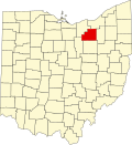
LakeCounty 085 Painesville Mar 6, 1840Geauga and Cuyahoga CountiesIts location on Lake Erie 231,640228.21 sq mi
(591 km2)
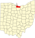
Map of Ohio highlighting Lake County.svg
LawrenceCounty 087 Ironton Dec 21, 1815Gallia and Scioto CountiesCaptain James Lawrence (1781–1813), naval hero in the War of 1812 56,118454.96 sq mi
(1,178 km2)
Map of Ohio highlighting Lawrence County.svg
LickingCounty 089 Newark Mar 1, 1808Fairfield County Licking River, named for the salt licks in the area, or an English pronunciation of the Lenape word W'li/'ik'/nk meaning "where the flood waters recede" [19] 183,201686.50 sq mi
(1,778 km2)
Map of Ohio highlighting Licking County.svg
LoganCounty 091 Bellefontaine Mar 1, 1818Champaign CountyGeneral Benjamin Logan (c.1742 – 1802), who destroyed Shawnee Indian towns in the county46,057458.44 sq mi
(1,187 km2)
Map of Ohio highlighting Logan County.svg
LorainCounty 093 Elyria Dec 26, 1822Huron, Cuyahoga, and Medina CountiesProvince of Lorraine, France 317,910492.50 sq mi
(1,276 km2)
Map of Ohio highlighting Lorain County.svg
LucasCounty 095 Toledo Jun 20, 1835Wood, Sandusky, and Huron Counties Robert Lucas (1781–1853), Governor of Ohio when the county was created425,484340.46 sq mi
(882 km2)
Map of Ohio highlighting Lucas County.svg
MadisonCounty 097 London Mar 1, 1810Franklin County James Madison (1751–1836), fourth President of the United States 44,602465.44 sq mi
(1,205 km2)
Map of Ohio highlighting Madison County.svg
MahoningCounty 099 Youngstown Mar 1, 1846Columbiana and Trumbull Counties Mahoning River, from a Lenape word meaning "at the licks"225,596415.25 sq mi
(1,075 km2)
Map of Ohio highlighting Mahoning County.svg
MarionCounty 101 Marion Apr 1, 1820Delaware CountyGeneral Francis Marion (1732–1795), lieutenant colonel in the Continental Army and later brigadier general in the American Revolutionary War 64,851403.84 sq mi
(1,046 km2)
Map of Ohio highlighting Marion County.svg
MedinaCounty 103 Medina Feb 18, 1812Portage County Medina, world-renowned religious site in western Saudi Arabia 184,042423 sq mi
(1,096 km2)
Map of Ohio highlighting Medina County.svg
MeigsCounty 105 Pomeroy Apr 1, 1819Gallia and Athens Counties Return Jonathan Meigs Jr. (1764–1825), Governor of Ohio and Postmaster General at the time the county was organized21,767429.42 sq mi
(1,112 km2)
Map of Ohio highlighting Meigs County.svg
MercerCounty 107 Celina Apr 1, 1820Darke CountyGeneral Hugh Mercer (1726–1777), a Revolutionary War officer42,439463.27 sq mi
(1,200 km2)
Map of Ohio highlighting Mercer County.svg
MiamiCounty 109 Troy Mar 1, 1807Montgomery County Miami Indians 110,876407.04 sq mi
(1,054 km2)
Map of Ohio highlighting Miami County.svg
MonroeCounty 111 Woodsfield Jan 29, 1813Belmont, Washington, and Guernsey Counties James Monroe (1758–1831), Secretary of State when the county was organized and future President of the United States 13,153455.54 sq mi
(1,180 km2)
Map of Ohio highlighting Monroe County.svg
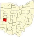
MontgomeryCounty 113 Dayton May 1, 1803Hamilton and Wayne CountiesGeneral Richard Montgomery (1738–1775), a Revolutionary War officer533,796461.68 sq mi
(1,196 km2)
Map of Ohio highlighting Montgomery County.svg
MorganCounty 115 McConnelsville Dec 29, 1817Washington, Guernsey, and Muskingum CountiesGeneral Daniel Morgan (c. 1735 – 1802), a Revolutionary War officer13,646417.66 sq mi
(1,082 km2)
Map of Ohio highlighting Morgan County.svg
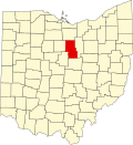
MorrowCounty 117 Mount Gilead Mar 1, 1848Knox, Marion, Delaware, and Richland Counties Jeremiah Morrow (1771–1852), Governor of Ohio 35,595406.22 sq mi
(1,052 km2)
Map of Ohio highlighting Morrow County.svg
MuskingumCounty 119 Zanesville March 1, 1804 [20] [21] Washington and Fairfield CountiesAn Indian word meaning "A town by the river" or "by the river side"86,305664.63 sq mi
(1,721 km2)
Map of Ohio highlighting Muskingum County.svg
NobleCounty 121 Caldwell Apr 1, 1851Monroe, Washington, Morgan, and Guernsey CountiesJames Noble, an early settler in the area14,311399.00 sq mi
(1,033 km2)
Map of Ohio highlighting Noble County.svg
OttawaCounty 123 Port Clinton Mar 6, 1840Erie, Sandusky, and Lucas CountiesNamed for the Ottawa Indians; Ottawa means "trader" in their language39,803254.95 sq mi
(660 km2)
Map of Ohio highlighting Ottawa County.svg
PauldingCounty 125 Paulding Apr 1, 1820Darke County John Paulding (1758–1818), captor of spy John André during the Revolutionary War 18,706416.26 sq mi
(1,078 km2)
Map of Ohio highlighting Paulding County.svg
PerryCounty 127 New Lexington Mar 1, 1818Washington, Fairfield, and Muskingum CountiesCommodore Oliver Hazard Perry (1785–1819), a naval officer of the War of 1812 35,551409.78 sq mi
(1,061 km2)
Map of Ohio highlighting Perry County.svg
PickawayCounty 129 Circleville Mar 1, 1810Ross, Fairfield, and Franklin CountiesA misspelling of the Piqua tribe, a branch of the Shawnee 61,086501.91 sq mi
(1,300 km2)
Map of Ohio highlighting Pickaway County.svg
PikeCounty 131 Waverly Feb 1, 1815Ross, Scioto, and Adams CountiesGeneral Zebulon M. Pike (1779–1813), a War of 1812 officer and discoverer of Pikes Peak in Colorado in 180627,001441.49 sq mi
(1,143 km2)
Map of Ohio highlighting Pike County.svg
PortageCounty 133 Ravenna Jun 7, 1807Trumbull CountyDerived from an Indian portage 162,665492.39 sq mi
(1,275 km2)
Map of Ohio highlighting Portage County.svg
PrebleCounty 135 Eaton Mar 1, 1808Montgomery and Butler CountiesCaptain Edward Preble (1761–1807), a Naval commander in the Revolutionary War 40,556424.80 sq mi
(1,100 km2)
Map of Ohio highlighting Preble County.svg
PutnamCounty 137 Ottawa Apr 1, 1820Shelby CountyGeneral Israel Putnam (1718–1790), a Revolutionary War officer34,199483.87 sq mi
(1,253 km2)
Map of Ohio highlighting Putnam County.svg
RichlandCounty 139 Mansfield Mar 1, 1808Fairfield CountyDescriptive of the soil in the area125,064496.88 sq mi
(1,287 km2)
Map of Ohio highlighting Richland County.svg
RossCounty 141 Chillicothe Aug 20, 1798Adams and Washington CountiesNamed for U.S. Senator from Pennsylvania James Ross by territorial governor Arthur St. Clair 76,501688.41 sq mi
(1,783 km2)
Map of Ohio highlighting Ross County.svg
SanduskyCounty 143 Fremont Apr 1, 1820Huron CountyAn Iroquois word meaning "cold water"58,709409.18 sq mi
(1,060 km2)
Map of Ohio highlighting Sandusky County.svg
SciotoCounty 145 Portsmouth May 1, 1803Adams County Scioto River; Scioto is a Wyandot Indian word meaning "deer"71,969612.27 sq mi
(1,586 km2)
Map of Ohio highlighting Scioto County.svg
SenecaCounty 147 Tiffin Apr 1, 1820Huron County Seneca Indians, who had a reservation in the county area at the time54,527550.59 sq mi
(1,426 km2)
Map of Ohio highlighting Seneca County.svg
ShelbyCounty 149 Sidney Apr 1, 1819Miami CountyGeneral Isaac Shelby (1750–1826), a Revolutionary War officer and Governor of Kentucky 47,765409.27 sq mi
(1,060 km2)
Map of Ohio highlighting Shelby County.svg
StarkCounty 151 Canton Feb 13, 1808Columbiana CountyGeneral John Stark (1728–1822), a Revolutionary War officer; known as the "Hero of Bennington" for his exemplary service at the Battle of Bennington in 1777372,716576.14 sq mi
(1,492 km2)
Map of Ohio highlighting Stark County.svg
SummitCounty 153 Akron Mar 3, 1840Medina, Portage, and Stark CountiesIts location at the highest elevation along the Ohio and Erie Canal 535,733419.38 sq mi
(1,086 km2)
Map of Ohio highlighting Summit County.svg
TrumbullCounty 155 Warren Jul 10, 1800Jefferson and Wayne Counties Jonathan Trumbull (1710–1785), Governor of Connecticut when the county was organized200,373616.48 sq mi
(1,597 km2)
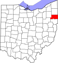
Map of Ohio highlighting Trumbull County.svg
TuscarawasCounty 157 New Philadelphia Mar 15, 1808Muskingum County Tuscarawas River, meaning "open mouth river"
or
the Tuscarawas tribe who lived on the river
91,874567.58 sq mi
(1,470 km2)
Map of Ohio highlighting Tuscarawas County.svg
UnionCounty 159 Marysville Apr 1, 1820Delaware, Franklin, Logan, and Madison CountiesIts formation by a union of four counties69,637436.65 sq mi
(1,131 km2)
Map of Ohio highlighting Union County.svg
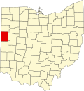
Van WertCounty 161 Van Wert Apr 1, 1820Darke County Isaac Van Wart (1760–1828), captor of spy John André during the Revolutionary War 28,704410.09 sq mi
(1,062 km2)
Map of Ohio highlighting Van Wert County.svg
VintonCounty 163 McArthur Mar 23, 1850Athens, Gallia, Hocking, Jackson, and Ross Counties Samuel Finley Vinton (1792–1862), Ohio Statesman and U.S. Congressman12,474414.08 sq mi
(1,072 km2)
Map of Ohio highlighting Vinton County.svg
WarrenCounty 165 Lebanon May 1, 1803Hamilton CountyGeneral Joseph Warren (1741–1775), a Revolutionary War officer252,148399.63 sq mi
(1,035 km2)
Map of Ohio highlighting Warren County.svg
WashingtonCounty 167 Marietta Jul 27, 1788One of the original counties George Washington (1732–1799), commander of the Continental Army, president of the Constitutional Convention, and future President of the United States 58,577635.15 sq mi
(1,645 km2)
Map of Ohio highlighting Washington County.svg
WayneCounty 169 Wooster Mar 1, 1812Stark CountyGeneral Anthony Wayne (1745–1796), a Revolutionary War officer116,510555.36 sq mi
(1,438 km2)
Map of Ohio highlighting Wayne County.svg
WilliamsCounty 171 Bryan Apr 1, 1820Darke County David Williams (1754–1831), captor of spy John André during the Revolutionary War 36,591421.74 sq mi
(1,092 km2)
Map of Ohio highlighting Williams County.svg
WoodCounty 173 Bowling Green Apr 1, 1820Refactored from non-county territory Eleazer D. Wood (1783–1814), founder of Fort Meigs 132,650617.32 sq mi
(1,599 km2)
Map of Ohio highlighting Wood County.svg
WyandotCounty 175 Upper Sandusky Feb 3, 1845Marion, Crawford, and Hardin Counties Wyandot Indians21,457405.61 sq mi
(1,051 km2)
Map of Ohio highlighting Wyandot County.svg

List of county codes

The Federal Information Processing Standard (FIPS) is used by the U.S. government to uniquely identify counties. In the following table, these codes link to the United States Census Bureau's "quick facts" for each county. Ohio's FIPS code of 39 is used to distinguish from counties in other states. For example, Adams County's unique nationwide identifier is 39001. [10]

Various state agencies identify counties by different coding schemes. The Ohio Department of Taxation assigns consecutive numbers for the purpose of enumerating taxing districts. [22] The Ohio Department of Public Safety, including the Ohio Bureau of Motor Vehicles, associates these county numbers with vehicle registrations. [23] The Department of Transportation uses three-letter abbreviations in road inventory and traffic management applications. [24] For historic preservation purposes, Ohio History Connection refers to counties by two- and three-letter abbreviations in the Ohio Archaeological Inventory and Ohio Historic Inventory, respectively. [25]

CountyFIPS codeODPS [23] /ODT [22] codeOAI [25] codeODOT [24] /OHI [25] code
Adams County 00101ADADA
Allen County 00302ALALL
Ashland County 00503ASASD
Ashtabula County 00704ABATB
Athens County 00905ATATH
Auglaize County 01106AUAUG
Belmont County 01307BLBEL
Brown County 01508BRBRO
Butler County 01709BUBUT
Carroll County 01910CACAR
Champaign County 02111CHCHP
Clark County 02312CLCLA
Clermont County 02513CTCLE
Clinton County 02714CNCLI
Columbiana County 02915COCOL
Coshocton County 03116CSCOS
Crawford County 03317CRCRA
Cuyahoga County 03518CUCUY
Darke County 03719DADAR
Defiance County 03920DEDEF
Delaware County 04121DLDEL
Erie County 04322ERERI
Fairfield County 04523FAFAI
Fayette County 04724FEFAY
Franklin County 04925FRFRA
Fulton County 05126FUFUL
Gallia County 05327GAGAL
Geauga County 05528GEGEA
Greene County 05729GRGRE
Guernsey County 05930GUGUE
Hamilton County 06131HAHAM
Hancock County 06332HKHAN
Hardin County 06533HRHAR
Harrison County 06734HNHAS
Henry County 06935HYHEN
Highland County 07136HIHIG
Hocking County 07337HOHOC
Holmes County 07538HSHOL
Huron County 07739HUHUR
Jackson County 07940JAJAC
Jefferson County 08141JEJEF
Knox County 08342KNKNO
Lake County 08543LALAK
Lawrence County 08744LELAW
Licking County 08945LILIC
Logan County 09146LOLOG
Lorain County 09347LNLOR
Lucas County 09548LULUC
Madison County 09749MAMAD
Mahoning County 09950MHMAH
Marion County 10151MNMAR
Medina County 10352MEMED
Meigs County 10553MSMEG
Mercer County 10754MRMER
Miami County 10955MIMIA
Monroe County 11156MOMOE
Montgomery County 11357MYMOT
Morgan County 11558MGMRG
Morrow County 11759MWMRW
Muskingum County 11960MUMUS
Noble County 12161NONOB
Ottawa County 12362OTOTT
Paulding County 12563PAPAU
Perry County 12764PEPER
Pickaway County 12965PIPIC
Pike County 13166PKPIK
Portage County 13367POPOR
Preble County 13568PRPRE
Putnam County 13769PUPUT
Richland County 13970RIRIC
Ross County 14171ROROS
Sandusky County 14372SASAN
Scioto County 14573SCSCI
Seneca County 14774SESEN
Shelby County 14975SHSHE
Stark County 15176STSTA
Summit County 15377SUSUM
Trumbull County 15578TRTRU
Tuscarawas County 15779TUTUS
Union County 15980UNUNI
Van Wert County 16181VWVAN
Vinton County 16382VIVIN
Warren County 16583WAWAR
Washington County 16784WNWAS
Wayne County 16985WEWAY
Williams County 17186WIWIL
Wood County 17387WOWOO
Wyandot County 17588WYWYA

See also

Related Research Articles

<span class="mw-page-title-main">Summit County, Ohio</span> County in Ohio, United States

Summit County is an urban county in the U.S. state of Ohio. As of the 2020 census, the population was 540,428, making it the fourth-most populous county in Ohio. Its county seat and largest city is Akron. The county was formed on March 3, 1840, from portions of Medina, Portage and Stark counties. It was named Summit County because the highest elevation on the Ohio and Erie Canal is in the county.

<span class="mw-page-title-main">Portage County, Ohio</span> County in Ohio

Portage County is a county in the U.S. state of Ohio. As of the 2020 census, the population was 161,791. Located in Northeast Ohio, Portage County is part of the Akron Metropolitan Statistical Area, which is also included in the Cleveland–Akron–Canton Combined Statistical Area. Its county seat is Ravenna and its largest city is Kent. The county, named for the portage between the Cuyahoga and Tuscarawas rivers, was created in 1807 and formally organized in 1808. In addition to the cities of Kent and Ravenna, Portage County also includes the cities of Aurora and Streetsboro, along with five villages, 18 civil townships, and several unincorporated places within those townships. Additionally, the county includes parts of the city of Tallmadge, and part of the village of Mogadore, both of which are mostly in neighboring Summit County.

<span class="mw-page-title-main">Geauga County, Ohio</span> County in Ohio, United States

Geauga County is a county in the U.S. state of Ohio. As of the 2020 census, the population was 95,397. The county seat and largest city is Chardon.

<span class="mw-page-title-main">Cuyahoga County, Ohio</span> County in Ohio, United States

Cuyahoga County is a large urban county located in the northeastern part of the U.S. state of Ohio. The county seat and largest city is Cleveland. As of the 2020 census, its population was 1,264,817, making it the second-most populous county in the state.

<span class="mw-page-title-main">Ashtabula County, Ohio</span> County in Ohio, United States

Ashtabula County is the northeasternmost county in the U.S. state of Ohio. As of the 2020 census, the population was 97,574. The county seat is Jefferson, while its largest city is Ashtabula. The county was created in 1808 and later organized in 1811. The name Ashtabula derives from the Lenape language phrase ashte-pihële, which translates to 'always enough (fish) to go around, to be given away' and is a contraction of apchi ('always') + tepi ('enough') + hële. Ashtabula County is part of the Cleveland, OH Metropolitan Statistical Area.

<span class="mw-page-title-main">Conneaut, Ohio</span> City in Ohio, United States

Conneaut is a city in Ashtabula County, Ohio, United States, along Lake Erie at the mouth of Conneaut Creek 66 miles (106 km) northeast of Cleveland. The population was 12,318 at the 2020 census. Conneaut is located at the far northeastern corner of the state, within the Cleveland metropolitan area.

<span class="mw-page-title-main">North Ridgeville, Ohio</span> City in Ohio, United States

North Ridgeville is a city located along the eastern border of Lorain County, Ohio, United States. The city's population was 35,280 as of the 2020 census. A part of the Cleveland metropolitan area, North Ridgeville is the fastest-growing city in northern Ohio. It has been ranked the 13th safest city in the United States and the safest in Ohio.

<span class="mw-page-title-main">Cuyahoga Falls, Ohio</span> City in Ohio, United States

Cuyahoga Falls is a city in Summit County, Ohio, United States. As of the 2020 census, the city population was 51,114. The second-largest city in Summit County, it is located directly north of Akron and is a suburb of the Akron metropolitan area. The city was founded in 1812 by William Wetmore and was originally named Manchester, but renamed for the Cuyahoga River and the series of waterfalls that run along the southern boundary of the city.

<span class="mw-page-title-main">Greater Cleveland</span> Metropolitan Statistical Area in United States

The Cleveland metropolitan area, or Greater Cleveland as it is more commonly known, is the metropolitan area surrounding the city of Cleveland in Northeast Ohio, United States. According to the 2020 census results, the six-county Cleveland, OH Metropolitan Statistical Area (MSA) consists of Cuyahoga County, Ashtabula County, Geauga County, Lake County, Lorain County, and Medina County, and has a population of 2,185,825, making it the 33rd-most populous metropolitan area in the United States and the third largest metropolitan area in Ohio. The metro area is also part of the larger Cleveland–Akron–Canton Combined Statistical Area with a population of over 3.7 million people, the most populous statistical area in Ohio and the 17th most populous in the United States.

<span class="mw-page-title-main">Northeast Ohio</span> Place in Ohio, United States

Northeast Ohio is a geographic and cultural region that comprises the northeastern counties of the U.S. state of Ohio. Definitions of the region consist of 16 to 23 counties between the southern shore of Lake Erie and the foothills of the Appalachian Mountains, home to over 4.5 million people. It is anchored by the metropolitan area of Cleveland, the most populous city in the region with over 372,000 residents in 2020. Other metropolitan centers include Akron, Canton, Mansfield, Sandusky, and Youngstown. Northeast Ohio includes most of the area known historically as the Connecticut Western Reserve.

<span class="mw-page-title-main">Chagrin Falls Township, Ohio</span> Township in Ohio, United States

Chagrin Falls Township is a township located in Cuyahoga County, Ohio, United States. As of the 2020 census, the township had a total population of 4,317, which includes the village of Chagrin Falls. The portion of the township outside the village limits had a population of 129 at the 2020 census. The unincorporated township consists of about 44 households on an area of 0.52 square miles (1.3 km2), resulting in a population density of 261.7 persons/mile². It is one of only two civil townships remaining in Cuyahoga County and the only Chagrin Falls Township statewide.

<span class="mw-page-title-main">Pierpont Township, Ashtabula County, Ohio</span> Township in Ohio, United States

Pierpont Township is one of the twenty-seven townships of Ashtabula County, Ohio, United States. The 2020 census found 1,158 people in the township.

<span class="mw-page-title-main">Outline of Ohio</span> Overview of and topical guide to Ohio

The following outline is provided as an overview of and topical guide to the U.S. state of Ohio:

The administrative divisions of Ohio are counties, municipalities, townships, special districts, and school districts.

References

  1. 1 2 Laning, J.F. (1896). "The Evolution of Ohio Counties". Ohio Archaeological and Historical Publications . V: 326–350. Archived from the original on November 21, 2015.. Other editions available at ISBN   1249686741 and Google Books
  2. Lawyer, James Patterson (1905). History of Ohio: From the Glacial Period to the Present Time. Press of F. J. Heer. p. 381. Retrieved August 18, 2007. Other editions available at ISBN   9781279183281
  3. Steinglass, Steven; Scarselli, Gino (2004). The Ohio State Constitution A Reference Guide. Westport, CT: Praeger Publishers. pp. 272–273. (OH county charter). Other editions available: ISBN   0313267650 and Google Books
  4. "Ohio Counties". County of Summit. November 15, 2011. Archived from the original on January 27, 2020. Retrieved February 28, 2013.{{cite web}}: CS1 maint: unfit URL (link)
  5. "Issue 6 reform wins big and sets in motion even bigger changes for Cuyahoga County". cleveland.com. November 4, 2009. Retrieved January 28, 2010.
  6. "OSBA - OSBA Staff Directory". www.ohiobar.org.
  7. "Title 3 - Ohio Revised Code | Ohio Laws".
  8. "Ohio QuickFacts". U.S. Census Bureau. Archived from the original on March 3, 2013. Retrieved February 27, 2013.
  9. "Population Estimates". U.S. Census Bureau. December 2009. Archived from the original on March 22, 2009. Retrieved February 27, 2013.
  10. 1 2 3 "County FIPS Code Listing for the State of OHIO". United States Environmental Protection Agency. Retrieved July 9, 2016.
  11. 1 2 3 "NACo - Find a County". Archived from the original on April 13, 2007. Retrieved July 22, 2007.
  12. 1 2 "Federal Roster: Counties of Ohio, Derivation of Name and Date of Erection" (PDF). Archived from the original on July 12, 2013. Retrieved July 21, 2013.{{cite web}}: CS1 maint: bot: original URL status unknown (link)
  13. 1 2 Howe, Henry (1891). Historical Collections of Ohio. Vol. 2. Columbus, OH: Henry Howe and Son. (OH county source). Other editions available: ISBN   1425565735 and Google Books
  14. https://www.census.gov/quickfacts/fact/table/OH/PST045223 [ bare URL ]
  15. Resolution of 111th Ohio General Assembly designating John Allen as the person for which Allen County was named.
  16. Ashtabula, Encyclopædia Britannica, 2007. Accessed November 19, 2007.
  17. Cuyahoga River, Encyclopædia Britannica, 2007. Accessed November 19, 2007.
  18. About Fulton County
  19. Mahr, August C. (April 1957). "Indian River and Place Names in Ohio". Ohio Archaeological and Historical Quarterly. 66 (2): 146–148.
  20. Downes, p. 368.
  21. Taylor & Taylor, p. 40.
  22. 1 2 "Ohio Counties with County Number" (PDF). Columbus, Ohio: Ohio Department of Taxation. June 25, 2020. Retrieved September 11, 2023.
  23. 1 2 Taxing District Code Book 2023 (PDF). Ohio Bureau of Motor Vehicles, Tax Distribution Section. January 3, 2023. Retrieved September 12, 2023.
  24. 1 2 "ODOT County Abbreviation Table" (PDF). Ohio Department of Transportation. May 1, 2013. Retrieved December 21, 2014.
  25. 1 2 3 "Ohio Archaeological Inventory Form Instruction Manual" (PDF). Ohio Historic Preservation Office. June 2003. p. 61. Retrieved September 12, 2023.

Further reading