Franklin County, Ohio

Last updated

Franklin County
Franklin County Govt Center 04.jpg
Flag of Franklin County, Ohio.svg
Seal of Franklin County (Ohio).svg
Etymology: Benjamin Franklin
Map of Ohio highlighting Franklin County.svg
Map of Ohio highlighting Franklin County
Coordinates: 39°58′N83°00′W / 39.967°N 83.000°W / 39.967; -83.000
Country United States
State Ohio
RegionCentral Ohio
FoundedApril 30, 1803 [1]
County seat Columbus
Area
  Total544 sq mi (1,410 km2)
  Land532 sq mi (1,380 km2)
  Water11 sq mi (30 km2)
Population
 (2020)
  Total1,323,807
  Estimate 
(2022)
1,321,820 Decrease2.svg
  Density2,400/sq mi (940/km2)
Gross Domestic Product
[2]
  TotalUS$106.988 billion (2022)
Time zone UTC−5 (North American EST)
  Summer (DST) UTC−4 (EDT)
Area codes 614, 380
Website franklincountyohio.gov

Franklin County is a county in the U.S. state of Ohio. As of the 2020 census, the population was 1,323,807, [3] making it the most populous county in Ohio. Most of its land area is taken up by its county seat, Columbus, [4] the state capital and most populous city in Ohio. The county was established on April 30, 1803, less than two months after Ohio became a state, and was named after Benjamin Franklin. [5] Originally, Franklin County extended north to Lake Erie before it was subdivided into smaller counties. Franklin County is the central county of the Columbus, Ohio Metropolitan Statistical Area.

Contents

Franklin County, particularly Columbus, has been a centerpiece for presidential and congressional politics, most notably the 2000 presidential election, the 2004 presidential election, and the 2006 midterm elections. Franklin County is home to one of the largest universities in the United States, Ohio State University, which has about 60,000 students on its main Columbus campus. [6]

It shares a name with Franklin County in Kentucky, where Frankfort is located. This makes it one of two pairs of capital cities in counties of the same name, along with Marion Counties in Indiana and Oregon.

History

On March 30, 1803, the Ohio government authorized the creation of Franklin County. The county originally was part of Ross County. Residents named the county in honor of Benjamin Franklin. [7] In 1816, Franklin County's Columbus became Ohio's state capital. Surveyors laid out the city in 1812, and officials incorporated it in 1816. Columbus was not Ohio's original capital, but the state legislature chose to move the state government there after its location for a short time at Chillicothe and at Zanesville. Columbus was chosen as the site for the new capital because of its central location within the state and access by way of major transportation routes (primarily rivers) at that time. The legislature chose it as Ohio's capital over a number of other competitors, including Franklinton, Dublin, Worthington, and Delaware.

On May 5, 1802, a group of prospective settlers founded the Scioto Company at the home of Rev. Eber B. Clark in Granby, Connecticut, for the purpose of forming a settlement between the Muskingum River and Great Miami River in the Ohio Country. James Kilbourne was elected president and Josiah Topping secretary. [8] [ full citation needed ] On August 30, 1802, James Kilbourne and Nathaniel Little arrived at Colonel Thomas Worthington's home in Chillicothe. They tentatively reserved land along the Scioto River on the Pickaway Plains for their new settlement. [9] [ full citation needed ]

On October 5, 1802, the Scioto Company met again in Granby and decided not to purchase the lands along the Scioto River on the Pickaway Plains, but rather to buy land 30 miles (48 km) farther north from Jonas Stanbery and his partner, an American Revolutionary War general, Jonathan Dayton. Sixteen thousand acres (65 km2; 6,500 ha) were purchased along the Whetstone River (now known as the Olentangy River) at $1.50 per acre. [10] [ full citation needed ] This land was part of the United States Military District surveyed by Israel Ludlow in 1797 and divided into townships 5 miles (8.0 km) square. [11]

Before the state legislature's decision in 1812, Columbus did not exist. The city was originally designed as the state's new capital, preparing itself for its role in Ohio's political, economic, and social life. In the years between the first ground-breaking and the actual movement of the capital in 1816, Columbus and Franklin County grew significantly. By 1813, workers had built a penitentiary, and by the following year, residents had established the first church, school, and newspaper in Columbus. Workers completed the Ohio Statehouse in 1861. Columbus and Franklin County grew quickly in population, with the city having 700 people by 1815. Columbus officially became the county seat in 1824. By 1834, the population of Columbus was 4,000 people, officially elevating it to "city" status.

Geography

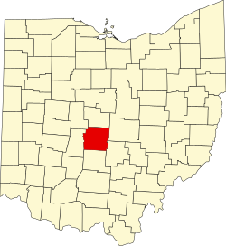
According to the United States Census Bureau, the county has a total area of 544 square miles (1,410 km2), of which 532 square miles (1,380 km2) is land and 11 square miles (28 km2) (2.1%) is water. [12] The county is located in the Till Plains and the Appalachian Plateau land regions.

The county is drained by the Olentangy River and the Scioto River. Major creeks in the county include Big Darby Creek, Big Walnut Creek, and Alum Creek. There are two large reservoirs in the county, Hoover Reservoir and Griggs Reservoir. [13]

Adjacent counties

Major highways

Demographics

Historical population
CensusPop.Note
1810 3,486
1820 10,292195.2%
1830 14,74143.2%
1840 25,04969.9%
1850 42,90971.3%
1860 50,36117.4%
1870 63,01925.1%
1880 86,79737.7%
1890 124,08743.0%
1900 164,46032.5%
1910 221,56734.7%
1920 283,95128.2%
1930 361,05527.2%
1940 388,7127.7%
1950 503,41029.5%
1960 682,96235.7%
1970 833,24922.0%
1980 869,1324.3%
1990 961,43710.6%
2000 1,068,97811.2%
2010 1,163,4148.8%
2020 1,323,80713.8%
2022 (est.)1,321,820 [14] −0.2%
U.S. Decennial Census [15]
1790–1960 [16] 1900–1990 [17]
1990–2000 [18] 2010–2020 [3]

2010 census

As of the 2010 census, there were 1,163,414 people, 477,235 households, and 278,030 families living in the county. [19] The population density was 2,186.1 inhabitants per square mile (844.1/km2). There were 527,186 housing units at an average density of 990.6 per square mile (382.5/km2). [20] The racial makeup of the county was 69.2% white, 21.2% black or African American, 3.9% Asian, 0.2% American Indian, 0.1% Pacific islander, 2.3% from other races, and 3.0% from two or more races. Those of Hispanic or Latino origin made up 4.8% of the population. [19] In terms of ancestry, 24.2% were German, 14.4% were Irish, 9.1% were English, 5.5% were Italian, and 5.0% were American. [21]

Of the 477,235 households, 31.0% had children under the age of 18 living with them, 39.0% were married couples living together, 14.4% had a female householder with no husband present, 41.7% were non-families, and 31.9% of all households were made up of individuals. The average household size was 2.38 and the average family size was 3.05. The median age was 33.4 years. [19]

The median income for a household in the county was $49,087 and the median income for a family was $62,372. Males had a median income of $45,920 versus $37,685 for females. The per capita income for the county was $26,909. About 12.1% of families and 17.0% of the population were below the poverty line, including 23.0% of those under age 18 and 9.4% of those age 65 or over. [22]

Ethnic origins in Franklin County Ethnic Origins in Franklin County, OH.png
Ethnic origins in Franklin County

Economy

Top Employers

According to the county's 2019 Comprehensive Annual Financial Report, [23] the top employers in the county are:

#Employer# of Employees
1 Ohio State University 33,335
2 OhioHealth 23,836
3 State of Ohio 21,342
4 JP Morgan Chase & Co. 18,400
5 Nationwide 12,500
6 Nationwide Children's Hospital 10,875
7 Kroger Co. 10,563
8 City of Columbus 8,963
9 Mount Carmel Health System 8,776
10 L Brands, Inc. 8,616

Politics

For most of the 20th century, Franklin County was a Republican bastion, as has long been the case with most of central Ohio. From 1896 to 1992, it went Republican all but five times. However, it has gone Democratic in every election since 1996, reflecting the Democratic trend in most other urban counties nationwide. Columbus and most of its northern and western suburbs lean Democratic, while the more blue-collar southern section of the county leans Republican. From 1996 to 2004, Democratic nominees carried the county by single digit margins, but it swung significantly in favor of Barack Obama in 2008. The county has swung towards Democrats in every subsequent Presidential election, with each candidate breaking the previous county record for both largest Democratic vote share and largest Democratic margin of victory in county history. Most recently, Democratic nominee Joe Biden won the county with 64.7 percent of the vote and a 31.4 percent margin of victory. [24]

In Congress, it is split between two districts. Most of Columbus itself is in the 3rd district, represented by Democrat Joyce Beatty. The southwestern portion is in 15th district, represented by Republican Mike Carey. [25]

United States presidential election results for Franklin County, Ohio [26]
Year Republican Democratic Third party
No.%No.%No.%
2020 211,23733.40%409,14464.68%12,1511.92%
2016 199,33133.93%351,19859.78%36,9956.30%
2012 215,99737.75%346,37360.53%9,8181.72%
2008 218,48638.89%334,70959.58%8,5681.53%
2004 237,25345.12%285,80154.35%2,7730.53%
2000 197,86247.78%202,01848.79%14,1943.43%
1996 178,41244.55%192,79548.14%29,3087.32%
1992 186,32441.89%176,65639.72%81,82118.39%
1988 226,26559.96%147,58539.11%3,5070.93%
1984 250,36064.12%131,53033.68%8,5842.20%
1980 200,94853.87%143,93238.58%28,1657.55%
1976 189,64555.66%141,62441.57%9,4432.77%
1972 219,77163.74%117,56234.09%7,4752.17%
1968 148,93351.78%101,24035.20%37,45113.02%
1964 131,34545.95%154,52754.05%00.00%
1960 161,17859.37%110,28340.63%00.00%
1956 151,54465.78%78,85234.22%00.00%
1952 138,89460.25%91,62039.75%00.00%
1948 98,70753.36%84,80645.84%1,4860.80%
1944 99,29252.62%89,39447.38%00.00%
1940 92,53348.92%96,60151.08%00.00%
1936 63,83040.39%90,74657.42%3,4712.20%
1932 67,95752.21%58,53944.97%3,6642.81%
1928 92,01965.86%47,08433.70%6090.44%
1924 61,89157.68%26,50524.70%18,89917.61%
1920 59,69154.23%48,45244.02%1,9211.75%
1916 24,10740.36%34,10357.10%1,5172.54%
1912 12,79125.22%20,69740.81%17,22733.97%
1908 28,91453.45%23,31443.10%1,8693.45%
1904 27,43961.49%15,50234.74%1,6813.77%
1900 22,23752.16%19,80946.46%5901.38%
1896 20,29151.96%18,32046.91%4421.13%
1892 14,34146.51%15,49550.25%9993.24%
1888 13,45347.59%14,12649.97%6922.45%
1884 11,19447.68%11,84250.44%4411.88%
1880 9,43848.30%9,86350.47%2401.23%
1876 7,55744.36%9,38355.07%970.57%
1872 5,79643.92%7,34555.66%560.42%
1868 5,07941.64%7,11958.36%00.00%
1864 4,81945.73%5,71954.27%00.00%
1860 4,29545.99%4,84651.90%1972.11%
1856 3,48844.42%3,79148.27%5747.31%

Government

Franklin County Officials

OfficeOfficeholderParty
Franklin County Commissioner Erica Crawley Democratic
Franklin County Commissioner Kevin Boyce Democratic
Franklin County CommissionerJohn O'Grady Democratic
Auditor Michael Stinziano Democratic
Clerk of Courts Maryellen O'Shaughnessy Democratic
CoronerNate Overmire Democratic
EngineerBrad Foster Republican
ProsecutorGary Tyack Democratic
Recorder Danny O'Connor Democratic
SheriffDallas Baldwin Democratic
TreasurerCheryl Brooks Sullivann Democratic

Ohio House of Representatives

DistrictRepresentativeParty
1 Dontavius Jarrells Democratic
2 Latyna Humphrey Democratic
3 Ismail Mohamed Democratic
4 Beryl Brown PiccolantonioDemocratic
5 Richard Brown Democratic
6 Adam Miller Democratic
7 Allison Russo Democratic
8 Beth Liston Democratic
9 Munira Abdullahi Democratic
10 David DobosRepublican
11 Anita Somani Democratic
12 Brian Stewart Republican

Ohio State Senate

DistrictSenatorParty
3 Michele Reynolds Republican
15 Hearcel Craig Democratic
16 Stephanie Kunze Republican
25 Bill DeMora Democratic

United States House of Representatives

DistrictRepresentativeParty
03 Joyce Beatty Democratic
15 Mike Carey Republican

United States Senate

SenatorParty
Sherrod Brown Democratic
J. D. Vance Republican

[27]

Communities

Map of Franklin County with municipal and township labels Franklin County, Ohio, 2010.pdf
Map of Franklin County with municipal and township labels

Franklin County is currently made up of 16 cities, 10 villages, and 17 townships.

Cities

Villages

Townships

Defunct Townships

Census-designated places

Other unincorporated communities

Education

School districts include: [29]

City school districts:

Local school districts:

State-operated schools include:

See also

Footnotes

  1. "Ohio County Profiles: Franklin County" (PDF). Ohio Department of Development. Archived from the original (PDF) on June 21, 2007. Retrieved April 28, 2007.
  2. "Gross Domestic Product by County and Metropolitan Area, 2022" (PDF). www.bea.gov. Bureau of Economic Analysis.
  3. 1 2 "State & County QuickFacts". United States Census Bureau. Retrieved April 11, 2022.
  4. "Find a County". National Association of Counties. Archived from the original on May 31, 2011. Retrieved June 7, 2011.
  5. "Franklin County data". Ohio State University Extension Data Center. Archived from the original on December 3, 2007. Retrieved April 28, 2007.
  6. "Statistical Summary". osu.edu. Retrieved February 21, 2018.
  7. Gannett, Henry (1905). The Origin of Certain Place Names in the United States. Govt. Print. Off. p. 131.
  8. McCormick 1998:7
  9. McCormick 1998:17
  10. McCormick 1998:19-27
  11. "A Century of Lawmaking for a New Nation: U.S. Congressional Documents and Debates, 1774 - 1875". memory.loc.gov. Retrieved April 19, 2018.
  12. "2010 Census Gazetteer Files". United States Census Bureau. August 22, 2012. Archived from the original on May 4, 2014. Retrieved February 7, 2015.
  13. Query of Geographic Names Information System
  14. "Annual Estimates of the Resident Population for Counties: April 1, 2020 to July 1, 2022". United States Census Bureau. Retrieved June 26, 2023.
  15. "U.S. Decennial Census". United States Census Bureau. Retrieved February 7, 2015.
  16. "Historical Census Browser". University of Virginia Library. Retrieved February 7, 2015.
  17. Forstall, Richard L., ed. (March 27, 1995). "Population of Counties by Decennial Census: 1900 to 1990". United States Census Bureau. Retrieved February 7, 2015.
  18. "Census 2000 PHC-T-4. Ranking Tables for Counties: 1990 and 2000" (PDF). United States Census Bureau. April 2, 2001. Archived (PDF) from the original on March 27, 2010. Retrieved February 7, 2015.
  19. 1 2 3 "DP-1 Profile of General Population and Housing Characteristics: 2010 Demographic Profile Data". United States Census Bureau. Archived from the original on February 13, 2020. Retrieved December 27, 2015.
  20. "Population, Housing Units, Area, and Density: 2010 - County". United States Census Bureau. Archived from the original on February 13, 2020. Retrieved December 27, 2015.
  21. "DP02 SELECTED SOCIAL CHARACTERISTICS IN THE UNITED STATES – 2006-2010 American Community Survey 5-Year Estimates". United States Census Bureau. Archived from the original on February 13, 2020. Retrieved December 27, 2015.
  22. "DP03 SELECTED ECONOMIC CHARACTERISTICS – 2006-2010 American Community Survey 5-Year Estimates". United States Census Bureau. Archived from the original on February 13, 2020. Retrieved December 27, 2015.
  23. "Franklin County, Ohio Comprehensive Annual Financial Report For the Year Ended December 31, 2019" (PDF). Archived (PDF) from the original on June 27, 2021. Retrieved June 27, 2021.
  24. "Election Archive Franklin County Board of Elections". vote.franklincountyohio.gov.
  25. "Franklin County Board of Elections". vote.franklincountyohio.gov.
  26. Leip, David. "Dave Leip's Atlas of U.S. Presidential Elections". uselectionatlas.org. Retrieved April 19, 2018.
  27. "Franklin County Elected Officials".
  28. "Archived copy" (PDF). Archived from the original (PDF) on February 6, 2015. Retrieved February 14, 2013.{{cite web}}: CS1 maint: archived copy as title (link)
  29. "2020 CENSUS - SCHOOL DISTRICT REFERENCE MAP: Franklin County, OH" (PDF). U.S. Census Bureau . Retrieved July 23, 2022. - Text list

Further reading

Related Research Articles

<span class="mw-page-title-main">Columbus, Ohio</span> Capital and largest city of Ohio, United States

Columbus is the capital and most populous city of the U.S. state of Ohio. With a 2020 census population of 905,748, it is the 14th-most populous city in the U.S., the second-most populous city in the Midwest after Chicago, and the third-most populous U.S. state capital after Phoenix, Arizona and Austin, Texas. Columbus is the seat of government of Franklin County; it also extends into Delaware and Fairfield counties. It is the core city of the Columbus metropolitan area, which encompasses ten counties in central Ohio. It had a population of 2,138,926 in 2020, making it the largest metropolitan area entirely in Ohio and 32nd-largest metro area in the U.S.

<span class="mw-page-title-main">Scioto County, Ohio</span> County in Ohio, United States

Scioto County is a county along the Ohio River in the south-central part of the U.S. state of Ohio. At the 2020 census, the population was 74,008. Its county seat is Portsmouth. The county was founded on March 24, 1804, from Adams County and is named for a Native American word referring to deer or deer-hunting. Scioto County comprises the Portsmouth, OH Micropolitan Statistical Area. It is at the confluence of the Scioto and Ohio rivers.

<span class="mw-page-title-main">Ross County, Ohio</span> County in Ohio, United States

Ross County is a county in the Appalachian region of the U.S. state of Ohio. As of the 2020 United States Census, the population was 77,093. Its county seat is Chillicothe, the first and third capital of Ohio. Established on August 20, 1798, the county is named for Federalist Senator James Ross of Pennsylvania. Ross County comprises the Chillicothe, OH Micropolitan Statistical Area, which is also included in the Columbus-Marion-Zanesville, OH Combined Statistical Area.

<span class="mw-page-title-main">Pickaway County, Ohio</span> County in Ohio, United States

Pickaway County is a county in the U.S. state of Ohio. As of the 2020 census, the population was 58,539. Its county seat is Circleville. Its name derives from the Pekowi band of Shawnee Indians, who inhabited the area.

<span class="mw-page-title-main">Madison County, Ohio</span> County in Ohio, United States

Madison County is a county located in the central portion of the U.S. state of Ohio. As of the 2020 census, the population was 43,824. Its county seat is London. The county is named for James Madison, President of the United States and was established on March 1, 1810.

<span class="mw-page-title-main">Fairfield County, Ohio</span> County in Ohio, US

Fairfield County is a county located in the U.S. state of Ohio. As of the 2020 census, the population was 158,921. Its county seat and largest city is Lancaster. Its name is a reference to the Fairfield area of the original Lancaster.

<span class="mw-page-title-main">Delaware County, Ohio</span> County in Ohio, United States

Delaware County is a county located in the central portion of the U.S. state of Ohio. As of the 2020 census, the population was 214,124. Its county seat and largest city is Delaware.

<span class="mw-page-title-main">Powell, Ohio</span> City in Ohio, United States

Powell is a city in Delaware County, Ohio, United States, located 14 miles (21.5 km) north of the state capital of Columbus. Powell had an estimated population of 14,163 at the 2020 census. Founded in the early 1800s, it is now a suburb of Columbus.

<span class="mw-page-title-main">Worthington, Ohio</span> City in Ohio, United States

Worthington is a city in Franklin County, Ohio, United States, and is a northern suburb of Columbus. The population in the 2020 Census was 14,786. The city was founded in 1803 by the Scioto Company led by James Kilbourne, who was later elected to the United States House of Representatives, and named in honor of Thomas Worthington, who later became governor of Ohio.

<span class="mw-page-title-main">Ashville, Ohio</span> Village in Ohio, United States

Ashville is a village in Pickaway County, Ohio, United States. The population was 4,621 at the 2020 census. Ashville is located 17 miles south of Columbus and 8 miles north of Circleville.

<span class="mw-page-title-main">Circleville, Ohio</span> City in Ohio, United States

Circleville is a city in, and the county seat of, Pickaway County, Ohio, United States. The city is situated along the Scioto River, 25 miles (40 km) south of Columbus. The population was recorded to be 13,927 in the 2020 census.

<span class="mw-page-title-main">Chillicothe, Ohio</span> City in Ohio, United States

Chillicothe is a city in and the county seat of Ross County, Ohio, United States. Located along the Scioto River 45 miles (72 km) south of Columbus, Chillicothe was the first and third capital of Ohio. It is the only city in Ross County and is the center of the Chillicothe micropolitan area. The population was 22,059 at the 2020 census. Chillicothe is a designated Tree City USA by the National Arbor Day Foundation.

<span class="mw-page-title-main">Dublin, Ohio</span> City in Ohio, United States

Dublin is a city in the U.S. state of Ohio. A suburb of Columbus, it falls within the jurisdictions of the counties of Franklin County, Delaware County, and Union County. The population was 49,328 at the 2020 census. The city of Dublin hosts the yearly Memorial Tournament at the Muirfield Village Golf Club. The Dublin Irish Festival advertises itself as the largest three-day Irish festival in the world.

<span class="mw-page-title-main">Olentangy River</span> River in Ohio, United States of America

The Olentangy River is a 97-mile-long (156 km) tributary of the Scioto River in Ohio, United States.

Ohio's 6th congressional district was represented by Representative Bill Johnson (R-OH) until his resignation in 2024. This district runs along the eastern side of the state, bordering West Virginia, and Pennsylvania. It stretches from Marietta through several Ohio River industrial towns all the way to the city of Youngstown.

<span class="mw-page-title-main">Jefferson Township, Franklin County, Ohio</span> Township in Ohio, United States

Jefferson Township is situated on the northeast edge of Franklin County, Ohio as a part of the Columbus metropolitan area and situated between the Blacklick Creek, Big Walnut Creek and Swisher Creek watershed. The township is one of the seventeen townships of Franklin County, Ohio, United States. The 2020 census found 14,475 people in the township. It was established on September 6, 1816.

<span class="mw-page-title-main">Pleasant Township, Franklin County, Ohio</span> Township in Ohio, United States

Pleasant Township is one of the seventeen townships of Franklin County, Ohio, United States. As of the 2020 census, the population was 6,757.

<span class="mw-page-title-main">Hamilton Township, Franklin County, Ohio</span> Township in Ohio, United States

Hamilton Township is one of the seventeen townships of Franklin County, Ohio, United States. The 2020 census found 8,634 people in the township.

<span class="mw-page-title-main">Geography of Columbus, Ohio</span> Topography, climate and cityscape in the city

The city of Columbus is located in central Ohio at the confluence of the Scioto and Olentangy rivers. The region is dominated by a humid continental climate, characterized by hot, muggy summers and cold, dry winters.

Northwest Columbus is a region in Franklin County, Ohio. It has about 45,000 residents, according to the 2010 U.S. census.