The Ohio Department of Natural Resources stated the Great Black Swamp covered 3,072,000 acres (1,243,000ha) and its Lake Erie marshes covered 300,000 acres (120,000ha).[6] Other estimates claim the wetlands covered 1,500 square miles (3,900km2); or 2,600 square miles (6,700km2); or were 140 miles (230km) wide.[7][8][9]
A Lidar-based DEM of the Laurentide ice sheet's footprints in which the Great Black Swamp developed. The image shows how the ice shaped the terrain with moraines and flat elevations of glacial till across Indiana, Ohio, and Michigan.
After the Maumee Torrent, the region developed the following proglacial lakes as water levels dropped: Arkona (13,800–13,600 YBP); Ypsilanti (13,600–13,000 YBP); Whittlesey (13,000–12,800 YBP); Warren and Wayne (12,800–12,500 YBP); Grassmere and Lundy (12,500–12,400 YBP); Early and Middle Lake Erie (12,400–4,000 YBP); and modern Lake Erie (4,000 YBP).[22]Isosatic rebound (an uplift of the Earth's crust from the ice sheet's removal) occurred 9,000 to 4,000 YBP, which impacted water flow. Drainage initially flowed west during the highest lake stages, 220 feet (67m) above current levels, then shifted east and eventually established Lake Erie's present outline.[23]
An illustration showing how a melting glacier shapes a moraine, a lacustrine plain, a proglacial lake, and other landforms. This is how the Huron-Erie Lake Plain and Lake Maumee were formed, followed later by the Great Black Swamp.An illustration showing how terrain impacts wetlands. A glacier shaped the Great Black Swamp's terrain, which developed a variety of wetlands, forests, prairies, and savannas.
The preceding glacial lake was believed to have had beaches.[24] A 2015 study found it actually had a chain of islands instead of a traditional beach, when it examined lake level changes based on evidence including lacustrine sands with diamicton from the Bølling-Allerød Interstadial (14,690–12,890 YBP).[25] This period is associated with meltwater pulse 1A, during which the global sea level rose between 52–82 feet (16–25m) in about 400–500 years.[26]
The Great Black Swamp formed on the drained Huron-Erie Lake Plain, including the Maumee Lake Plains, Paulding Plains, Marblehead Drift/Limestone Plains, and the Oak Openings.[27] This area rests on shale and Silurian, Devonian, and Mississippian bedrock, which correlate with bedrock and glacial aquifers.[28][29] The swamp's Paleozoic fossils exist in inland and shoreline quarries.[30][31]
Limestone, with 20–80 feet (6.1–24.4m) of clay-rich till deposited 15,000–13,000 YBP, covers the Maumee River's south side, while 90 feet (27m) of glacial drift covers shale to the north.[32][33][34] Drift depths vary across all Black Swamp counties, from 5 feet (1.5m) at Allen County to 176 feet (54m) at Williams County.[35][36]Aeolian sand dunes were deposited across the plain.[37][38] The 8.2-kiloyear event, a rapid drop in global temperatures, induced two phases of wind-blown loess deposition across the swamp and Ohio 8,950 to 8,005 YBP.[39]
Historians described the swamp's streams as "sluggish in their motions, their bed having little inclination", and its ground as, "alike retaining, and alike absorbing water".[43][44] The average slope of the land was about 4 feet (1m) per 1 mile (2km).[45][46] The weight of the ice sheet and proglacial lakes flattened the land, shaping its bedrock and soils.[47][48][49]Tectonic forces shaped structural basins, domes, and arches in the bedrock.[50][51] Varying aquifer mineralogy influenced groundwater geochemical composition.[52][53][54]Moraines contained the swamp; water from precipitation slowly flowed in braided, meandering patterns into the Maumee, Ottawa, Sandusky, Raisin, and Portage rivers towards Lake Erie.[55][56][57][58]
A replica of Fred the mastodon (Buesching mastodon), pictured left, based on fossils found west of the former Great Black Swamp. Pictured right is a female mastodon fossil.
Mastodon fossils have been discovered in the Black Swamp region since the late 19th century, in places such as Erie and Lenawee counties.[62][63][64] In 1998, an 80% complete male mastodon fossil skeleton was discovered in Fort Wayne.[65] The family who discovered it named it Fred, after their grandfather.[66] About 13,000 YBP, its body sank into wetland soils, where a low-oxygen environment helped preserve it. Scientists determined it had died from a fatal battle with another male, and its location of death was likely used by other mastodons for mating grounds.[67] Scientists studied the bones for oxygen and strontium levels to determine how the animal used the landscape.[68] They concluded from chemical signatures in the tusks that the mastodon's diet consisted of conifers such as spruce, which were abundant in the swamp region during the Late Pleistocene.[69]
Pollen evidence from the Ohio and Indiana till plains suggests post-Younger Dryas warming turned the swamp region's boreal climate into a temperate climate about 11,000 YBP.[70][71] Proglacial lakes also impacted climate patterns, when winds interfaced with changing lake surfaces 14,200–10,500 YBP.[72]
The region's geo-botanical relationship has been documented by many researchers, including geologist Dr. Jane L. Forsyth.[85] Her work illustrates how soil and elevation dictated vegetational mosaics: high sand dunes supported xeric oak savannas, while shallow bedrock with sand and clay surfaces fostered wet prairies and swamps. These contrasting conditions created a diverse landscape, encouraging wet and dry species to coexist (e.g., pin oak, chinquapin oak).[86]
The short-eared owl used the Black Swamp's wetlands for hunting and breeding.
Scenes About A Seneca Bark Lodge by Jesse Cornplanter, age 15, 1905. The Seneca lived in the Black Swamp region.
Evidence in northern Ohio of the first Indigenous peoples, known as Paleo-Indians, date to around 11,000 YBP, according to studies of the Paleo Crossing Site and Nobles Pond Site. Evidence from 11,000–12,000 YBP of early humans was found at Sheriden Cave to the east and included Clovis culture artifacts.[112] A 2012 study suggests humans existed in northern Ohio 13,738 to 13,435 YBP, based on the discovery of stone-tool cut marks on the bones of a Jefferson's ground sloth, which were found in a bog in the Huron River headwaters.[113]
Indigenous people harvested wild rice in the Black Swamp (lithograph by Seth Eastman c. 1850 based on his time with Indigenous people).An Ojibwe cedarbark bag used for harvesting wild rice, a plant native to the Black Swamp's wetlands.
The Indigenous peoples of the Northeastern Woodlands lived in the Black Swamp region.[119] Common languages included Algonquian and Iroquoian.[120] They managed their lands around the swamp through seasonal migration, hunting, fishing, cultivating corn, and soil burning.[121][122] Their traditional soil burns mirror modern prescribed burns used for habitat management. They harvested wild rice, a sensitive indicator of healthy freshwater marshes providing food and habitat for wildlife (e.g., deer, rabbits, muskrats, ducks).[123][124][125] They viewed wild rice (manoomin) as sacred and an important part of their identity, livelihood, religion, culture, and traditions.[126]
An archeological site near the Maumee River in Allen County, Indiana, and dated 1150–1430 AD uncovered ceramic pottery; projectile points; stone tools; corn; animal bone; mussel shells; and charcoal from firewood, which originated from beech, ash, hickory, elm, walnut, maple, and white oak.[129] Another Maumee River archaeological site in Lucas County, Ohio, yielded evidence of a late 18th to early 19th century Ottawa burial, which contained: trade goods; a shelter; an animal enclosure; Indigenous and European artifacts such as trade silver; and dietary evidence such as corn, fish, reptiles, and mollusks.[130]
Canoes in a Fog, Lake Superior by Frances Anne Hopkins, 1869. Hopkins based it on her experiences with Indigenous people. Their canoes show advanced engineering and design.
Following the reintroduction of horses in North America, Indigenous peoples utilized them alongside 15 feet (4.6m) long dugout canoes for transportation.[131][132] More complex birchbark canoes were engineered for higher capacities; a 1750s account by frontiersman James Smith describes a vessel 35 feet (11m) long, known in fur trade records as a "6-fathom gunwale length."[133][134] Birchbark canoes featured birch bark skins sewn with tree roots over light wooden frames — typically white birch, chestnut, basswood, and cottonwood — providing the longitudinal strength necessary for high-speed travel under heavy loads. Different models were used for specific bodies of water, from calm lakes to fast-moving rivers. Stone tools and axes made of flint, jasper, and quartz were used for construction until European metal tools were introduced.[135] Two Smithsonian historians noted the birchbark canoes' advanced design and engineering indicates a long period of development must have taken place before European contact.[136]
George Catlin's illustration, c. 1850, of a Kickapoo (center) and Potawatomi he observed praying. Both nations lived in the Black Swamp region.Ojibwe lived in the Black Swamp region (illustration by George Catlin).
The Anishinaabe and Ojibwe (Chippewa) utilized birch bark to create scrolls (wiigwaasabak) for written stories, songs, rituals, healing recipes, maps, and artwork. A stylus of bone or wood was used to etch markings, which were then rubbed with charcoal.[137] Birch bark was also crafted into boxes (wiigwaasi-makak) to store items, including food, thanks to the wood's preservative compound, betulin. The wood's suberin offered waterproof protection for items and food, and even canoes.[138] The Indigenous peoples harvested the bark without fatally injuring the trees.[139] They respected the life-giving abilities of the swamp, which was called Waabashkiki in the Ojibwe language.[140]
Anishinaabe peoples inhabited the swamp region for generations.[141] Villages bordered the area, including those of the Miami along the Maumee-Wabash portage, and the Great Miami and Little Miami Rivers.[142][143] The swamp was a regionally divided trapping ground for many Ohio River valley settlements, including Lower Shawneetown.[144][145][146][147] Within the swamp, the Shawnee settled along the Sandusky, Auglaize, and Maumee rivers.[148] The Shawnee called the Maumee River Ot-ta-wa-se-poie; the Wyandot called it Cagh-a-ren-du-teie.[149]
Archaeologists have studied ancient earthworks within the swamp region, which suggest Indigenous peoples modified the land for defense and fortification against warring nations.[156][157][158] Many of the swamp's earthworks were in Fulton, Lucas, and Sandusky counties in Ohio.[159]
A map by Major Ebenezer Denny of Indigenous villages he witnessed during the Harmar Campaign (1790). It shows how the Shawnee, Delaware, and Miami modified the Black Swamp's headwaters with agriculture.
The Potawatomi, Wea, Miami, and other Indigenous nations traveled the swamp's rivers for hunting, trade, and defense. They established villages at the swamp's headwaters — the confluence of the St. Joseph, St. Marys, and Maumee rivers in Indiana — to access the Great Lakes and northern territories.[160] This network included the Miami town of Kekionga and the Shawnee town of Chillicothe. In 1790, Major Ebenezer Denny witnessed villages with riverside gardens and corn fields when the U.S. military destroyed them during the Harmar campaign of the Northwest Indian War.[161]
Indigenous assimilation, removals, and treaties for the swamp
Charge of the Dragoons at Fallen Timbers by R.F. Zogbaum, 1895. The illustration depicts the Battle of Fallen Timbers, which took place on the Maumee River in the Great Black Swamp in 1794, and was the final battle of the Northwest Indian War.
The establishment of the Northwest Territory in 1787 by the U.S. Congress initiated major changes for northwest Ohio's Indigenous peoples and the Great Black Swamp. Following the 1794 Battle of Fallen Timbers and the end of the Northwest Indian War, the 1795 Treaty of Greenville reserved the entire region, including the swamp, for Indigenous control.[169][170] However, the U.S. government systematically took these lands, including the Great Black Swamp, for sale to white settlers through a series of treaties in the early 19th century.
The Great Black Swamp's name originated during the War of 1812, possibly referencing its black soil, the way its trees blocked sunlight, or the terrain's challenges for military transport.[181][182] On September 29, 1812, the first Ohio battle of the war took place in the swamp between Americans and Indigenous, ending in a draw on the Marblehead Peninsula in Sandusky Bay.[183][184] Shawnee leaders Tecumseh and Tenskwatawa formed an indigenous alliance to resist American expansion.[185] After their defeat at the 1811 Battle of Tippecanoe, the confederacy united with the British during the War of 1812 but disbanded following Tecumseh's death at the 1813 Battle of the Thames.
After the 1814 Treaty of Greenville, the 1817 Treaty of Fort Meigs took most of the swamp from the Indigenous peoples.[186][187][188][189] In 1818, Lewis Cass, territorial governor of Michigan, stated an interest to develop northwest Ohio for European-American use and to take it by force, even if it caused, he said, the "extinction" of the Indigenous peoples living there.[190]
One Indian mission school existed in Fort Wayne (1820–1822), led by Baptist missionary Isaac McCoy. He taught Indigenous students, and baptized people in the Maumee.[198] The 8 to 42 enrolled children were primarily Miami, Potawatomi, and Shawnee.[199]
A late-19th century photo of the Maumee Mission School, where Rev. Isaac Van Tassel, his wife, Lucia, and teachers taught Indigenous children (1822–1834) by the Maumee River.Kay be sen day way We Win, or Indian Woman with Child on Lap, by Eastman Johnson, 1857. The illustration depicts a child and mother, possibly Ojibwe (Chippewa). Johnson based it on his observations and interactions with Indigenous people.
The Ebenezer Mission School (or Old Maumee Mission School) operated 1822–1834 on the Maumee River in the Black Swamp of Wood County.[200] Established by the Western Presbyterian Missionary Society of Pennsylvania, the school occupied Missionary Island and 372 adjacent acres, and focused on "Christianizing and civilizing the Indians."[201] Rev. Isaac Van Tassel and his wife, Lucia, ran the complex, which included a two-story mission house, a schoolhouse, a blacksmith shop, and livestock farm with assistants, teachers, and laborers.[202][203]
Students included Ottawa, Chippewa, Miami, Shawnee, Munsee, Wyandotte, and Potawatomi children. Missionaries also conducted outreach to elders in Indigenous territories and nearby white settlements.[204][205] The school enrolled 80 to 150 Indigenous students aged 6 to 20. Activities included sports, sledding, making maple sugar, and the commercial harvesting of hickory nuts for eastern markets.[206] Schoolwork covered the Bible, arithmetic, grammar, and geography.[207] The Van Tassels studied Indigenous languages to produce translated spelling books with scriptures and hymns for Indigenous students.[208]
The school had been developing a growing community.[209] However, the U.S. government continued its policies of removing land from Indigenous peoples. The 1826 Treaty of Mississinewa ceded the swamp in Indiana north of the Maumee.[210][211] The 1831 Treaty with the Ottawa ceded lands in what became Ottawa, Ohio.[212][213] The 1832 Treaty with the Wyandot ceded lands north of what became Carey, Ohio, and the Springville Marsh State Nature Preserve.[214][215] The 1833 Treaty with the Ottawa ceded lands around the future Toledo.[216][217] This treaty completed American control of Lake Erie's Western Basin, known to the Ottawa as "Gitche Gumegsuwach" (Get-she-gum-eg-sug-wach).[218]
Van Tassel had the Presbyterian Missionary Society donate 600 to 700 acres of his school's land to the Ottawa so they could stay.[219] Eventually, the school closed in April 1834 because the U.S. government forced Indigenous populations to move west of the Mississippi.[220] The school is not listed as a boarding school by the Bureau of Indian Affairs.[221][222]
In 1841, by the Portage River in the swamp, a group of white people murdered a Wyandot, Chief Summundewat, who was one of the most vocal leaders opposed to the Indian Removals.[223][224][225][226] On March 17, 1842, the Wyandot Tribal Council signed a treaty with Special Commissioner John Johnston and sold all of their remaining lands in Michigan and 109,144 acres in the Ohio counties of Wyandot and Crawford.[227] In 1842, Charles Dickens, who was traveling through the U.S. at that time, met with the last of the Wyandot people in Ohio, and with Johnston himself, who had just negotiated the treaty. Dickens wrote about this encounter in his book, American Notes.
An illustration (1857–1859) by artist and surveyor John Arnot Fleming, based on his observations of Indigenous graves. The Wyandot (Wendat, Huron) buried their dead through various rituals in graves called Oi-go-sa-yé.
Dickens listened to Johnston, who spoke to him about the Wyandot, and gave him "a moving account of their strong attachment to the familiar scenes of their infancy, and in particular to the burial-places of their kindred; and of their great reluctance to leave them".[229] Burial grounds in the Wyandot (Wendat, Huron) language were called Oi-go-sa-yé.[228]
During the Removals, Americans authorized to work with the Indigenous as agents assured them the President said they would always own the land they would be moved to out west, in Indian Territory. Records indicate an agent was told by a Wyandot chief:
He promised the same thing to us at our last treaty; that if we would sell all but this reservation, he would protect us from the encroachments of the whites, and keep us in peace, and never ask us to sell another foot of our land. This was not ten years ago; and now you are at your old trade of trying to drive us away again. Besides, it would be no better if we were yonder; for there is no land or swamp so poor, but white men will want it; and if the President did not fulfill his word here, will he do it yonder? No! You white men never will be satisfied till the blue water of the great lakes, in which the sun sets, has drank the last drop of Indian blood. Here are our homes; and we are now beginning to live comfortably… Here, too, are the graves and bones of our fathers, our wives, and our children.[230]
Draining the swamp
First stages of settlement and development
A Lidar-based DEM outlining the Great Black Swamp's wetlands (excluding forests, prairies, savannas) across Indiana, Ohio, and Michigan. It follows presettlement vegetation maps based on 19th-century land surveys.
Following the forced removals of the Indigenous populations, white American settlement accompanied the Great Black Swamp's drainage.[231] Dry uplands were settled early, but the swamp's muddy terrain delayed development for decades.[232][233][234]
The swamp's impassibility factored into conflicts.[235][236][237][238][239] The Black Swamp Mutiny of 1813 occurred when American soldiers got lost in the swamp en route to the Battle of the Thames.[240] During the 1835–36 Toledo War, militias could not engage in the wetlands.[241][242] Even with a corduroy road, travel could take weeks; wheeled transport was often impossible most of the year.[243][244][245][246] People could walk across the swamp with ease when it was frozen hard in winter.[247]
Following the Land Ordinance of 1785, the General Land Office (GLO), established in 1812, managed the Public Land Survey System's surveying and platting. To sell the Ohio Lands, GLO surveyors recorded detailed landscape observations. From 1816 to 1856, they assessed the agricultural potential of soils, noted the quantity and quality of timber (including tree species and diameter), and recorded locations of wetlands and streams, burned areas, beaver floodings, and Indigenous or early-settler cultural sites.[248]
A PLSS index survey map of northwest Ohio, created after 1817. It shows the land purchased through the Treaty of Fort Meigs, leaving only a few Indigenous reservations. Land was sectioned into townships. Individual parcels were sold to settlers.
Survey records were vulnerable to losses or fires in the 19th century.[249] Surviving records, once used to sell land to 19th-century settlers, now help researchers identify environments that existed over 200 years ago.[250][251]GIS presettlement vegetation maps, based on survey records, show the Black Swamp's full extent across Indiana, Ohio, and Michigan.[2][3][1] They follow the work of Dr. Paul Sears, Dr. Edgar Nelson Transeau, and Dr. Robert B. Gordon, who created the first presettlement vegetation map in 1966.[252][253][254] In 2025, the Ohio Department of Natural Resources (Ohio DNR) began building a new, more detailed Ohio presettlement vegetation map.[255]
A Lidar-based DEM rendition of the Great Black Swamp region's outline, based on presettlement vegetation maps. It depicts the 3.3 million acres estimated by the Ohio DNR (1988), excluding environments outside the till plains and Fort Wayne Moraine, and Monroe County's shoreline wetlands. Precipitation expanded wetland borders into dry forests and prairies.
GIS presettlement vegetation maps show the Black Swamp was not uniform, but a composition of varied wetland fragments shaped by elevation and terrain. Its outline was defined by three large continuous wetland fragments:
Using GIS, the estimated meanproximity distance between each of the three large wetland fragments was 1.5 miles (2.4km).[259] Due to variances in cartographic methodology and the inclusion criteria for dry uplands, the estimated swamp size can range from 1.5million acres (607,028ha) up to the Ohio DNR's estimation of over 3.3million acres (1,335,463ha).[6] Outliers potentially missed by early-19th century surveyors measuring wetlands was how seasonal precipitation expanded the swamp's borders, turning dry forests into flooded forests, dry prairies into wet prairies, and other dry areas into vernal pools.[257][258] Increased water levels improved canoe navigation.[260] Dry conditions contracted wetlands.[261] In 1838, drought devastated the swamp. One historian described how wildlife — from deer to frogs — migrated across towns searching for water, how wetlands dried up, "their bottoms cracked open from shrinking", and how every tree within the swamp died.[262]
Border Settlers in Ohio by F.O.C. Darley, 1876. The print shows how settlers had to be inventive and resilient to survive. They felled trees to build homes and sell timber, and drained wetlands to farm.
Historians have arbitrarily suggested the Great Black Swamp's boundaries were only south of the Maumee River and also in Allen County, Indiana, and Defiance County, Ohio, denying the swamp's true extent in Lucas, Fulton, Henry, Lenawee, and Monroe counties.[275][276] Historian Bruce E. McGarvey acknowledged the swamp's true extent north of the Maumee, correcting misinformation from previous historians.[277] Geological and survey data conclusively show the swamp extended into Michigan.[278][2][3]
Presettlement vegetation and DEM mapping validate 19th-century observations of the swamp's extent across eighteen counties in Indiana, Ohio, and Michigan, including Williams and Erie counties.[279][280] Map data indicates landforms isolated certain wetlands from the swamp.[2][20] The data contradicts historic claims of the swamp's reach into Crawford, Darke, Mercer, Auglaize, and Wyandot counties.[281][282][283][284][285][286][287] Land survey data contradicts USGS and Ohio DNR reports that suggest the Black Swamp extended into Detroit.[288][289][2][3]
GIS presettlement vegetation maps indicate Charles Dickens did not travel through the Black Swamp during his 1842 stagecoach trip from Columbus to Upper Sandusky, despite popular claims to the contrary.[290][291][2] Dickens famously described the bone-jarring jolts of a corduroy road during this segment of his journey.[292] However, the episode occurred outside the swamp's boundaries. According to accounts from both Dickens and his secretary, G.W. Putnam, Dickens left Upper Sandusky by stagecoach for Tiffin, where only then did he travel through the Black Swamp by train to visit Sandusky.[293][294]
An image from Land Draining; a Handbook for Farmers on the Principles and Practice of Farm Draining by Manly Miles, 1892. It shows tiles laid 3 to 4 feet deep, visible beneath the person's foot, which lowered the water table and drained excess water into man-made ditches, allowing farmers to grow crops.
Wetland drainage accelerated following the federal Swamp Land Act of 1850 and subsequent state legislation, including an 1853 Ohio drainage law and the 1859 Ohio Ditch Law.[297][298][299] After the Maumee Valley generated over 9 million crop bushels in 1859, new drainage projects encouraged higher productivity gains.[300] By spade and shovel, settlers hand-dug deep ditches, which lowered the water table, then buried clay tiles (pipes made from local clay), which drained excess water into ditches.[301][302] Historian Henry Howe described the soils as a foot of "black decaying matter" over several feet of "rich yellow clay", followed by a "stratum of black clay of great depth."[303]
How wheat grows in undrained (Fig. 7) and drained soils (Fig. 9). Tile drains and ditches lower a wetland's water table (Fig. 8). Crop roots cannot grow in waterlogged, clay soils.
Settlers built their homes on river banks and sand ridges.[305] They often made their homes out of logs, and hunted game in the swamp for food, and for skins and furs to make clothing and other items.[306] They also caught large quantities of fish in the Sandusky and Maumee Rivers.[307] In open wet prairies without trees, water could be 4 feet (1.2m) deep, going up to a horse's saddle skirt.[308] In other places, the land was under 2 feet (0.61m) of water because the creeks were flooded by beaver dams, which took years for settlers to remove.[309]
Agricultural and geological surveys identified diverse vegetation, ranging from small species including Miami mist and pale touch-me-not to larger species including flowering dogwood and Kentucky coffeetree.[310][311][312][313] These inventories primarily assessed timber market value and tracked drainage progress by monitoring the decline of wetland plants.[314] Specific regional accounts included 32 plant species in Putnam County and 55 tree species in Monroe County.[315][316]
Settlers saw the swamp as "primeval forest".[317] Historian Martin Kaatz wrote about early-19th century accounts of how 100ft (30m) trees "nearly shut out the sun's rays except during the period of high sun".[318] Howe described the swamp's dense foliage was "almost impenetrable to the rays of the sun".[303] Geologist W.W. Mather noted the swamp's "gloomy silence".[34]
"Confused speculation": Public health crises in the swamp
Diseases and epidemics were common during the draining of the swamp. Their symptoms were recorded in medical journals and notes, but their causes were not known, and their high mortality rate possessed the first settlers in the swamp with fear and panic.[319] An Ohio public health official in the 1940s commented on the general ignorance in Ohio about diseases and epidemics between 1788 and 1873, describing it as "confused speculation".[320]
Settlers often blamed the swamp itself for every death, infection, and injury, leading many to call the City of Toledo and the Great Black Swamp, "The Graveyard of the Midwest".[321] One incident in particular involved the town of Gilboa in 1852, located next to the swamp. A cholera outbreak caused nearly 600 people to flee the town in fear and terror, and 13 people were reported killed by the disease.[322] It was later determined that a damp cellar that stored trash and decomposing vegetable matter was the source of the outbreak.[323]
Dr. Daniel Drake advocated for public education as a primary strategy against epidemics, collaborating with Ohio local governments and publishing literature on infectious diseases.[320] In his 1850 study on medical geography, Drake attributed "autumnal fevers" prevalent in the region to the Black Swamp.[324]
However, while wetlands and even migrating waterfowl are contamination vectors for diseases like cholera, caused by the bacteria Vibrio cholerae, and also Pasteurella multocida, or avian cholera, it is ultimately the lack of human hygiene and sanitation that lead to cholera epidemics.[325][326][327] During the War of 1812, soldiers at Fort Meigs drank water from the Black Swamp, exposing themselves to infections due to the lack of public health education.[328] An 1820 account noted people sometimes even drank water from "filthy ponds" and "puddles in the road" in Ohio.[329]
The Ghost of the Swamp by Maurice Sand (or Maurice Dudevant), 1850. The illustration is an allegory for malaria. Its mortality and infection rates in the Great Black Swamp are unknown, due to ignorance and unreliable medical information and treatment in the mid-19th century.
Malaria was deadly in the swamp, yet settlers were unaware that mosquitoes, not "bad air", transmitted it until Charles Louis Alphonse Laveran's discovery of plasmodium in 1880. A 2008 study of U.S. malaria covering the years 1850–1860 highlighted widespread public health ignorance at that time, noting how settlers did not know building ditches could create mosquito vectors, that mosquitoes favored rainfalls, and that temperature was the most crucial risk factor for infections.[330]
"Confused speculation" led to common misdiagnosis, leaving the exact number of malaria deaths in the swamp unknown. Even the 1870 U.S. census noted the lack of sufficient death records as the "gross incompleteness of the Returns of Deaths". The census mapped a high proportion of malaria deaths in northwest Ohio.[331]
Indigenous populations suffered significant losses not from the swamp they had lived with for over 13,000 years, but from disease endemics newly introduced by European and American settlers.[332][333][334] Diseases like smallpox decimated Indigenous communities, killing an estimated 90% of all Indigenous peoples across the Western Hemisphere.[335] European germ warfare also caused Indigenous population declines.[336][337]
By the 1860s and 1870s, germ theory became more widely accepted as the cause for diseases, thanks to its key advocates. Public health improved in 1886, when Ohio's government created a State Board of Health to educate the public, prevent the spread of infections and diseases, and end the era of "confused speculation".[338]
The Underground Railroad in the Great Black Swamp
A photo of Reverend William King (1812–1895), minister and abolitionist. He established a settlement in Canada for American runaway slaves. The trail to Canada led them through the Great Black Swamp. An estimated 1,000 people followed this trail to the Elgin settlement in Buxton.An 1863 illustration of a runaway slave hiding in a swamp from slave catchers and their dogs. Wetlands like the Great Black Swamp helped slaves in the Underground Railroad.
Indigenous peoples historically used the Black Swamp as shelter from enemies.[342] The Underground Railroad used it and other wetlands, including the swamps and marshes of Marion County, Indiana, where abolitionistQuakers led the slaves to freedom.[343] Before reaching Fort Wayne's swamps, slaves crossed other wetlands on their journey to Canada, including rivers like the Mississinewa. One historian noted slaves left Fort Wayne, and "fell into the water and into the mire", then followed the Maumee, and moved across Defiance and Monroe counties towards Detroit to reach Canada.[344] Slaves also followed the Maumee to Toledo to reach Canada.[345]
People who helped the slaves in the Underground Railroad were called agents and operators. They took massive risks by violating the Fugitive Slave Act of 1850, which demanded the return of slaves to their owners.
In 1998, the U.S. Congress established the Network to Freedom, a National Park Service program dedicated to the preservation and promotion of sites associated with the abolitionist movement.[348] The program officially recognizes three sites within the Black Swamp.[349]
Howard Family Farm: Located on Beaver Creek (Grand Rapids, Wood County), the farm existed within mixed oak-beech forests, and elm-ash swamps.[2]
King Cemetery: Also in Delta, which existed within swamps and forests of oak, ash, hickory, maple, basswood, elm, and black walnut.[350][2]
The King Cemetery memorializes prominent abolitionistReverend William King, founder of the Elgin Settlement (North Buxton) where many people escaping slavery sought freedom. Rev. King began his mission to free the slaves in 1848.[351] His story was told in Annie Straith Jamieson's 1925 book, William King: Friend and Champion of Slaves.[352]
An 1861 illustration depicting runaway slaves hiding in a marsh. Before slaves reached the Great Black Swamp to escape to Canada, they already had experience using wetlands in the slave states to evade capture.
Rev. King's brother, John King, who lived in Findlay and was known locally as "Uncle John King", was one of many people who initiated escapes and hid slaves within Wood and Hancock counties. Historians estimate 1,543 to over 2,000 Underground Railroad agents and operators in Ohio helped between 40,000 and 50,000 fugitive slaves escape to ports near Cleveland, and escape through the Great Black Swamp to ports near Toledo and Sandusky to cross Lake Erie and find freedom in Canada.[353]
One route through the swamp began at the confluence of the Auglaize and Blanchard rivers, and ran from Wapakoneta to Ottawa and Grand Rapids, then onwards to Fort Malden in Ontario.[354] An 1831 slave, Tice Davids, used the route from Ripley to Sandusky, which followed the eastern edge of the swamp.[355][356] At least 23 ports of entry existed on the Ohio River for slaves to cross the state.[357]
New Haven had stations along the Maumee in the swamp's headwaters.[358] Railroad stops would change locations to avoid detection.[359]
Runaway slaves used every effort to baffle their slave catchers trying to recapture them for their owners in the slave states. Wilbur Henry Siebert wrote how slaves used swamps to hide from slave catchers with bloodhounds, and also to hunt and forage for food and live in makeshift shelters.[360] Slaves hid in the Black Swamp, known by locals and the military as "impassable", with its "knee-deep" muck, thick growth of trees, and fearful reputation.[361][362][363][364][365] One historian described it as, "the well known and much dreaded Black Swamp, which was a terror to all travelers".[366]
Siebert described the Underground Railroad as "the beginning of a renaissance of American morals".[367] Historians believe more stations existed in the Underground Railroad between the Ohio River and Lake Erie than the official records state because of the massive organization of effort and resources to deliver slaves to freedom.[353][368] The swamp played an important role in that endeavor.
After the American Civil War, the U.S. focused on westward expansion, and developed more than 30,000 miles (48,000km) of railroad track by the 1860s. Ohio railroads consumed 1 million cords of wood annually just for fuel (the amount of wood used for railroad ties is unknown), with intense timber cutting and land clearing destroying forests and wetlands, including the Black Swamp.[371][369][372]
Iron ore imported to Ohio was smelted in Paulding County from the late 1860s to the mid-1880s, with each furnace burning charcoal from about 1,000 acres (400ha) of local forest each year.[386] By 1884, the Maumee and Paulding Furnace had been burning 15,000 tons of local charcoal and imported Michigan ores annually.[387]
Polish immigrants arrived in the swamp (1870s–1880s), some of whom were fleeing Kulturkampf. Other ethnic groups fleeing economic, religious, and political challenges from Central/Eastern Europe included people from Galicia, in what is now southeastern Poland and Western Ukraine. While some of them worked in Toledo's industries, others farmed in the former swamp, able to own their own land, a right that was taken away from them back in their homeland.[395]
The swamp's rich soils provided a new beginning for African-Americans in farming. This was not made easy by the Ohio Black Laws of 1804 and 1807, which made black people pay a residency fee, register with the county clerk, have a white Ohian as a sponsor, and obtain travel and freedom papers, all under the threat of expulsion.[356] Successful African-Americans included Archibald Worthington, a former slave. In 1855, near his 160-acre (65ha) farm in Defiance County, he created a cemetery which he platted for and donated to other African-Americans.[396] His cemetery and farm were south of the Maumee near wetlands, prairies, and forests.[2] The cemetery received a historic marker in 2025.[397]
A 2009 study described African-American lives in 19th-century northwest Ohio, including a 750-acre (300ha) colony of former slaves in Van Wert County; how the family of Godfrey Brown, a runaway slave and Continental Army soldier, brought relatives to Van Wert after buying their release from a Southern plantation in 1830; and generational land owners in Paulding County, like Charles Williams, born 1867, who lived and worked on the farm his grandfather had bought after fleeing slavery.[398] It described how racial prejudice was rare where black people lived in Paulding, Van Wert, and other Black Swamp counties, and how black residents sometimes married white and Indigenous people. 1870s race riots pushed out many black families from the region.[399] This contributed to black land loss in the United States.
By 1887, two-fifths of Henry County were owned by land companies and speculators which heavily drained and timbered the Black Swamp.[400] Industrialists exploited the swamp, including Eber Brock Ward. In 1863, Ward purchased 4,089 acres (1,655ha) of Lucas County wetlands, and named it "New Jerusalem" (modern-day Jerusalem Township). He commissioned a trade canal between Cedar Creek and Lake Erie; while a steam-powered dredger was used, most excavation was performed manually. Lumbering was profitable there until an 1895 muck fire burned for three months, destroying the canal's remaining trees.[401]
The Black Swamp's Ohio counties had over 1,300 miles (2,100km) of ditches by 1876.[402] More than 50 drainage tile factories operated in northwest Ohio by 1880.[403][404][405] Bowling Green resident James B. Hill expedited the draining of swamps with his Buckeye Traction Ditcher.[406] Built in 1893, it was the first successful steam-driven tractor ditcher.[407]
Railroads, drainage tile industries, and ditches contributed to the swamp's destruction.[412][413][414][415] One example is the Jackson Cut-Off Ditch; built for $110,000, it drained 30,000 acres (12,000ha) of wetlands.[416][417] It was created following two ditch laws passed in 1871 and 1878.[418][419][420] Completed 1878–1879, it diverted Yellow and Brush Creeks and the Portage River's North Branch into Beaver Creek and the Maumee to drain Wood, Henry, Hancock, and Putnam counties.[421][422]Lidar-based DEM images reveal both channelized streams and original meandering stream channels, divided by a network of roads and deep ditches, including the Jackson Cut-Off.[423] Farming communities maintain ditches to direct water to the Maumee, and prevent flooding.[424][425][426]
The 1920 United States census reported that the State of Ohio had a total of 24,984 miles (40,208km) of completed open ditches and 9,205 miles (14,814km) of completed tile drains (both numbers excluding ditches and tile drains that were being planned or under construction).[427] About 15,000 miles (24,000km) of these reported ditches were in the former Great Black Swamp region alone.[428][429]
By 1883, deforestation reduced Ohio's forests from 24million acres (9,712,455ha) to 4million acres (1,618,743ha).[430][431] By 1890, all the swamp's trees in Paulding County were logged for fuel and lumber.[432]
One 19th-century account lamented the loss of money, not ecology, when black walnut was destroyed by settlers unaware the trees were financially worth more than the land.[433] Historian Martin Kaatz noted how settlers waged "war" with nature, stating, "trees had to be felled, underbrush cleared, stumps removed, and predatory animals killed".[434]
Between 1800 and 1855, settlers had completely extirpatedwolves, bobcats, elk, mountain lions, and bison from Ohio. By 1881, the last black bear was killed in the swamp in Paulding County, where settlers were nearly finished clearing trees and draining wetlands.[435] A section of Indiana's Black Swamp in Jackson Township was known as "Bear's Nest" or "Bear Swamp", where hunters killed black bear.[436][373][437] The Passenger pigeon also inhabited the swamp, living among the trees unbothered by the muddy surface.[107] It was hunted to extinction, with the last one dying in the Cincinnati Zoo in 1914. In 1918, the last Carolina parakeet also died at the zoo, and became extinct in the wild due to overhunting and habitat destruction. Native to forests and wetlands in the American Midwest, it inhabited the Black Swamp along the Maumee River.[108]
An oil well on the Sandusky River near Tiffin (1892). This site was previously covered by beech forests and elm-ash swamps. Riverside wells could pollute the water, and kill plants and animals.
During the 19th century, prevailing social views favored draining wetlands for agricultural use. Even Charles Dickens in 1842 wrote favorably of Ohio potentially reclaiming wetlands he observed near Cincinnati.[438] However, this era also saw growing recognition of human rights and environmental abuses.
In Hard Times, Dickens, who was anti-slavery, opposed the industrial application of utilitarianism, which exploited workers for the sake of maximum "utility".[439] Scholars have argued such utilitarian mindsets often struggle to account for empathy or conservation.[440][441][442] Similar to utilitarianism, extractivism in the 19th and early 20th centuries focused on maximum wealth and utility, but caused environmental and human rights abuses worldwide.[443][444][445] In the U.S., Manifest Destiny asserted that uncultivated Indigenous lands were being "wasted", in order to justify the seizure and farming of those territories.[446] These prevailing mindsets dismissed wetlands as "wastelands", justifying their destruction for maximum economic utility.[447]
In Greensburg Township, Putnam County, settlers reportedly perceived the Blanchard River's wetlands as "worthless" until they drained them for farming.[448] Wetlands were also deemed "worthless" in places like Lenawee County.[449] In Sandusky County, wetlands were considered "useless" until they became wheat fields.[450] Wetlands were also considered "evil" by those promoting their drainage for farming.[451]
In less than thirty years (1859–1885), the Great Black Swamp, once teeming with countless plants and animals, was erased from the land that had shaped it since the end of the Younger Dryas 11,700 years ago. Currently, about 80% of the former swamp has been planted with crops; only 0.02% remains as freshwater wetlands.[8]
Economic and population growth
The Black Swamp's soils powered agricultural growth, and were initially viewed as "inexhaustible".[458][459][460][461] When long-term farming exhausted their original nutrients, fertilizers became widely used.[462][463] By 1870, wetlands purchased for $2–$10 per acre were valued at $20–$50 per acre once drained for farming.[464][465]
Since the 19th century, state and federal census records have documented growth in the agricultural economies and population of the Black Swamp region. Though a 1921 fire destroyed most of the 1890 U.S. census archives, crucial statistics are preserved at the state level.[466]
In Ohio, the swamp spanned Allen, Defiance, Erie, Fulton, Hancock, Henry, Lucas, Ottawa, Paulding, Putnam, Sandusky, Seneca, Van Wert, Williams, and Wood counties. The 1920 U.S. Census recorded 42,654 farms in the former Ohio swamp region, with a total "Value of All Crops" of $126,317,389 (unadjusted).[469] Crops included corn, wheat, oats, cereals, fruits (e.g., apples, peaches, strawberries, raspberries), potatoes, tobacco, sugar beets, forage, and hay. The census detailed labor and supply costs, livestock totals, the value of related products (dairy, wool), farm mortgage debts, and other important figures.
The total population for the fifteen Ohio former swamp counties in 1920 was 740,177. It was 249,029 in 1860, when settlers had spent a year beginning to drain the swamp since the Ohio Ditch Law was passed in 1859.[467]
In 2022, the United States Department of Agriculture (USDA) Ohio census reported the number of farms and revenues from the fifteen Ohio counties in the former swamp. In total, they had 12,478 farms, and generated $2,512,448,000 in crop revenues, excluding animal products. Crops were mostly soybean, corn, and wheat.[470] In 2020, the total population of the fifteen Ohio counties was 1,198,555.[471]
In Indiana, the swamp extended into Allen County. In 1920, the census reported Allen County had 4,221 farms, and their "Value of All Crops", excluding products from animals (e.g., livestock, poultry), was $11,054,888 (unadjusted).[472] In 2022, the USDA census reported Allen County had 1,497 farms and $254,903,000 in crops sold, excluding animal products.[473] In 1920, Allen County's total population was 114,303.[474] In 2020, it was 385,410.[475]
In Michigan, the swamp extended into Lenawee and Monroe counties. The 1920 census reported both counties had 9,188 farms, and their "Value of All Crops", excluding animal products, was $21,878,825 (unadjusted).[476] In 2022, the USDA census reported both counties had 2,327 farms and earned $435,654,000 in crops sold, excluding animal products.[477] In 1920, the total population for both counties was 84,882.[478] In 2020, it was 254,232.[479]
In 2022, the counties inside the former Great Black Swamp (15 in Ohio, 2 in Michigan, 1 in Indiana) earned approximately $3.2 billion in crop revenues (excluding animal products) for their states' economies.
Public perception about wetlands has changed over time, scrutinizing bias, stereotypes, and historical denials. A 1982 WBGU-TVPBS documentary perpetuated misinformation about the Great Black Swamp by omitting many facts and eulogizing its destruction as a "heroic conquest."[480] Historian Bruce E. McGarvey criticized the documentary for ignoring accurate history and focusing instead on exaggerated myths about the swamp.[481]
In 2024, the United States Fish and Wildlife Service (USFWS) alerted the public that U.S. wetland destruction has increased by 50% since 2009, and urged wetland conservation, stating, "wetland loss leads to the reduced health, safety and prosperity of all Americans".[482] In 2025, PBS Western Reserve released a documentary about the Great Black Swamp and the importance of wetlands, stating, "the misunderstanding of what wetlands provide to nature poses the threat of continued loss."[483]
Better understood today, wetlands provide critical ecosystem services, including flood and sediment control, water storage during droughts, nutrient filtering, and biodiverse habitats.[484][485][486][487][488] Inland freshwater wetlands hold carbon more effectively than forests, and hold ten times more carbon than coastal wetlands.[489]
Wetland conservation in the United States is supported by a variety of government agencies, communities, farmers, and non-profit groups devoted to protecting existing wetlands and restoring those that are lost or degraded. In the late 20th century, efforts increased to restore wetlands to their presettlement state (e.g., Limberlost Swamp).[490] Following Lake Erie's harmful algal blooms in 2011, interest has grown in restoring portions of the drained Black Swamp.[403][491]William J. Mitsch called for the restoration of 150 square miles (390km2) of the original swamp.[492] This would reduce phosphorus inflow from the Maumee River to Lake Erie by 40%.[8]
The Olentangy River Wetland Research Park is a 52-acre (21ha) facility dedicated to wetland science, research, and education, and advises local water resource management, conservation, and restoration projects. It features two experimental wetland basins, an oxbow wetland, bottomland hardwood forest, a mesocosm compound, laboratories, a classroom, offices, and meeting spaces.
Founded in 1993, the Black Swamp Conservancy protects 17,600 acres (7,100ha) of former swamplands throughout northwest Ohio.[493] Their recent restoration project, the Clary Boulee McDonald Preserve, became the Seneca County Park in 2024. This site, located next to Wolf Creek, used to be beech forests and elm-ashswamp forests in the 19th century. The restoration establishes wildlife corridors and visitor trails.[494] The organization consistently collaborates with local farmers to ensure its restoration efforts benefit surrounding communities.[495]
The Oak Openings Region hosts preserves managed by The Nature Conservancy and the Ohio Department of Natural Resources (Ohio DNR). The Nature Conservancy owns the 1,400-acre (570ha) Kitty Todd Nature Preserve in Lucas County, an assemblage of oak savanna and restored wetlands. Early settlers avoided farming this area due to its sandy soil.[496] Historically, the region consisted of unique, varied vegetation, ranging from wet sedge meadow to wet prairie to oak savanna, sustained by wind-blown sand dunes and wetlands that cycled from wet (winter/spring) to dry (summer).[497] The Ohio DNR manages former Black Swamp sites north of the Maumee River like Campbell State Nature Preserve, Irwin Prairie State Nature Preserve, and Goll Woods State Nature Preserve.[498][499][500]
Metroparks Toledo restores wetlands, such as Howard Marsh Metropark. This restoration converted about 1,000 acres (400ha) of agricultural land into wetland, and now provides habitat for over half of Ohio's bird species.[501]Pearson Metropark is another example of both a historic, old growth wet forest, paired with sections of restored wetlands.[502]
In 2024, the U.S. Army Corps of Engineers (USACE) completed a five-year restoration of 12 acres (4.9ha) of coastal wetlands at Port Clinton in Ottawa County. According to the land surveys from the early 19th century, the area the USACE restored used to be freshwater fens and marshes, and also elm-ash swamp forests. Upon project completion, the USACE stated, "Wetlands are essential to the health of our Great Lakes".[503]
Fertilizers restore soil nutrients depleted by farming to maintain crop productivity. However, fertilizers and farm runoff also become pollution sources that fuel the growth of harmful algal blooms (HABs).[504][14]
In 2014, HABs shut down Toledo's water supply.[8] The historic destruction of the Great Black Swamp, which once naturally filtered nutrients entering the lake, contributed to HABs and the eutrophication of Lake Erie.[505] Over $10 million were estimated in lost shoreline property value services, and over 500,000 Toledo residents could not drink the city's tap water for three days.[506]
HABs threaten public health. Airborne HAB toxins can cause eye irritation, breathing problems, and trigger asthma attacks.[507] When cyanobacteria release powerful toxins such as microcystin and microcystin-LR, they can harm the human liver, worsen pre-existing colitis, exacerbate lung inflammation in asthma, and amplify the non-alcoholic fatty liver disease which is common in people living with diabetes.[508]
HABs hurt Ohio's economy. A 2017 study determined Ohio lakeshore homes can lose 22% of their value when located near algal-infested waters.[509] A 2018 study determined algal blooms in the Western Basin of Lake Erie could cost Ohio beach and fishing recreation $59.2 million and $5.3 million each year.[510] The International Joint Commission estimated Ohio lost $71 million in economic benefits from a 2011 HAB event, and lost $65 million from the 2014 event.[511]
In July 2025, Gov. DeWine signed a budget bill approving House and Senate proposals for over $120 million in cuts to H2Ohio – a 45% reduction.[515][516]
Total Phosphorus (TP) loads from Lake Erie watersheds (2009–2019), with total phosphorus by Metric Tons Annually (MTA).
A 2022 Ohio EPA report identifying cost-effective pollution control strategies found the Maumee watershed contributes the most phosphorus pollution to Lake Erie.[517] The report attributed this pollution to several sources, including runoff from row crops, non-agricultural stormwater, and livestock operations. Nutrient sources in farm soil include commercial fertilizers (e.g., superphosphate, monoammonium phosphate, diammonium phosphate) and organic sources (e.g., manure, composts, biosolids).[518]
Conservation tillage (e.g., no-till, ridge-till) maintains at least 30% crop residue to improve soil health and reduce erosion.[519] However, these practices can increase dissolved phosphorus in runoff, especially when paired with manure application.[520] Without streambank erosion control, these inputs merge with "legacy phosphorus" (older phosphorus deposits stored in the banks of ditches and streams), further hindering restoration efforts.[521][522]
Through voluntary programs, the U.S. Department of Agriculture (USDA) and the Natural Resources Conservation Service (NRCS) help farmers mitigate nutrient pollution via wetland restoration, denitrifying bioreactors, and controlled tile drainage.[523][524][525] By regulating water table elevations and drainage flow, controlled drainage significantly reduces growing season nutrient fluxes.[526][527]
The USDA and NRCS utilize a voluntary Edge-of-Field Monitoring network across northwest Ohio's 4.5-million-acre (1.8 million ha) Maumee watershed.[528] Installed at field edges, the equipment analyzes water from tile drains and surface runoff to measure nutrient loss.[529] This helps farmers optimize fertilizer timing and placement, and make better-informed decisions to maximize yields and conserve resources.[530][531] The network provides essential data for scientists to help protect water quality and farmland.[532]
The Ohio Department of Natural Resources (Ohio DNR), USDA, and NRCS assist farmers with windbreaks and other soil conservation methods to prevent wind erosion, thereby improving stream water quality.[533][534] They work to mitigate soil loss, recognizing each lost ton as a farming financial loss and a nutrient loss. One optimal soil ton contains 2 pounds (0.91kg) of nitrogen, 9 pounds (4.1kg) of phosphorus, and 31 pounds (14kg) of potassium.[535]
A 2013 study analyzed perspectives from farmers in the Maumee watershed, including how they perceive nutrient control measures, how they often have to prioritize "economic over environmental risk", and the financial and personal risks they take in running a farm.[539]
In June 2025, the U.S. EPA awarded the Ohio Department of Agriculture $1 million to provide technical assistance across 300,000 acres (120,000ha) of the Maumee watershed. The funding supports efforts to reduce annual phosphorus runoff by an estimated 10,000 pounds (4,500kg).[544]
Industrial pollution, PCBs, and PAHs in the Ottawa and Maumee Rivers compromise water and public health.[545][546][547][548] In 2024, five companies paid $7.2 million for polluting in the Maumee watershed.[549] In 2025, Campbell's admitted to years of polluting the Maumee River.[550]Contaminants of emerging concern also harm the environment, and cause population declines of threatened and endangered freshwater species.[551]
Environmental advocates have criticized the Ohio EPA for failing to adequately regulate pollution from concentrated animal feeding operations (CAFOs).[552] Agricultural groups have litigated, claiming Clean Water Act regulations inadequately address Lake Erie pollution, specifically from CAFOs.[553] In the former Black Swamp region, CAFO expansion has increased nutrient loading, requiring improved manure and fertilizer management.[554]
The International Joint Commission and various environmental stakeholders argue voluntary pollution prevention for farmers is insufficient, calling for mandatory regulations and enforcement penalties.[555][556] A 2024 Maumee watershed study identified a need for trusted agricultural organizations to communicate the seriousness of water quality risks rather than focusing primarily on agricultural benefits.[557]
Biodiversity has suffered significantly due to the loss of the Great Black Swamp. Species threatened with extinction include the spotted turtle, which has declined significantly over the years.[558][559][560] The copperbelly water snake has suffered significant population losses. Today, this species inhabits just 20 square miles (52km2) of remnant swamp forest in Ohio, Michigan, and Indiana, with experts estimating that only 40 to 100 individuals remain.[561][562][563][564] The piping plover, the loggerhead shrike, and the northern harrier are other species that need protection, and are considered endangered in Ohio.[565]Wetland conservation projects focus on restoring habitats to suit the needs of these species.
Black bears were extirpated in most of Ohio by the 1850s, and the last one in the Great Black Swamp (Paulding County) was killed by 1881. They were rediscovered in the State in the 1970s, having entered from Pennsylvania and West Virginia. The Ohio Department of Natural Resources (Ohio DNR) has been conducting surveys, estimating the current population at 50 to 100 bears. Most of the black bear sightings occur along the borders with Pennsylvania and West Virginia. Only four sightings were recorded between 1993 and 2022 in the former Great Black Swamp region (Fulton and Seneca counties).[566] The Ohio DNR lists the black bear as an Endangered Species in Ohio and bans hunting them.
The sandhill crane was extirpated in Ohio by the early 20th century, but has slowly made a comeback. Most recently, the Ohio DNR, the International Crane Foundation, and the Ohio Bird Conservation Initiative counted 184 sandhill cranes across the former Great Black Swamp region (Fulton, Lucas, Ottawa, and Sandusky counties) during the 2023 and 2024 during nesting seasons.[567] The Ohio DNR lists them as threatened.[568]
Hunting and habitat loss decimated the whooping crane population in North America by the late 19th and early 20th centuries. The whooping crane was thought to have been a resident of the Great Black Swamp region, especially since it still uses the Mississippi Flyway. Despite the Ohio Bird Records Committee believing the species deserved inclusion on the Ohio list of historic bird species, its historic presence cannot be confirmed due to poor record keeping in the late 19th and early 20th centuries, including lost/destroyed photographs, documents, crane skins, and even cranes stuffed by taxidermists.[569] Whooping cranes are rarely sighted today, either in the former swamp region or the rest of Ohio.[570]
Indigenous peoples descended from northwest Ohio, today
Indigenous peoples in the U.S. refer to themselves as American Indians or Native Americans, with preferred usage depending on the individual.[571][572] Preferences include identifying by their nations: Wyandot, Chippewa, Seneca, and other groups who called the Great Black Swamp region home, which shaped their languages and cultures for millennia. Contemporary Indigenous identity is maintained despite a history of harmful federal policies, including the Dawes Act, the 1956 Indian Relocation Act, and the mismanagement of reservations.[573][574]
Indigenous groups in Ohio have sought historical recognition and cultural preservation. In 2023, Ohio's Hopewell Ceremonial Earthworks became a UNESCOWorld Heritage Site, and the Native American Indian Center of Central Ohio (NAICCO) purchased land for Indigenous cultural activities.[575] The 2024 WYSO podcast, The Ohio Country, documented efforts by tribal descendants to revive their languages and cultural bonds to Ohio.[576] Historically, some Indigenous people returned to the state following forced removal, such as Mother Solomon, who left Kansas' Wyandot territory for Upper Sandusky in 1865.
The American Indian statue at the Battle of Fallen Timbers Monument, Lucas County. Following defeat in the Northwest Indian War, exacerbated by British betrayal, Indigenous peoples lost ancestral lands and the Black Swamp to the U.S. government. Today, they continue to pursue legal rights, and work to preserve Ohio's Indigenous history.
Stories shared by Indigenous descendants of northwest Ohio directly challenge historical denials, such as the 1982 WBGU-TVPBS documentary's false claim that Indigenous peoples abandoned the Great Black Swamp due to mosquitoes and fear of the land.[480] Historical records confirm Indigenous groups did not willingly leave the swamp region; they were forcibly removed by the U.S. government under the Indian Removal Act. Even Charles Dickens noted their deep reluctance to leave their lands and the graves of their loved ones when he met them in 1842.[229] Being opposed to removal, they were forced from Ohio by overcrowded steamboats, wagons, horseback, or by walking to Indian Territory west of the Mississippi.[577]
Government betrayals continued: when the Wyandot people arrived in Kansas in 1843, they learned they would not be fully paid for the lands they sold to the U.S. government, and that the land the government had promised them in Indian Territory did not exist.[578][579]
Efforts are underway in the 2020s to return an estimated 6,500 Indigenous remains in Ohio museums and collections to their respective nations for reburial, as mandated by the Native American Graves Protection and Repatriation Act (NAGPRA).[580][581] Because of constant construction projects breaking ground, efforts to identify possible Indigenous graves are ongoing in northwest Ohio.[582][583] In 2003, human bones dating to 1600 B.C.E. (over 3,600 years old), found at an Ottawa County construction site in the former Great Black Swamp, were given a reburial ceremony led by four indigenous people from the Five States Alliance of First Americans.[584]
NAGPRA's inventory reports the number of Indigenous individuals and funerary objects recovered from burial sites within the former Great Black Swamp region. They included the following Ohio counties: Allen (66 individuals, 20 funerary objects), Erie (215 individuals, 189 funerary objects), Fulton (13 individuals, 20 funerary objects), Hancock (2 individuals), Henry (3 individuals), Lucas (5 individuals, 2888 funerary objects), Ottawa (490 individuals, 6 funerary objects), Putnam (3 individuals), Sandusky (634 individuals, 1087 funerary objects), Williams (3 individuals), and Wood (41 individuals, 11 funerary objects). Defiance, Paulding, Seneca, and Van Wert counties were not included. They also included the following counties outside of Ohio: Allen County, Indiana (1 individual); and the Michigan counties of Lenawee (1 individual) and Monroe (3 individuals, 20 funerary objects).[585] In March 2025, the National Park Service and the U.S. Department of the Interior reported on Indigenous human remains from Wood County, identifying at least 1,399 individuals and 4,661 associated funerary objects dating back centuries.[586] One historian suggested hundreds, perhaps thousands, of burial sites remain undiscovered in the Lake Erie basin.[587]
Indigenous nations from the Great Black Swamp and other Lake Erie regions suffered the psychological trauma of losing their ancestral lands and burial places.[588] These graves were central to their cultural and spiritual beliefs, representing a sacred bond with their ancestors that was violently severed. This has contributed to their historical trauma.[589][590][591][592]
Indigenous traditional ecological knowledge is gaining recognition from the U.S. EPA and other organizations for its benefits in land and nature management.[603][604][605][606][607][608] However, recent legal challenges, including the 2023 Supreme Court ruling in Sackett v. EPA, have created obstacles for U.S. wetland protection by focusing on private land-use rights. A 2025 report by the Natural Resources Defense Council (NRDC) argued the Sackett ruling threatens to remove protections for tens of millions of acres of existing wetlands, leaving them vulnerable to pollution and destruction.[609]
Development threatens global wetlands, including the Congo Peatlands, the world's largest tropical peatland swamp.[610] It covers 41million acres (16,592,111ha), and stores 30 billion metric tonnes of carbon.[611][612] A growing logging industry, some of it illegal and financed by foreign entrepreneurs, threatens to destroy the Peatlands and complicate the lives of its historic inhabitants and Indigenous peoples.[613]
A buoy used for harmful algal bloom monitoring and research in the Western Basin of Lake Erie. This data helps scientists and Ohio communities forecast and prepare for harmful algal bloom events.
BGSU's Center for Great Lakes and Watershed Studies addresses critical water issues affecting Ohio, Lake Erie, and the former Great Black Swamp region.[614] In October 2025, WBGU-TVPBS interviewed scientists from the center to discuss Ohio water protection, wetland restoration, and applying their research to global water issues.[615]
As the shallowest and warmest of the Great Lakes, Lake Erie is experiencing more frequent harmful algal blooms (HABs). Increased organic nitrogen input encourages Microcystis blooms and toxin production.[616] Rising temperatures are causing HABs to last longer.[617] To manage these threats, the National Oceanic and Atmospheric Administration (NOAA) monitors HABs, utilizing satellites, field observations, models, buoys, and public health reports.[618] NOAA provides hypoxia forecasts to alert decision-makers to cold, hypoxic upwellings near the shore.[619][620] Such comprehensive measures are essential due to the lack of wetlands and increasing pollution.
123456INDIANAMAP-INMAP.HUB.ARCGIS.COM. "Presettlement Land Cover IDNR 2016". Indiana Geographic Information Office, Indiana State Government, WEB: last updated December 18, 2024.
↑Atwater, Caleb, 1778-1867. "War with Great Britain". A History of the State of Ohio, Natural And Civil, 2nd edition. Cincinnati: Stereotyped by Glezen & Shepard, 1838, p. 214.
1234United States Geological Survey (2025). Delta, OH (Topographic map) (Map). 1:1,155,581. US Topo / 3DEP Elevation. Reston, VA: United States Department of the Interior, USGS. §Point of citation, SE quadrant: 41.558889°N 84.000556°W. Retrieved November 28, 2025– via The National Map (3DEP Elevation – Hillshade Stretched Layer Opacity 100, 3DEP Elevation – Aspect Map Layer Opacity 15, Hydro Cached Layer, and Governmental Unit Boundaries Layer).
↑Orton, Edward (chapter author, State geologist, editor). "The Drift Deposits of Ohio". Report of the Geological Survey of Ohio. Volume VI. Economic Geology, Publishers: Authority of the Legislature of Ohio, Columbus: The Westbote Co., State Printers, 1888, pp. 776–778.
↑Klippart, John H. (chapter author); Newberry, J.S. (Chief geologist, editor). "Agricultural Survey". Geological Survey of Ohio. Report of Progress in 1870, Columbus: Nevins & Myers, State Printers, 1871, p. 339.
↑Winchell, N.H. (chapter author); Newberry, J.S. (Chief geologist, editor). "Report on the Geology of Wood County". Report of the Geological Survey of Ohio, Vol. II. Geology and Paleontology, Part I. Geology, Publishers: Authority of the Legislature of Ohio, Columbus, OH: Nevins & Myers State Printers, 1874, p. 384.
↑Killey, Myrna M. "Illinois' Ice Age Legacy". Geoscience Education Series 14, Illinois Department of Natural Resources, Illinois State Geological Survey, 2007, p. 17.
↑Bownocker, J.A. (State geologist) et al. "Chapter V: Physiographic History — Changes on the Till Plain". Report of the Geological Survey of Ohio. Volume XI. Comprising Bulletins 12, 13, 14 and 15 of the Fourth Series. Columbus, OH: published by the Authority of the Legislature of Ohio, printed by The Springfield Publishing Co. (Springfield, OH), December 1913, p. 291.
↑Newberry, J.S. (Chief geologist, chapter author, editor). "Physical Geography of Ohio". Report of the Geological Survey of Ohio. Volume I. Geology and Paleontology. Part I. Geology, Publishers: Authority of the Legislature of Ohio, Columbus, OH: Nevins and Myers, State Printers, 1873, p. 38.
↑United States Geological Survey (2025). "Adrian, Defiance, Findlay, and Toledo 30x60 minute quadrangle (Topographic map)" (Map). 1:577,791. Map View (beta). Reston, VA: United States Department of the Interior, USGS. §Point of citation: 41.558889°N, 84.000556°W. Retrieved December 15, 2025– via The National Geologic Map Database.
↑Gilbert, G.K. (chapter author); Newberry, J.S. (Chief geologist, editor). "Surface Geology of the Maumee Valley". Report of the Geological Survey of Ohio. Volume I. Geology and Paleontology. Part I. Geology, Publishers: Authority of the Legislature of Ohio, Columbus, OH: Nevins and Myers, State Printers, 1873, pp. 540–544.
↑Dryer, Charles R. (essay author); Gorby, S.S. (State Geologist, editor) "The Drift of the Wabash-Erie Region — A Summary of Results". Indiana. Department of Geology and Natural Resources. Eighteenth Annual Report. 1893, Indianapolis: Wm. B. Burford, Contractor for State Printing and Binding, 1894, pp. 83–90.
↑Jones, Grove B; Van Duyne; Cornelius (chapter authors); Barrett, Edward (State geologist, editor). "Soil Survey of Allen County". Thirty-Seventh Annual Report of Department of Geology and Natural Resources Indiana, 1912, Indianapolis: Wm. B. Burford, Contractors for State Printing and Binding, 1913, pp. 306–307.
↑Ohio State Board of Agriculture. "County Societies: Paulding County". Fortieth Annual Report of the Ohio State Board of Agriculture, With an Abstract of the Proceedings of the County Agricultural Societies, to the General Assembly of Ohio, For the Year 1885, Columbus: Myers Brothers, State Printers, 1886, p. 293.
↑Klippart, J.H. (chapter author). "Condition of Agriculture in Ohio in 1876". Thirty-First Annual Report of the Ohio State Board of Agriculture, With an Abstract of the Proceedings of the County Agricultural Societies, to the General Assembly of Ohio, For the Year 1876, Columbus: Nevins & Myers, State Printers, 1877, p. 499.
↑Shane, L. C. K. "Intensity and rate of vegetational and climatic changes in the Ohio region between 14,000 and 9,000 14C yr B.P.", In: W. S. Dancey (ed.), The First Discovery of America: Archaeological Evidence of the Early Inhabitants of the Ohio Area, Ohio Archaeological Council, Columbus, OH, 1994, p. 7-21.
↑Klippart, John H. (chapter author); Newberry, J.S. (Chief geologist, editor). "Agricultural Survey". Geological Survey of Ohio. Report of Progress in 1870, Columbus: Nevins & Myers, State Printers, 1871, pp. 348–350.
↑Crumley, J.J. "Tamarack for Fence Posts". Ohio Experiment Station Monthly Bulletin (Pamphlets on Forestry in Ohio Vol. 4), March 1919, p. 83.
12Kirkpatrick, John. (essay author). "Descriptions of the Rapacious Birds of Ohio". Thirteenth Annual Report of the Ohio State Board of Agriculture, With an Abstract of the Proceedings of the County Agricultural Societies: to the General Assembly of Ohio, For the Year 1858. Columbus: Richard Nevins, State Printer, 1859, p. 376.
↑Ohio State Board of Agriculture. "Condition of Agriculture in Ohio in 1876". Thirty-First Annual Report of the Ohio State Board of Agriculture... To The General Assembly of the State of Ohio For the Year 1876, State Legislature of Ohio, Columbus: Nevins & Myers (state printers), 1877, pp. 504–506.
↑Kellerman, W.A. (chapter author); Orton, Edward (State geologist, editor). "Chapter II. Botany. Catalogue of Ohio Plants". Report of the Geological Survey of Ohio. Volume VII. Economic Geology. Archaeology. Botany. Paleontology. Publishers: Authority of the Legislature of Ohio, Norwalk, OH: The Laning Ptg. Co., State Printers, 1893, pp. 201–202.
↑Kellerman, W.A. (chapter author); Orton, Edward (State geologist, editor). "Chapter II. Botany. Catalogue of Ohio Plants". Report of the Geological Survey of Ohio. Volume VII. Economic Geology. Archaeology. Botany. Paleontology. Publishers: Authority of the Legislature of Ohio, Norwalk, OH: The Laning Ptg. Co., State Printers, 1893, pp. 205–216.
↑Kellerman, W.A. (chapter author); Orton, Edward (State geologist, editor). "Chapter II. Botany. Catalogue of Ohio Plants". Report of the Geological Survey of Ohio. Volume VII. Economic Geology. Archaeology. Botany. Paleontology. Publishers: Authority of the Legislature of Ohio, Norwalk, OH: The Laning Ptg. Co., State Printers, 1893, pp. 218–230.
↑Winchell, N.H. (chapter author); Newberry, J.S. (Chief geologist, editor). "Report on the Geology of Paulding County". Report of the Geological Survey of Ohio, Vol. II. Geology and Paleontology, Part I. Geology, Publishers: Authority of the Legislature of Ohio, Columbus, OH: Nevins & Myers State Printers, 1874, pp. 336–337.
↑Jordon, M.D., David L. (essay author); Newberry, J.S. (Chief geologist, editor). "Report on the Fishes of Ohio". Report of the Geological Survey of Ohio. Volume IV. Zoology and Botany. Part I. Zoology, Publishers: Authority of the Legislature of Ohio, Columbus: Nevins and Myers, State Printers, 1882, pp. 920–921.
↑Jordon, M.D., David L. (essay author); Newberry, J.S. (Chief geologist, editor). "Report on the Fishes of Ohio". Report of the Geological Survey of Ohio. Volume IV. Zoology and Botany. Part I. Zoology, Publishers: Authority of the Legislature of Ohio, Columbus: Nevins and Myers, State Printers, 1882, pp. 766–768.
↑Brayton, A.M. (essay author); Newberry, J.S. (Chief geologist, editor). "Report on the Mammals of Ohio". Report of the Geological Survey of Ohio. Volume IV. Zoology and Botany. Part I. Zoology, Publishers: Authority of the Legislature of Ohio, Columbus: Nevins and Myers, State Printers, 1882, pp. 154–156.
↑Potter, Emory D.; Brayton, A.M. (letter); Newberry, J.S. (Chief geologist, editor). "Report on the Mammals of Ohio". Report of the Geological Survey of Ohio. Volume IV. Zoology and Botany. Part I. Zoology, Publishers: Authority of the Legislature of Ohio, Columbus: Nevins and Myers, State Printers, 1882, pp. 184–185.
↑Brayton, A.M. (essay); Newberry, J.S. (Chief geologist, editor). "Report on the Mammals of Ohio". Report of the Geological Survey of Ohio. Volume IV. Zoology and Botany. Part I. Zoology, Publishers: Authority of the Legislature of Ohio, Columbus: Nevins and Myers, State Printers, 1882, pp. 150–153.
123Ohio State Board of Agriculture. "Reports from County Societies: Ottawa County". Thirty-Fourth Annual Report of the Ohio State Board of Agriculture, With an Abstract of the Proceedings of the County Agricultural Societies, to the General Assembly of Ohio, For the Year 1879, Columbus: Nevins & Myers, State Printers, 1880, p. 333.
↑Wheaton, J.M. (essay author); Newberry, J.S. (Chief geologist, editor). "Report on the Birds of Ohio". Report of the Geological Survey of Ohio. Volume IV. Zoology and Botany. Part I. Zoology, Publishers: Authority of the Legislature of Ohio, Columbus: Nevins and Myers, State Printers, 1882, p. 446.
↑Wheaton, J.M. (essay author); Newberry, J.S. (Chief geologist, editor). "Report on the Birds of Ohio". Report of the Geological Survey of Ohio. Volume IV. Zoology and Botany. Part I. Zoology, Publishers: Authority of the Legislature of Ohio, Columbus: Nevins and Myers, State Printers, 1882, p. 433.
↑Wheaton, J.M. (essay author); Newberry, J.S. (Chief geologist, editor). "Report on the Birds of Ohio". Report of the Geological Survey of Ohio. Volume IV. Zoology and Botany. Part I. Zoology, Publishers: Authority of the Legislature of Ohio, Columbus: Nevins and Myers, State Printers, 1882, p. 440.
12Wheaton, J.M. (essay author); Newberry, J.S. (Chief geologist, editor). "Report on the Birds of Ohio". Report of the Geological Survey of Ohio. Volume IV. Zoology and Botany. Part I. Zoology, Publishers: Authority of the Legislature of Ohio, Columbus: Nevins and Myers, State Printers, 1882, p. 404.
↑Brayton, A.M. (essay); Newberry, J.S. (Chief geologist, editor). "Report on the Mammals of Ohio". Report of the Geological Survey of Ohio. Volume IV. Zoology and Botany. Part I. Zoology, Publishers: Authority of the Legislature of Ohio, Columbus: Nevins and Myers, State Printers, 1882, p. 458.
↑Brayton, A.M. (essay); Newberry, J.S. (Chief geologist, editor). "Report on the Mammals of Ohio". Report of the Geological Survey of Ohio. Volume IV. Zoology and Botany. Part I. Zoology, Publishers: Authority of the Legislature of Ohio, Columbus: Nevins and Myers, State Printers, 1882, p. 15.
↑Brayton, A.M. (essay author); Newberry, J.S. (Chief geologist, editor). "Report of the Mammals of Ohio". Report of the Geological Survey of Ohio. Volume IV. Zoology and Botany. Part I. Zoology, Publishers: Authority of the Legislature of Ohio, Columbus: Nevins and Myers, State Printers, 1882, pp. 72–73.
↑Kellerman, W.A. (chapter author); Orton, Edward (State geologist, editor) "Chapter II. Botany. Catalogue of Ohio Plants". Report of the Geological Survey of Ohio. Volume VII. Economic Geology. Archaeology. Botany. Paleontology. Publishers: Authority of the Legislature of Ohio, Norwalk, OH: The Laning Ptg. Co., State Printers, 1893, p. 220.
↑Prufer, Olaf H; Baby, Raymond S. Palaeo-Indians of Ohio. Columbus, OH: Ohio Historical Society, 1963, p. 52.
↑Curry, Wm. L. (chapter author) "The Wyandot Chief, Leather Lips". Ohio Archaeological And Historical Publications Vol. XII. Columbus: Published for the Ohio State Archaeological and Historical Society by Fred J. Heer, 1903, p. 32.
↑Taylor, Col. E.L. (speech author) "The Ohio Indians". Ohio Archaeological And Historical Publications Vol. VI. Columbus: Published for the Ohio State Archaeological and Historical Society by Fred J. Heer, 1898, pp. 78–79.
↑Tanner, Helen Hornbeck (editor). Atlas of Great Lakes Indian History. University of Oklahoma Press, Inc., 1987, p. 62.
↑Thomas, Mrs. Cyrus (chapter author). Bibliography of the Earthworks of Ohio: Wood County". Ohio Archaeological And Historical Publications, Vol. 1, June, 1887–March, 1888, Columbus: Republished for the Ohio State Archaeological and Historical Society by Lutheran Book Concern, 1893, p. 282.
↑Whitt, Laurelyn; Clarke, Alan W. "North American Genocides". North American Genocides: Indigenous Nations, Settler Colonialism, and International Law. Cambridge: Cambridge University Press, 2019, pp. i–ii.
↑Kappler, Charles J., compiler and editor. "Treaty with the Wyandot, Etc., 1795". Indian Affairs: Laws and Treaties, Vol. 2 (Treaties), Washington, D.C.: The Senate Committee on Indian Affairs, 1904, pp. 39–45.
↑Royce, Charles C., compiler. "Schedule of Indian Land Cessions (Cessions 15, 18, 20)". Indian Land Cessions in the United States, Eighteenth Annual Report of the Bureau of American Ethnology to the Secretary of the Smithsonian Institution, 1896–'97, J.W. Powell, Director. Washington, D.C., 1899, pp. 654–655.
↑Kappler, Charles J., compiler and editor. "Treaty with the Wyandot, Etc., 1805". Indian Affairs: Laws and Treaties, Vol. 2 (Treaties), Washington, D.C.: The Senate Committee on Indian Affairs, 1904,pp.77–78.
↑Royce, Charles C. (compiler); Thomas, Cyrus (introduction). "Schedule of Indian Land Cessions (Cession 53)". Indian Land Cessions in the United States, Eighteenth Annual Report of the Bureau of American Ethnology to the Secretary of the Smithsonian Institution, 1896–'97, in Two Parts-Part 2, J.W. Powell, Director. Washington, D.C., 1899, pp. 666–669.
↑Kappler, Charles J., compiler and editor. "Treaty with the Ottawa, Etc., 1807". Indian Affairs: Laws and Treaties, Vol. 2 (Treaties), Washington, D.C.: The Senate Committee on Indian Affairs, 1904, pp. 92–95.
↑Royce, Charles C., compiler. "Schedule of Indian Land Cessions (Cession 66)". Indian Land Cessions in the United States, Eighteenth Annual Report of the Bureau of American Ethnology to the Secretary of the Smithsonian Institution, 1896–'97, in Two Parts-Part 2, J.W. Powell, Director. Washington, D.C., 1899, pp. 674–675.
↑Kappler, Charles J., compiler and editor. "Treaty with the Chippewa, Etc., 1808". Indian Affairs: Laws and Treaties, Vol. 2 (Treaties), Washington, D.C.: The Senate Committee on Indian Affairs, 1904, pp. 99–100.
↑Royce, Charles C., compiler. "Schedule of Indian Land Cessions (Cession 70)". Indian Land Cessions in the United States, Eighteenth Annual Report of the Bureau of American Ethnology to the Secretary of the Smithsonian Institution, 1896–'97, in Two Parts-Part 2, J.W. Powell, Director. Washington, D.C., 1899, pp. 676–677.
↑McGarvey, Bruce E. "Landscape Myths of the Black Swamp (Part I)." Northwest Ohio Quarterly, vol. 60, no. 2, Spring 1988, p. 58.
↑MARBLEHEADOHIO.ORG. "History: the First Battle Site". Village of Marblehead, Ohio (government website), Community/Page/History, 2025.
↑Atwater, Caleb, 1778–1867. "War with Great Britain". A History of the State of Ohio, Natural And Civil, 2nd edition. Cincinnati: Stereotyped by Glezen & Shepard, 1838, p. 225.
↑NPS.GOV. "Person: Tecumseh". National Park Service, U.S. Department of the Interior, WEB: last updated November 12, 2023.
↑Kappler, Charles J., compiler and editor. "Treaty with the Wyandot, Etc., 1817". Indian Affairs: Laws and Treaties, Vol. 2 (Treaties), Washington, D.C.: The Senate Committee on Indian Affairs, 1904, pp. 145–155.
↑Royce, Charles C., compiler. "Schedule of Indian Land Cessions (Cessions 87 & 88)". Indian Land Cessions in the United States, Eighteenth Annual Report of the Bureau of American Ethnology to the Secretary of the Smithsonian Institution, 1896–'97, in Two Parts-Part 2, J.W. Powell, Director. Washington, D.C., 1899, pp. 684–685.
↑Whitt, Laurelyn; Clarke, Alan W. "North American Genocides Denial". North American Genocides: Indigenous Nations, Settler Colonialism, and International Law. Cambridge: Cambridge University Press, 2019, pp. 8–25.
↑Whitt, Laurelyn; Clarke, Alan W. "Introduction". North American Genocides: Indigenous Nations, Settler Colonialism, and International Law. Cambridge: Cambridge University Press, 2019, p. 4.
↑American Board of Commissioners for Foreign Missions. The Missionary Herald ... for the Year 1830. Boston: Printed for the American Board of Commissioners for Foreign Missions, Vol. XXVI, 1830, p. 13.
↑Kappler, Charles J., compiler and editor. "Treaty with the Potawatomi, 1826". Indian Affairs: Laws and Treaties, Vol. 2 (Treaties), Washington, D.C.: The Senate Committee on Indian Affairs, 1904, pp. 273–277.
↑Royce, Charles C. (compiler); Thomas, Cyrus (introduction). "Schedule of Indian Land Cessions (Cession 132)". Indian Land Cessions in the United States, Eighteenth Annual Report of the Bureau of American Ethnology to the Secretary of the Smithsonian Institution, 1896–'97, in Two Parts-Part 2, J.W. Powell, Director. Washington, D.C., 1899, pp. 716–717.
↑Kappler, Charles J., compiler and editor. "Treaty with the Ottawa, Etc., 1831". Indian Affairs: Laws and Treaties, Vol. 2 (Treaties), Washington, D.C.: The Senate Committee on Indian Affairs, 1904, pp. 335–339.
↑Royce, Charles C., compiler. "Schedule of Indian Land Cessions (Cessions 167, 168)". Indian Land Cessions in the United States, Eighteenth Annual Report of the Bureau of American Ethnology to the Secretary of the Smithsonian Institution, 1896–'97, in Two Parts-Part 2, J.W. Powell, Director. Washington, D.C., 1899, pp. 734–735.
↑Kappler, Charles J., compiler and editor. "Treaty with the Wyandot, 1832". Indian Affairs: Laws and Treaties, Vol. 2 (Treaties), Washington, D.C.: The Senate Committee on Indian Affairs, 1904, pp. 339–341.
↑Royce, Charles C., compiler. "Schedule of Indian Land Cessions (Cession 171)". Indian Land Cessions in the United States, Eighteenth Annual Report of the Bureau of American Ethnology to the Secretary of the Smithsonian Institution, 1896–'97, in Two Parts-Part 2, J.W. Powell, Director. Washington, D.C., 1899, pp. 734–735.
↑Kappler, Charles J., compiler and editor. "Treaty with the Ottawa, 1833". Indian Affairs: Laws and Treaties, Vol. 2 (Treaties), Washington, D.C.: The Senate Committee on Indian Affairs, 1904, pp. 392–394.
↑Royce, Charles C., compiler. "Schedule of Indian Land Cessions (Cessions 182 and 183)". Indian Land Cessions in the United States, Eighteenth Annual Report of the Bureau of American Ethnology to the Secretary of the Smithsonian Institution, 1896–'97, in Two Parts-Part 2, J.W. Powell, Director. Washington, D.C., 1899, pp. 748–749.
↑Haynes, Julia M. (chapter author) "Fremont in History". Ohio Archaeological And Historical Publications Vol. X. Columbus: Published for the Society by Fred J. Heer, 1902, p. 62.
↑Atwater, Caleb, 1778–1867. "War with Great Britain". A History of the State of Ohio, Natural And Civil, 2nd edition. Cincinnati: Stereotyped by Glezen & Shepard, 1838, p. 190-191.
↑Maumee Valley Pioneer Association. Addresses, Memorials And Sketches. Maumee Valley Pioneer Association, Toledo, Ohio: Vrooman, Anderson, & Bateman, 1897, p. 12.
↑United States Geological Survey (2025). Delta, OH (Topographic map) (Map). 1:1,155,581. US Topo / 3DEP Elevation. Reston, VA: United States Department of the Interior, USGS. §Point of citation, SE quadrant: 41.558889°N 84.000556°W. Retrieved November 28, 2025– via The National Map (3DEP Elevation – Hillshade Stretched Layer, Hydro Cached Layer, and Governmental Unit Boundaries Layer).
↑Gordon, Robert B. (Robert Benson), 1901–1981. The Natural Vegetation of Ohio in Pioneer Days. Columbus: Ohio State University, 1969, p. 55, Permalink: 991020082229708507.
↑Klippart, John H. (chapter author). "Dairy Husbandry". Twenty-Fifth Annual Report of the Ohio State Board of Agriculture, With an Abstract of the Proceedings of the County Agricultural Societies: To the General Assembly, For the Year 1870, Columbus: Nevins & Myers, State Printers, 1871, p. 490.
↑Lindemuth, A.C. (chapter author); Newberry, J.S. (Chief geologist, editor) "Report of the Geology of Darke County". Report of the Geological Survey of Ohio. Volume III. Geology and Paleontology. Part I. Geology, Publishers: Authority of the Legislature of Ohio, Columbus, OH: Nevins and Myers, State Printers, 1878, p. 499.
↑Andrews, George W. (chapter author). "An Essay on the Agriculture of Auglaize County". Twenty-Fifth Annual Report of the Ohio State Board of Agriculture, With an Abstract of the Proceedings of the County Agricultural Societies: To the General Assembly, For the Year 1870, Columbus: Nevins & Myers, State Printers, 1871, p. 397.
↑Jones, Robert Leslie. The History of Agriculture in Ohio to 1880. Kent State University Press, 1983, p. 66.
↑Ohio State Board of Agriculture. "History and Review of the Condition of Agriculture in Ohio: The Maumee Valley". Fourteenth Annual Report of the Ohio State Board of Agriculture, With an Abstract of the Proceedings of the County Agricultural Societies: to the General Assembly of Ohio, For the Year 1859. Columbus: Richard Nevins, State Printer, 1860, pp. 553–556.
↑Wilhelm, Peter W. "Draining The Black Swamp: Henry and Wood Counties, Ohio, 1870–1920." Northwest Ohio Quarterly, vol. 56, no. 3, Summer 1984, p. 84.
↑Klippart, John H. (essay author). "Land Drainage: Chapter VI. Drainage Deepens the Soil". Nineteenth Annual Report of the Ohio State Board of Agriculture, With an Abstract of the Proceedings of the County Agricultural Societies: to the General Assembly of Ohio, For the Year 1864, Columbus: Richard Nevins, State Printer, 1865, p. 482.
↑Ohio State Board of Agriculture. "Report on Weeds". Appendix, Fourth Annual Report of the Ohio Agricultural Experiment Station for 1885, Fortieth Annual Report of the Ohio State Board of Agriculture... For the Year 1885, To The General Assembly of the State of Ohio, State Legislature of Ohio, Columbus: Myers Brothers (state printers), 1885, pp. 199–206.
↑Ohio State Board of Agriculture. "Condition of Agriculture in Ohio in 1876". Thirty-First Annual Report of the Ohio State Board of Agriculture, With an Abstract of the Proceedings of the County Agricultural Societies, to the General Assembly of Ohio, For the Year 1876, Columbus: Nevins & Myers (state printers), 1877, pp. 520–531.
↑Winchell, N.H. (chapter author); Newberry, J.S. (Chief geologist, editor). "Report on the Geology of Van Wert County". Report of the Geological Survey of Ohio, Vol. II. Geology and Paleontology, Part I. Geology, Publishers: Authority of the Legislature of Ohio, Columbus, OH: Nevins & Myers State Printers, 1874, pp. 315–316.
↑Gilbert, G.K. (chapter author); Newberry, J.S. (Chief geologist, editor). "Geology of Williams County". Report of the Geological Survey of Ohio, Vol. I. Geology and Paleontology, Part I. Geology, Publishers: Authority of the Legislature of Ohio, Columbus, OH: Nevins & Myers State Printers, 1873, pp. 565–566.
↑Klippart, John H. (essay author). "Land Drainage: Chapter XVII. What Lands Need Draining". Nineteenth Annual Report of the Ohio State Board of Agriculture, With an Abstract of the Proceedings of the County Agricultural Societies: to the General Assembly of Ohio, For the Year 1864, Columbus: Richard Nevins, State Printer, 1865, pp. 519–521.
↑NPS.GOV. "Network to Freedom". National Park Service, U.S. Department of the Interior, WEB: Updated February 12, 2025.
↑Network to Freedom. "Visit Underground Railroad Locations". Network to Freedom, National Park Service, U.S. Department of the Interior, WEB: updated August 18, 2025.
↑Siebert, A.M., Wilbur H. (chapter author) "The Underground Railroad in Ohio". Ohio Archaeological And Historical Publications, Vol. IV, Columbus: Published for the Ohio State Archaeological and Historical Society by John L. Trauger, 1895. p. 60.
↑Siebert, A.M., Wilbur H. (chapter author) "The Underground Railroad in Ohio". Ohio Archaeological And Historical Publications, Vol. IV, Columbus: Published for the Ohio State Archaeological and Historical Society by John L. Trauger, 1895. p. 57.
↑Siebert, A.M., Wilbur H. (chapter author) "The Underground Railroad in Ohio". Ohio Archaeological And Historical Publications, Vol. IV, Columbus: Published for the Ohio State Archaeological and Historical Society by John L. Trauger, 1895. p. 59.
↑Siebert, A.M., Wilbur H. (chapter author) "The Underground Railroad in Ohio". Ohio Archaeological And Historical Publications, Vol. IV, Columbus: Published for the Ohio State Archaeological and Historical Society by John L. Trauger, 1895. p. 52.
↑Atwater, Caleb, 1778–1867. "War with Great Britain"; "Common Roads and Highways". A History of the State of Ohio, Natural And Civil, 2nd edition. Cincinnati: Stereotyped by Glezen & Shepard, 1838, p. 212-223; 284.
↑Siebert, A.M., Wilbur H. (chapter author) "The Underground Railroad in Ohio". Ohio Archaeological And Historical Publications, Vol. IV, Columbus: Published for the Ohio State Archaeological and Historical Society by John L. Trauger, 1895. p. 56.
↑Siebert, A.M., Wilbur H. (chapter author) "The Underground Railroad in Ohio". Ohio Archaeological And Historical Publications, Vol. IV, Columbus: Published for the Ohio State Archaeological and Historical Society by John L. Trauger, 1895. pp. 62–63.
12Ohio State Board of Agriculture. "Statistics of Crop Returns: Maumee Valley". Eighteenth Annual Report of the Ohio State Board of Agriculture, With an Abstract of the Proceedings of the County Agricultural Societies: to the General Assembly of Ohio, For the Year 1863. Columbus: Richard Nevins, State Printer, 1864, pp. cxiv–cxvi.
12Ohio State Board of Agriculture. "Reports from County Societies. 1881. Putnam County". Thirty-Sixth Annual Report of the Ohio State Board of Agriculture, With an Abstract of the Proceedings of the County Agricultural Societies, to the General Assembly of Ohio, For the Year 1881, Columbus: G.J. Brand & Co., State Printers, 1882, pp. 265–266.
↑Klippart, John H. (essay author). "Land Drainage: Chapter XVII. What Lands Need Draining". Nineteenth Annual Report of the Ohio State Board of Agriculture, With an Abstract of the Proceedings of the County Agricultural Societies: to the General Assembly of Ohio, For the Year 1864, Columbus: Richard Nevins, State Printer, 1865, p. 518.
↑Fenton, John. (chapter author). "Wood County 1854". Ninth Annual Report of the Board of Agriculture, of the State of Ohio, to the Governor. For the Year 1854. Columbus: S. Medary, Printers, 1855, p. 165.
↑Evers-Ross, C.W.; Oblinger, F.J. "Oil in Wood County". Reminiscences of pioneer days in Wood County and the Maumee Valley: a pioneer scrap book. Bowling Green, Ohio: s.n.; 1909, pp. 104–105.
↑Orton, Edward (chapter author, State geologist, editor). "The Origin and Accumulation of Petroleum and Natural Gas". Report of the Geological Survey of Ohio. Volume VI. Economic Geology, Publishers: Authority of the Legislature of Ohio, Columbus: The Westbote Co., State Printers, 1888, pp. 230–233, 306.
↑Prosser, Charles S. (chapter author); Orton, Jr, Edward (State geologist, editor). "Revised Nomenclature of the Ohio Geological Formations". Report of the Geological Survey of Ohio. Volume IX. Comprising Bulletins 4-5-6-7 and 8 of the Fourth Series. Columbus, OH: published by the Authority of the Legislature of Ohio, December 1906, p. 28.
↑Lord, N.W. (chapter author); Orton, Edward (State geologist, editor) "Iron Manufacture of Ohio". Report of the Geological Survey of Ohio. Volume V. Economic Geology, Publishers: Authority of the Legislature of Ohio, Columbus: G.H. Brand & Co., State Printers, 1884, p. 497.
↑WGTE Public Media. "Cornerstones: the Irish in Toledo". WGTE Public Documentaries: Toledo Stories. Toledo Lucas County Public Library Collections, October 8, 2003.
↑Everett, Homer (1813–1887), and H.Z. Williams & Bro. History of Sandusky County, Ohio. Cleveland, Ohio: H. Z. Williams & Bro., 1882, p. 135.
↑WGTE Public Media."Cornerstones: the Germans". WGTE Public Documentaries: Toledo Stories. Toledo Lucas County Public Library Collections, November 14, 2002.
↑Boberg, Alice; Wroblewski, Ralph. "Part Two: Polish Immigration to the United States". Polish Americans and their Communities of Cleveland. Cleveland Ethnic Heritage Studies, Cleveland State University, 1997, Section: "Economic Immigration: 1865-1920's – Polish Historical and Economic Backgrounds", ISBN978-1-936323-13-5
↑Ohio State Board of Agriculture. "Reports of County Societies: Henry County". Forty-Second Annual Report of the Ohio State Board of Agriculture, With an Abstract of the Proceedings of the County Agricultural Societies, For the Year 1887, to the General Assembly of the State of Ohio, Columbus: Myers Brothers, State Printers, 1888, p. 295.
↑Klippart, J.H. (chapter author). "Condition of Agriculture in Ohio in 1876". Thirty-First Annual Report of the Ohio State Board of Agriculture, With an Abstract of the Proceedings of the County Agricultural Societies, to the General Assembly of Ohio, For the Year 1876, Columbus: Nevins & Myers, State Printers, 1877, pp. 550–559.
↑American Society of Mechanical Engineers (ASME). "Buckeye Steam Traction Ditcher". American Society of Mechanical Engineers. Hancock Historical Museum Association, Findlay, Ohio, August 5, 1988.
↑United States Geological Survey (2025). Hoytville, OH (Topographic map) (Map). 1:36,112. US Topo / 3DEP Elevation. Reston, VA: United States Department of the Interior, USGS. §Point of citation, NW quadrant: 41.236285°N 83.830682°W. Retrieved December 21, 2025– via The National Map (3DEP Elevation – Hillshade Stretched Layer Opacity 100, 3DEP Elevation – Aspect Map Layer Opacity 30, and Hydro Cached Layer).
↑Klippart, J.H. (chapter author). "Condition of Agriculture in Ohio in 1876". Thirty-First Annual Report of the Ohio State Board of Agriculture, With an Abstract of the Proceedings of the County Agricultural Societies, to the General Assembly of Ohio, For the Year 1876, Columbus: Nevins & Myers, State Printers, 1877, pp. 561–562.
↑Wilhelm, Peter W. "Draining The Black Swamp: Henry and Wood Counties, Ohio, 1870–1920." Northwest Ohio Quarterly, vol. 56, no. 3, Summer 1984, p. 86.
↑United States Geological Survey (2025). Hoytville, OH (Topographic map) (Map). 1:72,224. US Topo / 3DEP Elevation. Reston, VA: United States Department of the Interior, USGS. §Point of citation, NW quadrant: 41.236285°N 83.830682°W. Retrieved November 27, 2025– via The National Map (3DEP Elevation – Hillshade Stretched Layer).
↑Christopher B. Burke Engineering Ltd. "Practice 601 Channel Bottom Dipping". Indiana Drainage Handbook: An Administrative and Technical Guide for Activities within Indiana Streams and Ditches, Prepared in Accordance with State of Indiana Public Law 329-1995 October, 1996, Indianapolis: Christopher B. Burke Engineering Ltd., October, 1999, pp. 5.601-1–5.601-3.
↑Wilhelm, Peter W. "Draining The Black Swamp: Henry and Wood Counties, Ohio, 1870–1920." Northwest Ohio Quarterly, vol. 56, no. 3, Summer 1984, pp. 80–81.
↑1920 Fourteenth Census of the United States. "Drainage 1920 United States". Dept. of Commerce, Government Printing Office, 1920.
↑ASME.ORG "Buckeye Steam Traction Ditcher". The American Society of Mechanical Engineers, Hancock Historical Museum Association, Findlay, OH, August 5, 1988.
↑Wilhelm, Peter W. "Draining The Black Swamp: Henry and Wood Counties, Ohio, 1870–1920." Northwest Ohio Quarterly, vol. 56, no. 3, Summer 1984, p. 80.
↑Williams, Michael (chapter author); Richard P. Tucker and J.F. Richards (editors). "Ohio: Microcosm of Agricultural Clearing in the Midwest". Global Deforestation and the Nineteenth-Century World Economy, Durham, NC: Duke Press Policy Studies, 1983, pp. 6–13.
↑Williams, Michael (chapter author); Richard P. Tucker and J.F. Richards (editors). "Ohio: Microcosm of Agricultural Clearing in the Midwest". Global Deforestation and the Nineteenth-Century World Economy, Durham, NC: Duke Press Policy Studies, 1983, p. 4.
↑Everett, Homer (1813–1887), and H.Z. Williams & Bro. History of Sandusky County, Ohio. Cleveland, Ohio: H. Z. Williams & Bro., 1882, p. 808.
↑Brady, J. (essay author). "Prize Essay on Ditching". Twelfth Annual Report of the Ohio State Board of Agriculture, With an Abstract of the Proceedings of the County Agricultural Societies, to the General Assembly of Ohio: For the Year 1857. Columbus: Richard Nevins, State Printer, 1858, pp. 454-457.
↑Ohio State Board of Agriculture. "Proceedings of the First Annual Central Farmers' Institute". Forty-First Annual Report of the Ohio State Board of Agriculture, With an Abstract of the Proceedings of the County Agricultural Societies, For the Year 1886. To the General Assembly of the State of Ohio, Columbus: Myers Brothers, State Printers, 1887, pp. 136–137.
↑Potter, Emery D. (chapter author). "Ohio State Fish Commission: Report of Superintendent of Hatchery". Thirty-First Annual Report of the Ohio State Board of Agriculture, With an Abstract of the Proceedings of the County Agricultural Societies, to the General Assembly of Ohio, For the Year 1876, Columbus: Nevins & Myers, State Printers, 1877, pp. 129–131.
↑Ohio State Board of Agriculture. "Reports of County Societies: Wood County". Forty-First Annual Report of the Ohio State Board of Agriculture, With an Abstract of the Proceedings of the County Agricultural Societies, For the Year 1886. To the General Assembly of the State of Ohio, Columbus: Myers Brothers, State Printers, 1887, p. 362.
↑Jones, Grove B; Van Duyne; Cornelius (chapter authors); Barrett, Edward (State geologist, editor). "Soil Survey of Allen County". Thirty-Seventh Annual Report of Department of Geology and Natural Resources Indiana, 1912, Indianapolis: Wm. B. Burford, Contractors for State Printing and Binding, 1913, pp. 320–325, 328–331.
↑Klippart, John H. (chapter author); Newberry, J.S. (Chief geologist, editor). "Agricultural Survey". Geological Survey of Ohio. Report of Progress in 1870, Columbus: Nevins & Myers, State Printers, 1871, pp. 377–378.
↑Klippart, John H. (chapter author); Newberry, J.S. (Chief geologist, editor). "Agricultural Survey". Geological Survey of Ohio. Report of Progress in 1870, Columbus: Nevins & Myers, State Printers, 1871, pp. 367–369.
↑Department of Chemistry. "Peat as Fertilizer". Monthly Bulletin 345, Ohio Agricultural Experiment Station (Pamphlets on Forestry in Ohio Vol. 4), June 1920, p. 240.
↑Ohio State Board of Agriculture. "Report of Chemist". Appendix, Fourth Annual Report of the Ohio Agricultural Experiment Station for 1885, Fortieth Annual Report of the Ohio State Board of Agriculture... For the Year 1885, To The General Assembly of the State of Ohio, State Legislature of Ohio, Columbus: Myers Brothers (state printers), 1885, pp. 236–237.
↑Carter, M.R. "Ch: Conservation Tillage". Encyclopedia of Soils in the Environment, edited by Daniel Hillel. Academic Press, 2005, 1:306–311. ISBN978-0-12-348530-4
↑OHIOLINE.OSU.EDU. "Respiratory Impairment in Agriculture". Ohio AgrAbility Fact Sheet Series (Ohioline), Ohio State University Extension, WEB: November 8, 2013.
↑Bostwick, Peg; et al. "Wetland Program Plans Handbook". National Association of Wetland Managers, The Association of State Wetland Managers, September 2013.
↑COASTALSCIENCE.NOAA.GOV. "Lake Erie Harmful Algal Bloom Forecast". National Centers for Coastal Ocean Science, National Oceanic and Atmospheric Administration, WEB: 2025.
American Board of Commissioners for Foreign Missions. The Missionary Herald ... for the Year 1830. Boston: Printed for the American Board of Commissioners for Foreign Missions, Vol. XXVI, 1830.
American Society of Mechanical Engineers (ASME). "Buckeye Steam Traction Ditcher". American Society of Mechanical Engineers. Hancock Historical Museum Association, Findlay, Ohio, August 5, 1988.
Bostwick, Peg; et al. "Wetland Program Plans Handbook". National Association of Wetland Managers, The Association of State Wetland Managers, September 2013.
Cleveland Museum of Natural History. "Giving Spotted Turtles a Head Start". YouTube Channel of the Cleveland Museum of Natural History. July 13, 2017.
COASTALSCIENCE.NOAA.GOV. "Lake Erie Harmful Algal Bloom Forecast". National Centers for Coastal Ocean Science, National Oceanic and Atmospheric Administration, WEB: 2025.
Gordon, Robert B. (Robert Benson), 1901–1981. The Natural Vegetation of Ohio in Pioneer Days. Columbus: Ohio State University, 1969, Permalink: 991020082229708507.
Gordon, Robert B., et al. "Original Natural Vegetation of Ohio" GIS interactive map. The Natural Vegetation of Ohio, at the Time of the Earliest Land Surveys by Robert B. Gordon, Ohio Biological Survey, 1966. ArcGIS map updated April 3, 2019.
INDIANAMAP-INMAP.HUB.ARCGIS.COM. "Presettlement Land Cover IDNR 2016". Indiana Geographic Information Office, Indiana State Government, WEB: last updated December 18, 2024.
Killey, Myrna M. "Illinois' Ice Age Legacy". Geoscience Education Series 14, Illinois Department of Natural Resources, Illinois State Geological Survey, 2007.
Network to Freedom. "Visit Underground Railroad Locations". Network to Freedom, National Park Service, U.S. Department of the Interior, WEB: updated August 18, 2025.
NGMDB.USGS.GOV. "The National Geologic Map Database". Reston, VA: U.S. Geological Survey, U.S. Department of the Interior, WEB: date accessed Monday December 15, 2025.
OHIOLINE.OSU.EDU. "Respiratory Impairment in Agriculture". Ohio AgrAbility Fact Sheet Series (Ohioline), Ohio State University Extension, WEB: November 8, 2013.
Shane, L. C. K. "Intensity and rate of vegetational and climatic changes in the Ohio region between 14,000 and 9,000 14C yr B.P.", In: W. S. Dancey (ed.), The First Discovery of America: Archaeological Evidence of the Early Inhabitants of the Ohio Area, Ohio Archaeological Council, Columbus, OH, 1994, p.7–21.
United States Geological Survey. "National Map Viewer: Delta, OH (Topographic map)". US Topo / 3DEP Elevation. Reston, VA: United States Department of the Interior, USGS, 2025. Accessed via The National Map Viewer.
United States Geological Survey. "National Map Viewer: Hoytville, OH (Topographic map)". US Topo / 3DEP Elevation. Reston, VA: United States Department of the Interior, USGS, 2025. Accessed via The National Map Viewer.
WGTE Public Media. "Cornerstones: the Irish in Toledo". WGTE Public Documentaries: Toledo Stories. Toledo Lucas County Public Library Collections, October 8, 2003.
WGTE Public Media."Cornerstones: the Germans". WGTE Public Documentaries: Toledo Stories. Toledo Lucas County Public Library Collections, November 14, 2002.
Wilcox, Frank. N. Ohio Indian Trails. Cleveland, OH: The Gates Press, 1933.
Wilhelm, Peter W. "Draining The Black Swamp: Henry and Wood Counties, Ohio, 1870–1920." Northwest Ohio Quarterly, vol. 56, no. 3, Summer 1984, pp.79–93.
Crook, Nathan. A Culinary History of the Great Black Swamp. Charleston, SC: The History Press: American Palate (imprint of Arcadia Publishing), November 19, 2013.
Crosby, Alfred. Ecological Imperialism: The Biological Expansion of Europe, 900–1900. New York: Cambridge University Press, 1986.
Fenn, Elizabeth A. Pox Americana: The Great Smallpox Epidemic of 1775–82. New York: Hill and Wang, 2001
Grieser, O.; Beck, E. Out of the Wilderness, History of the Central Mennonite Church, 1835–1960, The Dean Hicks Company, Grand Rapids Michigan, 1960.
Jones, Robert Leslie. The History of Agriculture in Ohio to 1880. Kent State University Press, 1983.
McDonnell, Michael A. Masters of Empire: Great Lakes Indians and the Making of America. New York: Hill and Wang, 2015.
Ostler, Jeffrey. Surviving Genocide: Native Nations and the United States from the American Revolution to Bleeding Kansas. New Haven, CT: Yale University Press, 2019.
Stockwell, Mary. The Other Trail of Tears: The Removal of the Ohio Indians, Westholme Publishing, 2014.
Stothers, David M. "The Protohistoric Time Period in the Southwestern Lake Erie Region: European-Derived Trade Material, Population Movement and Cultural Realignment." In Cultures before Contact: The Late Prehistory of Ohio and Surrounding Regions, edited by Robert A. Genheimer. Columbus: Ohio Archaeological Council, 2000.
Stothers, David M. and Timothy J. Abel. "Beads, Brass, and Beaver: Archaeological Reflections of Protohistoric 'Fire Nation' Trade and Exchange." Archaeology of Eastern North America 19 (1991): 121–134.
Wensink, Patrick. The Great Black Swamp: Toxic Algae, Toxic Relationships, and the Most Interesting Place Nobody's Ever Heard Of. Cleveland, OH: Belt Publishing (imprint of Arcadia Publishing), November 11, 2025.
This page is based on this Wikipedia article Text is available under the CC BY-SA 4.0 license; additional terms may apply. Images, videos and audio are available under their respective licenses.


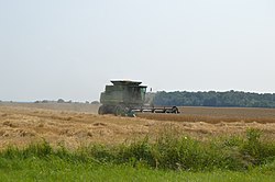


