Pike County, Ohio

Last updated

Pike County
Pike County Courthouse in Waverly.jpg
Pike County Courthouse in Waverly.
Seal of Pike County Ohio.svg
Map of Ohio highlighting Pike County.svg
Location within the U.S. state of Ohio
Ohio in United States.svg
Ohio's location within the U.S.
Coordinates: 39°05′N83°04′W / 39.08°N 83.07°W / 39.08; -83.07
CountryFlag of the United States.svg United States
StateFlag of Ohio.svg  Ohio
FoundedFebruary 1, 1815 [1]
Named for Zebulon Pike
Seat Waverly
Largest cityWaverly
Area
  Total444 sq mi (1,150 km2)
  Land440 sq mi (1,100 km2)
  Water3.7 sq mi (10 km2)  0.8%
Population
 (2020)
  Total27,088 Decrease2.svg
  Density61/sq mi (24/km2)
Time zone UTC−5 (Eastern)
  Summer (DST) UTC−4 (EDT)
Congressional district 2nd

Pike County is a county located in the Appalachian (southern) region of the U.S. state of Ohio. As of the 2020 census, the population was 27,088. [2] Its county seat is Waverly. [3] The county is named for explorer Zebulon Pike. [4]

Contents

History

Pike County was organized on February 1, 1815, from portions of Scioto, Ross, and Adams Counties, and was named in honor of Zebulon Pike, the explorer and soldier who had recently been killed in the War of 1812. Pike County was the site of the Pike County Massacre where eight members of the Rhoden family were shot and killed the evening of April 21–22, 2016. [5]

Geography

According to the U.S. Census Bureau, the county has a total area of 444 square miles (1,150 km2), of which 440 square miles (1,100 km2) is land and 3.7 square miles (9.6 km2) (0.8%) is water. [6]

Adjacent counties

Demographics

Historical population
CensusPop.Note
1820 4,253
1830 6,02441.6%
1840 7,62626.6%
1850 10,95343.6%
1860 13,64324.6%
1870 15,44713.2%
1880 17,92716.1%
1890 17,482−2.5%
1900 18,1723.9%
1910 15,723−13.5%
1920 14,151−10.0%
1930 13,876−1.9%
1940 16,11316.1%
1950 14,607−9.3%
1960 19,38032.7%
1970 19,114−1.4%
1980 22,80219.3%
1990 24,2496.3%
2000 27,69514.2%
2010 28,7093.7%
2020 27,088−5.6%
U.S. Decennial Census [7]
1790-1960 [8] 1900-1990 [9]
1990-2000 [10] 2020 [2]

2000 census

As of the census [11] of 2000, there were 27,695 people, 10,444 households, and 7,665 families living in the county. The population density was 63 people per square mile (24 people/km2). There were 11,602 housing units at an average density of 26 units per square mile (10/km2). The racial makeup of the county was 96.72% White, 0.89% Black or African American, 0.74% Native American, 0.18% Asian, 0.04% Pacific Islander, 0.07% from other races, and 1.36% from two or more races. 0.56% of the population were Hispanic or Latino of any race.

There were 10,444 households, out of which 35.50% had children under the age of 18 living with them, 56.80% were married couples living together, 11.90% had a female householder with no husband present, and 26.60% were non-families. 22.80% of all households were made up of individuals, and 10.40% had someone living alone who was 65 years of age or older. The average household size was 2.61 and the average family size was 3.04.

In the county, the population was spread out, with 27.20% under the age of 18, 8.90% from 18 to 24, 28.90% from 25 to 44, 21.50% from 45 to 64, and 13.60% who were 65 years of age or older. The median age was 35 years. For every 100 females there were 95.40 males. For every 100 females age 18 and over, there were 92.50 males.

The median income for a household in the county was $31,649, and the median income for a family was $35,934. Males had a median income of $32,379 versus $20,761 for females. The per capita income for the county was $16,093. About 15.10% of families and 18.60% of the population were below the poverty line, including 23.20% of those under age 18 and 13.60% of those age 65 or over.

2010 census

As of the 2010 United States Census, there were 28,709 people, 11,012 households, and 7,743 families living in the county. [12] The population density was 65.2 inhabitants per square mile (25.2/km2). There were 12,481 housing units at an average density of 28.3 units per square mile (10.9 units/km2). [13] The racial makeup of the county was 96.6% white, 0.9% black or African American, 0.5% American Indian, 0.2% Asian, 0.2% from other races, and 1.6% from two or more races. Those of Hispanic or Latino origin made up 0.7% of the population. [12] In terms of ancestry, 19.3% were German, 14.8% were Irish, 12.9% were English, and 12.5% were American. [14]

Of the 11,012 households, 34.6% had children under the age of 18 living with them, 51.2% were married couples living together, 13.1% had a female householder with no husband present, 29.7% were non-families, and 25.1% of all households were made up of individuals. The average household size was 2.56 and the average family size was 3.02. The median age was 39.2 years. [12]

The median income for a household in the county was $35,912 and the median income for a family was $43,010. Males had a median income of $40,645 versus $27,422 for females. The per capita income for the county was $17,494. About 18.0% of families and 23.6% of the population were below the poverty line, including 32.7% of those under age 18 and 15.2% of those age 65 or over. [15]

Government

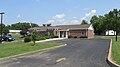
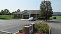
The Garnet A. Wilson Public Library serves area communities from its main branch in Waverly, Ohio and from its branches in Beaver, Piketon, and Western Pike County.

In 2005, the library loaned more than 238,000 items to its 20,000 cardholders. Total holding are over 91,000 volumes with over 210 periodical subscriptions. [16]

Pike County has adopted a county flag with an unusual shape, rounded at the fly end. It bears fourteen stars, representing the county's townships, and various industry symbols within a circular emblem, all upon a green field. [17] The flag is through and through except for the emblem. [18]

Politics

Pike County used to be very strongly Democratic in presidential elections, being the only county in the state to vote for Adlai Stevenson in 1956. However, things have changed recently; Bill Clinton in 1996 was the last Democrat to win the county, though Barack Obama lost here by only one vote in 2012. In 2016, the county took a sharp turn to the right as Republican Donald Trump won over 65% of the vote in the county; he went on to win over 70% four years later.

United States presidential election results for Pike County, Ohio [19]
Year Republican Democratic Third party
No.%No.%No.%
2020 9,15773.70%3,11025.03%1571.26%
2016 7,90266.12%3,53929.61%5104.27%
2012 5,68549.03%5,68449.02%2271.96%
2008 6,16249.27%6,03348.24%3112.49%
2004 6,52051.84%5,98947.62%670.53%
2000 5,33350.50%4,92346.62%3042.88%
1996 3,75934.85%5,54251.38%1,48613.78%
1992 4,09435.93%5,05744.39%2,24219.68%
1988 5,61151.39%5,19147.54%1171.07%
1984 6,31855.90%4,89543.31%890.79%
1980 4,42645.08%4,93850.30%4544.62%
1976 3,72938.95%5,73459.89%1111.16%
1972 5,03757.49%3,53140.30%1932.20%
1968 3,24740.01%3,44542.45%1,42317.54%
1964 2,56732.50%5,33167.50%00.00%
1960 3,68445.92%4,33954.08%00.00%
1956 3,44747.15%3,86352.85%00.00%
1952 2,98243.37%3,89356.63%00.00%
1948 2,63936.85%4,51663.06%60.08%
1944 3,11743.99%3,96856.01%00.00%
1940 3,16538.94%4,96261.06%00.00%
1936 2,95335.82%5,28764.13%40.05%
1932 2,74334.69%5,10764.58%580.73%
1928 3,24654.51%2,70945.49%00.00%
1924 2,56943.87%3,18554.39%1021.74%
1920 3,07552.08%2,79947.41%300.51%
1916 1,61643.06%2,09155.72%461.23%
1912 1,18434.45%1,69149.20%56216.35%
1908 1,79845.54%2,08552.81%651.65%
1904 1,81845.69%2,09052.53%711.78%
1900 2,34253.98%1,96045.17%370.85%
1896 2,22850.64%2,14548.75%270.61%
1892 1,68644.47%1,92650.80%1794.72%
1888 1,76943.90%2,16253.65%992.46%
1884 1,79243.78%2,23854.68%631.54%
1880 1,75644.16%2,19255.13%280.70%
1876 1,46541.14%2,09658.86%00.00%
1872 1,28445.01%1,56854.96%10.04%
1868 1,15540.08%1,72759.92%00.00%
1864 1,04841.24%1,49358.76%00.00%
1860 95838.44%1,39756.06%1375.50%
1856 52325.23%1,17556.68%37518.09%

Communities

Map of Pike County, Ohio with municipal and township labels Map of Pike County Ohio With Municipal and Township Labels.PNG
Map of Pike County, Ohio with municipal and township labels

City

Villages

Townships

Census-designated places

Unincorporated communities

See also

Related Research Articles

<span class="mw-page-title-main">Adams County, Ohio</span> County in Ohio, United States

Adams County is a county in the U.S. state of Ohio. As of the 2020 census, the population was 27,477. Its county seat and largest village is West Union. The county is named after John Adams, the second President of the United States.

<span class="mw-page-title-main">Scioto County, Ohio</span> County in Ohio, United States

Scioto County is a county located along the Ohio River in the south central region of the U.S. state of Ohio. At the 2020 census, the population was 74,008. Its county seat is Portsmouth. The county was founded on March 24, 1804, from Adams County and is named for a Native American word referring to deer or deer-hunting. Scioto County comprises the Portsmouth, OH Micropolitan Statistical Area. It is located at the confluence of the Scioto and Ohio rivers.

<span class="mw-page-title-main">Ross County, Ohio</span> County in Ohio, United States

Ross County is a county in the Appalachian region of the U.S. state of Ohio. As of the 2020 United States Census, the population was 77,093. Its county seat is Chillicothe, the first and third capital of Ohio. Established on August 20, 1798, the county is named for Federalist Senator James Ross of Pennsylvania. Ross County comprises the Chillicothe, OH Micropolitan Statistical Area, which is also included in the Columbus-Marion-Zanesville, OH Combined Statistical Area.

<span class="mw-page-title-main">Lawrence County, Ohio</span> County in Ohio, United States

Lawrence County is the southernmost county located in the U.S. state of Ohio. As of the 2020 census, the population was 58,240. Its county seat is Ironton. The county was created in 1815 and later organized in 1817. It is named for James Lawrence, the naval officer famous for the line "do not give up the ship". Lawrence County is part of the Huntington–Ashland metropolitan area.

<span class="mw-page-title-main">Jackson County, Ohio</span> County in Ohio, United States

Jackson County is a county located in the U.S. state of Ohio. As of the 2020 census, the population was 32,653. Its county seat is Jackson. The county is named for Andrew Jackson, a hero of the War of 1812 who was subsequently elected President of the United States. It is known as "The Little Wales of Ohio." Jackson County comprises the Jackson, OH Micropolitan Statistical Area.

<span class="mw-page-title-main">Highland County, Ohio</span> County in Ohio, United States

Highland County is a county located in the U.S. state of Ohio. As of the 2020 census, the population was 43,317. Its county seat is Hillsboro. The county is named for the topography which is hilly and divides the watersheds of the Little Miami and Scioto Rivers.

<span class="mw-page-title-main">Gallia County, Ohio</span> County in Ohio, United States

Gallia County is a county located in the U.S. state of Ohio. As of the 2020 census, the population was 29,220. Its county seat and largest village is Gallipolis.

<span class="mw-page-title-main">Ostrander, Ohio</span> Village in Ohio, United States

Ostrander is a village in Delaware County, Ohio, United States. The population was 1,094 at the 2020 census.

<span class="mw-page-title-main">Delta, Ohio</span> Village in Ohio, United States

Delta is a village in Fulton County, Ohio, United States. The population was 3,316 at the 2020 census.

<span class="mw-page-title-main">Beaver, Ohio</span> Village in Ohio, United States

Beaver is a village in Pike County, Ohio, United States. The population was 442 at the 2020 census.

<span class="mw-page-title-main">Piketon, Ohio</span> Village in Ohio, United States

Piketon is a village in Pike County in the U.S. state of Ohio, along the Scioto River. The village is best known for the uranium enrichment plant located there, which is one of only three such plants in the United States. The population was 2,111 at the 2020 U.S. census.

<span class="mw-page-title-main">Waverly, Ohio</span> City in Ohio, United States

Waverly is a city in, and the county seat of, Pike County, Ohio, United States, located about 14 miles (23 km) south of Chillicothe. The population was 4,165 at the 2020 census. The town was formed in 1829, as the construction of the Ohio and Erie Canal along the west bank of the Scioto River brought new growth to the area. In 1861, the county seat was moved here from Piketon.

<span class="mw-page-title-main">Bainbridge, Ross County, Ohio</span> Village in Ohio, United States

Bainbridge is a village in Ross County, Ohio, United States, along Paint Creek. The population was 765 at the 2020 census.

<span class="mw-page-title-main">Franklin Furnace, Ohio</span> Census-designated place in Ohio, United States

Franklin Furnace is a census-designated place (CDP) in Scioto County, Ohio, United States, along the Ohio River. The population was 1,525 at the 2020 census.

<span class="mw-page-title-main">Lucasville, Ohio</span> Census-designated place in Ohio, United States

Lucasville is a census-designated place (CDP) in Scioto County, Ohio, United States. The population was 1,655 at the 2020 census. It is part of the Portsmouth micropolitan area.

<span class="mw-page-title-main">Otway, Ohio</span> Village in Ohio, United States

Otway is a village in Scioto County, Ohio, United States. The population was 92 at the 2020 census.

<span class="mw-page-title-main">Rarden, Ohio</span> Village in Ohio, United States

Rarden is a village in Scioto County, Ohio, United States. The population was 146 at the 2020 census.

<span class="mw-page-title-main">South Webster, Ohio</span> Village in Ohio, United States

South Webster is a village in northeast Scioto County, Ohio, United States. It lies along State Route 140. The population was 670 at the 2020 census.

<span class="mw-page-title-main">Wheelersburg, Ohio</span> Census-designated place in Ohio, United States

Wheelersburg is a census-designated place (CDP) in Scioto County, Ohio, United States. It lies along the northern banks of the Ohio River in southern Ohio. Wheelersburg is approximately 7 miles (11 km) east of Portsmouth and 14 miles (23 km) west of Ironton. It is in Porter Township. The population was 6,531 at the 2020 census.

<span class="mw-page-title-main">Tuscarawas, Ohio</span> Village in Ohio, United States

Tuscarawas, originally Trenton, is a village in Tuscarawas County, Ohio, United States. The population was 1,035 at the 2020 census.

References

  1. "Ohio County Profiles: Pike County" (PDF). Ohio Department of Development. Archived from the original (PDF) on June 21, 2007. Retrieved April 28, 2007.
  2. 1 2 2020 census
  3. "Find a County". National Association of Counties. Archived from the original on May 31, 2011. Retrieved June 7, 2011.
  4. "Pike County data". Ohio State University Extension Data Center. Retrieved April 28, 2007.[ dead link ]
  5. "Pike County Massacre".
  6. "2010 Census Gazetteer Files". United States Census Bureau. August 22, 2012. Archived from the original on May 4, 2014. Retrieved February 10, 2015.
  7. "U.S. Decennial Census". United States Census Bureau. Retrieved February 10, 2015.
  8. "Historical Census Browser". University of Virginia Library. Retrieved February 10, 2015.
  9. Forstall, Richard L., ed. (March 27, 1995). "Population of Counties by Decennial Census: 1900 to 1990". United States Census Bureau. Retrieved February 10, 2015.
  10. "Census 2000 PHC-T-4. Ranking Tables for Counties: 1990 and 2000" (PDF). United States Census Bureau. April 2, 2001. Archived (PDF) from the original on March 27, 2010. Retrieved February 10, 2015.
  11. "U.S. Census website". United States Census Bureau . Retrieved January 31, 2008.
  12. 1 2 3 "DP-1 Profile of General Population and Housing Characteristics: 2010 Demographic Profile Data". United States Census Bureau. Archived from the original on February 13, 2020. Retrieved December 27, 2015.
  13. "Population, Housing Units, Area, and Density: 2010 - County". United States Census Bureau. Archived from the original on February 13, 2020. Retrieved December 27, 2015.
  14. "DP02 SELECTED SOCIAL CHARACTERISTICS IN THE UNITED STATES – 2006-2010 American Community Survey 5-Year Estimates". United States Census Bureau. Archived from the original on February 13, 2020. Retrieved December 27, 2015.
  15. "DP03 SELECTED ECONOMIC CHARACTERISTICS – 2006-2010 American Community Survey 5-Year Estimates". United States Census Bureau. Archived from the original on February 13, 2020. Retrieved December 27, 2015.
  16. "2005 Ohio Public Library Statistics:Statistics by County and Town". State Library of Ohio. Archived from the original on September 24, 2006. Retrieved November 10, 2006.
  17. "Pike". County Flags. Columbus, Ohio: Ohio Statehouse Museum. Archived from the original on July 20, 2019. Retrieved July 20, 2019.
  18. Stanley, Stephanie (November 9, 2015). "PCPADV hosts discussion about teen dating violence". The Pike County News Watchman . Waverly, Ohio. Retrieved July 20, 2019.
  19. Leip, David. "Dave Leip's Atlas of U.S. Presidential Elections". uselectionatlas.org. Retrieved May 3, 2018.
  20. "TOWNSHIP WEBSITES | Ohio Township Association". www.ohiotownships.org. Archived from the original on July 15, 2016. Retrieved January 11, 2022.

39°05′N83°04′W / 39.08°N 83.07°W / 39.08; -83.07