Holocene glacial retreat

Last updated

The Holocene glacial retreat is a geographical phenomenon that involved the global retreat of glaciers (deglaciation) that previously had advanced during the Last Glacial Maximum. Ice sheet retreat initiated ca. 19,000 years ago and accelerated after ca. 15,000 years ago. The Holocene, starting with abrupt warming 11,700 years ago, resulted in rapid melting of the remaining ice sheets of North America and Europe.

Contents

Geographical alterations

Antarctica

Fragments of Larsen B ice shelf lingered until 2005. Fragments of Larsen B Ice Shelf Lingered Until 2005.gif
Fragments of Larsen B ice shelf lingered until 2005.

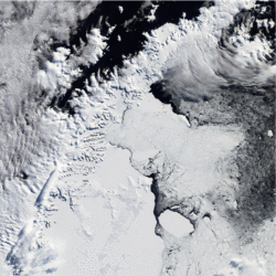
Radiocarbon dating has been used to date the start of glacial retreat on Alexander Island 18,000 years ago. [1] The outermost locations like Marguerite Bay were fully deglaciated 12,000 years ago and the further inland locations continued deglaciating for an additional 3,000 years. [1] The Larsen ice shelf was formed in the early Holocene at the latest estimation of 10,700 years ago. [2] Certain segments of the ice shelf have collapsed as recently as 1995 for Larsen A and a large segment of Larsen B collapsed in 2002. [2]

Europe

The many valleys of the Cairngorms, a mountainous region in the Eastern Scottish Highlands are littered with deposits from this period.

In northwestern Iceland, the Icelandic ice sheet began its non-uniform retreat about 15,000 years ago. [3] Surface exposure dating using the isotope 36Cl was the primary means of dating boulders and terminal moraines in the Drangajökull area in Iceland. [3] Ages of erratic boulders found near the Leirufjörður valley and moraine range from 7-12 thousand years old. [3] The average age for the groupings of boulders in the Leirufjörður area is 9.3 thousand years ago. [3] Directly south of Leirufjörður in the Kaldalon Valley, the average age of the boulders is 15,000. [3] The two different average ages are a result of different rates of glacial activity in Iceland. [3]

Modern glacial activity. Antarctica is not pictured. Glacier Mass Balance Map.png
Modern glacial activity. Antarctica is not pictured.

Another area that has experienced deglaciation during the Holocene is Spitsbergen island within the Svalbard archipelago in Norway. [4] For the last 12,000 years exposed rockwalls have been eroding due to a mixture of biogenic flaking, frost shattering, and stress relaxation that results when glaciers retreat. [4] One way the rate of rockwall retreat is measured is by examining the diameters of local lichen to establish an age of growth. [4]

North America

The retreat of the Laurentide Ice Sheet in Canada led to the formation of moraines and up to 26 proglacial lakes scattered throughout central Canada. The deglaciation occurred from the last glacial maximum (21,000 years ago) to 7000 years ago. Some of the lakes in the southern Ungava Bay area were fully deglaciated c. 6,000 years ago. [5] Meltwater from the glacial prehistoric Lake Agassiz contributed to the neoglaciation during the Holocene, which resulted in an uptick of glacial activity at least as far away as Iceland. [3]

The Nuup Kangerlua and Sermilik regions, in southwestern and southeastern Greenland respectively, are two localities that experienced deglaciation after the Holocene warming period started. [6] Warming atmospheric temperatures as well as warming waters in the Labrador Sea accelerated the speed of deglaciation which started on the coasts of Greenland before heading inland. [6] Moraines located in the interior of the Nuup Kangerlua area have been dated 8.1 to 8.3 thousand years ago; they mark a local cooling that caused glaciers to re-advance and leave them behind. [6]

The modern Ohio River was formed when the river was temporarily dammed just southwest of Louisville, Kentucky, creating a large lake until the dam burst. The Ohio River largely supplanted the former Teays River drainage system, which was disrupted by the glaciers.

Ancient Lake Chicago, on the southern margin of the Wisconsin Glacier, found successive lower outlets as the glacier retreated until the Saint Lawrence River route was uncovered. Corresponding to each level, remnant lake shore features may be found in many areas. One prehistoric shoreline is delineated by Bluff Avenue, a north-south street on the La Grange, Illinois east side.

Changes in sea level during the Holocene. Holocene Sea Level.png
Changes in sea level during the Holocene.

Current river delta positioning and sediment composition in northern Michigan were created by a glacial lake. The lake resulted from retreating glaciers. [7]

South America

The Northern Patagonian Icefield is one location that experienced a glacial activity surge during the neoglaciation period. Terminal moraines formed 5.7 thousand years ago in the San Rafael Glacier, and around 4.96 thousand years ago, they formed in the nearby Colonia Glacier. [8] In the Southern Patagonian Icefield located in Argentina and Chile, some glaciers have actually been advancing to their peak extents as recently as the 19th century as evidenced by moraines. [9] Another remnant of glacial activity in the southern Patagonian icefield is the creation of meltwater channels within the El Canal spillway found near the Lago del Toro in Chile. The different layers of stratification have been used to date different occurrences of glacial lakes in the region. [10]

New Zealand

Within the last 30 years, while most locations have experienced continued glacial retreat, glaciers in the Southern Alps of New Zealand have advanced. Glaciers located near coasts, such as in New Zealand, are particularly responsive to climate change and serve as an indicator of local climate change. The anticipated warming waters near New Zealand in the Tasman Sea will lead to a reduction in glacial mass balance. [11]

Eight records of local temperature variability on multi-centennial scales throughout the course of the Holocene, and an average of these (thick dark line). Holocene Temperature Variations.png
Eight records of local temperature variability on multi-centennial scales throughout the course of the Holocene, and an average of these (thick dark line).

See also

Related Research Articles

<span class="mw-page-title-main">Holocene</span> Current geological epoch, covering the last 11,700 years

The Holocene is the current geological epoch, beginning approximately 11,700 years ago. It follows the Last Glacial Period, which concluded with the Holocene glacial retreat. The Holocene and the preceding Pleistocene together form the Quaternary period. The Holocene is an interglacial period within the ongoing glacial cycles of the Quaternary, and is equivalent to Marine Isotope Stage 1.

<span class="mw-page-title-main">Younger Dryas</span> Time period c. 12,900–11,700 years ago with Northern Hemisphere glacial cooling and SH warming

The Younger Dryas (YD) was a period in Earth's geologic history that occurred circa 12,900 to 11,700 years Before Present (BP). It is primarily known for the sudden or "abrupt" cooling in the Northern Hemisphere, when the North Atlantic Ocean cooled and annual air temperatures decreased by ~3 °C (5.4 °F) over North America, 2–6 °C (3.6–10.8 °F) in Europe and up to 10 °C (18 °F) in Greenland, in a few decades. Cooling in Greenland was particularly rapid, taking place over just 3 years or less. At the same time, the Southern Hemisphere experienced warming. This period ended as rapidly as it began, with dramatic warming over ~50 years, which transitioned the Earth from the glacial Pleistocene epoch into the current Holocene.

<span class="mw-page-title-main">Last Glacial Period</span> Period of major glaciations of the Northern Hemisphere (115,000–12,000 years ago)

The Last Glacial Period (LGP), also known as the Last glacial cycle, occurred from the end of the Last Interglacial to the beginning of the Holocene, c. 115,000 – c. 11,700 years ago, and thus corresponds to most of the timespan of the Late Pleistocene.

<span class="mw-page-title-main">Last Glacial Maximum</span> Circa 24,000–16,000 BCE; most recent era when ice sheets were at their greatest extent

The Last Glacial Maximum (LGM), also referred to as the Last Glacial Coldest Period, was the most recent time during the Last Glacial Period where ice sheets were at their greatest extent 26,000 and 20,000 years ago. Ice sheets covered much of Northern North America, Northern Europe, and Asia and profoundly affected Earth's climate by causing a major expansion of deserts, along with a large drop in sea levels.

<span class="mw-page-title-main">Laurentide ice sheet</span> Continental glacier in North America during the last ice age

The Laurentide ice sheet was a massive sheet of ice that covered millions of square miles, including most of Canada and a large portion of the Northern United States, multiple times during the Quaternary glacial epochs, from 2.58 million years ago to the present.

<span class="mw-page-title-main">Northern Patagonian Ice Field</span> A series of interconnected glaciers in Chile

The Northern Patagonian Ice Field, located in southern Chile, is the smaller of two remnant parts in which the Patagonian Ice Sheet in the Andes Mountains of southern South America can be divided. It is completely contained within the boundaries of Laguna San Rafael National Park.

<span class="mw-page-title-main">Oldest Dryas</span> Abrupt climatic cooling event during the last glacial retreat

The Oldest Dryas is a biostratigraphic subdivision layer corresponding to a relatively abrupt climatic cooling event, or stadial, which occurred during the last glacial retreat. The time period to which the layer corresponds is poorly defined and varies between regions, but it is generally dated as starting at 18.5–17 thousand years (ka) before present (BP) and ending 15–14 ka BP. As with the Younger and Older Dryas events, the stratigraphic layer is marked by abundance of the pollen and other remains of Dryas octopetala, an indicator species that colonizes arctic-alpine regions. The termination of the Oldest Dryas is marked by an abrupt oxygen isotope excursion, which has been observed at many sites in the Alps that correspond to this interval of time.

<span class="mw-page-title-main">Quaternary glaciation</span> Series of alternating glacial and interglacial periods

The Quaternary glaciation, also known as the Pleistocene glaciation, is an alternating series of glacial and interglacial periods during the Quaternary period that began 2.58 Ma and is ongoing. Although geologists describe this entire period up to the present as an "ice age", in popular culture this term usually refers to the most recent glacial period, or to the Pleistocene epoch in general. Since Earth still has polar ice sheets, geologists consider the Quaternary glaciation to be ongoing, though currently in an interglacial period.

<span class="mw-page-title-main">Puyehue Lake</span> Lake in Chile

Puyehue Lake, is an Andean piedmont lake on the border of Los Lagos Region with Los Ríos Region of Chile.

<span class="mw-page-title-main">Bølling–Allerød Interstadial</span> Interglacial period about 14,000 years ago

The Bølling–Allerød Interstadial, also called the Late Glacial Interstadial (LGI), was an interstadial period which occurred from 14,690 to c. 12,890 years Before Present, during the final stages of the Last Glacial Period. It was defined by abrupt warming in the Northern Hemisphere, and a corresponding cooling in the Southern Hemisphere, as well as a period of major ice sheet collapse and corresponding sea level rise known as Meltwater pulse 1A. This period was named after two sites in Denmark where paleoclimate evidence for it was first found, in the form of vegetation fossils that could have only survived during a comparatively warm period in Northern Europe. It is also referred to as Interstadial 1 or Dansgaard–Oeschger event 1.

<span class="mw-page-title-main">Neoglaciation</span>

The neoglaciation describes the documented cooling trend in the Earth's climate during the Holocene, following the retreat of the Wisconsin glaciation, the most recent glacial period. Neoglaciation has followed the hypsithermal or Holocene Climatic Optimum, the warmest point in the Earth's climate during the current interglacial stage, excluding the global warming-induced temperature increase starting in the 20th century. The neoglaciation has no well-marked universal beginning: local conditions and ecological inertia affected the onset of detectably cooler conditions.

<span class="mw-page-title-main">Antarctic Cold Reversal</span> Episode in Earth climate history

The Antarctic Cold Reversal (ACR) was a climatic event of intense atmospheric and oceanic cooling across the southern hemisphere (>40°S) between 14,700 and 13,000 years before present (BP) that interrupted the most recent deglacial climate warming. This cooling event was initially well noted in Antarctic ice core records. Soon after, evidence from sediment cores and glacial advances from land masses and Oceanic sectors south of 40°S expanded the region of this climate cooling event. The ACR illustrates the complexity of the climate changes at the transition from the Pleistocene to the Holocene Epochs.

Lake Bassano was a proglacial lake that formed in the Late Pleistocene during the deglaciation of south-central Alberta by the impoundment of a re-established drainage system and addition of glacial meltwater. It is associated with the development of through-flowing drainage within the Red Deer River basin in particular, and the South Saskatchewan drainage network in general. Approximately 7,500 square kilometres (2,900 sq mi) of the Bassano basin is covered with lacustrine sediments. These sediments are bordered by the topographically higher Buffalo Lake Moraine to the west, the Suffield Moraine to the east and the Lethbridge Moraine to the south.

<span class="mw-page-title-main">Reclus (volcano)</span> Volcano located in the Patagonia Ice Field, Chile

Reclus, also written as Reclús, is a cinder cone and stratovolcano located in the Southern Patagonian Ice Field, Chile. Part of the Austral Volcanic Zone of the Andes, its summit rises 1,000 metres (3,300 ft) above sea level and is capped by a crater about 1 kilometre (0.62 mi) wide. Close to the volcano lies the Amalia Glacier, which is actively eroding Reclus.

<span class="mw-page-title-main">Weichselian glaciation</span> Last glacial period and its associated glaciation in northern parts of Europe

The Weichselian glaciation is the regional name for the Last Glacial Period in the northern parts of Europe. In the Alpine region it corresponds to the Würm glaciation. It was characterized by a large ice sheet that spread out from the Scandinavian Mountains and extended as far as the east coast of Schleswig-Holstein, northern Poland and Northwest Russia. This glaciation is also known as the Weichselian ice age, Vistulian glaciation, Weichsel or, less commonly, the Weichsel glaciation, Weichselian cold period (Weichsel-Kaltzeit), Weichselian glacial (Weichsel-Glazial), Weichselian Stage or, rarely, the Weichselian complex (Weichsel-Komplex).

Deglaciation is the transition from full glacial conditions during ice ages, to warm interglacials, characterized by global warming and sea level rise due to change in continental ice volume. Thus, it refers to the retreat of a glacier, an ice sheet or frozen surface layer, and the resulting exposure of the Earth's surface. The decline of the cryosphere due to ablation can occur on any scale from global to localized to a particular glacier. After the Last Glacial Maximum, the last deglaciation begun, which lasted until the early Holocene. Around much of Earth, deglaciation during the last 100 years has been accelerating as a result of climate change, partly brought on by anthropogenic changes to greenhouse gases.

<span class="mw-page-title-main">Bjørn G. Andersen</span>

Bjørn Grothaug Andersen was a Norwegian professor of Quaternary geology and glaciology who made foundational contributions to glacial geology and the understanding of climate change.

<span class="mw-page-title-main">Llanquihue glaciation</span> Last glacial period in southern Chile

The last glacial period and its associated glaciation is known in southern Chile as the Llanquihue glaciation. Its type area lies west of Llanquihue Lake where various drifts or end moraine systems belonging to the last glacial period have been identified. The glaciation is the last episode of existence of the Patagonian Ice Sheet. Around Nahuel Huapi Lake the equivalent glaciation is known as the Nahuel Huapi Drift.

<span class="mw-page-title-main">Early Holocene sea level rise</span> Sea level rise between 12,000 and 7,000 years ago

The early Holocene sea level rise (EHSLR) was a significant jump in sea level by about 60 m (197 ft) during the early Holocene, between about 12,000 and 7,000 years ago, spanning the Eurasian Mesolithic. The rapid rise in sea level and associated climate change, notably the 8.2 ka cooling event , and the loss of coastal land favoured by early farmers, may have contributed to the spread of the Neolithic Revolution to Europe in its Neolithic period.

<span class="mw-page-title-main">Quelccaya Ice Cap</span> Glacier in Peru

The Quelccaya Ice Cap is the second largest glaciated area in the tropics, after Coropuna. Located in the Cordillera Oriental section of the Andes mountains in Peru, the cap covers an area of 42.8 square kilometres (16.5 sq mi) with ice up to 200 metres (660 ft) thick. It is surrounded by tall ice cliffs and a number of outlet glaciers, the largest of which is known as Qori Kalis Glacier; lakes, moraines, peat bogs and wetlands are also present. There is a rich flora and fauna, including birds that nest on the ice cap. Quelccaya is an important source of water, eventually melting and flowing into the Inambari and Vilcanota Rivers.

References

  1. 1 2 Roberts, S. J.; Hodgson, D. A.; Bentley, M. J.; Sanderson, D. C. W.; Milne, G.; Smith, J. A.; Verleyen, E.; Balbo, A. (2009-11-01). "Holocene relative sea-level change and deglaciation on Alexander Island, Antarctic Peninsula, from elevated lake deltas". Geomorphology. 112 (1–2): 122–134. Bibcode:2009Geomo.112..122R. doi:10.1016/j.geomorph.2009.05.011.
  2. 1 2 Curry, Philip; Pudsey, Carol J. (2007). "New Quaternary sedimentary records from near the Larsen C and former Larsen B ice shelves; evidence for Holocene stability". Antarctic Science. 19 (3): 355–364. Bibcode:2007AntSc..19..355C. doi: 10.1017/S0954102007000442 . ISSN   1365-2079. S2CID   129610602.
  3. 1 2 3 4 5 6 7 Brynjólfsson, Skafti; Schomacker, Anders; Ingólfsson, Ólafur; Keiding, Jakob K. (2015-10-15). "Cosmogenic 36Cl exposure ages reveal a 9.3 ka BP glacier advance and the Late Weichselian-Early Holocene glacial history of the Drangajökull region, northwest Iceland". Quaternary Science Reviews. 126: 140–157. Bibcode:2015QSRv..126..140B. doi:10.1016/j.quascirev.2015.09.001.
  4. 1 2 3 André, Marie-Françoise (1997-05-01). "Holocene Rockwall Retreat in Svalbard: A Triple-Rate Evolution". Earth Surface Processes and Landforms . 22 (5): 423–440. Bibcode:1997ESPL...22..423A. doi:10.1002/(SICI)1096-9837(199705)22:5<423::AID-ESP706>3.3.CO;2-Y. ISSN   1096-9837.
  5. Jansson, Krister N (2003-05-01). "Early Holocene glacial lakes and ice marginal retreat pattern in Labrador/Ungava, Canada". Palaeogeography, Palaeoclimatology, Palaeoecology. 193 (3): 473–501. Bibcode:2003PPP...193..473J. doi:10.1016/s0031-0182(03)00262-1.
  6. 1 2 3 Larsen, Nicolaj K.; Funder, Svend; Kjær, Kurt H.; Kjeldsen, Kristian K.; Knudsen, Mads F.; Linge, Henriette (2014-05-15). "Rapid early Holocene ice retreat in West Greenland". Quaternary Science Reviews. APEX II: Arctic Palaeoclimate and its Extremes. 92: 310–323. doi:10.1016/j.quascirev.2013.05.027.
  7. Schaetzl, Randall J.; Lepper, Kenneth; Thomas, Sarah E.; Grove, Leslie; Treiber, Emma; Farmer, Alison; Fillmore, Austin; Lee, Jordan; Dickerson, Bethany (2017-03-01). "Kame deltas provide evidence for a new glacial lake and suggest early glacial retreat from central Lower Michigan, USA". Geomorphology. 280: 167–178. Bibcode:2017Geomo.280..167S. doi:10.1016/j.geomorph.2016.11.013.
  8. Nimick, David A.; McGrath, Daniel; Mahan, Shannon A.; Friesen, Beverly A.; Leidich, Jonathan (2016-08-01). "Latest Pleistocene and Holocene glacial events in the Colonia valley, Northern Patagonia Icefield, southern Chile". Journal of Quaternary Science. 31 (6): 551–564. Bibcode:2016JQS....31..551N. doi:10.1002/jqs.2847. ISSN   1099-1417. S2CID   132303469.
  9. Strelin, Jorge A.; Kaplan, Michael R.; Vandergoes, Marcus J.; Denton, George H.; Schaefer, Joerg M. (2014-10-01). "Holocene glacier history of the Lago Argentino basin, Southern Patagonian Icefield". Quaternary Science Reviews. 101: 124–145. Bibcode:2014QSRv..101..124S. doi:10.1016/j.quascirev.2014.06.026.
  10. García, Juan-Luis; Strelin, Jorge A.; Vega, Rodrigo M.; Hall, Brenda L.; Stern, Charles R. (2015-05-13). "Deglacial ice-marginal glaciolacustrine environments and structural moraine building in Torres del Paine, Chilean southern Patagonia". Andean Geology. 42 (2): 190–212. doi: 10.5027/andgeov42n2-a03 . ISSN   0718-7106.
  11. Mackintosh, Andrew N.; Anderson, Brian M.; Lorrey, Andrew M.; Renwick, James A.; Frei, Prisco; Dean, Sam M. (2017-02-14). "Regional cooling caused recent New Zealand glacier advances in a period of global warming". Nature Communications. 8: ncomms14202. Bibcode:2017NatCo...814202M. doi:10.1038/ncomms14202. PMC   5316876 . PMID   28195582.