Fridtjof Wedel-Jarlsberg Nansen was a Norwegian polymath and Nobel Peace Prize laureate. He gained prominence at various points in his life as an explorer, scientist, diplomat, humanitarian and co-founded the Fatherland League.

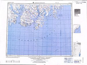
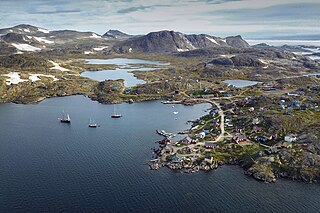
Tasiilaq, formerly Ammassalik or Angmagssalik and King Oscar Haven, is a town on Ammassalik Island in southeastern Greenland, within the municipality of Sermersooq. With 1,985 inhabitants as of 2020, it is the most populous community on the eastern coast, and the seventh-largest town in Greenland. The Sermilik Station, dedicated to the research of the nearby Mittivakkat Glacier, is located near the town.
Kulusuk, formerly Kap Dan, is a settlement in the Sermersooq municipality in southeastern Greenland, located on an island of the same name. The settlement population of 241 includes many Danes choosing to live there due to the airport. In the Kalaallisut language, the name of the village means "Chest of a Black Guillemot".
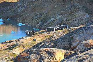
Sermilik Station is a glaciology research station on Ammassalik Island, dedicated to the research of the nearby Mittivakkat Glacier. It is run jointly by the Department of Geography and Spatial Planning at the University of Graz and the Department of Geography at the University of Copenhagen.
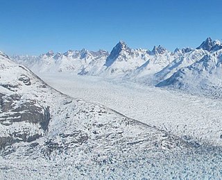
Helheim Glacier is a glacier in the Sermersooq municipality, Eastern Greenland.

Ammassalik Fjord is a 41 km (25.5 mi) long fjord in the Sermersooq municipality in southeastern Greenland.

Ammassalik Island is an island in the Sermersooq municipality in southeastern Greenland, with an area of 772 km2 (298.1 sq mi).
J.P. Koch Fjord is a fjord in Peary Land, northern Greenland. To the west, the fjord opens into the Lincoln Sea of the Arctic Ocean.
Kitak is an island in the Sermersooq municipality in southeastern Greenland.

Kangerlussuaq Fjord is a fjord in eastern Greenland. It is part of the Sermersooq municipality.

Midgard Glacier is a glacier in the Sermersooq municipality, Eastern Greenland.

Southern Sermilik is a fjord in southwestern Greenland. Administratively it is part of the Kujalleq municipality.

Umivik Bay, also known as Umiivik and Umerik, is a bay in King Frederick VI Coast, southeastern Greenland. It is part of the Sermersooq municipality.
Lindenow Fjord or Kangerlussuatsiaq, is a fjord in the King Frederick VI Coast, Kujalleq municipality, southern Greenland.

King Frederick VI Coast is a major geographic division of Greenland. It comprises the coastal area of Southeastern Greenland in Sermersooq and Kujalleq municipalities fronting the Irminger Sea of the North Atlantic Ocean. It is bordered by King Christian IX Land on the north and the Greenland Ice Sheet to the west.
Ikersuaq, old spelling Ikerssuak, is a fjord in southwestern Greenland. Administratively it is part of the Kujalleq municipality.
Griffenfeld Island, Griffenfeldt Island, or Umanaq, after the name of the highest peak. is an uninhabited island in the Sermersooq municipality in southern Greenland.

Johan Petersen Fjord, also known as Petersen Bay, is a fjord in King Christian IX Land, Eastern Greenland. The fjord is named after Danish Arctic explorer Johan Petersen (1813–1880).

Fenris Glacier is a glacier in the Sermersooq municipality, Eastern Greenland.