Tasiilaq, formerly Ammassalik and Angmagssalik, is a town on Ammassalik Island in southeastern Greenland, within the municipality of Sermersooq. With 1,985 inhabitants as of 2020, it is the most populous community on the eastern coast, and the seventh-largest town in Greenland. The Sermilik Station, dedicated to the research of the nearby Mittivakkat Glacier, is located near the town.

The Napasorsuaq is a 1,590m–high mountain in southern Greenland, in the Kujalleq municipality.

Mont Forel is a mountain in King Christian IX Land, Sermersooq Municipality, Greenland. It is part of the Schweizerland range, also known as 'Schweizerland Alps'.

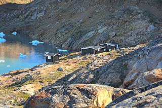
Sermilik Station is a glaciology research station on Ammassalik Island, dedicated to the research of the nearby Mittivakkat Glacier. It is run jointly by the Department of Geography and Spatial Planning at the University of Graz and the Department of Geography at the University of Copenhagen.

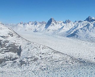
Helheim Glacier is a glacier in the Sermersooq municipality, Eastern Greenland.

Ammassalik Island is an island in the Sermersooq municipality in southeastern Greenland, with an area of 772 km2 (298.1 sq mi).

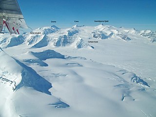
The Watkins Range is Greenland's highest mountain range. It is located in King Christian IX Land, Sermersooq municipality.
Tasermiut Fjord is a 70-kilometre-long fjord in southwestern Greenland. Administratively it is part of the Kujalleq municipality. Nanortalik Island is located near the mouth of the fjord.

King Christian IX Land is a coastal area of Southeastern Greenland in Sermersooq Municipality fronting the Denmark Strait and extending through the Arctic Circle from 65°N to 70°N.

Kangerlussuaq Fjord is a fjord in eastern Greenland. It is part of the Sermersooq municipality.

Midgard Glacier is a glacier in the Sermersooq municipality, Eastern Greenland.

Sermilik is a fjord in eastern Greenland. It is part of the Sermersooq municipality.

Southern Sermilik is a fjord in southwestern Greenland. Administratively it is part of the Kujalleq municipality.
Ikersuaq, old spelling Ikerssuak, is a fjord in southwestern Greenland. Administratively it is part of the Kujalleq municipality.

Mount Paatusoq, also known as 'Mount Patuersoq', is the highest mountain in the Kujalleq municipality, SE Greenland.

Schweizerland, also known as Schweizerland Alps, is a mountain range in King Christian IX Land, eastern Greenland. Administratively this range is part of the Sermersooq Municipality. Its highest point is one of the highest peaks in Greenland.

Johan Petersen Fjord, also known as Petersen Bay, is a fjord in King Christian IX Land, Eastern Greenland. The fjord is named after Danish Arctic explorer Johan Petersen (1813–1880).


