Huber Ridge, Ohio

Last updated
Huber Ridge, Ohio
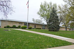
Huber Ridge Elementary School.jpg
Huber Ridge Elementary School
OHMap-doton-Huber Ridge.png
Location of Huber Ridge, Ohio
Coordinates: 40°05′28″N82°55′02″W / 40.09111°N 82.91722°W / 40.09111; -82.91722
Country United States
State Ohio
County Franklin
Township Blendon
Area
[1]
  Total1.06 sq mi (2.74 km2)
  Land1.05 sq mi (2.71 km2)
  Water0.01 sq mi (0.03 km2)
Elevation
[2]
833 ft (254 m)
Population
 (2020)
  Total4,940
  Density4,718.24/sq mi (1,821.72/km2)
Time zone UTC-5 (Eastern (EST))
  Summer (DST) UTC-4 (EDT)
FIPS code 39-36624 [3]
GNIS feature ID2393059 [2]

Huber Ridge is a census-designated place (CDP) in Blendon Township, Franklin County, Ohio, United States. The population was 4,940 at the 2020 census.

Contents

Geography

Houses on Panama Drive Panama Drive, Huber Ridge.jpg
Houses on Panama Drive

Huber Ridge is located in northeastern Franklin County. Interstate 270, the beltway around Columbus, forms the northern and eastern edges of the CDP. The southern border is Ohio State Route 161 (E. Dublin Granville Road), and the southwest edge follows Alum Creek, a tributary of the Scioto River. The western edge of Huber Ridge is west of Ohio State Route 3 (Westerville Road).

The city of Columbus borders Huber Ridge to the west and south, and the city of Westerville is to the north, across I-270.

According to the United States Census Bureau, the Huber Ridge CDP has a total area of 1.0 square mile (2.7 km2), of which 0.01 square miles (0.03 km2), or 0.96%, is water. [4]

Demographics

Historical population
CensusPop.Note
2020 4,940
U.S. Decennial Census [5]

As of the census [3] of 2000, there were 4,883 people, 1,737 households, and 1,344 families residing in the CDP. The population density was 4,492.5 inhabitants per square mile (1,734.6/km2). There were 1,788 housing units at an average density of 1,645.0 per square mile (635.1/km2). The racial makeup of the CDP was 91.13% White, 5.47% Black or African American, 0.20% Native American, 0.98% Asian, 0.45% from other races, and 1.76% from two or more races. Hispanic or Latino of any race were 1.25% of the population.

There were 1,737 households, out of which 43.1% had children under the age of 18 living with them, 60.4% were married couples living together, 13.1% had a female householder with no husband present, and 22.6% were non-families. 17.0% of all households were made up of individuals, and 4.5% had someone living alone who was 65 years of age or older. The average household size was 2.81 and the average family size was 3.17.

In the CDP the population was spread out, with 30.9% under the age of 18, 7.5% from 18 to 24, 34.2% from 25 to 44, 19.9% from 45 to 64, and 7.5% who were 65 years of age or older. The median age was 32 years. For every 100 females there were 90.7 males. For every 100 females age 18 and over, there were 90.3 males.

The median income for a household in the CDP was $51,289, and the median income for a family was $55,855. Males had a median income of $37,386 versus $27,733 for females. The per capita income for the CDP was $19,842. About 2.2% of families and 3.8% of the population were below the poverty line, including 6.2% of those under age 18 and none of those age 65 or over.

Related Research Articles

<span class="mw-page-title-main">Vernon Valley, New Jersey</span> Populated place in Sussex County, New Jersey, US

Vernon Valley is an unincorporated community and census-designated place (CDP) located in Vernon Township, in Sussex County, in the U.S. state of New Jersey. As of the 2010 United States Census, the CDP's population was 1,626.

<span class="mw-page-title-main">Beckett Ridge, Ohio</span> Census-designated place in Ohio, United States

Beckett Ridge is a census-designated place (CDP) in West Chester Township, Butler County, Ohio, United States. The population was 9,192 at the 2020 census.

<span class="mw-page-title-main">Olde West Chester, Ohio</span> Census-designated place in Ohio, United States

Olde West Chester is a census-designated place (CDP) in West Chester Township, Butler County, Ohio, United States. The population was 201 at the 2020 census.

<span class="mw-page-title-main">Ross, Ohio</span> Census-designated place in Ohio, United States

Ross is a census-designated place (CDP) in Ross Township, Butler County, Ohio, United States. The population was 3,478 at the 2020 census. Ross sits along U.S. Route 27 between Cincinnati, Ohio and Oxford, Ohio. Ross is part of the Cincinnati metropolitan area.
<span class="mw-page-title-main">Green Meadows, Ohio</span> Census-designated place in Ohio, United States

Green Meadows is a census-designated place (CDP) in Mad River Township, Clark County, Ohio, United States, on the west side of Enon. The population was 2,373 at the 2020 census. It is part of the Springfield, Ohio Metropolitan Statistical Area.

<span class="mw-page-title-main">Holiday Valley, Ohio</span> Census-designated place in Ohio, United States

Holiday Valley is a census-designated place (CDP) in Mad River Township, Clark County, Ohio, United States. The population was 1,480 at the 2020 census. It is part of the Springfield, Ohio Metropolitan Statistical Area. Holiday Valley became a CDP in the 1990 United States Census.

<span class="mw-page-title-main">Northridge, Clark County, Ohio</span> Census-designated place in Ohio, United States

Northridge is a census-designated place (CDP) in Clark County, Ohio, United States. The population was 7,518 at the 2020 census. It is part of the Springfield, Ohio Metropolitan Statistical Area.
<span class="mw-page-title-main">Park Layne, Ohio</span> Census-designated place in Ohio, United States

Park Layne is a census-designated place (CDP) in Bethel Township, Clark County, Ohio, United States. The population of the CDP was 4,248 at the 2020 census. It is part of the Springfield, Ohio Metropolitan Statistical Area. Park Layne became a CDP in the 1980 United States Census.

Blacklick Estates is a census-designated place (CDP) in Franklin County, Ohio, United States: partly in Madison Township and partly in Truro Township. As of the 2020 census the population was 8,990.

<span class="mw-page-title-main">Northgate, Ohio</span> Census-designated place in Ohio, United States

Northgate is a census-designated place (CDP) in Colerain Township, Hamilton County, Ohio, United States. The population was 7,277 at the 2020 census.
<span class="mw-page-title-main">Granville South, Ohio</span> Census-designated place in Ohio, United States

Granville South is a census-designated place (CDP) in Licking County, Ohio, United States. The population was 1,420 at the 2020 census.

<span class="mw-page-title-main">Harbor Hills, Ohio</span> Census-designated place in Ohio, United States

Harbor Hills is a census-designated place (CDP) in southern Licking County, Ohio, United States. The population was 1,565 at the 2020 census.

<span class="mw-page-title-main">Maple Ridge, Ohio</span> Census-designated place in Ohio, United States

Maple Ridge is a census-designated place in southwestern Mahoning County, Ohio, United States, located between Alliance and Sebring. The population was 667 at the 2020 census. It is part of the Youngstown–Warren metropolitan area.

<span class="mw-page-title-main">Hunter, Ohio</span> CDP in Ohio, United States

Hunter is a census-designated place (CDP) in Franklin Township, Warren County, Ohio, United States. The population was 3,363 at the 2020 census.

<span class="mw-page-title-main">Sandy Ridge, Pennsylvania</span> Census-designated place in Pennsylvania, United States

Sandy Ridge is an unincorporated community and census-designated place (CDP) in Centre County, Pennsylvania, United States. It is part of the State College, Pennsylvania Metropolitan Statistical Area. The population was 407 at the 2010 census.

<span class="mw-page-title-main">Eureka Mill, South Carolina</span> Census-designated place in South Carolina, United States

Eureka Mill is a census-designated place (CDP) in Chester County, South Carolina, United States. The population was 1,476 at the 2010 census, down from 1,737 at the 2000 census.

<span class="mw-page-title-main">Loveland Park, Ohio</span> Census-designated place in Ohio, United States

Loveland Park is a census-designated place (CDP) located in Symmes Township, Hamilton County and Deerfield Township, Warren County, in the southwestern part of the U.S. state of Ohio. The CDP is named after the city of Loveland. The population was 1,737 at the 2020 census.

<span class="mw-page-title-main">Mineral Ridge, Ohio</span> Census-designated place in Ohio, United States

Mineral Ridge is an unincorporated community and census-designated place in southern Trumbull and northern Mahoning counties in the U.S. state of Ohio. The population was 3,951 at the 2020 census. It is a suburb of the Youngstown–Warren metropolitan area. Mineral Ridge was named for valuable coal deposits near the original town site.

<span class="mw-page-title-main">Kittery (CDP), Maine</span> Census-designated place in Maine, United States

Kittery is a census-designated place (CDP) consisting of the main village in the town of Kittery in York County, Maine, United States. The village is also known as Kittery Foreside. The population of the CDP was 4,562 at the 2010 census. It is part of the Portland–South Portland–Biddeford, Maine Metropolitan Statistical Area.
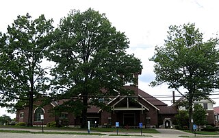
<span class="mw-page-title-main">Dry Ridge, Ohio</span> Census-designated place in Ohio, United States

Dry Ridge is a census-designated place (CDP) in Colerain Township, Hamilton County, Ohio, United States. The population was 2,698 at the 2020 census.
References

  1. "ArcGIS REST Services Directory". United States Census Bureau. Retrieved September 20, 2022.
  2. 1 2 U.S. Geological Survey Geographic Names Information System: Huber Ridge, Ohio
  3. 1 2 "U.S. Census website". United States Census Bureau . Retrieved 2008-01-31.
  4. "Geographic Identifiers: 2010 Census Summary File 1 (G001), Huber Ridge CDP, Ohio". American FactFinder. U.S. Census Bureau. Archived from the original on February 13, 2020. Retrieved July 5, 2016.
  5. "Census of Population and Housing". Census.gov. Retrieved June 4, 2016.