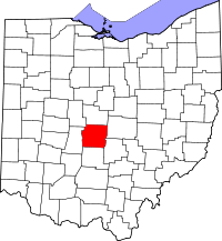
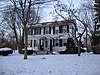
[3] Name on the Register [4] Image Date listed [5] Location City or town Description 1 Demas Adams House Demas Adams House April 17, 1980 (# 80003005 721 High St. 40°05′19″N 83°01′08″W / 40.088611°N 83.018889°W / 40.088611; -83.018889 (Demas Adams House ) Worthington 2 Agler-La Follette House Agler-La Follette House December 14, 1978 (# 78002062 2621 Sunbury Rd. 40°01′29″N 82°56′04″W / 40.024722°N 82.934444°W / 40.024722; -82.934444 (Agler-La Follette House ) Mifflin Township 3 Alkire House Alkire House March 30, 1978 (# 78002068 259 N. State St. 40°07′58″N 82°56′00″W / 40.132778°N 82.933333°W / 40.132778; -82.933333 (Alkire House ) Westerville 4 Arendt-Seymour House Arendt-Seymour House August 15, 1989 (# 89001024 53 W. Columbus St. 39°50′29″N 82°48′28″W / 39.841347°N 82.807806°W / 39.841347; -82.807806 (Arendt-Seymour House ) Canal Winchester 5 Artz House Artz House April 11, 1979 (# 79002901 56 N. High St. 40°06′03″N 83°06′48″W / 40.100833°N 83.113333°W / 40.100833; -83.113333 (Artz House ) Dublin 6 Bank Block Building Bank Block Building September 15, 1997 (# 97000510 1255-1293 Grandview Ave. 39°58′58″N 83°02′44″W / 39.982778°N 83.045556°W / 39.982778; -83.045556 (Bank Block Building ) Grandview Heights 7 Barnhardt-Bolenbaugh House Barnhardt-Bolenbaugh House August 15, 1989 (# 89001027 113 E. Waterloo St. 39°50′28″N 82°48′07″W / 39.841111°N 82.801944°W / 39.841111; -82.801944 (Barnhardt-Bolenbaugh House ) Canal Winchester 8 Dr. L.W. Beery House Dr. L.W. Beery House August 15, 1989 (# 89001033 68 Washington St. 39°50′32″N 82°48′32″W / 39.842111°N 82.808889°W / 39.842111; -82.808889 (Dr. L.W. Beery House ) Canal Winchester 9 Bergstresser Covered Bridge Bergstresser Covered Bridge May 3, 1974 (# 74001484 West of State Route 674 over Walnut Creek 39°49′48″N 82°49′00″W / 39.83°N 82.816667°W / 39.83; -82.816667 (Bergstresser Covered Bridge ) Canal Winchester 10 E. Boles Cottage E. Boles Cottage April 11, 1979 (# 79002886 5350 Hayden Run Rd. 40°03′35″N 83°08′49″W / 40.059722°N 83.146944°W / 40.059722; -83.146944 (E. Boles Cottage ) Hilliard 11 Asher Brand Residence Asher Brand Residence April 11, 1979 (# 79002740 5381 Brand Rd. 40°07′06″N 83°07′57″W / 40.118333°N 83.1325°W / 40.118333; -83.1325 (Asher Brand Residence ) Dublin 12 Brelsford-Seese House Brelsford-Seese House April 11, 1979 (# 79002888 129 Riverview St. 40°05′49″N 83°06′44″W / 40.096944°N 83.112222°W / 40.096944; -83.112222 (Brelsford-Seese House ) Dublin 13 Bruns-Wynkoop House Bruns-Wynkoop House August 15, 1989 (# 89001023 129 Washington St. 39°50′25″N 82°48′31″W / 39.840389°N 82.808611°W / 39.840389; -82.808611 (Bruns-Wynkoop House ) Canal Winchester 14 J.G. Butler House J.G. Butler House April 11, 1979 (# 79002759 35 S. High St. 40°05′56″N 83°06′50″W / 40.098806°N 83.113889°W / 40.098806; -83.113889 (J.G. Butler House ) Dublin 15 Aurora Buttles House Aurora Buttles House April 17, 1980 (# 80003007 12 E. Strafford Ave. 40°05′28″N 83°01′03″W / 40.091111°N 83.0175°W / 40.091111; -83.0175 (Aurora Buttles House ) Worthington 16 Buttles-Johnson House Buttles-Johnson House April 3, 1973 (# 73001443 956 High St. 40°05′37″N 83°01′02″W / 40.093611°N 83.017222°W / 40.093611; -83.017222 (Buttles-Johnson House ) Worthington 17 Canal Winchester Methodist Church Canal Winchester Methodist Church March 15, 1982 (# 82003567 S. Columbus and High St. 39°50′27″N 82°48′22″W / 39.840833°N 82.806111°W / 39.840833; -82.806111 (Canal Winchester Methodist Church ) Canal Winchester 18 Canal Winchester School Canal Winchester School February 9, 2007 (# 07000026 100 South Washington St. 39°50′27″N 82°48′34″W / 39.840833°N 82.809444°W / 39.840833; -82.809444 (Canal Winchester School ) Canal Winchester 19 Tom Cannon Mound Tom Cannon Mound May 2, 1974 (# 74001498 On a bluff over the confluence of the Big and Little Darby Creeks [6] 39°53′37″N 83°13′05″W / 39.893611°N 83.218056°W / 39.893611; -83.218056 (Tom Cannon Mound ) Pleasant Township 20 Capital University Historic District Capital University Historic District December 17, 1982 (# 82001457 E. Main St. at College Ave. 39°57′21″N 82°56′19″W / 39.955833°N 82.938611°W / 39.955833; -82.938611 (Capital University Historic District ) Bexley 21 Carnegie Library Otterbein University Carnegie Library Otterbein University February 5, 2021 (# 100006110 102 West College Ave. 40°07′32″N 82°56′07″W / 40.1256°N 82.9352°W / 40.1256; -82.9352 (Carnegie Library Otterbein University ) Westerville 22 J. Carty-R.J. Tussing House J. Carty-R.J. Tussing House August 15, 1989 (# 89001025 48 Elm St. 39°50′42″N 82°48′28″W / 39.845°N 82.807778°W / 39.845; -82.807778 (J. Carty-R.J. Tussing House ) Canal Winchester 23 Central College Presbyterian Church Central College Presbyterian Church November 24, 1980 (# 80004068 6891 Sunbury Rd. 40°05′59″N 82°53′22″W / 40.099611°N 82.889444°W / 40.099611; -82.889444 (Central College Presbyterian Church ) Westerville 24 O.P. Chaney Grain Elevator O.P. Chaney Grain Elevator January 28, 1988 (# 87002551 W. Oak and N. High Sts. 39°50′40″N 82°48′23″W / 39.844444°N 82.806389°W / 39.844444; -82.806389 (O.P. Chaney Grain Elevator ) Canal Winchester 25 Chapman-Hutchinson House Chapman-Hutchinson House April 11, 1979 (# 79002688 37 S. Riverview St. 40°05′56″N 83°06′45″W / 40.098889°N 83.1125°W / 40.098889; -83.1125 (Chapman-Hutchinson House ) Dublin 26 Fletcher Coffman House Fletcher Coffman House April 11, 1979 (# 79002751 6659 Coffman Rd. 40°06′15″N 83°08′02″W / 40.104167°N 83.133889°W / 40.104167; -83.133889 (Fletcher Coffman House ) Dublin 27 Columbus Street Historic District Columbus Street Historic District May 5, 1988 (# 88000559 8-129 E. Columbus St. and 57 S. High St. 39°50′26″N 82°48′13″W / 39.840556°N 82.803611°W / 39.840556; -82.803611 (Columbus Street Historic District ) Canal Winchester 28 Columbus, Hocking Valley and Toledo Railway Depot Columbus, Hocking Valley and Toledo Railway Depot January 28, 1988 (# 87002550 100 N. High St. 39°50′44″N 82°48′21″W / 39.845556°N 82.805833°W / 39.845556; -82.805833 (Columbus, Hocking Valley and Toledo Railway Depot ) Canal Winchester 29 Walter Datz House Walter Datz House April 11, 1979 (# 79002889 5040 Tuttle Rd. 40°04′40″N 83°07′41″W / 40.077778°N 83.128056°W / 40.077778; -83.128056 (Walter Datz House ) Dublin 30 David's Reformed Church David's Reformed Church August 15, 1989 (# 89001017 80 W. Columbus St. 39°50′30″N 82°48′31″W / 39.841667°N 82.808611°W / 39.841667; -82.808611 (David's Reformed Church ) Canal Winchester 31 Alexander Davis Cabin Alexander Davis Cabin April 11, 1979 (# 79002892 5436 Dublin Rd. (rear house) 40°04′41″N 83°06′46″W / 40.078056°N 83.112778°W / 40.078056; -83.112778 (Alexander Davis Cabin ) Dublin 32 Alexander Davis House Alexander Davis House April 11, 1979 (# 79002746 5436 Dublin Rd. (front house) 40°04′41″N 83°06′48″W / 40.078056°N 83.113333°W / 40.078056; -83.113333 (Alexander Davis House ) Dublin 33 James Davis Barn James Davis Barn April 11, 1979 (# 79002789 5707 Dublin Rd. 40°04′58″N 83°06′55″W / 40.082778°N 83.115278°W / 40.082778; -83.115278 (James Davis Barn ) Dublin 34 James Davis Farm James Davis Farm April 11, 1979 (# 79002772 5707 Dublin Rd. 40°05′00″N 83°06′55″W / 40.083333°N 83.115278°W / 40.083333; -83.115278 (James Davis Farm ) Dublin 35 Samuel Henry Davis House Samuel Henry Davis House April 11, 1979 (# 79002692 5083 Rings Rd. 40°05′02″N 83°07′41″W / 40.083889°N 83.128056°W / 40.083889; -83.128056 (Samuel Henry Davis House ) Dublin 36 Samuel Davis House Samuel Davis House February 15, 1974 (# 74001488 4264 Dublin Rd. 40°02′44″N 83°06′13″W / 40.045556°N 83.103611°W / 40.045556; -83.103611 (Samuel Davis House ) Norwich Township 37 Elias Decker Farmhouse Elias Decker Farmhouse August 15, 1989 (# 89001034 6170 Lithopolis Rd. 39°49′36″N 82°50′16″W / 39.826667°N 82.837778°W / 39.826667; -82.837778 (Elias Decker Farmhouse ) Canal Winchester 38 Samuel Deitz Farmhouse Samuel Deitz Farmhouse August 15, 1989 (# 89001021 280 Ashbrook Rd. 39°49′59″N 82°48′56″W / 39.833056°N 82.815556°W / 39.833056; -82.815556 (Samuel Deitz Farmhouse ) Canal Winchester 39 Drexel Theater Drexel Theater June 8, 2015 (# 15000322 2254 E. Main St. 39°57′26″N 82°56′19″W / 39.9573°N 82.9386°W / 39.9573; -82.9386 (Drexel Theater ) Bexley 40 Dublin Cemetery Vaults Dublin Cemetery Vaults April 11, 1979 (# 79002790 State Route 161 , 0.25 miles (0.40 km) west of its intersection with Dublin River Rd. 40°05′51″N 83°07′01″W / 40.0975°N 83.116944°W / 40.0975; -83.116944 (Dublin Cemetery Vaults ) Dublin 41 Dublin Christian Church Dublin Christian Church April 11, 1979 (# 79002742 81 W. Bridge St. (State Route 161 ) 40°05′56″N 83°06′58″W / 40.098889°N 83.116111°W / 40.098889; -83.116111 (Dublin Christian Church ) Dublin 42 Dublin Christian Church Dublin Christian Church April 11, 1979 (# 79002896 53 N. High St. 40°06′00″N 83°06′50″W / 40.1°N 83.113889°W / 40.1; -83.113889 (Dublin Christian Church ) Dublin 43 Dublin High Street Historic District Dublin High Street Historic District April 11, 1979 (# 79003645 6-126 High St. (both sides of street) 40°05′58″N 83°06′49″W / 40.099444°N 83.113611°W / 40.099444; -83.113611 (Dublin High Street Historic District ) Dublin 44 Dublin Veterinary Clinic Dublin Veterinary Clinic April 11, 1979 (# 79002884 32 W. Bridge St. 40°05′59″N 83°06′53″W / 40.099722°N 83.114722°W / 40.099722; -83.114722 (Dublin Veterinary Clinic ) Dublin 45 John Dun Homestead John Dun Homestead April 11, 1979 (# 79002691 8055 Dublin-Bellpoint Rd. (at intersection of Ashford Rd.) 40°07′56″N 83°07′28″W / 40.132361°N 83.124306°W / 40.132361; -83.124306 (John Dun Homestead ) Dublin 46 Robert P. Duncan House Robert P. Duncan House August 23, 1984 (# 09000094 333 N. Parkview Ave. 39°58′34″N 82°56′31″W / 39.976111°N 82.941944°W / 39.976111; -82.941944 (Robert P. Duncan House ) Bexley 47 George and Christina Ealy House George and Christina Ealy House July 2, 2008 (# 08000626 6359 Dublin-Granville Rd. 40°04′57″N 82°49′10″W / 40.082603°N 82.819528°W / 40.082603; -82.819528 (George and Christina Ealy House ) New Albany 48 Henry J. Epley House Henry J. Epley House August 15, 1989 (# 89001020 55 Franklin St. 39°50′26″N 82°48′29″W / 39.840556°N 82.808056°W / 39.840556; -82.808056 (Henry J. Epley House ) Canal Winchester 49 Richard W. Evans House Richard W. Evans House April 17, 1980 (# 80003020 92 E. Granville Rd. 40°05′20″N 83°00′55″W / 40.088889°N 83.015278°W / 40.088889; -83.015278 (Richard W. Evans House ) Worthington 50 John W. Everal Farm Buildings John W. Everal Farm Buildings September 18, 1975 (# 75001404 7610 Cleveland Ave. 40°07′35″N 82°56′52″W / 40.126389°N 82.947778°W / 40.126389; -82.947778 (John W. Everal Farm Buildings ) Westerville 51 Foor-Alspach House Foor-Alspach House August 15, 1989 (# 89001035 92 E. Waterloo St. 39°50′30″N 82°48′10″W / 39.841667°N 82.802778°W / 39.841667; -82.802778 (Foor-Alspach House ) Canal Winchester 52 Frantz House Frantz House April 11, 1979 (# 79002741 6152 Frantz Rd. 40°05′31″N 83°07′27″W / 40.091944°N 83.124167°W / 40.091944; -83.124167 (Frantz House ) Dublin 53 John Galbreath Mound John Galbreath Mound July 15, 1974 (# 74001497 Eastern bank of Big Darby Creek, west of Galloway [7] 39°54′43″N 83°13′16″W / 39.911944°N 83.221194°W / 39.911944; -83.221194 (John Galbreath Mound ) Pleasant Township 54 Gantz Homestead Gantz Homestead June 20, 1979 (# 79001842 2233 Gantz Rd. 39°53′52″N 83°03′46″W / 39.897778°N 83.062778°W / 39.897778; -83.062778 (Gantz Homestead ) Grove City 55 Gardner House Gardner House April 17, 1980 (# 80003009 80 W. Granville Rd. 40°05′28″N 83°01′13″W / 40.091111°N 83.020278°W / 40.091111; -83.020278 (Gardner House ) Worthington 56 Christian Gayman House Christian Gayman House August 15, 1989 (# 89001037 110 E. Waterloo St. 39°50′30″N 82°48′08″W / 39.841667°N 82.802222°W / 39.841667; -82.802222 (Christian Gayman House ) Canal Winchester 57 Eleanor A. Gelpi House Eleanor A. Gelpi House March 19, 2001 (# 01000198 7125 Riverside Dr. 40°06′45″N 83°06′39″W / 40.112500°N 83.110833°W / 40.112500; -83.110833 (Eleanor A. Gelpi House ) Dublin 58 Gilbert House Gilbert House April 17, 1980 (# 80003016 72 E. Granville Rd. 40°05′19″N 83°00′56″W / 40.088611°N 83.015556°W / 40.088611; -83.015556 (Gilbert House ) Worthington 59 Gilbert-Wilcox House Gilbert-Wilcox House April 17, 1980 (# 80003021 196 E. Granville Rd. 40°05′19″N 83°00′41″W / 40.088611°N 83.011389°W / 40.088611; -83.011389 (Gilbert-Wilcox House ) Worthington 60 A.G. Grant Homestead A.G. Grant Homestead June 3, 1998 (# 98000667 4124 Haughn Rd. 39°52′48″N 83°05′07″W / 39.88°N 83.085278°W / 39.88; -83.085278 (A.G. Grant Homestead ) Grove City 61 Green Lawn Abbey Green Lawn Abbey June 27, 2007 (# 07000632 700 Greenlawn Ave. 39°56′26″N 83°00′58″W / 39.940556°N 83.016111°W / 39.940556; -83.016111 (Green Lawn Abbey ) Franklin Township 62 James Griffith House James Griffith House August 15, 1989 (# 89001019 172 Washington St. 39°50′21″N 82°48′34″W / 39.839167°N 82.809444°W / 39.839167; -82.809444 (James Griffith House ) Canal Winchester 63 Groveport Log Houses Groveport Log Houses May 6, 1976 (# 76001428 Wirt Rd. 39°50′58″N 82°53′07″W / 39.849444°N 82.885278°W / 39.849444; -82.885278 (Groveport Log Houses ) Groveport 64 Groveport School Groveport School July 24, 2009 (# 09000564 715 E. Main St. 39°51′01″N 82°52′51″W / 39.850278°N 82.880833°W / 39.850278; -82.880833 (Groveport School ) Groveport 65 Groveport Town Hall Historic Group Groveport Town Hall Historic Group July 31, 1978 (# 78002067 628, 632 Main and Main and Front Sts. 39°51′05″N 82°52′57″W / 39.851389°N 82.8825°W / 39.851389; -82.8825 (Groveport Town Hall Historic Group ) Groveport 66 Groveport United Methodist Church Groveport United Methodist Church April 20, 1995 (# 95000494 512 Main St. 39°51′08″N 82°53′10″W / 39.852222°N 82.886111°W / 39.852222; -82.886111 (Groveport United Methodist Church ) Groveport 67 Parley Haffey Farm Complex Parley Haffey Farm Complex August 15, 1989 (# 89001022 525 Gender Rd. 39°49′55″N 82°49′52″W / 39.831944°N 82.831111°W / 39.831944; -82.831111 (Parley Haffey Farm Complex ) Canal Winchester 68 J.L. Hamilton Residence J.L. Hamilton Residence April 11, 1979 (# 79002887 6273 Cosgray Rd. 40°05′54″N 83°11′20″W / 40.098333°N 83.188889°W / 40.098333; -83.188889 (J.L. Hamilton Residence ) Washington Township 69 Benjamin Hanby House Benjamin Hanby House November 10, 1970 (# 70000493 160 W. Main St. 40°07′34″N 82°56′15″W / 40.126111°N 82.937500°W / 40.126111; -82.937500 (Benjamin Hanby House ) Westerville 70 Gideon Hart House Gideon Hart House August 14, 1973 (# 73001442 7328 Hempstead Rd. 40°06′32″N 82°53′52″W / 40.108889°N 82.897778°W / 40.108889; -82.897778 (Gideon Hart House ) Westerville 71 Lucy Hart House Lucy Hart House April 17, 1980 (# 80003008 64 W. Granville Rd. 40°05′29″N 83°01′11″W / 40.091389°N 83.019722°W / 40.091389; -83.019722 (Lucy Hart House ) Worthington 72 Helpman-Chaney House Helpman-Chaney House August 15, 1989 (# 89001032 132 W. Columbus St. 39°50′30″N 82°48′38″W / 39.841667°N 82.810556°W / 39.841667; -82.810556 (Helpman-Chaney House ) Canal Winchester 73 Christian S. Herr House Christian S. Herr House March 5, 1982 (# 82003571 North of Lockbourne at 1451 Rathmell Rd. 39°51′38″N 82°58′08″W / 39.860694°N 82.968750°W / 39.860694; -82.968750 (Christian S. Herr House ) Hamilton Township 74 Hilliard Methodist Episcopal Church Hilliard Methodist Episcopal Church August 4, 1988 (# 88000634 4066 Main St. 40°02′05″N 83°09′30″W / 40.034722°N 83.158333°W / 40.034722; -83.158333 (Hilliard Methodist Episcopal Church ) Hilliard 75 Holder-Wright Works Holder-Wright Works February 15, 1974 (# 74001496 Off Bright Rd., east of the Scioto River [8] 40°06′47″N 83°06′23″W / 40.112994°N 83.106328°W / 40.112994; -83.106328 (Holder-Wright Works ) Dublin 76 Home for the Aged Deaf Home for the Aged Deaf November 25, 1980 (# 80004522 6971 Sunbury Rd. 40°06′05″N 82°53′21″W / 40.101250°N 82.889167°W / 40.101250; -82.889167 (Home for the Aged Deaf ) Westerville 77 Hotel Central Hotel Central April 17, 1980 (# 80003012 649 High St. 40°05′13″N 83°01′06″W / 40.086944°N 83.018333°W / 40.086944; -83.018333 (Hotel Central ) Worthington 78 Franz Huntington House Franz Huntington House May 29, 1980 (# 80002999 81 N. Drexel Ave. 39°58′17″N 82°56′16″W / 39.971389°N 82.937778°W / 39.971389; -82.937778 (Franz Huntington House ) Bexley 79 Indian Run Cemetery Stone Walls Indian Run Cemetery Stone Walls April 11, 1979 (# 79002863 North High St. 40°06′07″N 83°06′55″W / 40.101944°N 83.115278°W / 40.101944; -83.115278 (Indian Run Cemetery Stone Walls ) Dublin 80 Jackson Fort Jackson Fort December 16, 1974 (# 74001493 Surrounding a house at 3845 Westerville Rd. [9] 40°02′55″N 82°56′44″W / 40.048611°N 82.945556°W / 40.048611; -82.945556 (Jackson Fort ) Blendon Township 81 H.P. Jeffers Mound H.P. Jeffers Mound May 2, 1974 (# 74001499 Above the junction of Olentangy River Rd. and Plesenton Dr., west of downtown Worthington [10] 40°05′33″N 83°02′22″W / 40.0925°N 83.0394°W / 40.0925; -83.0394 (H.P. Jeffers Mound ) Worthington 82 Malcolm Jeffrey House Malcolm Jeffrey House May 6, 1983 (# 83001970 358 N. Parkview 39°58′35″N 82°56′25″W / 39.9764°N 82.9403°W / 39.9764; -82.9403 (Malcolm Jeffrey House ) Bexley 83 Karrer Barn Karrer Barn April 11, 1979 (# 79002788 6199 Dublin Rd. 40°05′42″N 83°06′49″W / 40.095°N 83.1136°W / 40.095; -83.1136 (Karrer Barn ) Dublin It has a hay hood . 84 Henry Karrer House Henry Karrer House April 11, 1979 (# 79002744 19 S. Riverview 40°05′58″N 83°06′44″W / 40.0994°N 83.1122°W / 40.0994; -83.1122 (Henry Karrer House ) Dublin 85 Kilbourn Commercial Building Kilbourn Commercial Building April 17, 1980 (# 80003010 679-681 High St. 40°05′16″N 83°01′06″W / 40.0878°N 83.0183°W / 40.0878; -83.0183 (Kilbourn Commercial Building ) Worthington 86 William Kilbourn House William Kilbourn House April 11, 1979 (# 79002894 63 S. Riverview St. 40°05′54″N 83°06′44″W / 40.0983°N 83.1122°W / 40.0983; -83.1122 (William Kilbourn House ) Dublin 87 Frederick G. Kilgour House Frederick G. Kilgour House July 3, 2012 (# 12000392 1415 Kirkley Rd. 40°01′11″N 83°03′00″W / 40.0198°N 83.0500°W / 40.0198; -83.0500 (Frederick G. Kilgour House ) Upper Arlington 88 William King House William King House August 15, 1989 (# 89001031 80 E. Waterloo St. 39°50′31″N 82°48′11″W / 39.8419°N 82.8031°W / 39.8419; -82.8031 (William King House ) Canal Winchester 89 Lanman-Ingram House Lanman-Ingram House February 8, 2021 (# 100006113 2015 West Fifth Ave. 39°59′22″N 83°03′40″W / 39.9895°N 83.0611°W / 39.9895; -83.0611 (Lanman-Ingram House ) Marble Cliff 90 Abraham Lehman Farmhouse Abraham Lehman Farmhouse August 15, 1989 (# 89001016 40 Lehman Dr. 39°50′58″N 82°48′47″W / 39.849444°N 82.813056°W / 39.849444; -82.813056 (Abraham Lehman Farmhouse ) Canal Winchester 91 C. Leppert Barn C. Leppert Barn April 11, 1979 (# 79002784 5280 Pinney Rd. 40°05′28″N 83°07′44″W / 40.091111°N 83.128889°W / 40.091111; -83.128889 (C. Leppert Barn ) Dublin 92 C. Leppert Cabin C. Leppert Cabin April 11, 1979 (# 79002785 5280 Pinney Rd. 40°05′27″N 83°07′42″W / 40.090833°N 83.128333°W / 40.090833; -83.128333 (C. Leppert Cabin ) Dublin 93 C. Leppert Farm C. Leppert Farm April 11, 1979 (# 79002783 5280 Pinney Rd. 40°05′27″N 83°07′42″W / 40.090833°N 83.128333°W / 40.090833; -83.128333 (C. Leppert Farm ) Dublin 94 Alexander W. Livingston House Alexander W. Livingston House June 17, 1994 (# 94000593 1792 Graham Rd. 39°56′52″N 82°47′44″W / 39.947639°N 82.795694°W / 39.947639; -82.795694 (Alexander W. Livingston House ) Reynoldsburg 95 Doctor Longenecker Office Building Doctor Longenecker Office Building March 9, 1990 (# 90000379 633-5 High St. 40°05′11″N 83°01′06″W / 40.086389°N 83.018333°W / 40.086389; -83.018333 (Doctor Longenecker Office Building ) Worthington 96 David Marshall House David Marshall House April 11, 1979 (# 79002686 7455 Cosgray Rd. 40°06′26″N 83°11′30″W / 40.107222°N 83.191667°W / 40.107222; -83.191667 (David Marshall House ) Washington Township 97 Mattoon-Woodrow House Mattoon-Woodrow House April 17, 1980 (# 80003011 72 E. North St. 40°05′34″N 83°00′56″W / 40.092778°N 83.015556°W / 40.092778; -83.015556 (Mattoon-Woodrow House ) Worthington 98 McCracken-Sells House McCracken-Sells House November 29, 1984 (# 84000440 3983 Dublin Rd. 40°02′08″N 83°06′12″W / 40.035556°N 83.103333°W / 40.035556; -83.103333 (McCracken-Sells House ) Mifflin Township 99 Austin McDowell House Austin McDowell House April 11, 1979 (# 79002906 6189 Dublin Rd. 40°05′37″N 83°06′47″W / 40.093611°N 83.113056°W / 40.093611; -83.113056 (Austin McDowell House ) Dublin 100 Dr. McKitrick House Dr. McKitrick House April 11, 1979 (# 79002687 16 N. High St. 40°05′59″N 83°06′50″W / 40.099722°N 83.113889°W / 40.099722; -83.113889 (Dr. McKitrick House ) Dublin 101 Dr. McKitrick Office Dr. McKitrick Office April 11, 1979 (# 79002882 22 N. High St. 40°06′00″N 83°06′48″W / 40.1°N 83.113333°W / 40.1; -83.113333 (Dr. McKitrick Office ) Dublin 102 Dr. James Merryman House Dr. James Merryman House May 26, 1988 (# 88000638 5232 Norwich St. 40°02′00″N 83°09′24″W / 40.033333°N 83.156667°W / 40.033333; -83.156667 (Dr. James Merryman House ) Hilliard 103 Methodist Church Parsonage Methodist Church Parsonage August 15, 1989 (# 89001030 59 W. Columbus St. 39°50′29″N 82°48′29″W / 39.841389°N 82.808056°W / 39.841389; -82.808056 (Methodist Church Parsonage ) Canal Winchester 104 J.F. Miller House J.F. Miller House May 31, 1984 (# 84003682 1600 Roxbury Rd. 39°59′18″N 83°03′41″W / 39.988472°N 83.061389°W / 39.988472; -83.061389 (J.F. Miller House ) Marble Cliff 105 Charles Mitchell House Charles Mitchell House April 11, 1979 (# 79002890 6992 Dublin-Bellpoint Rd. 40°06′36″N 83°06′52″W / 40.110000°N 83.114444°W / 40.110000; -83.114444 (Charles Mitchell House ) Washington Township 106 Myer House Myer House April 11, 1979 (# 79002689 5927 Rings Rd. 40°04′51″N 83°09′03″W / 40.080750°N 83.150833°W / 40.080750; -83.150833 (Myer House ) Dublin 107 Nafzger-Miller House Nafzger-Miller House January 21, 1999 (# 98001641 110 Mill St. 40°01′13″N 82°52′46″W / 40.020278°N 82.879444°W / 40.020278; -82.879444 (Nafzger-Miller House ) Gahanna 108 New England Lodge New England Lodge March 20, 1973 (# 73001444 634 N. High St. 40°05′10″N 83°01′04″W / 40.086111°N 83.017778°W / 40.086111; -83.017778 (New England Lodge ) Worthington 109 Niles Car & Manufacturing Company Electric Railway Interurban Combine No. 21 Niles Car & Manufacturing Company Electric Railway Interurban Combine No. 21 June 19, 1987 (# 87000762 990 Proprietor's Rd. 40°05′24″N 83°00′07″W / 40.09°N 83.001944°W / 40.09; -83.001944 (Niles Car & Manufacturing Company Electric Railway Interurban Combine No. 21 ) Worthington 110 Lewis Noble House Lewis Noble House April 17, 1980 (# 80003006 48 W. South St. 40°05′04″N 83°01′09″W / 40.084444°N 83.019167°W / 40.084444; -83.019167 (Lewis Noble House ) Worthington 111 North High Street Historic District North High Street Historic District August 15, 1989 (# 89001038 Roughly N. High St. and E. and W. Mound St. 39°50′39″N 82°48′19″W / 39.844167°N 82.805278°W / 39.844167; -82.805278 (North High Street Historic District ) Canal Winchester 112 Odd Fellows Hall Odd Fellows Hall May 26, 1988 (# 88000636 4065 Main St. 40°02′05″N 83°09′32″W / 40.034722°N 83.158889°W / 40.034722; -83.158889 (Odd Fellows Hall ) Hilliard 113 Ohio and Erie Canal Southern Descent Historic District Ohio and Erie Canal Southern Descent Historic District April 1, 2019 (# 100003572 Multiple 39°49′09″N 82°57′40″W / 39.8193°N 82.9611°W / 39.8193; -82.9611 (Ohio and Erie Canal Southern Descent Historic District ) Lockbourne Boundary increase approved September 2, 2022 ; extends into other Ohio counties 114 Old Peace Lutheran Church Old Peace Lutheran Church April 23, 1987 (# 87000640 78-82 N. High St. 40°01′11″N 82°52′42″W / 40.019686°N 82.878261°W / 40.019686; -82.878261 (Old Peace Lutheran Church ) Gahanna 115 Charles S. Osborn House Charles S. Osborn House March 28, 1977 (# 77001061 5785 Cooper Rd., south of Westerville 40°05′17″N 82°55′55″W / 40.088056°N 82.931944°W / 40.088056; -82.931944 (Charles S. Osborn House ) Blendon Township 116 Otterbein Mausoleum Otterbein Mausoleum November 29, 1979 (# 79001845 W. Walnut St. 40°07′13″N 82°56′10″W / 40.120278°N 82.936111°W / 40.120278; -82.936111 (Otterbein Mausoleum ) Westerville 117 Jonathan Park House Jonathan Park House April 17, 1980 (# 80003013 91 E. Granville Rd. 40°05′18″N 83°00′55″W / 40.088333°N 83.015278°W / 40.088333; -83.015278 (Jonathan Park House ) Worthington 118 Peoples Bank Company Building Peoples Bank Company Building August 15, 1989 (# 89001026 10 N. High St. 39°50′35″N 82°48′22″W / 39.843056°N 82.806111°W / 39.843056; -82.806111 (Peoples Bank Company Building ) Canal Winchester 119 Pinney Road Log Cabin Pinney Road Log Cabin April 11, 1979 (# 79002786 Pinney Rd. 40°05′51″N 83°07′28″W / 40.097500°N 83.124444°W / 40.097500; -83.124444 (Pinney Road Log Cabin ) Dublin 120 Dr. Eli Pinney House Dr. Eli Pinney House April 11, 1979 (# 79002761 109 S. Riverview St. 40°05′50″N 83°06′44″W / 40.097222°N 83.112222°W / 40.097222; -83.112222 (Dr. Eli Pinney House ) Dublin 121 Presbyterian Parsonage Presbyterian Parsonage November 25, 1980 (# 80004246 6972 Sunbury Rd. 40°06′04″N 82°53′18″W / 40.101111°N 82.888333°W / 40.101111; -82.888333 (Presbyterian Parsonage ) Westerville 122 Principal's Cottage Principal's Cottage April 17, 1980 (# 80003014 38 Short St. 40°05′09″N 83°01′09″W / 40.085833°N 83.019167°W / 40.085833; -83.019167 (Principal's Cottage ) Worthington 123 John Rager Farmhouse John Rager Farmhouse October 1, 1990 (# 90001498 8020 Groveport Rd., west of Canal Winchester 39°50′54″N 82°51′07″W / 39.848472°N 82.852083°W / 39.848472; -82.852083 (John Rager Farmhouse ) Madison Township 124 F. Riley House F. Riley House April 11, 1979 (# 79002738 182 S. High St. 40°05′45″N 83°06′46″W / 40.095833°N 83.112778°W / 40.095833; -83.112778 (F. Riley House ) Dublin 125 Louis Rings Barn No. 1 Louis Rings Barn No. 1 April 11, 1979 (# 79002769 6665 Shiers-Rings Rd. 40°05′37″N 83°10′15″W / 40.093611°N 83.170833°W / 40.093611; -83.170833 (Louis Rings Barn No. 1 ) Dublin 126 Louis Rings Barn No. 2 Louis Rings Barn No. 2 April 11, 1979 (# 79002767 6665 Shiers-Rings Rd. 40°05′37″N 83°10′15″W / 40.093611°N 83.170836°W / 40.093611; -83.170836 (Louis Rings Barn No. 2 ) Dublin 127 Louis Rings Residence Louis Rings Residence April 11, 1979 (# 79002765 6665 Shiers-Rings Rd. 40°05′38″N 83°10′12″W / 40.093889°N 83.17°W / 40.093889; -83.17 (Louis Rings Residence ) Dublin 128 Ripley House Ripley House April 17, 1980 (# 80003015 623 High St. 40°05′09″N 83°01′06″W / 40.085833°N 83.018333°W / 40.085833; -83.018333 (Ripley House ) Worthington 129 Rush Creek Village Historic District Rush Creek Village Historic District August 14, 2003 (# 03000760 Residential subdivision centered along E. South St., east of Morning St. 40°05′10″N 83°00′33″W / 40.086111°N 83.009167°W / 40.086111; -83.009167 (Rush Creek Village Historic District ) Worthington 130 Mark Russell House Mark Russell House December 12, 1976 (# 76001429 5751 N. High St. 40°04′48″N 83°01′09″W / 40.08°N 83.019167°W / 40.08; -83.019167 (Mark Russell House ) Riverlea 131 Benjamin Sells Barn No. 1 Benjamin Sells Barn No. 1 April 11, 1979 (# 79003133 4586 Hayden Run Rd. 40°04′05″N 83°06′58″W / 40.068000°N 83.116250°W / 40.068000; -83.116250 (Benjamin Sells Barn No. 1 ) Washington Township 132 Benjamin Sells Barn No. 2 Benjamin Sells Barn No. 2 April 11, 1979 (# 79003134 4586 Hayden Run Rd. 40°04′05″N 83°07′00″W / 40.068194°N 83.116667°W / 40.068194; -83.116667 (Benjamin Sells Barn No. 2 ) Washington Township 133 Benjamin Sells House Benjamin Sells House July 30, 1975 (# 75001403 4586 Hayden Run Rd. 40°04′06″N 83°06′57″W / 40.068333°N 83.115833°W / 40.068333; -83.115833 (Benjamin Sells House ) Washington Township 134 Benjamin Sells Wash House Benjamin Sells Wash House April 11, 1979 (# 79002893 4586 Hayden Run Rd. 40°04′05″N 83°06′57″W / 40.068111°N 83.115833°W / 40.068111; -83.115833 (Benjamin Sells Wash House ) Washington Township 135 David Sells Barn David Sells Barn April 11, 1979 (# 79003135 4586 Hayden Run Rd. 40°04′04″N 83°07′00″W / 40.067778°N 83.116667°W / 40.067778; -83.116667 (David Sells Barn ) Washington Township 136 Eliud Sells House Eliud Sells House April 11, 1979 (# 79002891 83 S. Riverview St. 40°05′53″N 83°06′03″W / 40.098056°N 83.100833°W / 40.098056; -83.100833 (Eliud Sells House ) Dublin 137 William Henry Sells House William Henry Sells House April 11, 1979 (# 79002895 6028 Dublin Rd. 40°05′04″N 83°06′51″W / 40.084444°N 83.114167°W / 40.084444; -83.114167 (William Henry Sells House ) Dublin 138 Sessions Village Sessions Village February 20, 1975 (# 75001401 Both sides of Sessions Dr. 39°58′10″N 82°56′40″W / 39.969444°N 82.944444°W / 39.969444; -82.944444 (Sessions Village ) Bexley 139 Sharon Township Town Hall Sharon Township Town Hall April 17, 1980 (# 80003017 Granville Rd. and Hartford St. 40°05′19″N 83°00′58″W / 40.088611°N 83.016111°W / 40.088611; -83.016111 (Sharon Township Town Hall ) Worthington 140 Shepard Street School Shepard Street School November 29, 1979 (# 79001841 106 Short St. 40°01′13″N 82°52′37″W / 40.020278°N 82.876944°W / 40.020278; -82.876944 (Shepard Street School ) Gahanna 141 Carl H. Shier Barn Carl H. Shier Barn April 11, 1979 (# 79002873 7026 Shier-Rings Rd. 40°05′38″N 83°11′00″W / 40.093889°N 83.183333°W / 40.093889; -83.183333 (Carl H. Shier Barn ) Washington Township 142 Carl H. Shier Chicken House Carl H. Shier Chicken House April 11, 1979 (# 79002868 7026 Shier-Rings Rd. 40°05′38″N 83°11′00″W / 40.093889°N 83.183333°W / 40.093889; -83.183333 (Carl H. Shier Chicken House ) Washington Township 143 Carl H. Shier House Carl H. Shier House April 11, 1979 (# 79002865 7026 Shier-Rings Rd. 40°05′38″N 83°11′00″W / 40.093889°N 83.183333°W / 40.093889; -83.183333 (Carl H. Shier House ) Washington Township 144 Capt. J.S. Skeele House Capt. J.S. Skeele House April 17, 1980 (# 80003018 700 Hartford St. 40°05′18″N 83°00′57″W / 40.088333°N 83.015833°W / 40.088333; -83.015833 (Capt. J.S. Skeele House ) Worthington 145 John Snow House John Snow House July 26, 1973 (# 73001445 41 W. New England Ave. 40°05′12″N 83°01′09″W / 40.086667°N 83.019167°W / 40.086667; -83.019167 (John Snow House ) Worthington 146 Squire's Glen Farm Squire's Glen Farm August 13, 1974 (# 74001485 6770 Sunbury Rd. 40°05′50″N 82°53′10″W / 40.097222°N 82.886111°W / 40.097222; -82.886111 (Squire's Glen Farm ) Westerville 147 St. John's Episcopal Church St. John's Episcopal Church April 17, 1980 (# 80003019 700 High St. 40°05′19″N 83°01′02″W / 40.088611°N 83.017222°W / 40.088611; -83.017222 (St. John's Episcopal Church ) Worthington 148 St. John's Lutheran Church St. John's Lutheran Church April 11, 1979 (# 79002877 6135 Rings Rd. 40°04′48″N 83°09′24″W / 40.08°N 83.156667°W / 40.08; -83.156667 (St. John's Lutheran Church ) Dublin 149 Joshua Stevenson House Joshua Stevenson House June 21, 2007 (# 07000581 5105 Bowen Rd., north of Canal Winchester 39°52′44″N 82°48′16″W / 39.878889°N 82.804444°W / 39.878889; -82.804444 (Joshua Stevenson House ) Madison Township 150 Temperance Row Historic District Temperance Row Historic District October 16, 2008 (# 08000995 Park, Grove, Walnut, and University Sts. 40°07′24″N 82°56′11″W / 40.123333°N 82.936389°W / 40.123333; -82.936389 (Temperance Row Historic District ) Westerville 151 Thompson-Builder House Thompson-Builder House April 11, 1979 (# 79002749 5051 Brand Rd. 40°07′00″N 83°07′39″W / 40.116667°N 83.1275°W / 40.116667; -83.1275 (Thompson-Builder House ) Dublin 152 Morgan Thrush Farm Complex Morgan Thrush Farm Complex August 15, 1989 (# 89001036 375 Gender Rd. 39°50′24″N 82°49′46″W / 39.840000°N 82.829444°W / 39.840000; -82.829444 (Morgan Thrush Farm Complex ) Canal Winchester 153 Times Building-Lodge Hall Times Building-Lodge Hall August 15, 1989 (# 89001028 19 E. Waterloo St. 39°50′32″N 82°48′18″W / 39.842222°N 82.805000°W / 39.842222; -82.805000 (Times Building-Lodge Hall ) Canal Winchester 154 Towers Hall, Otterbein College Towers Hall, Otterbein College March 4, 1971 (# 71000638 Main and Grove Sts. on the Otterbein College campus 40°07′31″N 82°56′11″W / 40.125278°N 82.936389°W / 40.125278; -82.936389 (Towers Hall, Otterbein College ) Westerville 155 Upper Arlington Historic District Upper Arlington Historic District September 30, 1985 (# 85002694 Roughly bounded by Lane Ave., Andover Rd., 5th Ave., Cambridge Boulevard, and Riverside Dr. 39°59′59″N 83°03′54″W / 39.999722°N 83.065°W / 39.999722; -83.065 (Upper Arlington Historic District ) Upper Arlington 156 Uptown Westerville Historic District Uptown Westerville Historic District June 17, 2019 (# 100004055 State St. between Home St. and Dill and Starrock Alleys 40°07′36″N 82°55′54″W / 40.126667°N 82.931667°W / 40.126667; -82.931667 (Uptown Westerville Historic District ) Westerville 157 Rev. Ebenezer Washburn House Rev. Ebenezer Washburn House November 25, 1980 (# 80003004 7121 Sunbury Rd. 40°06′15″N 82°53′18″W / 40.104167°N 82.888333°W / 40.104167; -82.888333 (Rev. Ebenezer Washburn House ) Westerville 158 Washington Township School Washington Township School April 11, 1979 (# 79002762 4915 Brand Rd. 40°07′02″N 83°07′33″W / 40.117222°N 83.125833°W / 40.117222; -83.125833 (Washington Township School ) Dublin 159 Washington Township Voting Hall Washington Township Voting Hall April 11, 1979 (# 79002880 Rings Rd., fourth building east of the railroad tracks 40°04′37″N 83°10′47″W / 40.076944°N 83.179722°W / 40.076944; -83.179722 (Washington Township Voting Hall ) Washington Township 160 Wesley Chapel Wesley Chapel February 27, 1979 (# 79001843 Southeast of Hilliard at 3299 Dublin Rd. 40°01′02″N 83°06′00″W / 40.017222°N 83.1°W / 40.017222; -83.1 (Wesley Chapel ) Norwich Township 161 West Mound Street Historic District West Mound Street Historic District February 11, 1988 (# 88000072 10-54 West Mound St., 23 Elm St. 39°50′39″N 82°48′25″W / 39.844167°N 82.806944°W / 39.844167; -82.806944 (West Mound Street Historic District ) Canal Winchester 162 Westerville High School-Vine Street School Westerville High School-Vine Street School May 29, 1975 (# 75001405 44 N. Vine St. 40°07′38″N 82°55′43″W / 40.127222°N 82.928611°W / 40.127222; -82.928611 (Westerville High School-Vine Street School ) Westerville 163 Frieda Whitmer House Frieda Whitmer House April 11, 1979 (# 79002690 5530 Houchard Rd. 40°04′42″N 83°11′51″W / 40.078333°N 83.197500°W / 40.078333; -83.197500 (Frieda Whitmer House ) Washington Township 164 Jacob Wilcox Farm Jacob Wilcox Farm April 11, 1979 (# 79002899 7495 Rings Rd. 40°04′29″N 83°11′42″W / 40.074861°N 83.195000°W / 40.074861; -83.195000 (Jacob Wilcox Farm ) Washington Township 165 James Wilcox House James Wilcox House April 11, 1979 (# 79002898 7590 Rings Rd. 40°04′31″N 83°11′52″W / 40.075278°N 83.197639°W / 40.075278; -83.197639 (James Wilcox House ) Washington Township 166 Winterringer Building and House Winterringer Building and House June 9, 1988 (# 88000720 5344 Center St. 40°02′04″N 83°09′35″W / 40.034444°N 83.159722°W / 40.034444; -83.159722 (Winterringer Building and House ) Hilliard 167 Worthington Historic District Worthington Historic District April 13, 2010 (# 10000190 Roughly bounded by North, South, Morning, and Evening Sts. 40°05′20″N 83°01′05″W / 40.088867°N 83.018067°W / 40.088867; -83.018067 (Worthington Historic District ) Worthington 168 Worthington Historical Society Museum Worthington Historical Society Museum April 17, 1980 (# 80003022 50 W. New England Ave. 40°05′13″N 83°01′12″W / 40.086944°N 83.02°W / 40.086944; -83.02 (Worthington Historical Society Museum ) Worthington 169 Worthington Manufacturing Company Boardinghouse Worthington Manufacturing Company Boardinghouse June 19, 1973 (# 73001446 25 Fox Lane 40°05′05″N 83°01′46″W / 40.084722°N 83.029444°W / 40.084722; -83.029444 (Worthington Manufacturing Company Boardinghouse ) Worthington 170 Worthington Public Square Worthington Public Square April 17, 1980 (# 80003024 Village Green 40°05′19″N 83°01′05″W / 40.088611°N 83.018056°W / 40.088611; -83.018056 (Worthington Public Square ) Worthington 171 Worthington United Presbyterian Church Worthington United Presbyterian Church April 17, 1980 (# 80003023 High St. and W. Granville Rd. 40°05′22″N 83°01′08″W / 40.089444°N 83.018889°W / 40.089444; -83.018889 (Worthington United Presbyterian Church ) Worthington 172 Horace Wright House Horace Wright House April 17, 1980 (# 80003025 137 E. Granville Rd. 40°05′17″N 83°00′49″W / 40.088056°N 83.013611°W / 40.088056; -83.013611 (Horace Wright House ) Worthington 173 George Karrer Farm George Karrer Farm April 11, 1979 (# 79002905 167 S. High St. 40°05′40″N 83°06′48″W / 40.094444°N 83.113333°W / 40.094444; -83.113333 (George Karrer Farm ) Dublin 174 Potter Wright House Potter Wright House April 17, 1980 (# 80003026 174 E. New England Ave. 40°05′12″N 83°00′45″W / 40.086667°N 83.0125°W / 40.086667; -83.0125 (Potter Wright House ) Worthington 175 Zellers-Langel House Zellers-Langel House August 15, 1989 (# 89001029 163 W. Waterloo St. 39°50′43″N 82°48′38″W / 39.845278°N 82.810556°W / 39.845278; -82.810556 (Zellers-Langel House ) Canal Winchester 176 Zion's Evangelical Lutheran Church Zion's Evangelical Lutheran Church June 16, 2004 (# 04000609 4501 Groveport Rd. 39°52′34″N 82°56′52″W / 39.876111°N 82.947778°W / 39.876111; -82.947778 (Zion's Evangelical Lutheran Church ) Obetz