National Register of Historic Places listings in Vinton County, Ohio

Last updated

Location of Vinton County in Ohio Map of Ohio highlighting Vinton County.svg
Location of Vinton County in Ohio

This is a list of the National Register of Historic Places listings in Vinton County, Ohio.

Contents

This is intended to be a complete list of the properties on the National Register of Historic Places in Vinton County, Ohio, United States. The locations of National Register properties for which the latitude and longitude coordinates are included below, may be seen in an online map. [1]

There are 11 properties listed on the National Register in the county.


    This National Park Service list is complete through NPS recent listings posted September 15, 2023. [2]

Map all coordinates using: OpenStreetMap

Current listings

[3] Name on the Register [4] ImageDate listed [5] Location City or townDescription
1 Eakin Mill Covered Bridge
Eakin Mill Covered Bridge Eakin Mill Covered Bridge.jpg
Eakin Mill Covered Bridge
March 16, 1976
(#76001539)
Mound Hill Rd. north of Arbaugh
39°10′16″N82°20′13″W / 39.171111°N 82.336944°W / 39.171111; -82.336944 (Eakin Mill Covered Bridge)
Vinton Township
2 Hope Furnace
Hope Furnace Hope furnace.JPG
Hope Furnace
May 25, 1973
(#73001546)
5 miles northeast of Zaleski on State Route 278
39°19′55″N82°20′25″W / 39.331944°N 82.340278°W / 39.331944; -82.340278 (Hope Furnace)
Brown Township
3 Markham Mound May 3, 1974
(#74001640)
Address Restricted
Zaleski
4 Masonic Lodge No. 472
Masonic Lodge No. 472 Masonic Lodge No. 472, Zaleski.jpg
Masonic Lodge No. 472
March 9, 2000
(#00000182)
18 Commercial St.
39°16′56″N82°23′37″W / 39.282222°N 82.393611°W / 39.282222; -82.393611 (Masonic Lodge No. 472)
Zaleski
5 Moonville Tunnel
Moonville Tunnel Moonville tunnel.jpg
Moonville Tunnel
March 22, 2021
(#100006291)
Hope-Moonville Rd., 2 miles (3.2 km) southwest of Lake Hope State Park
39°18′26″N82°19′20″W / 39.3073°N 82.3223°W / 39.3073; -82.3223 (Moonville Tunnel)
Zaleski vicinity
6 Mt. Olive Road Covered Bridge
Mt. Olive Road Covered Bridge Mt. Olive Road Covered Bridge.jpg
Mt. Olive Road Covered Bridge
October 8, 1976
(#76001538)
1 mile northeast of Allensville on Mt. Olive Rd.
39°17′10″N82°35′21″W / 39.286111°N 82.589167°W / 39.286111; -82.589167 (Mt. Olive Road Covered Bridge)
Jackson Township
7 Ponn Humpback Covered Bridge
Ponn Humpback Covered Bridge PONN HUMPBACK COVERED BRIDGE.jpg
Ponn Humpback Covered Bridge
April 11, 1973
(#73001545)
4 miles southwest of Wilkesville over Raccoon Creek
39°02′52″N82°22′35″W / 39.047778°N 82.376389°W / 39.047778; -82.376389 (Ponn Humpback Covered Bridge)
Wilkesville Township Built in 1874 to replace an arsoned structure; arsoned in 2013 [6]
8 Ranger Station Mound
Ranger Station Mound Ranger Station Mound, southern side.jpg
Ranger Station Mound
July 15, 1974
(#74001641)
Entrance to Zaleski State Forest [7]
39°17′14″N82°23′42″W / 39.287361°N 82.395000°W / 39.287361; -82.395000 (Ranger Station Mound)
Zaleski
9 Ratcliffe Mound
Ratcliffe Mound Ratcliffe Mound from north.jpg
Ratcliffe Mound
August 28, 1975
(#75001548)
5 miles northeast of Londonderry on State Route 327 [8]
39°18′27″N82°43′32″W / 39.307500°N 82.725556°W / 39.307500; -82.725556 (Ratcliffe Mound)
Eagle Township
10 Trinity Episcopal Church
Trinity Episcopal Church Trinity Episcopal Church, McArthur.jpg
Trinity Episcopal Church
March 16, 1976
(#76001540)
Sugar and High Sts.
39°14′51″N82°28′49″W / 39.2475°N 82.480278°W / 39.2475; -82.480278 (Trinity Episcopal Church)
McArthur
11 Zaleski Methodist Church Mound
Zaleski Methodist Church Mound Zaleski Methodist Church Mound.jpg
Zaleski Methodist Church Mound
July 15, 1974
(#74001642)
114 Broadway St. [9]
39°17′02″N82°23′44″W / 39.283889°N 82.395694°W / 39.283889; -82.395694 (Zaleski Methodist Church Mound)
Zaleski

See also

Related Research Articles

<span class="mw-page-title-main">National Register of Historic Places listings in Cuyahoga County, Ohio</span>

This is a list of the National Register of Historic Places listings in Cuyahoga County, Ohio.

<span class="mw-page-title-main">National Register of Historic Places listings in Franklin County, Ohio</span>

This is a list of the National Register of Historic Places listings in Franklin County, Ohio.

<span class="mw-page-title-main">National Register of Historic Places listings in Hamilton County, Ohio</span>

This is a list of the National Register of Historic Places listings in Hamilton County, Ohio.

<span class="mw-page-title-main">National Register of Historic Places listings in Delaware County, Ohio</span>

This is a list of the National Register of Historic Places listings in Delaware County, Ohio.

<span class="mw-page-title-main">National Register of Historic Places listings in Fairfield County, Ohio</span>

This is a list of the National Register of Historic Places listings in Fairfield County, Ohio.

<span class="mw-page-title-main">National Register of Historic Places listings in Licking County, Ohio</span>

This is a list of the National Register of Historic Places listings in Licking County, Ohio.

<span class="mw-page-title-main">National Register of Historic Places listings in Warren County, Ohio</span>

This is a list of the National Register of Historic Places listings in Warren County, Ohio.

<span class="mw-page-title-main">National Register of Historic Places listings in Greene County, Ohio</span>

This is a list of the National Register of Historic Places listings in Greene County, Ohio.

<span class="mw-page-title-main">National Register of Historic Places listings in Ross County, Ohio</span>

This is a list of the National Register of Historic Places listings in Ross County, Ohio.

<span class="mw-page-title-main">National Register of Historic Places listings in Athens County, Ohio</span>

This is a list of the National Register of Historic Places listings in Athens County, Ohio.

<span class="mw-page-title-main">National Register of Historic Places listings in Clermont County, Ohio</span>

This is a list of the National Register of Historic Places listings in Clermont County, Ohio.

<span class="mw-page-title-main">National Register of Historic Places listings in Highland County, Ohio</span>

This is a list of the National Register of Historic Places listings in Highland County, Ohio.

<span class="mw-page-title-main">National Register of Historic Places listings in Adams County, Ohio</span>

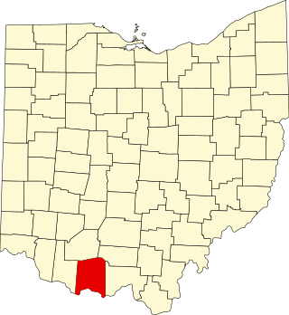
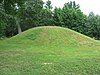
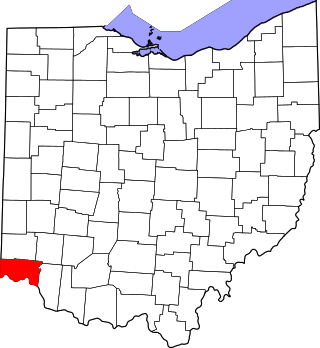
This is a list of the National Register of Historic Places listings in Adams County, Ohio.

<span class="mw-page-title-main">National Register of Historic Places listings in Fayette County, Ohio</span>

This is a list of the National Register of Historic Places listings in Fayette County, Ohio.

<span class="mw-page-title-main">National Register of Historic Places listings in Geauga County, Ohio</span>

This is a list of the National Register of Historic Places listings in Geauga County, Ohio.

<span class="mw-page-title-main">National Register of Historic Places listings in Perry County, Ohio</span>

This is a list of the National Register of Historic Places listings in Perry County, Ohio.

<span class="mw-page-title-main">National Register of Historic Places listings in Hocking County, Ohio</span>

This is a list of the National Register of Historic Places listings in Hocking County, Ohio.

<span class="mw-page-title-main">National Register of Historic Places listings in Madison County, Ohio</span>

This is a list of the National Register of Historic Places listings in Madison County, Ohio.

<span class="mw-page-title-main">National Register of Historic Places listings in Meigs County, Ohio</span>

This is a list of the National Register of Historic Places listings in Meigs County, Ohio.

<span class="mw-page-title-main">National Register of Historic Places listings in Union County, Ohio</span>

This is a list of the National Register of Historic Places listings in Union County, Ohio.

References

  1. The latitude and longitude information provided in this table was derived originally from the National Register Information System, which has been found to be fairly accurate for about 99% of listings. Some locations in this table may have been corrected to current GPS standards.
  2. National Park Service, United States Department of the Interior, "National Register of Historic Places: Weekly List Actions", retrieved September 15, 2023.
  3. Numbers represent an alphabetical ordering by significant words. Various colorings, defined here, differentiate National Historic Landmarks and historic districts from other NRHP buildings, structures, sites or objects.
  4. "National Register Information System". National Register of Historic Places . National Park Service. April 24, 2008.
  5. The eight-digit number below each date is the number assigned to each location in the National Register Information System database, which can be viewed by clicking the number.
  6. Investigators Still Looking for Answers in Humpback Bridge Fire, Vinton County Courier , 2013-08-07. Accessed 2013-08-20.
  7. Location derived from Owen, Lorrie K., ed. Dictionary of Ohio Historic Places. Vol. 1. St. Clair Shores: Somerset, 1999, 1369. The NRIS lists the site as "Address Restricted".
  8. Location derived from Owen, Lorrie K., ed. Dictionary of Ohio Historic Places. Vol. 2. St. Clair Shores: Somerset, 1999, 1370. The NRIS lists the site as "Address Restricted".
  9. Location given is that of Zaleski United Methodist Church as given by this United Methodist Church website. The NRIS lists the site as "Address Restricted".