National Register of Historic Places listings in Montgomery County, Ohio

Last updated

Location of Montgomery County in Ohio Map of Ohio highlighting Montgomery County.svg
Location of Montgomery County in Ohio

This is a list of the National Register of Historic Places listings in Montgomery County, Ohio.

Contents

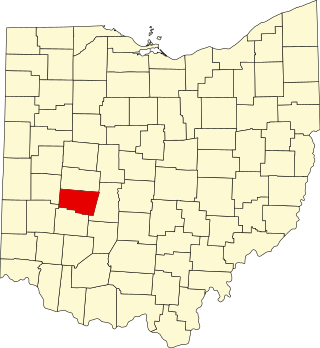
This is intended to be a complete list of the properties and districts on the National Register of Historic Places in Montgomery County, Ohio, United States. The locations of National Register properties and districts for which the latitude and longitude coordinates are included below, may be seen in an online map. [1]

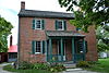
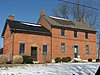
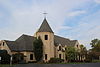
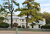
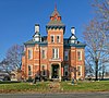
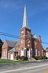
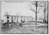
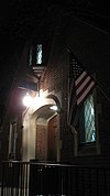
There are 158 properties and districts listed on the National Register in the county, including 7 National Historic Landmarks. The city of Dayton is the location of 115 of these properties and districts, including 5 National Historic Landmarks; they are listed separately, while the remaining properties and districts are listed here. A single property, the Miami Valley Golf Course and Clubhouse, is split between Dayton and other parts of the county, and it thus appears on both lists. Another 2 properties were once listed but have been removed.


    This National Park Service list is complete through NPS recent listings posted February 23, 2024. [2]

Current listings

Dayton

Outside Dayton

[3] Name on the Register [4] ImageDate listed [5] Location City or townDescription
1 Arnold Homestead
Arnold Homestead Arnold Homestead.jpg
Arnold Homestead
November 7, 1977
(#77001077)
North of Dayton on State Route 201
39°52′20″N84°05′46″W / 39.872222°N 84.096111°W / 39.872222; -84.096111 (Arnold Homestead)
Huber Heights
2 Aullwood House and Garden
Aullwood House and Garden Aullwood House and Garden 1.jpg
Aullwood House and Garden
February 5, 1999
(#99000092)
900 Aullwood Rd., northwest of Dayton
39°52′05″N84°16′32″W / 39.868056°N 84.275556°W / 39.868056; -84.275556 (Aullwood House and Garden)
Butler Township
3 Ausenbaugh-McElhenny House
Ausenbaugh-McElhenny House Ausenbaugh-McElhenny House.jpg
Ausenbaugh-McElhenny House
July 18, 1975
(#75001503)
7373 Taylorsville Rd.
39°51′39″N84°06′09″W / 39.860833°N 84.1025°W / 39.860833; -84.1025 (Ausenbaugh-McElhenny House)
Huber Heights
4 George Bixler Farm
George Bixler Farm George Bixler Farm from southwest.jpg
George Bixler Farm
August 22, 2002
(#02000888)
13213 Providence Pike, south of Brookville
39°48′19″N84°25′40″W / 39.805278°N 84.427778°W / 39.805278; -84.427778 (George Bixler Farm)
Perry Township
5 Robert Bradford House
Robert Bradford House Robert Bradford House.jpg
Robert Bradford House
March 21, 1979
(#79001897)
South of Centerville on Social Row Rd.
39°35′22″N84°08′26″W / 39.589444°N 84.140556°W / 39.589444; -84.140556 (Robert Bradford House)
Washington Township
6 Erma Bombeck House
Erma Bombeck House Erma Bombeck House.jpg
Erma Bombeck House
February 23, 2015
(#15000043)
162 Cushwa Dr.
39°38′32″N84°09′07″W / 39.642361°N 84.152083°W / 39.642361; -84.152083 (Erma Bombeck House)
Centerville
7 Carlisle Fort
Carlisle Fort Gateway at the Carlisle Fort.jpg
Carlisle Fort
February 15, 1974
(#74001584)
Western bank of Twin Creek, south of Germantown [6]
39°35′26″N84°21′15″W / 39.5906°N 84.3543°W / 39.5906; -84.3543 (Carlisle Fort)
German Township
8 Centerville Historic District
Centerville Historic District CentervilleHistoricDistrict.jpg
Centerville Historic District
December 17, 1974
(#74001577)
Irregular pattern at Franklin and Main Sts.
39°37′42″N84°09′38″W / 39.628333°N 84.160556°W / 39.628333; -84.160556 (Centerville Historic District)
Centerville
9 Deerwood Farm
Deerwood Farm Deerwood Farmhouse.jpg
Deerwood Farm
November 12, 1975
(#75001507)
North of Dayton at 7200 Peters Pike
39°51′07″N84°13′37″W / 39.851944°N 84.226944°W / 39.851944; -84.226944 (Deerwood Farm)
Butler Township
10 Emmanuel's Evangelical Lutheran Church
Emmanuel's Evangelical Lutheran Church Emmanuel's Evangelical Lutheran Church 2.JPG
Emmanuel's Evangelical Lutheran Church
September 6, 1990
(#90001292)
30 W. Warren St.
39°37′40″N84°22′18″W / 39.627778°N 84.371667°W / 39.627778; -84.371667 (Emmanuel's Evangelical Lutheran Church)
Germantown
11 Joseph Flory House
Joseph Flory House Joseph Flory House.jpg
Joseph Flory House
March 29, 1978
(#78002143)
Northwest of Clayton on Diamond Mill Rd.
39°51′58″N84°22′07″W / 39.866111°N 84.368611°W / 39.866111; -84.368611 (Joseph Flory House)
Clay Township
12 Fox Hollow
Fox Hollow Fox Hollow near Centerville.jpg
Fox Hollow
June 9, 2006
(#06000481)
6320 Mad River Rd.
39°39′22″N84°11′29″W / 39.656111°N 84.191389°W / 39.656111; -84.191389 (Fox Hollow)
Washington Township
13 Gunckel's Town Plan Historic District
Gunckel's Town Plan Historic District Gunckel's Town Plan Florentine Hotel.JPG
Gunckel's Town Plan Historic District
May 13, 1976
(#76001502)
Roughly bounded by Mulberry and Walnut Sts. and Warren and Market Sts.
39°37′32″N84°22′14″W / 39.625556°N 84.370556°W / 39.625556; -84.370556 (Gunckel's Town Plan Historic District)
Germantown
14 Hawthorn Hill
Hawthorn Hill Hawthornhillhouse8.jpg
Hawthorn Hill
October 18, 1974
(#74001585)
Harman and Park Aves.
39°43′20″N84°10′34″W / 39.722222°N 84.176111°W / 39.722222; -84.176111 (Hawthorn Hill)
Oakwood
15 Jacob's Church
Jacob's Church St. Jacob's Evangelical Lutheran Church in Miamisburg.jpg
Jacob's Church
September 6, 1990
(#90001290)
213 E. Central Ave.
39°38′31″N84°17′11″W / 39.641944°N 84.286389°W / 39.641944; -84.286389 (Jacob's Church)
Miamisburg
16 Ethol Kellog House
Ethol Kellog House Ethol Kellog House site.jpg
Ethol Kellog House
June 18, 1976
(#76001498)
West of Centerville off State Route 725 on Yankee St.
39°37′47″N84°12′02″W / 39.629722°N 84.200556°W / 39.629722; -84.200556 (Ethol Kellog House)
Washington Township
17 Charles F. Kettering House
Charles F. Kettering House Charles F. Kettering House.jpg
Charles F. Kettering House
December 22, 1977
(#77001080)
3965 Southern Boulevard
39°41′37″N84°11′38″W / 39.693611°N 84.193889°W / 39.693611; -84.193889 (Charles F. Kettering House)
Kettering Burned down in 1995.
18 Koehne-Poast Farm
Koehne-Poast Farm Koehne-Poast Farm.jpg
Koehne-Poast Farm
April 11, 1977
(#77001079)
West of Germantown off State Route 725
39°37′29″N84°23′08″W / 39.624722°N 84.385556°W / 39.624722; -84.385556 (Koehne-Poast Farm)
German Township and Germantown
19 Krug House
Krug House Krug House in Union.jpg
Krug House
August 12, 1992
(#92000973)
3473 Sweet Potato Ridge Rd.
39°53′30″N84°19′10″W / 39.891667°N 84.319444°W / 39.891667; -84.319444 (Krug House)
Union
20 Long-Mueller House
Long-Mueller House Long-Mueller House in Kettering.jpg
Long-Mueller House
April 23, 1987
(#87000637)
986 Laurelwood Rd.
39°42′02″N84°11′16″W / 39.700556°N 84.187778°W / 39.700556; -84.187778 (Long-Mueller House)
Kettering
21 Long-Romspert House
Long-Romspert House Long-Romspert House.jpg
Long-Romspert House
December 21, 1987
(#87001522)
1947 Far Hills Ave.
39°42′51″N84°10′20″W / 39.714028°N 84.172222°W / 39.714028; -84.172222 (Long-Romspert House)
Oakwood
22 Market Square
Market Square BaumOperaHouse.JPG
Market Square
November 10, 1975
(#75001510)
Both sides of Main St. including junctions at Central and Linden Aves.
39°38′27″N84°17′22″W / 39.640833°N 84.289333°W / 39.640833; -84.289333 (Market Square)
Miamisburg
23 Samuel Martindale House
Samuel Martindale House Samuel Martindale House.jpg
Samuel Martindale House
May 22, 1978
(#78002148)
Northeast of Englewood off U.S. Route 40
39°53′43″N84°16′54″W / 39.895278°N 84.281750°W / 39.895278; -84.281750 (Samuel Martindale House)
Butler Township
24 Miami-Erie Canal Lock No. 70
Miami-Erie Canal Lock No. 70 Miami-Erie Canal Lock No. 70.jpg
Miami-Erie Canal Lock No. 70
December 20, 1982
(#82001479)
Fishburg and Endicott Rds.
39°50′28″N84°09′32″W / 39.841111°N 84.158889°W / 39.841111; -84.158889 (Miami-Erie Canal Lock No. 70)
Huber Heights
25 Miamisburg Mound
Miamisburg Mound Miamisburg jqj.jpg
Miamisburg Mound
November 10, 1970
(#70000511)
Southeast of Miamisburg on State Route 725
39°37′38″N84°16′51″W / 39.627222°N 84.280833°W / 39.627222; -84.280833 (Miamisburg Mound)
Miamisburg
26 Miami Valley Golf Course and Clubhouse
Miami Valley Golf Course and Clubhouse Miami Valley Golf Club entrance.jpg
Miami Valley Golf Course and Clubhouse
June 30, 2015
(#15000372)
3311 Salem Ave.
39°47′31″N84°14′34″W / 39.791944°N 84.242778°W / 39.791944; -84.242778 (Miami Valley Golf Course and Clubhouse)
Harrison Township Extends into Dayton
27 Normandy Farms
Normandy Farms Normandy United Methodist Church 1.JPG
Normandy Farms
November 25, 1983
(#83004322)
450 W. Alex-Bell Rd., northwest of Centerville
39°38′43″N84°10′08″W / 39.645278°N 84.168889°W / 39.645278; -84.168889 (Normandy Farms)
Washington Township
28 Pease Homestead
Pease Homestead Pease Homestead 1.JPG
Pease Homestead
August 11, 1980
(#80003169)
2123 Alexander-Bellbrook Rd., northwest of Centerville
39°40′17″N84°12′23″W / 39.671389°N 84.206389°W / 39.671389; -84.206389 (Pease Homestead)
Miami Township
29 David Rohr Mansion and Carriage House
David Rohr Mansion and Carriage House David Rohrer House -- Germantown, Ohio.jpg
David Rohr Mansion and Carriage House
May 22, 1978
(#78002149)
Astoria Rd. and State Route 725
39°37′20″N84°23′06″W / 39.622222°N 84.385°W / 39.622222; -84.385 (David Rohr Mansion and Carriage House)
Germantown
30 Salem Bear Creek Church, Salem Evangelical Lutheran Church
Salem Bear Creek Church, Salem Evangelical Lutheran Church Salem Bear Creek Church 2.JPG
Salem Bear Creek Church, Salem Evangelical Lutheran Church
September 6, 1990
(#90001291)
Roughly bounded by Union Rd., Dayton Germantown Pike, and Bear Creek
39°40′48″N84°18′34″W / 39.68°N 84.309444°W / 39.68; -84.309444 (Salem Bear Creek Church, Salem Evangelical Lutheran Church)
Moraine
31 Schantz Park Historic District
Schantz Park Historic District Schantz and Glendora in Schantz Park.jpg
Schantz Park Historic District
October 16, 1992
(#92001492)
Roughly bounded by Far Hills, Irving, Mahart and Schenck Aves.
39°43′54″N84°10′37″W / 39.731667°N 84.176944°W / 39.731667; -84.176944 (Schantz Park Historic District)
Oakwood
32 Adam Schantz Sr. House
Adam Schantz Sr. House Adam Schantz House 7-2011.jpg
Adam Schantz Sr. House
March 7, 1980
(#80003178)
314-316 Schantz Ave.
39°43′54″N84°10′35″W / 39.731667°N 84.176389°W / 39.731667; -84.176389 (Adam Schantz Sr. House)
Oakwood
33 Schuter Carpenter Shop and House
Schuter Carpenter Shop and House Schuter Carpenter Shop and House 1.JPG
Schuter Carpenter Shop and House
September 27, 1980
(#80003179)
3224 W. Alexandersville-Bellbrook Rd., east of West Carrollton
39°40′24″N84°13′37″W / 39.673333°N 84.226944°W / 39.673333; -84.226944 (Schuter Carpenter Shop and House)
Miami Township
34 Sears, Roebuck and Company September 5, 2023
(#100009303)
5200 Salem Ave.
39°49′11″N84°16′54″W / 39.8198°N 84.2817°W / 39.8198; -84.2817 (Sears, Roebuck and Company)
Trotwood
35 Shuey's Mill
Shuey's Mill Shuey's Mill 2.JPG
Shuey's Mill
September 5, 1975
(#75001508)
Main St.
39°37′15″N84°22′13″W / 39.620833°N 84.370278°W / 39.620833; -84.370278 (Shuey's Mill)
Germantown
36 Skywood Farms
Skywood Farms Skywood Farms near Centerville.jpg
Skywood Farms
February 22, 1996
(#96000117)
732 W. Alex-Bell Rd., northwest of Centerville
39°38′58″N84°10′46″W / 39.649444°N 84.179444°W / 39.649444; -84.179444 (Skywood Farms)
Washington Township
37 Samuel Spitler House
Samuel Spitler House Samuel Spitler House -- Brookville, Ohio.jpg
Samuel Spitler House
September 28, 1973
(#73001507)
14 Market St.
39°50′08″N84°24′50″W / 39.835556°N 84.413889°W / 39.835556; -84.413889 (Samuel Spitler House)
Brookville Designed by architect George Franklin Barber
38 John Stump House and Mill
John Stump House and Mill John Stump Mill.jpg
John Stump House and Mill
July 7, 1975
(#75001509)
Southwest of Germantown at the junction of Sigel and Oxford Rds.
39°37′02″N84°23′28″W / 39.617222°N 84.391111°W / 39.617222; -84.391111 (John Stump House and Mill)
German Township
39 Taylorsville Canal Inn
Taylorsville Canal Inn Taylorsville Canal Inn.jpg
Taylorsville Canal Inn
November 16, 1977
(#77001078)
4240 Taylorsville Rd.
39°51′48″N84°09′54″W / 39.863333°N 84.165°W / 39.863333; -84.165 (Taylorsville Canal Inn)
Huber Heights
40 Trailsend
Trailsend Trailsend Home of Gov. Cox.jpg
Trailsend
May 22, 1979
(#79001905)
3500 Governors Trail
39°42′04″N84°11′57″W / 39.701111°N 84.199167°W / 39.701111; -84.199167 (Trailsend)
Kettering
41 Trotwood Railroad Station and Depot
Trotwood Railroad Station and Depot Trotwood Railroad Station.jpg
Trotwood Railroad Station and Depot
January 26, 1981
(#81000448)
2 E. Main St.
39°47′49″N84°18′40″W / 39.797083°N 84.311111°W / 39.797083; -84.311111 (Trotwood Railroad Station and Depot)
Trotwood
42 Watkins House
Watkins House Watkins House in Washington Township.jpg
Watkins House
December 24, 1974
(#74001578)
9950 Lebanon Pike, south of Centerville
39°35′57″N84°09′40″W / 39.599167°N 84.161111°W / 39.599167; -84.161111 (Watkins House)
Washington Township
43 Wright Library
Wright Library Entrance to the Wright Library, Oakwood.jpg
Wright Library
December 24, 2013
(#13000981)
1776 Far Hills Ave.
39°42′56″N84°10′16″W / 39.715556°N 84.171111°W / 39.715556; -84.171111 (Wright Library)
Oakwood
44 Wolf Creek Mound
Wolf Creek Mound Sycamore State Park near the Wolf Creek Mound.jpg
Wolf Creek Mound
June 4, 1973
(#73001511)
Atop the highest hill at the confluence of Poplar Run and Wolf Creek, west of central Trotwood [7] :15
39°48′14″N84°20′48″W / 39.803889°N 84.346667°W / 39.803889; -84.346667 (Wolf Creek Mound)
Trotwood

Former listings

[3] Name on the RegisterImageDate listedDate removedLocationCity or townDescription
1 John Beard Farm May 5, 1978 [8]
(#78002151)
February 2, 1980South of Vandalia on Mulberry Lane
Vandalia Was in the process of being demolished when it was listed in 1978. [9]
2 Germantown Covered Bridge
Germantown Covered Bridge Germantown Covered Bridge, Center Street spanning Little Twin Creek, Germantown (Montgomery County, Ohio).jpg
Germantown Covered Bridge
September 3, 1971
(#71000647)
July 6, 1981Center St., over Little Twin Creek
Germantown Destroyed after being hit by passing vehicle on February 19, 1981. [10]
3 Weber House July 3, 1974
(#09000104)
1975120 N. Second St.
Miamisburg Demolished in June 1975.

See also

Related Research Articles

<span class="mw-page-title-main">National Register of Historic Places listings in Hamilton County, Ohio</span>

This is a list of the National Register of Historic Places listings in Hamilton County, Ohio.

<span class="mw-page-title-main">National Register of Historic Places listings in Butler County, Ohio</span>

This is a list of the National Register of Historic Places listings in Butler County, Ohio.

<span class="mw-page-title-main">National Register of Historic Places listings in Delaware County, Ohio</span>

This is a list of the National Register of Historic Places listings in Delaware County, Ohio.

<span class="mw-page-title-main">National Register of Historic Places listings in Warren County, Ohio</span>

This is a list of the National Register of Historic Places listings in Warren County, Ohio.

<span class="mw-page-title-main">National Register of Historic Places listings in Ashtabula County, Ohio</span>

This is a list of the National Register of Historic Places listings in Ashtabula County, Ohio.

<span class="mw-page-title-main">National Register of Historic Places listings in Miami County, Ohio</span>

This is a list of the National Register of Historic Places listings in Miami County, Ohio.

<span class="mw-page-title-main">National Register of Historic Places listings in Greene County, Ohio</span>

This is a list of the National Register of Historic Places listings in Greene County, Ohio.

<span class="mw-page-title-main">National Register of Historic Places listings in Muskingum County, Ohio</span>

This is a list of the National Register of Historic Places listings in Muskingum County, Ohio.

<span class="mw-page-title-main">National Register of Historic Places listings in Clark County, Ohio</span>

This is a list of the National Register of Historic Places listings in Clark County, Ohio.

<span class="mw-page-title-main">National Register of Historic Places listings in Ross County, Ohio</span>

This is a list of the National Register of Historic Places listings in Ross County, Ohio.

<span class="mw-page-title-main">National Register of Historic Places listings in Scioto County, Ohio</span>

This is a list of the National Register of Historic Places listings in Scioto County, Ohio.

<span class="mw-page-title-main">National Register of Historic Places listings in Athens County, Ohio</span>

This is a list of the National Register of Historic Places listings in Athens County, Ohio.

<span class="mw-page-title-main">National Register of Historic Places listings in Clermont County, Ohio</span>

This is a list of the National Register of Historic Places listings in Clermont County, Ohio.

<span class="mw-page-title-main">National Register of Historic Places listings in Pickaway County, Ohio</span>

This is a list of the National Register of Historic Places listings in Pickaway County, Ohio, USA.

<span class="mw-page-title-main">National Register of Historic Places listings in Darke County, Ohio</span>

This is a list of the National Register of Historic Places listings in Darke County, Ohio.

<span class="mw-page-title-main">National Register of Historic Places listings in Highland County, Ohio</span>

This is a list of the National Register of Historic Places listings in Highland County, Ohio.

<span class="mw-page-title-main">National Register of Historic Places listings in Clinton County, Ohio</span>

This is a list of the National Register of Historic Places listings in Clinton County, Ohio.

<span class="mw-page-title-main">National Register of Historic Places listings in Perry County, Ohio</span>

This is a list of the National Register of Historic Places listings in Perry County, Ohio.

<span class="mw-page-title-main">National Register of Historic Places listings in Fulton County, Ohio</span>

This is a list of the National Register of Historic Places listings in Fulton County, Ohio.

<span class="mw-page-title-main">National Register of Historic Places listings in Pike County, Ohio</span>

This is a list of the National Register of Historic Places listings in Pike County, Ohio.

References

  1. The latitude and longitude information provided in this table was derived originally from the National Register Information System, which has been found to be fairly accurate for about 99% of listings. Some locations in this table may have been corrected to current GPS standards.
  2. National Park Service, United States Department of the Interior, "National Register of Historic Places: Weekly List Actions", retrieved February 23, 2024.
  3. 1 2 Numbers represent an alphabetical ordering by significant words. Various colorings, defined here, differentiate National Historic Landmarks and historic districts from other NRHP buildings, structures, sites or objects.
  4. "National Register Information System". National Register of Historic Places . National Park Service. April 24, 2008.
  5. The eight-digit number below each date is the number assigned to each location in the National Register Information System database, which can be viewed by clicking the number.
  6. Location derived from Mills, William C. Archeological Atlas of Ohio. Columbus: Ohio State Archeological and Historical Society, 1914, page 57 and plate 57. The NRIS lists the site as "Address Restricted".
  7. Koleszar, Stephen C. An Archaeological Survey of Southwestern Ohio. Columbus: Ohio Historical Society, 1970.
  8. 44 FR 7562
  9. "Crumbling old house designated as historic". Dayton Daily News . October 25, 1978. p. 13. Retrieved August 15, 2022 via Newspapers.com.
  10. "Collision destroys covered bridge". Dayton Daily News . February 19, 1981. p. 1. Retrieved August 15, 2022 via Newspapers.com.