Phillipsburg, Ohio

Last updated

Phillipsburg, Ohio
Main east of Cherry, Phillipsburg.jpg
West Main Street
Montgomery County Ohio incorporated and unincorporated areas Phillipsburg highlighted.svg
Location in Montgomery County and the state of Ohio.
Coordinates: 39°54′17″N84°24′6″W / 39.90472°N 84.40167°W / 39.90472; -84.40167
Country United States
State Ohio
County Montgomery
Township Clay
Area
[1]
  Total0.27 sq mi (0.69 km2)
  Land0.27 sq mi (0.69 km2)
  Water0.00 sq mi (0.00 km2)
Elevation
[2]
1,037 ft (316 m)
Population
 (2020)
  Total498
  Density1,872.18/sq mi (721.58/km2)
Time zone UTC-5 (Eastern (EST))
  Summer (DST) UTC-4 (EDT)
ZIP code
45354
Area code(s) 937, 326
FIPS code 39-62414 [3]
GNIS feature ID1056916 [2]

Phillipsburg is a village in Montgomery County, Ohio, United States. The population was 498 at the 2020 census. It is part of the Dayton Metropolitan Statistical Area.

Contents

History

Phillipsburg was platted in 1836, and named for Philip Studybaker, a member of the town company. [4] A post office was established as Centre in 1848, the name was changed to Center in 1893, and changed again to Phillipsburg in 1903. [5] Phillipsburg was incorporated as a village in 1899. [4]

Geography

Phillipsburg is located at 39°54′17″N84°24′6″W / 39.90472°N 84.40167°W / 39.90472; -84.40167 (39.904603, -84.401630). [6]

According to the United States Census Bureau, the village has a total area of 0.27 square miles (0.70 km2), all land. [7]

Demographics

Historical population
CensusPop.Note
1870 187
1880 21515.0%
1890 27025.6%
1910 343
1920 3481.5%
1930 43625.3%
1940 50415.6%
1950 60920.8%
1960 71517.4%
1970 83116.2%
1980 705−15.2%
1990 644−8.7%
2000 628−2.5%
2010 557−11.3%
2020 498−10.6%
U.S. Decennial Census [8]

2010 census

As of the census [9] of 2010, there were 557 people, 235 households, and 163 families living in the village. The population density was 2,063.0 inhabitants per square mile (796.5/km2). There were 255 housing units at an average density of 944.4 per square mile (364.6/km2). The racial makeup of the village was 97.7% White, 1.4% African American, 0.4% Asian, 0.4% from other races, and 0.2% from two or more races. Hispanic or Latino of any race were 3.2% of the population.

There were 235 households, of which 30.2% had children under the age of 18 living with them, 47.2% were married couples living together, 14.0% had a female householder with no husband present, 8.1% had a male householder with no wife present, and 30.6% were non-families. 26.4% of all households were made up of individuals, and 8.1% had someone living alone who was 65 years of age or older. The average household size was 2.37 and the average family size was 2.81.

The median age in the village was 40.4 years. 21.5% of residents were under the age of 18; 7.8% were between the ages of 18 and 24; 28% were from 25 to 44; 24.1% were from 45 to 64; and 18.5% were 65 years of age or older. The gender makeup of the village was 51.3% male and 48.7% female.

2000 census

As of the census [3] of 2000, there were 628 people, 250 households, and 188 families living in the village. The population density was 2,365.2 inhabitants per square mile (913.2/km2). There were 257 housing units at an average density of 967.9 per square mile (373.7/km2). The racial makeup of the village was 98.57% White, 0.80% African American, 0.32% Native American, 0.16% from other races, and 0.16% from two or more races. Hispanic or Latino of any race were 0.80% of the population.

There were 250 households, out of which 30.4% had children under the age of 18 living with them, 60.8% were married couples living together, 10.0% had a female householder with no husband present, and 24.4% were non-families. 20.4% of all households were made up of individuals, and 10.0% had someone living alone who was 65 years of age or older. The average household size was 2.51 and the average family size was 2.89.

In the village, the population was spread out, with 24.5% under the age of 18, 7.8% from 18 to 24, 27.9% from 25 to 44, 25.0% from 45 to 64, and 14.8% who were 65 years of age or older. The median age was 37 years. For every 100 females there were 93.8 males. For every 100 females age 18 and over, there were 95.1 males.

The median income for a household in the village was $41,458, and the median income for a family was $47,969. Males had a median income of $37,625 versus $25,917 for females. The per capita income for the village was $17,687. About 5.1% of families and 6.1% of the population were below the poverty line, including 9.3% of those under age 18 and 12.2% of those age 65 or over.

Education

Phillipsburg is served by the Northmont City School District of Montgomery County, Ohio. The schools include:

Phillipsburg Elementary School was closed in 2009, with its students being sent to Union Elementary School, [10] [11] and the property was sold to a private owner in the following November. [12]

Transportation

Major highways

Ohio State Route 49 bisects Phillipsburg 4 miles north of I-70 in Montgomery County, Ohio

Airports

Phillipsburg Airport is located on the Northeast edge of the village of Phillipsburg. The airport was opened in 1949 and remains active to this day. [13] The airport is home to 35 aircraft and averages 186 aircraft operations per day. [14] Phillipsburg Airport was originally named Myer's Airport after it original owner John L. Myers. The airport was run by Gene and Jayne Miller for many years. As of 2013, the airport is now owned and operated by Danny and Jaime Steel-Potter. [13]

Notable people

Related Research Articles

<span class="mw-page-title-main">Montgomery County, Ohio</span> County in Ohio, United States

Montgomery County is located in the southwestern portion of the U.S. state of Ohio. As of the 2020 census, the population was 537,309, making it the fifth-most populous county in Ohio. The county seat is Dayton. The county was named in honor of Richard Montgomery, an American Revolutionary War general killed in 1775 while attempting to capture Quebec City, Canada. Montgomery County is part of the Dayton, Ohio Metropolitan Statistical Area.

<span class="mw-page-title-main">Wintersville, Ohio</span> Village in Ohio, United States

Wintersville is a village in central Jefferson County, Ohio. The population was 3,609 as of the 2020 Census. It is part of the Weirton–Steubenville metropolitan area. The village is suburban in nature and is governed by a mayor and council elected by non-partisan ballot.

<span class="mw-page-title-main">Brookville, Ohio</span> City in Ohio, United States

Brookville is a small city in northwestern Montgomery County, Ohio, United States. It is a suburb of Dayton. The population was 5,989 at the 2020 census.

<span class="mw-page-title-main">Centerville, Ohio</span> City in Ohio, United States

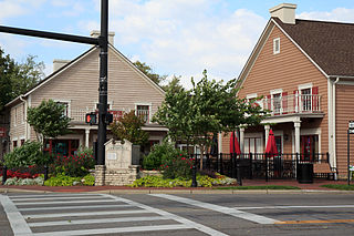
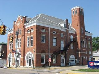
Centerville is a city in Montgomery County, Ohio, United States. A core suburb of Metro Dayton, its population was 24,240 as of the 2020 census.

<span class="mw-page-title-main">Clayton, Ohio</span> City in Ohio, United States

Clayton is a city in Montgomery county in the U.S. state of Ohio. The population was 13,310 at the 2020 United States census. A suburb of Dayton. It is part of the Dayton Metropolitan Statistical Area.

<span class="mw-page-title-main">Englewood, Ohio</span> City in Ohio, United States

Englewood is a city in Montgomery County, Ohio, and a northern suburb of Dayton. The population was 13,463 at the 2020 census. It is part of the Dayton metropolitan area.

<span class="mw-page-title-main">Farmersville, Ohio</span> Village in Ohio, United States

Farmersville is a village in Jackson Township, Montgomery County, Ohio, United States. The population was 975 at the 2020 census. It is part of the Dayton Metropolitan Statistical Area.

<span class="mw-page-title-main">New Lebanon, Ohio</span> Village in Ohio, United States

New Lebanon is a village in Montgomery County, Ohio, United States. The population was 3,796 at the 2020 census. It is part of the Dayton Metropolitan Statistical Area.

<span class="mw-page-title-main">Oakwood, Montgomery County, Ohio</span> City in Ohio, United States

Oakwood is a city in Montgomery County, Ohio, United States. A suburb of Dayton. The population was 9,572 at the 2020 census. Oakwood is part of the Dayton metropolitan area. It was incorporated in 1908. John Henry Patterson, industrialist and founder of the National Cash Register Corporation, is considered the "Father of Oakwood."

<span class="mw-page-title-main">Riverside, Ohio</span> City in Ohio, United States

Riverside is a city in Montgomery County, Ohio, United States. A suburb of Dayton, The population was 24,474 at the 2020 census. It is part of the Dayton Metropolitan Statistical Area.

<span class="mw-page-title-main">Trotwood, Ohio</span> City in Ohio, United States

Trotwood is a city in Montgomery County, Ohio, United States and is a suburb of Dayton.

<span class="mw-page-title-main">Vandalia, Ohio</span> City in Ohio, United States

Vandalia is a city in Montgomery County, Ohio, United States, and a suburb of Dayton. Its population was 15,209 during the 2020 census. In addition to being the city closest to Dayton International Airport, Vandalia lies at the crossroads of I-75 and I-70.

<span class="mw-page-title-main">Fort Jennings, Ohio</span> Village in Ohio, United States

Fort Jennings is a village in the southwestern corner of Putnam County, Ohio, United States. The population was 485 at the 2010 census.

<span class="mw-page-title-main">Stone Creek, Ohio</span> Village in Ohio, United States

Stone Creek is a village in Tuscarawas County, Ohio, United States. The population was 153 at the 2020 census.

<span class="mw-page-title-main">Kettering, Ohio</span> City in Ohio, United States

Kettering is a city in Montgomery County, Ohio, United States. It is an inner suburb of Dayton, Ohio. As of the 2020 census, the city had a population of 57,862, making it the largest suburb in the Dayton metropolitan area.

<span class="mw-page-title-main">Union, Ohio</span> City in Ohio, United States

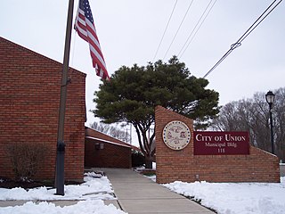
Union is a city in Montgomery and Miami Counties in the U.S. state of Ohio. The population was 6,859 at the time of the 2020 census. It is part of the Dayton Metropolitan Statistical Area.

<span class="mw-page-title-main">Carlisle, Ohio</span> City in Ohio, United States

Carlisle is a city in northwestern Warren and southern Montgomery counties in the southwestern part of the U.S. state of Ohio. The city is in Franklin Township, Warren County, Ohio and German Township, Montgomery County, Ohio.

<span class="mw-page-title-main">Springboro, Ohio</span> City in Ohio, United States

Springboro is a city in the U.S. state of Ohio. A suburb of Cincinnati and Dayton, it is located mostly in Warren County in Clearcreek and Franklin Townships; with a small portion in Miami Township in Montgomery County. The city is part of the Miami Valley. As of the 2020 census, the city had a population of 19,062.

<span class="mw-page-title-main">Verona, Ohio</span> Village in Ohio, United States

Verona is a village in Montgomery and Preble counties in the U.S. state of Ohio. The population was 403 at the 2020 census. It is part of the Dayton Metropolitan Statistical Area.

<span class="mw-page-title-main">Bayside, Wisconsin</span> Village in Milwaukee and Ozaukee counties, Wisconsin

Bayside is a village in Milwaukee and Ozaukee counties in the U.S. state of Wisconsin. The population was 4,482 at the 2020 census. Of this, 4,378 were in Milwaukee County, and only 104 were in Ozaukee County.

References

  1. "ArcGIS REST Services Directory". United States Census Bureau. Retrieved September 20, 2022.
  2. 1 2 "US Board on Geographic Names". United States Geological Survey. October 25, 2007. Retrieved January 31, 2008.
  3. 1 2 "U.S. Census website". United States Census Bureau . Retrieved January 31, 2008.
  4. 1 2 Drury, Augustus Waldo (1909). History of the City of Dayton and Montgomery County, Ohio, Volume 1. S. J. Clarke Publishing Company. p. 929.
  5. U.S. Geological Survey Geographic Names Information System: Phillipsburg Post Office
  6. "US Gazetteer files: 2010, 2000, and 1990". United States Census Bureau. February 12, 2011. Retrieved April 23, 2011.
  7. "US Gazetteer files 2010". United States Census Bureau. Archived from the original on July 2, 2012. Retrieved January 6, 2013.
  8. "Census of Population and Housing". Census.gov. Retrieved June 4, 2015.
  9. "U.S. Census website". United States Census Bureau . Retrieved January 6, 2013.
  10. "DaytonDailyNews Dayton, Ohio". January 26, 2009. Archived from the original on June 26, 2011.
  11. "Phillipsburg Elementary School (closed 2010)".
  12. "Unknown".[ dead link ]
  13. 1 2 "Phillipsburg Airport website". Archived from the original on November 17, 2015. Retrieved November 16, 2015.
  14. "AirNav".