Woodbourne-Hyde Park, Ohio

Last updated
Woodbourne-Hyde Park, Ohio
Woodbourne-Hyde Park.jpg
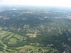
Aerial view of Woodbourne-Hyde Park
Coordinates: 39°39′39″N84°10′25″W / 39.66083°N 84.17361°W / 39.66083; -84.17361 Coordinates: 39°39′39″N84°10′25″W / 39.66083°N 84.17361°W / 39.66083; -84.17361
Country United States
State Ohio
County Montgomery
Township Washington
Area
  Total4.6 sq mi (11.9 km2)
  Land4.6 sq mi (11.9 km2)
  Water0.0 sq mi (0.0 km2)
Population
 (2000)
  Total7,910
  Density1,726.3/sq mi (666.5/km2)
Time zone UTC-5 (Eastern (EST))
  Summer (DST) UTC-4 (EDT)
FIPS code 39-86331 [1]

Woodbourne-Hyde Park is an unincorporated area in Washington Township in Montgomery County, Ohio, United States. A Suburb of Dayton. It was delineated as a census-designated place (CDP) at the 2000 census, at which time its population was 7,910. It was not delineated as a CDP for the 2010 census.

Contents

Woodbourne-Hyde Park is located south of the city of Dayton and is a Suburb of Dayton.

Geography

Woodbourne-Hyde Park is located at 39°39′39″N84°10′25″W / 39.66083°N 84.17361°W / 39.66083; -84.17361 (39.660776, -84.173563). [2]

According to the United States Census Bureau, the CDP had a total area of 4.6 square miles (11.9 km2), all land.

Demographics

As of the census [1] of 2000, there were 7,910 people, 2,933 households, and 2,372 families residing in the CDP. The population density was 1,726.3 people per square mile (666.8/km2). There were 3,020 housing units at an average density of 659.1/sq mi (254.6/km2). The racial makeup of the CDP was 96.09% White, 1.01% African American, 0.08% Native American, 1.85% Asian, 0.23% from other races, and 0.75% from two or more races. Hispanic or Latino of any race were 0.80% of the population.

There were 2,933 households, out of which 29.6% had children under the age of 18 living with them, 74.8% were married couples living together, 4.4% had a female householder with no husband present, and 19.1% were non-families. 17.1% of all households were made up of individuals, and 9.1% had someone living alone who was 65 years of age or older. The average household size was 2.53 and the average family size was 2.85.

In the CDP the population was spread out, with 21.6% under the age of 18, 3.3% from 18 to 24, 19.8% from 25 to 44, 30.3% from 45 to 64, and 25.0% who were 65 years of age or older. The median age was 48 years. For every 100 females, there were 91.0 males. For every 100 females age 18 and over, there were 86.5 males.

The median income for a household in the CDP was $80,041, and the median income for a family was $87,654. Males had a median income of $61,541 versus $37,537 for females. The per capita income for the CDP was $38,052. About 1.1% of families and 2.1% of the population were below the poverty line, including 4.6% of those under age 18 and 1.2% of those age 65 or over.

Related Research Articles

<span class="mw-page-title-main">Twin Lakes, California</span> Census-designated place in California, United States

Twin Lakes is a census-designated place (CDP) in Santa Cruz County, California, United States. The population is at an estimated 5,378 as of 2016 which is up by 461 in 2010.

<span class="mw-page-title-main">Lindale, Georgia</span> Census-designated place in Georgia, United States

Lindale is an unincorporated community and census-designated place (CDP) in Floyd County, Georgia, United States. It is part of the Rome, Georgia Metropolitan Statistical Area. The population was 4,191 at the 2010 census.

<span class="mw-page-title-main">Pine Knot, Kentucky</span> CDP in Kentucky, United States

Pine Knot is a census-designated place (CDP) in McCreary County, Kentucky, United States. The population was 1,680 at the 2000 census.

<span class="mw-page-title-main">Brooklyn Park, Maryland</span> Census-designated place in Maryland, United States

Brooklyn Park is a census-designated place (CDP) in Anne Arundel County, Maryland, United States. The population was 14,373 at the 2010 census.

<span class="mw-page-title-main">Barclay-Kingston, New Jersey</span> Former census-designated place in New Jersey, United States

Barclay-Kingston is an unincorporated community and former census-designated place (CDP) located within Cherry Hill Township, in Camden County, New Jersey, United States. As of the 2000 United States Census, the section population was 10,728. In the 2010 United States Census, the Barclay-Kingston CDP was split into two new CDPs, Barclay and Kingston Estates.

<span class="mw-page-title-main">Beckett Ridge, Ohio</span> Census-designated place in Ohio, United States

Beckett Ridge is a census-designated place (CDP) in West Chester Township, Butler County, Ohio, United States. The population was 9,187 at the 2010 census.

<span class="mw-page-title-main">Olde West Chester, Ohio</span> Census-designated place in Ohio, United States

Olde West Chester is a census-designated place (CDP) in West Chester Township, Butler County, Ohio, United States. The population was 240 at the 2010 census.

<span class="mw-page-title-main">Groesbeck, Ohio</span> Census-designated place in Ohio, United States

Groesbeck is a census-designated place (CDP) in Hamilton County, Ohio, United States. The population was 6,788 at the 2010 census. It is a suburb of Cincinnati.

<span class="mw-page-title-main">White Oak, Ohio</span> Census-designated place in Ohio, United States

White Oak is a census-designated place (CDP) in Hamilton County, Ohio, United States. It is seven miles northwest of Cincinnati. The population was 19,167 at the 2010 census. White Oak's geography is unique in that it is situated in both Green Township and Colerain Township.

<span class="mw-page-title-main">Drexel, Ohio</span> CDP in Ohio, United States

Drexel is a census-designated place (CDP) in Jefferson Township, Montgomery County, Ohio, United States. The population was 2,076 at the 2010 census, an increase from 2,057 in 2000. Informally, the Drexel designation also applies to the neighboring portion of Trotwood.

Fort McKinley is an unincorporated community in Harrison Township in Montgomery County, Ohio, United States. It was delineated as a census-designated place (CDP) at the 2000 census, when its population was 3,989. It was not delineated as a CDP for the 2010 census.

<span class="mw-page-title-main">Northridge, Montgomery County, Ohio</span> Unincorporated community in Ohio, United States

Northridge is an unincorporated community in Harrison Township in Montgomery County, Ohio, United States. It was delineated as a census-designated place (CDP) for the 2000 census, at which time its population was 8,487. It was not delineated as a CDP for the 2010 census. It is located directly north of the city of Dayton and is part of the Dayton Metropolitan Statistical Area.

Shiloh is a census-designated place (CDP) in Harrison Township in Montgomery County, Ohio, United States. It was delineated as a census-designated place at the 2000 census, at which time its population was 11,272. It was not delineated as a CDP at the 2010 census. It is located directly north of the city of Dayton and is part of the Dayton Metropolitan Statistical Area.

Flint Creek is an unincorporated area and census-designated place (CDP) in Delaware County, Oklahoma, United States. The population was 732 at the 2010 census, up from 580 in 2000.

<span class="mw-page-title-main">Woodbourne, Pennsylvania</span> Census-designated place in Pennsylvania, United States

Woodbourne is a census-designated place (CDP) in Bucks County, Pennsylvania, United States. The population was 3,851 at the 2010 census.

<span class="mw-page-title-main">Klingerstown, Pennsylvania</span> CDP in Pennsylvania, United States

Klingerstown is a census-designated place (CDP) in Upper Mahantongo Township, Schuylkill County, Pennsylvania, United States. As of the 2000 census, the CDP population was 102.

<span class="mw-page-title-main">Weigelstown, Pennsylvania</span> CDP in Pennsylvania, United States

Weigelstown is a census-designated place (CDP) in York County, Pennsylvania, United States. The population was 12,875 at the 2010 census.

<span class="mw-page-title-main">Clarks Hill, South Carolina</span> CDP in South Carolina, United States

Clarks Hill is a census-designated place (CDP) in McCormick County, South Carolina, United States. The population was 376 at the 2000 census.

<span class="mw-page-title-main">Hilltop, Texas</span> Census-designated place in Texas, United States

Hilltop is an unincorporated community and census-designated place (CDP) in Frio County, Texas, United States. Its population was 287 at the 2010 census.

<span class="mw-page-title-main">Thomaston (CDP), Connecticut</span> Census-designated place in Connecticut, United States

Thomaston is a census-designated place (CDP) in Litchfield County, Connecticut, United States. It comprises the downtown portion of the town of Thomaston. As of the 2010 census, the population of the CDP was 1,910, out of 7,887 in the entire town.

References

  1. 1 2 "U.S. Census website". United States Census Bureau . Retrieved 2008-01-31.
  2. "US Gazetteer files: 2010, 2000, and 1990". United States Census Bureau. 2011-02-12. Retrieved 2011-04-23.